
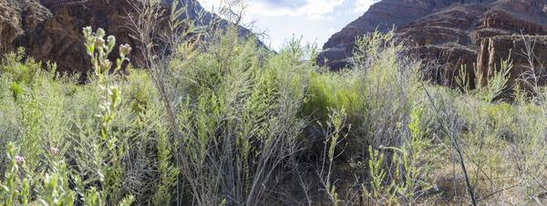
Nonnative tamarisk is resistant to wildfire, in part due to its abilty to resprout from the its roots.
Images
Below are images associated with SBSC's science and staff. Images appear according to the year they were taken. To search, type a keyword or select a year from the dropdown menu. Or, click through the pages using the arrows at the bottom of the page.
Filter Total Items: 683

Nonnative tamarisk is fire resistant
Nonnative tamarisk is resistant to wildfire, in part due to its abilty to resprout from the its roots.

Tamarisk re-grows new leaves after tamarisk leaf beetle defoliation
Tamarisk re-grows new leaves after tamarisk leaf beetle defoliationTamarisk can re-grow new leaves after being defoliated by the biocontrol agent tamarisk leaf beetle (Diorhabda spp.).
Tamarisk re-grows new leaves after tamarisk leaf beetle defoliation
Tamarisk re-grows new leaves after tamarisk leaf beetle defoliationTamarisk can re-grow new leaves after being defoliated by the biocontrol agent tamarisk leaf beetle (Diorhabda spp.).

Grand Canyon Base Map
Screen capture of Grand Canyon shaded relief base map used by the USGS's Grand Canyon Monitoring and Research Center.
Screen capture of Grand Canyon shaded relief base map used by the USGS's Grand Canyon Monitoring and Research Center.
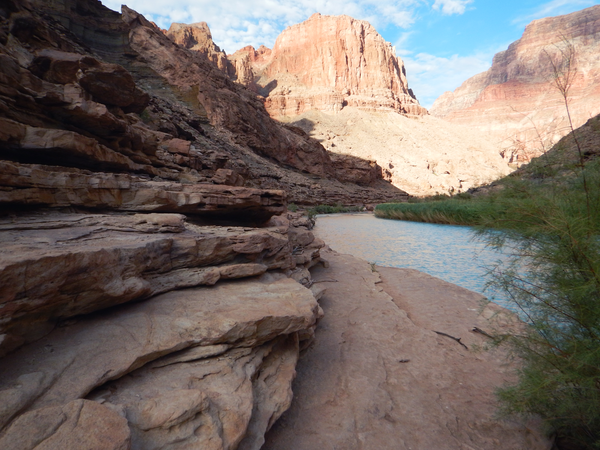
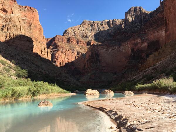
The Little Colorado River in Grand Canyon, with researchers in the distance
The Little Colorado River in Grand Canyon, with researchers in the distanceThe Little Colorado River in Grand Canyon, with researchers in the distance during a humpback chub monitoring trip. Photo by Maria Dzul, USGS, July 2016.
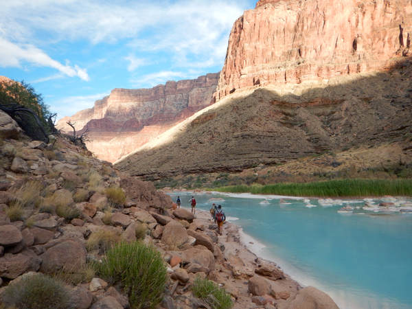
Researchers hike near the Little Colorado River to a humpback chub monitoring site
Researchers hike near the Little Colorado River to a humpback chub monitoring siteResearchers hike near the Little Colorado River to a humpback chub monitoring site. Photo by Maria Dzul, USGS, July 2016.
Researchers hike near the Little Colorado River to a humpback chub monitoring site
Researchers hike near the Little Colorado River to a humpback chub monitoring siteResearchers hike near the Little Colorado River to a humpback chub monitoring site. Photo by Maria Dzul, USGS, July 2016.
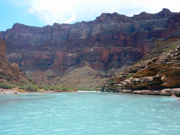
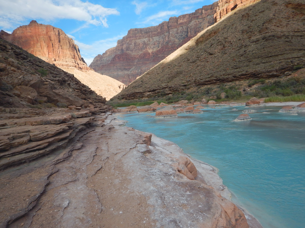
The Little Colorado River in Grand Canyon
The Little Colorado River winds through Grand Canyon. Photo by Maria Dzul, USGS, July 2016.
The Little Colorado River winds through Grand Canyon. Photo by Maria Dzul, USGS, July 2016.
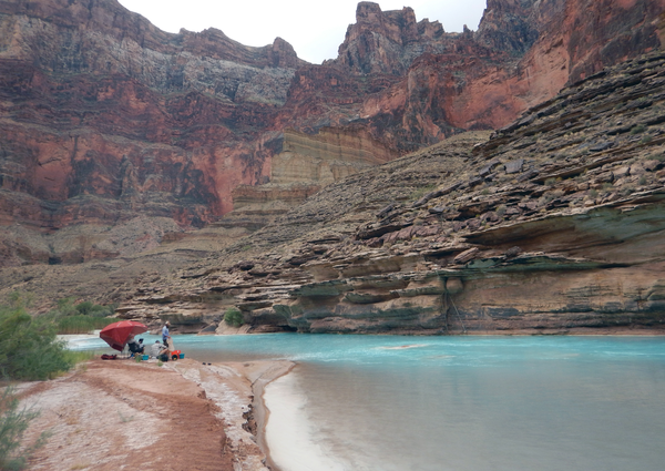
Researchers near the Little Colorado River during a humpback chub monitoring trip
Researchers near the Little Colorado River during a humpback chub monitoring tripResearchers process data near the Little Colorado River during a humpback chub monitoring trip. Photo by Maria Dzul, July 2016.
Researchers near the Little Colorado River during a humpback chub monitoring trip
Researchers near the Little Colorado River during a humpback chub monitoring tripResearchers process data near the Little Colorado River during a humpback chub monitoring trip. Photo by Maria Dzul, July 2016.
The Little Colorado River
The Little Colorado River in Grand Canyon. Photo by Maria Dzul, USGS, July 2016.
The Little Colorado River in Grand Canyon. Photo by Maria Dzul, USGS, July 2016.
The Little Colorado River
The Little Colorado River near Grand Canyon. Photo by Lucas Bair, USGS, Southwest Biological Science Center.
The Little Colorado River near Grand Canyon. Photo by Lucas Bair, USGS, Southwest Biological Science Center.

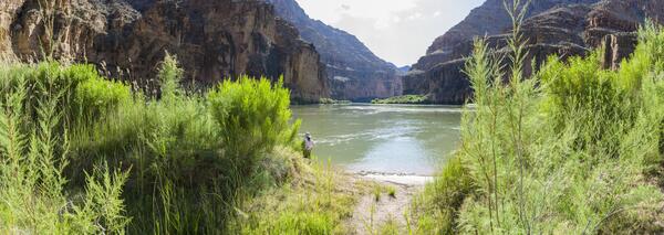
Monitoring riparian vegetation along the Colorado River
Monitoring riparian vegetation along the Colorado RiverMonitoring riparian vegetation along the Colorado River downstream of Glen Canyon Dam
Monitoring riparian vegetation along the Colorado River
Monitoring riparian vegetation along the Colorado RiverMonitoring riparian vegetation along the Colorado River downstream of Glen Canyon Dam

Humpback Chub in the Colorado River, Grand Canyon
Humpback chub, a federally protected species, in habitat near the confluence of the Colorado River and Little Colorado Rivers in Grand Canyon. Photo by David Ward, USGS.
Humpback chub, a federally protected species, in habitat near the confluence of the Colorado River and Little Colorado Rivers in Grand Canyon. Photo by David Ward, USGS.

USGS Research Ecologist Jeff Lovich gets ready to release a male desert tortoise
USGS Research Ecologist Jeff Lovich gets ready to release a male desert tortoiseUSGS Research Ecologist Jeff Lovich gets ready to release a male desert tortoise into its cave-like shelter in southern Joshua Tree National Park after collecting data. Photo by Shellie Puffer, USGS, SBSC.
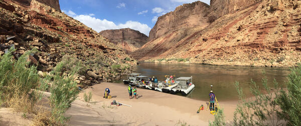
Sandbar beach on the Colorado River in Grand Canyon
Sandbar beach on the Colorado River in Grand CanyonRiver channel mapping boats on a sandbar beach on the Colorado River, in Grand Canyon, 2016. USGS photo, public domain.
Sandbar beach on the Colorado River in Grand Canyon
Sandbar beach on the Colorado River in Grand CanyonRiver channel mapping boats on a sandbar beach on the Colorado River, in Grand Canyon, 2016. USGS photo, public domain.
Repeat photograph taken along the Colorado River in 2016 that is a pseudo-match to an EC LaRue USGS 1923 Birdseye Expedition image
Repeat photograph taken along the Colorado River in 2016 that is a pseudo-match to an EC LaRue USGS 1923 Birdseye Expedition imageA USGS repeat photograph that is a pseudo-match to an E.C. LaRue USGS image from 1923, taken during the Birdseye Expedition, prior to Glen Canyon Dam construction upstream of this site on the Colorado River.
Repeat photograph taken along the Colorado River in 2016 that is a match to an EC LaRue USGS 1923 Birdseye Expedition image
Repeat photograph taken along the Colorado River in 2016 that is a match to an EC LaRue USGS 1923 Birdseye Expedition imageA USGS repeat photograph that is a match to an E.C. LaRue USGS image from 1923, taken during the Birdseye Expedition, prior to Glen Canyon Dam construction upstream of this site on the Colorado River in Grand Canyon.
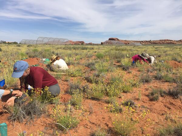
Field technicians taking root data on dryland plant species for EDGE
Field technicians taking root data on dryland plant species for EDGEField technicians taking root data on dryland plant species on the Colorado Plateau.
Field technicians taking root data on dryland plant species for EDGE
Field technicians taking root data on dryland plant species for EDGEField technicians taking root data on dryland plant species on the Colorado Plateau.

Kelp Crab
A Kelp Crab (Pugettia producta) captured in a beach seine during a 2012 Bainbridge Island larval forage fish survey. This survey focused on the abundance, habitat use, and food habits of larval forage fish (surf smelt and sand lance) and was conducted by scientists from the Columbia River Research Laboratory -Western Fisheries Research Center.
A Kelp Crab (Pugettia producta) captured in a beach seine during a 2012 Bainbridge Island larval forage fish survey. This survey focused on the abundance, habitat use, and food habits of larval forage fish (surf smelt and sand lance) and was conducted by scientists from the Columbia River Research Laboratory -Western Fisheries Research Center.

Sonoran Desert Wildflowers and Invasive Species
Ecosystems are changing at a rapid pace. It can be difficult to determine if a landscape is in need of restoration. In this photo of the spring wildflower bloom in the Sonoran desert, an invasive annual grass, Bromus rubens (red brome), is pervasive. Land managers have to make decisions about when, where, and how to intervene in a system.
Ecosystems are changing at a rapid pace. It can be difficult to determine if a landscape is in need of restoration. In this photo of the spring wildflower bloom in the Sonoran desert, an invasive annual grass, Bromus rubens (red brome), is pervasive. Land managers have to make decisions about when, where, and how to intervene in a system.

La Sal Mountain Range
Snow-capped peaks of the La Sal Mountain Range as seen from the Island in the Sky District of Canyonlands National Park. This is one area in the Southwest where biocrust plays an important role.
Snow-capped peaks of the La Sal Mountain Range as seen from the Island in the Sky District of Canyonlands National Park. This is one area in the Southwest where biocrust plays an important role.
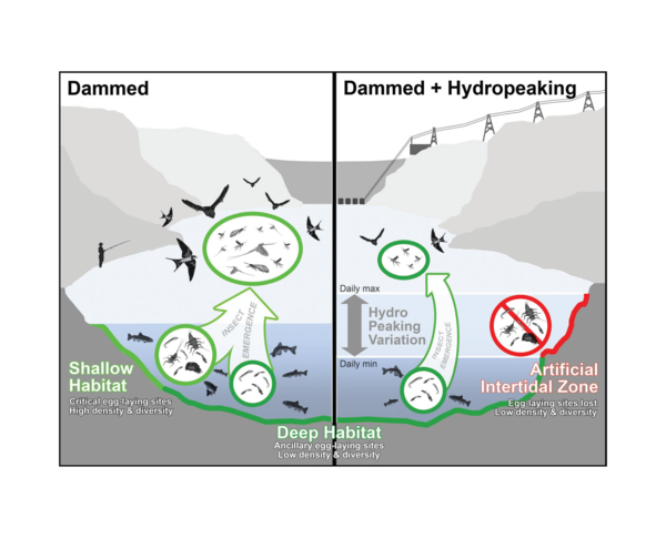
HydropeakingFigure_Bioscience2016_med.png
Hydropeaking creates a bottleneck for aquatic insects. Insect eggs laid along a rivers edge become dessicated when exposed to the air during low flows. Figure originally published in Bioscience; Kennedy et al. 2016.
Hydropeaking creates a bottleneck for aquatic insects. Insect eggs laid along a rivers edge become dessicated when exposed to the air during low flows. Figure originally published in Bioscience; Kennedy et al. 2016.

Bats emerging at dusk
During the fall bats can be seen emerging from under the causeway at Yolo Bypass Wildlife Area near Sacramento, CA. Photo by Erika Sanchez-Chopitea, Western Geographic Science Center, USGS.
During the fall bats can be seen emerging from under the causeway at Yolo Bypass Wildlife Area near Sacramento, CA. Photo by Erika Sanchez-Chopitea, Western Geographic Science Center, USGS.