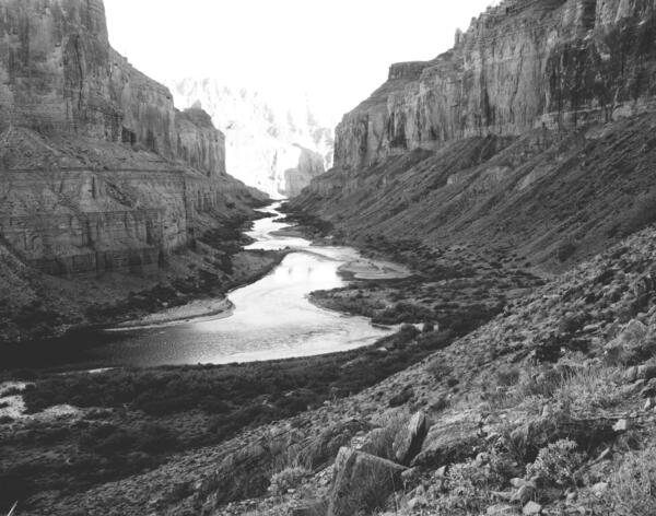
Colorado River, Grand Canyon, River Mile 52.8, Nankoweap, Downstream View from River Right, 2010
Colorado River, Grand Canyon, River Mile 52.8, Nankoweap, Downstream View from River Right, 2010September 18, 2010. Colorado River, Grand Canyon, River Mile 52.8, Nankoweap, Downstream View from River Right. Riparian vegetation continues to increase along the river, reducing the amount of sand that is visible at this distance. There has been a slight increase in the amount of mesquite, but overall it appears to be similar to that present 19 years before.