U.S. flag

An official website of the United States government

Ecosystems Mission Area

The USGS Ecosystems Mission Area provides science that directly benefits the health, safety, and prosperity of the American people by providing trusted and timely information to help address the Nation’s toughest management and conservation issues impacting public lands and the surrounding communities that benefit from them. 

News

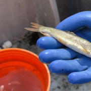
Treading Water. 6PPD and 6PPD-quinone in US Streams: Analysis, Sample Handling, and National Reconnaissance

Treading Water. 6PPD and 6PPD-quinone in US Streams: Analysis, Sample Handling, and National Reconnaissance

Case of the Month - Fatal intestinal nematodiasis in a Red-tailed Hawk

Case of the Month - Fatal intestinal nematodiasis in a Red-tailed Hawk

New research highlights opportunities for enhacing amphibian occupancy in Rocky Mountain National Park

New research highlights opportunities for enhacing amphibian occupancy in Rocky Mountain National Park

Publications

Sediment nutrient dynamics in selected Milwaukee metropolitan area streams, Wisconsin, 2022

The U.S. Geological Survey and Milwaukee Metropolitan Sewerage District in Wisconsin have an ongoing partnership to monitor water quality in streams in the Milwaukee metropolitan area and to assess the effects of stream restoration on habitat and water quality. Because sediment nutrient dynamics can improve or further impair water quality, we measured sediment nitrogen and phosphorus...
Authors
Rebecca M. Kreiling, Lynn A. Bartsch, Kenna J. Gierke, Patrik M. Perner, Faith A. Fitzpatrick, Hayley T. Olds

Scent detection dogs detect a species of hard tick, Dermacentor albipictus, with comparable accuracy and efficiency to traditional tick drag surveys

BackgroundAccurate surveillance data are critical for addressing tick and tick-borne pathogen risk to human and animal health. Current surveillance methods for detecting invading or expanding tick species are limited in their ability to scale efficiently to state or national levels. In this study we explored the potential use of scent detection dogs to assist field surveys for a hard...
Authors
Troy Koser, Aimee Hurt, Laura Thompson, Alyson Courtemanch, Benjamin Wise, Paul C. Cross

Management strategy evaluation to assess trade-offs associated with invasive Blue Catfish fisheries and predation impacts

ObjectiveMany species are intentionally introduced beyond their native range to provide benefits to humans (e.g., food, recreation, or biocontrol). However, introduced species can become invasive and can harm native species, prompting resource managers to explore options to simultaneously conserve native biota and enhance fishing opportunities. Management of Chesapeake Bay Blue Catfish...
Authors
Corbin David Hilling, Yan Jiao, Joseph Schmitt, Mary C. Fabrizio, Paul L. Angermeier, Donald J. Orth

Science

Southwest Fire Innovation Landscape Network: Advanced tools for fuel monitoring and assessment of wildfire risk

The USGS Southwest Biological Science Center is coordinating the Southwest Fire Innovation Landscape Network to prepare fire and natural resource managers for rapidly changing fire landscapes by conducting research and building science-management partnerships. The network develops advanced tools and technologies to assess fuel loads and the effectiveness of fuel treatments, understand wildfire...
link

Southwest Fire Innovation Landscape Network: Advanced tools for fuel monitoring and assessment of wildfire risk

The USGS Southwest Biological Science Center is coordinating the Southwest Fire Innovation Landscape Network to prepare fire and natural resource managers for rapidly changing fire landscapes by conducting research and building science-management partnerships. The network develops advanced tools and technologies to assess fuel loads and the effectiveness of fuel treatments, understand wildfire...
Learn More

WebDART: A Cutting-edge Web Tool that Evaluates Land Condition

WebDART is an online ecological assessment tool available to a wide audience that incorporates Landsat satellite remote sensing imagery, topography, geology, soil conditions, and rangeland geospatial and vegetation mapping to compare altered terrain with an unspoiled area that has similar characteristics in the same region. The tool gives resource managers, landowners, companies, and other...
link

WebDART: A Cutting-edge Web Tool that Evaluates Land Condition

WebDART is an online ecological assessment tool available to a wide audience that incorporates Landsat satellite remote sensing imagery, topography, geology, soil conditions, and rangeland geospatial and vegetation mapping to compare altered terrain with an unspoiled area that has similar characteristics in the same region. The tool gives resource managers, landowners, companies, and other...
Learn More

Expanding Distribution of Chronic Wasting Disease

Chronic wasting disease (CWD) has been detected in 36 US states and five Canadian provinces in free-ranging cervids and/or commercial captive cervid facilities. CWD has been detected in free-ranging cervids in 36 states and four provinces and in captive cervid facilities in 22 states and three provinces.
link

Expanding Distribution of Chronic Wasting Disease

Chronic wasting disease (CWD) has been detected in 36 US states and five Canadian provinces in free-ranging cervids and/or commercial captive cervid facilities. CWD has been detected in free-ranging cervids in 36 states and four provinces and in captive cervid facilities in 22 states and three provinces.
Learn More
Was this page helpful?