
A New App to Report Flash Floods and Debris Flows in Grand Canyon
Help Track Natural Hazards in Grand Canyon—One Report at a Time
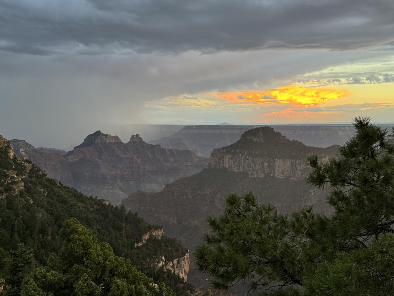
A new community science tool helps scientists gather valuable information on hazardous events such as floods, debris flows, and landslides that occur in the backcountry of Grand Canyon National Park. Visitors to Grand Canyon can help improve our understanding of the impacts these events have which helps to improve future warnings.
The USGS Grand Canyon Monitoring and Research Center has launched a new community science reporting application that allows users to document natural hazard events—such as flooding, debris flows, landslides, or rockfalls—while in the remote sections of Grand Canyon.

The app is accessible via mobile download or directly through a web browser using a URL link or the QR code.
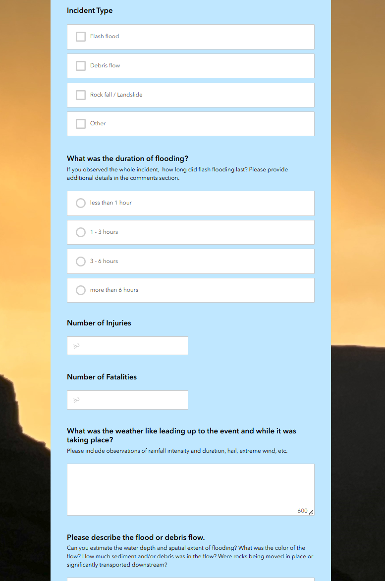
Each entry submitted captures key details including the date, type, and location of the incident, its duration, weather conditions, any injuries or fatalities, additional observations, and optional photos.
Visitors can submit their reports once they return to an area with cell service.
Submitted information is shared with the National Weather Service, contributes to on-going data collection for flash floods and debris flows, and will be used to help improve forecasting of these events in the future.
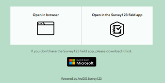
Once on the app's landing page, select "Open in browser" to enter information on a web browser, or select "Open in the Survey123 field app" to download the app to your device.
Background
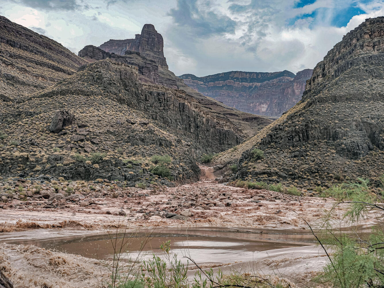
Scientific understanding about flash flood frequency and their impacts on recreation in Grand Canyon remains limited.
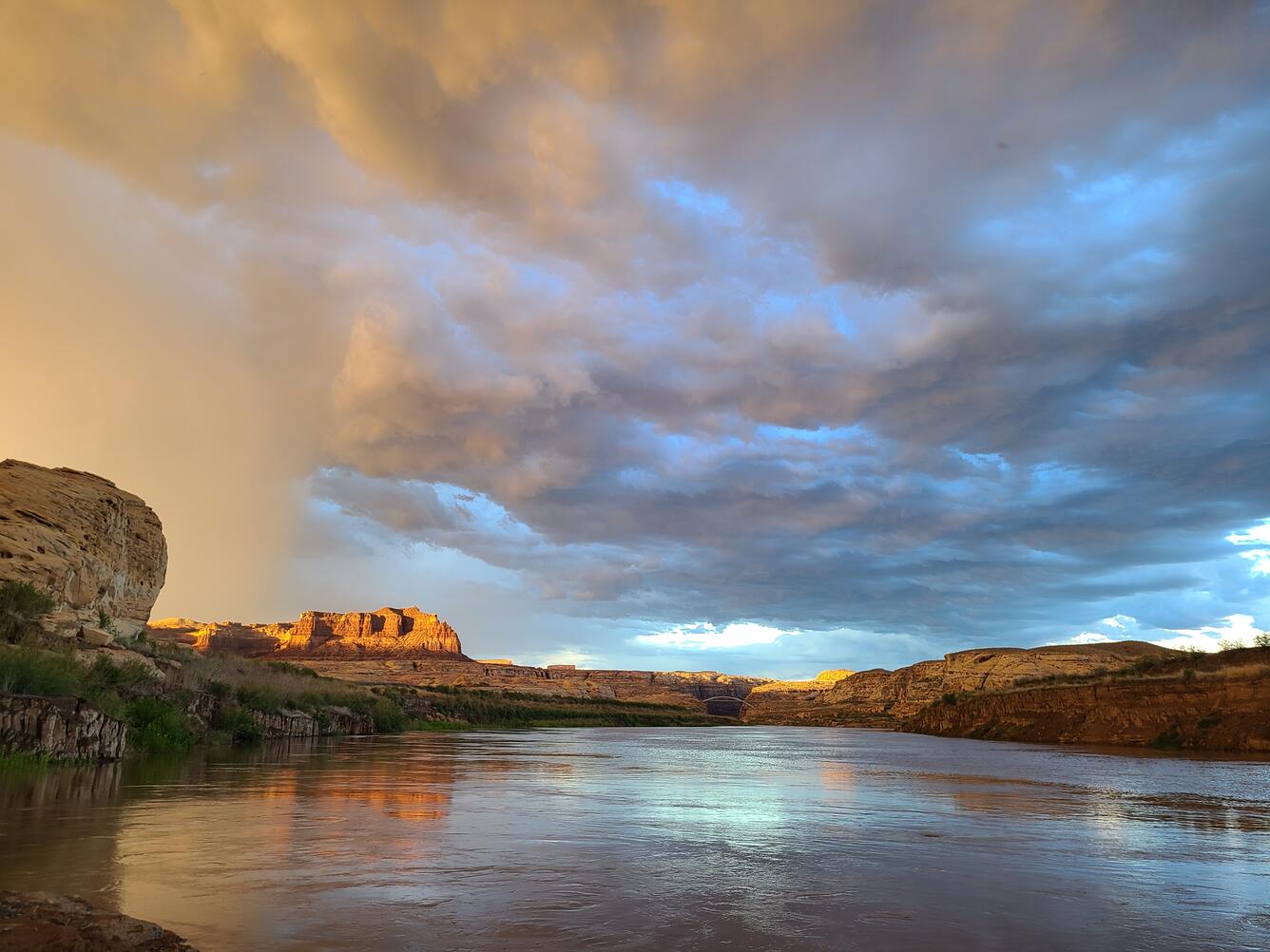
Roughly 740 tributaries flow into the Colorado River in Grand Canyon that do not have stream gages, and all are susceptible to flash flooding.
Data collected through the backcountry event reporting app will help the National Weather Service refine its forecast models and issue more accurate alerts for flash floods and related events in Grand Canyon.
Given the extreme terrain and remoteness of these events, the USGS and its partners identified community science crowdsourcing as the most efficient way to gather on-the-ground observations.
The app allows individuals who witness flash floods, debris flows, or other incidents to record vital, first-hand information.
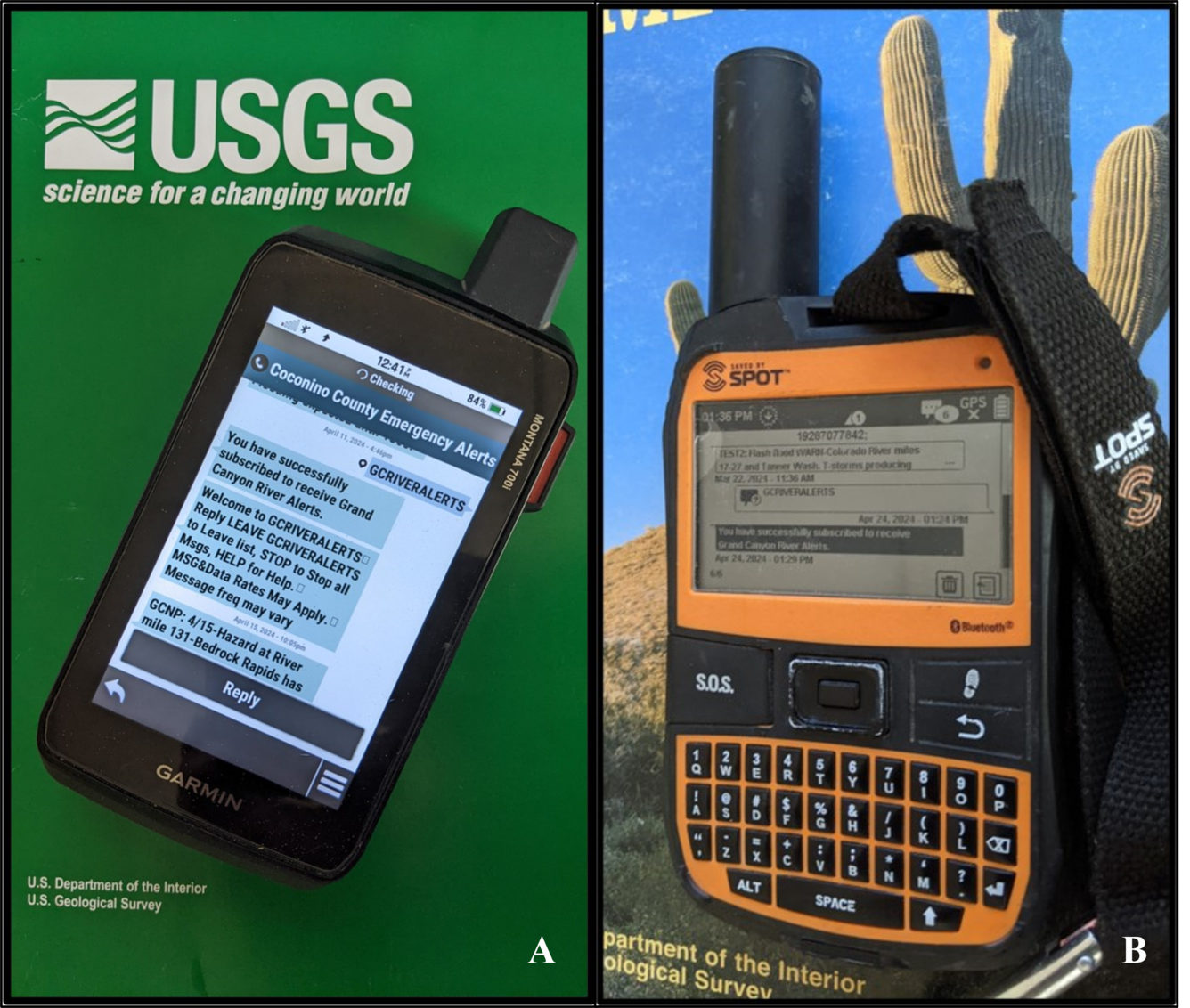
The event reporting application was developed in conjunction with the Grand Canyon River Alert System, a free service developed by the USGS in collaboration with Coconino County Emergency Management, the National Weather Service, and the National Park Service, as an identified need to help improve the accuracy of emergency forecasts.
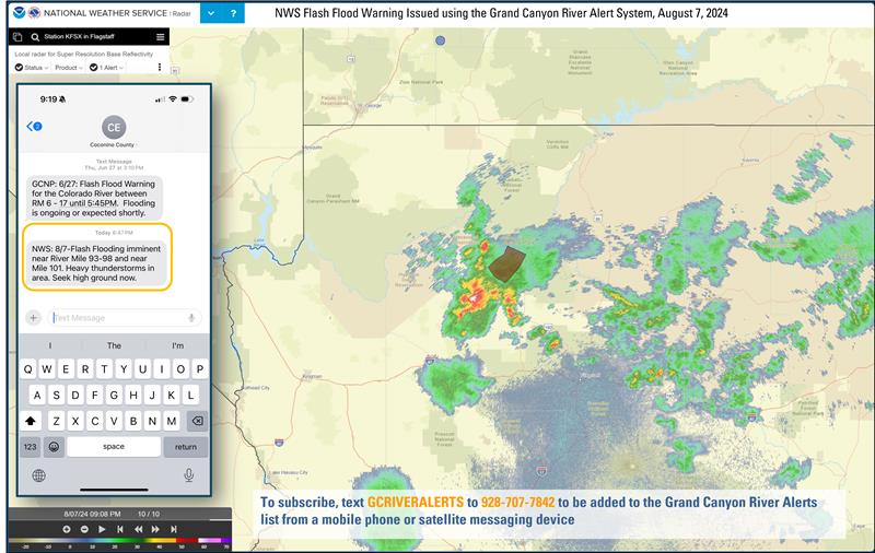
The Grand Canyon Alert System delivers emergency text alerts from Coconino County Emergency Management to subscribers—either to a cell phone when reception is available, or to a satellite messaging device in remote areas of Grand Canyon without cell coverage.
The goal is to engage those traveling in the backcountry, and in particular, subscribers to the Grand Canyon River Alert System, by encouraging them to contribute valuable field observations that will enhance the quality and accuracy of future alerts.
Both the Grand Canyon River Alert System and the backcountry event reporting app were developed in response to a growing awareness of the intersection between weather-related hazards, visitor-use patterns, and advances in satellite communication.
The USGS brings expertise in satellite communication and applied geospatial analysis, integrating data such as river campsites, tributary drainages, other landscape features, and the Colorado River Mile System to better understand risks associated with these events and provide important location data used in the alerts.

The National Weather Service and Coconino County Emergency Management contribute specialized knowledge in crafting and distributing emergency alerts.
The National Park Service offers valuable experience in developing backcountry hazard messaging and disseminating information to backcountry permit holders.
Together, these agencies combined their expertise to design and implement both the alert system and the event reporting application.
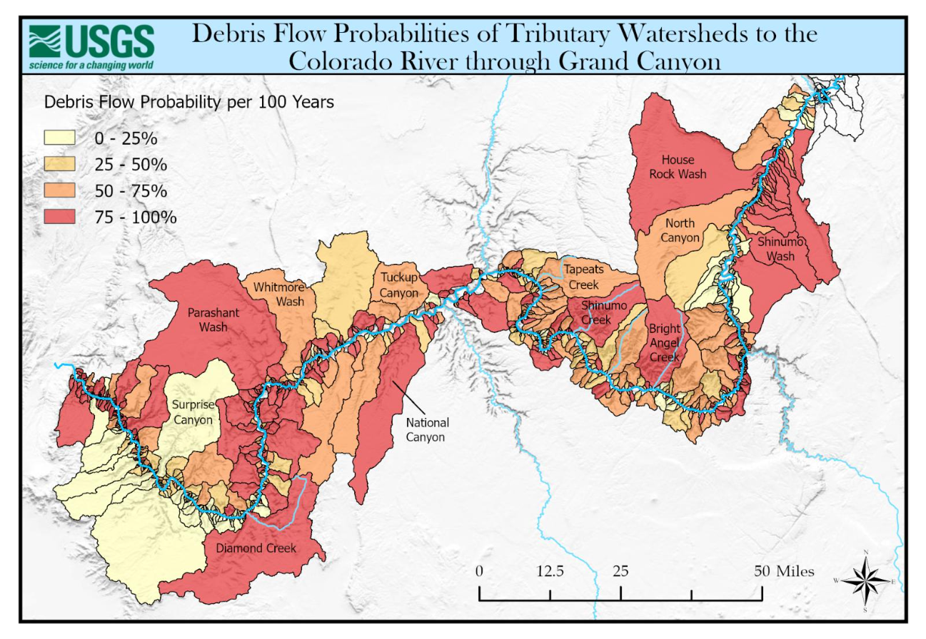
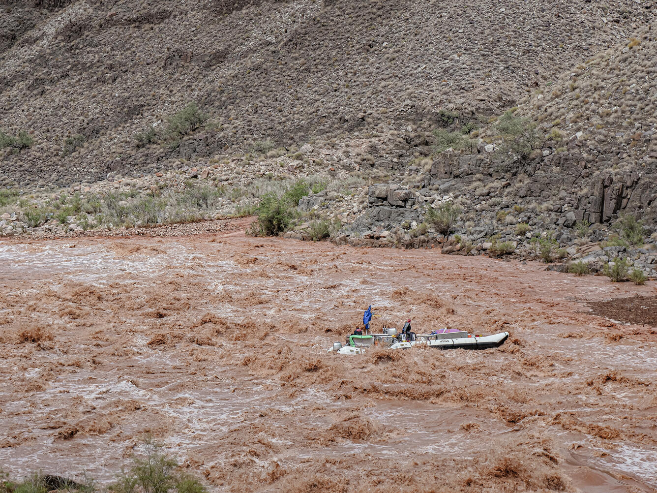
Weather-related risks in Grand Canyon are especially high at debris fans, where tributaries meet the Colorado River and where sandbars are common, attracting people to camp and recreate.
Some landscape features pose greater risk than others—for example, a debris fan near a tributary mouth is more vulnerable during flooding than a sandbar located farther away.
To support risk-based decision-making, the USGS Grand Canyon Monitoring and Research Center geospatial team harvested previously published debris flow probability data for Grand Canyon tributary watersheds and conducted a detailed analysis to estimate debris flow probability and debris fan composition at each campsite.


Tributary watershed information is now integrated into the alert system to help communicate risk levels at specific river mile locations throughout Grand Canyon.
During the 2024 commercial river season—the first year of testing the Grand Canyon River Alert System—a total of 29 alerts were issued.
Most were weather-related alerts from the National Weather Service, warning of potential or imminent flash flooding during the summer monsoon season.
Other alerts included river travel obstructions, anticipated changes in Colorado River flow, and missing persons reports issued by Grand Canyon National Park.
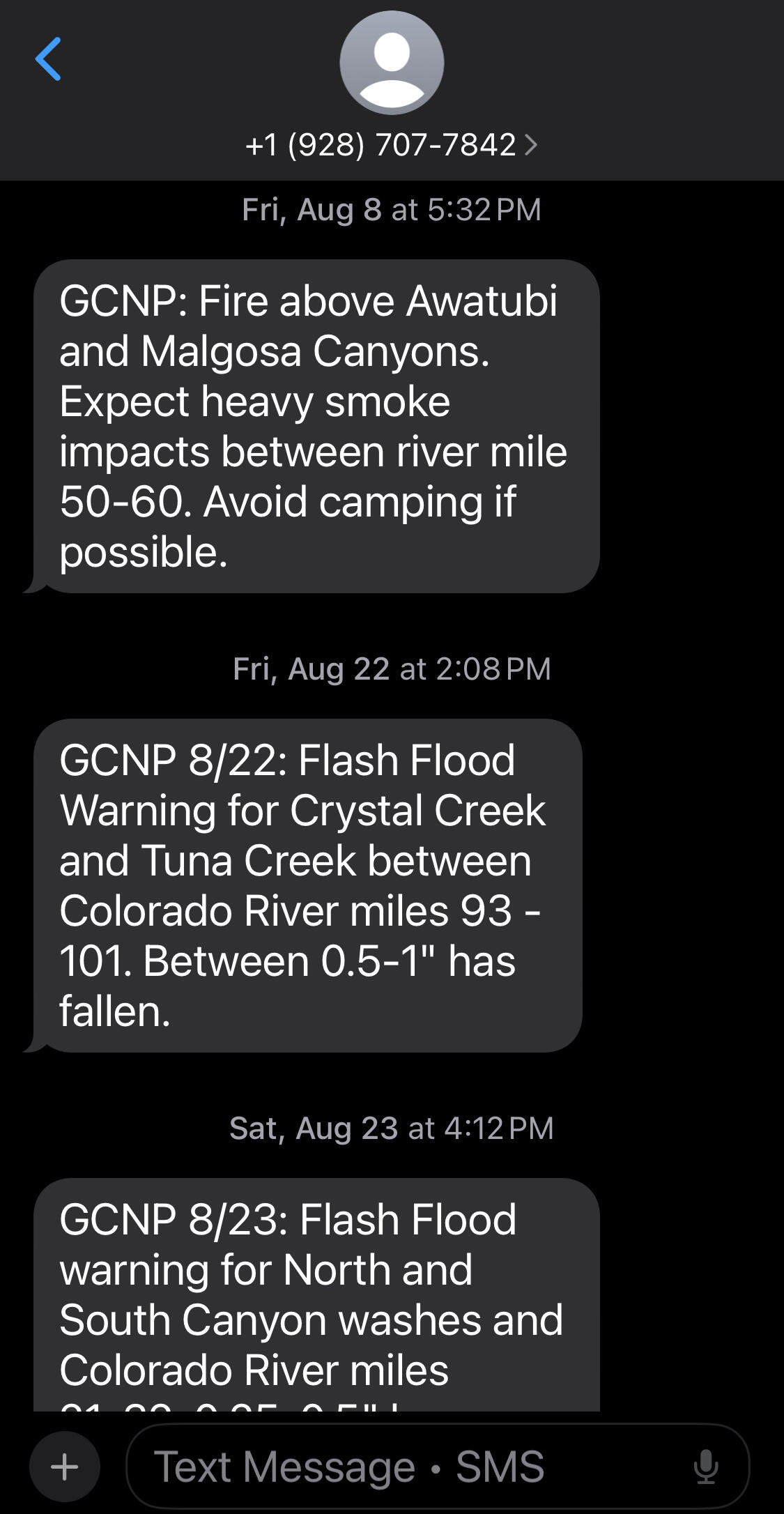
In 2025, the system expanded to include alerts related to wildfire activity, including notifications about areas experiencing heavy smoke from the Dragon Bravo Fire.
Looking Ahead
While the Grand Canyon River Alert System and the community science event reporting application were originally developed to better inform backcountry users about debris flows and flash flood hazards, the potential extends far beyond Grand Canyon.
These tools could serve as models for delivering emergency alerts in other remote wilderness areas—both across the U.S. and internationally.
Data collected through the incident reporting app will not only enhance future forecasting efforts but may also spark new lines of research that haven’t been explored before.
Likewise, feedback from users of both the alert system and the reporting app will help guide the agencies involved, as these tools continue to evolve and expand in use.
Learn more about the new backcountry alert system that warns Grand Canyon visitors about flash floods
A geonarrative about debris flow and flash flood risk in Grand Canyon
A new community science tool helps scientists gather valuable information on hazardous events such as floods, debris flows, and landslides that occur in the backcountry of Grand Canyon National Park. Visitors to Grand Canyon can help improve our understanding of the impacts these events have which helps to improve future warnings.
The USGS Grand Canyon Monitoring and Research Center has launched a new community science reporting application that allows users to document natural hazard events—such as flooding, debris flows, landslides, or rockfalls—while in the remote sections of Grand Canyon.
The app is accessible via mobile download or directly through a web browser using a URL link or the QR code.
Each entry submitted captures key details including the date, type, and location of the incident, its duration, weather conditions, any injuries or fatalities, additional observations, and optional photos.
Visitors can submit their reports once they return to an area with cell service.
Submitted information is shared with the National Weather Service, contributes to on-going data collection for flash floods and debris flows, and will be used to help improve forecasting of these events in the future.
Once on the app's landing page, select "Open in browser" to enter information on a web browser, or select "Open in the Survey123 field app" to download the app to your device.
Background
Scientific understanding about flash flood frequency and their impacts on recreation in Grand Canyon remains limited.
Roughly 740 tributaries flow into the Colorado River in Grand Canyon that do not have stream gages, and all are susceptible to flash flooding.
Data collected through the backcountry event reporting app will help the National Weather Service refine its forecast models and issue more accurate alerts for flash floods and related events in Grand Canyon.
Given the extreme terrain and remoteness of these events, the USGS and its partners identified community science crowdsourcing as the most efficient way to gather on-the-ground observations.
The app allows individuals who witness flash floods, debris flows, or other incidents to record vital, first-hand information.
The event reporting application was developed in conjunction with the Grand Canyon River Alert System, a free service developed by the USGS in collaboration with Coconino County Emergency Management, the National Weather Service, and the National Park Service, as an identified need to help improve the accuracy of emergency forecasts.
The Grand Canyon Alert System delivers emergency text alerts from Coconino County Emergency Management to subscribers—either to a cell phone when reception is available, or to a satellite messaging device in remote areas of Grand Canyon without cell coverage.
The goal is to engage those traveling in the backcountry, and in particular, subscribers to the Grand Canyon River Alert System, by encouraging them to contribute valuable field observations that will enhance the quality and accuracy of future alerts.
Both the Grand Canyon River Alert System and the backcountry event reporting app were developed in response to a growing awareness of the intersection between weather-related hazards, visitor-use patterns, and advances in satellite communication.
The USGS brings expertise in satellite communication and applied geospatial analysis, integrating data such as river campsites, tributary drainages, other landscape features, and the Colorado River Mile System to better understand risks associated with these events and provide important location data used in the alerts.
The National Weather Service and Coconino County Emergency Management contribute specialized knowledge in crafting and distributing emergency alerts.
The National Park Service offers valuable experience in developing backcountry hazard messaging and disseminating information to backcountry permit holders.
Together, these agencies combined their expertise to design and implement both the alert system and the event reporting application.
Weather-related risks in Grand Canyon are especially high at debris fans, where tributaries meet the Colorado River and where sandbars are common, attracting people to camp and recreate.
Some landscape features pose greater risk than others—for example, a debris fan near a tributary mouth is more vulnerable during flooding than a sandbar located farther away.
To support risk-based decision-making, the USGS Grand Canyon Monitoring and Research Center geospatial team harvested previously published debris flow probability data for Grand Canyon tributary watersheds and conducted a detailed analysis to estimate debris flow probability and debris fan composition at each campsite.
Tributary watershed information is now integrated into the alert system to help communicate risk levels at specific river mile locations throughout Grand Canyon.
During the 2024 commercial river season—the first year of testing the Grand Canyon River Alert System—a total of 29 alerts were issued.
Most were weather-related alerts from the National Weather Service, warning of potential or imminent flash flooding during the summer monsoon season.
Other alerts included river travel obstructions, anticipated changes in Colorado River flow, and missing persons reports issued by Grand Canyon National Park.
In 2025, the system expanded to include alerts related to wildfire activity, including notifications about areas experiencing heavy smoke from the Dragon Bravo Fire.
Looking Ahead
While the Grand Canyon River Alert System and the community science event reporting application were originally developed to better inform backcountry users about debris flows and flash flood hazards, the potential extends far beyond Grand Canyon.
These tools could serve as models for delivering emergency alerts in other remote wilderness areas—both across the U.S. and internationally.
Data collected through the incident reporting app will not only enhance future forecasting efforts but may also spark new lines of research that haven’t been explored before.
Likewise, feedback from users of both the alert system and the reporting app will help guide the agencies involved, as these tools continue to evolve and expand in use.