Photo of subcore tubes inserted into mud before they are removed
Photo of subcore tubes inserted into mud before they are removedPhoto of subcore tubes inserted into mud before they are removed.


Official websites use .gov
A .gov website belongs to an official government organization in the United States.

Secure .gov websites use HTTPS
A lock () or https:// means you’ve safely connected to the .gov website. Share sensitive information only on official, secure websites.

St. Petersburg Coastal and Marine Science Center images.

Photo of subcore tubes inserted into mud before they are removed.
Photo of subcore tubes inserted into mud before they are removed.

Photo of researchers positioning giant box core in hoist on deck of the research vessel
Photo of researchers positioning giant box core in hoist on deck of the research vessel

Photograph of planktic foraminifers collected from the sediment trap. Magnified 255x.
Photograph of planktic foraminifers collected from the sediment trap. Magnified 255x.

This image displays expected overwash probabilities at Cape Canaveral given a typical nor’easter storm striking the coast.
This image displays expected overwash probabilities at Cape Canaveral given a typical nor’easter storm striking the coast.

We collect terrestrial (barrier island) and marine (nearshore and estuarine) sediment cores to ground-truth geophysical observations. These cores are used to understand the history of barrier island formation and erosion.
We collect terrestrial (barrier island) and marine (nearshore and estuarine) sediment cores to ground-truth geophysical observations. These cores are used to understand the history of barrier island formation and erosion.
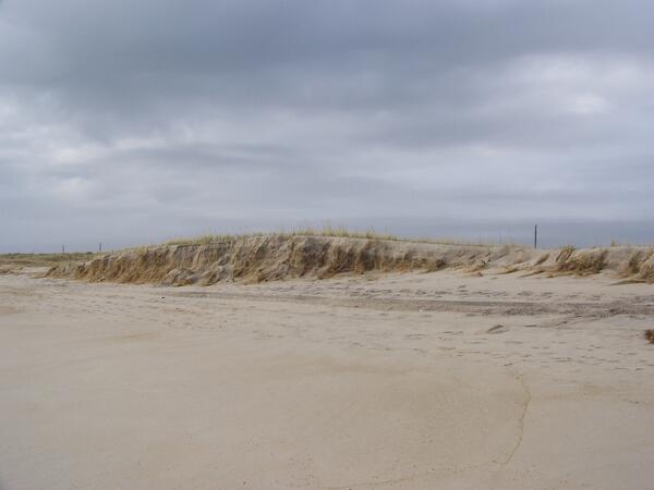
An eroded dune due to waves striking the base of the dune (called a "collision regime"), during a storm. This erosion left the dune narrower and more susceptible to future damage by creating a scarp. Collision at a dune toe can erode and collapse dunes, creating a scarp feature.
An eroded dune due to waves striking the base of the dune (called a "collision regime"), during a storm. This erosion left the dune narrower and more susceptible to future damage by creating a scarp. Collision at a dune toe can erode and collapse dunes, creating a scarp feature.
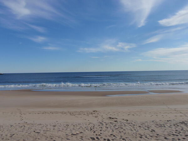
Waves carrying sand back to the beach, forming a sandbar after an erosion event. This image demonstrates how eroded sediment typically returns to the beach after a storm. Ponquogue Beach, Hampton Bays, NY
Waves carrying sand back to the beach, forming a sandbar after an erosion event. This image demonstrates how eroded sediment typically returns to the beach after a storm. Ponquogue Beach, Hampton Bays, NY
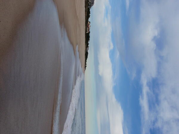
Image 3. Swash regime on the Long Island South Shore near East Hampton, NY. This cuspate beach shows waves flowing onto the lower beach (called swash) but stopping well short of the dune toe.
Image 3. Swash regime on the Long Island South Shore near East Hampton, NY. This cuspate beach shows waves flowing onto the lower beach (called swash) but stopping well short of the dune toe.
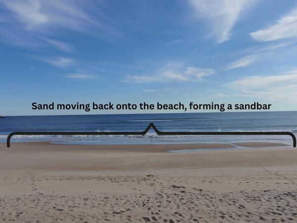
Waves return sand to a beach forming a sandbar after an erosion event during a storm, at Ponquogue Beach, Hampton Bays, NY.
Waves return sand to a beach forming a sandbar after an erosion event during a storm, at Ponquogue Beach, Hampton Bays, NY.
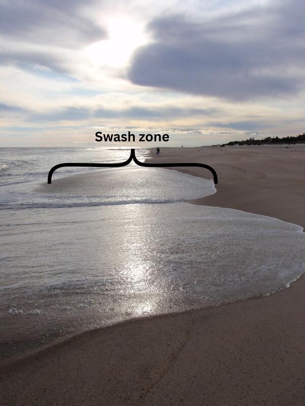
Waves flow onto a beach after a wave break on the part of the beach called the 'swash zone' (labeled).
Waves flow onto a beach after a wave break on the part of the beach called the 'swash zone' (labeled).
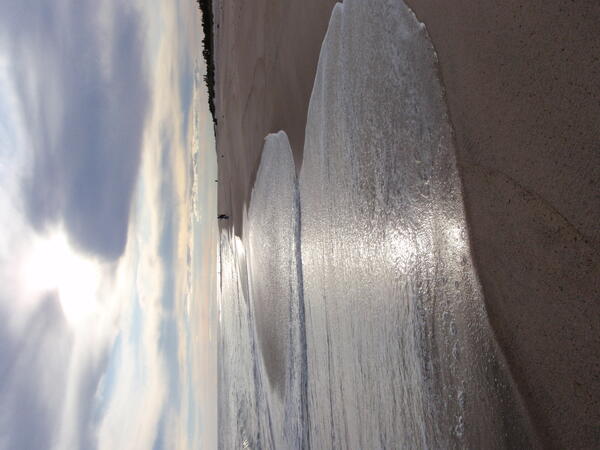
Waves flow onto a beach after a wave break on the part of the beach called the 'swash zone'.
Waves flow onto a beach after a wave break on the part of the beach called the 'swash zone'.

The Native communities’ in-ground food storage facilities are being lost as a result of eroding bluffs and thawing permafrost.
The Native communities’ in-ground food storage facilities are being lost as a result of eroding bluffs and thawing permafrost.

Though this image was taken prior to the peak of the Nor'Ida storm event, elevated water levels have already eroded the oceanside of a primary dune.
Though this image was taken prior to the peak of the Nor'Ida storm event, elevated water levels have already eroded the oceanside of a primary dune.

Low dunes on Cape Canaveral often overwash during storm events, transporting sand landward. Critical infrastructure may be buried or flooded. In addition, significant landward transport of sand may lead to extensive shoreline erosion.
Low dunes on Cape Canaveral often overwash during storm events, transporting sand landward. Critical infrastructure may be buried or flooded. In addition, significant landward transport of sand may lead to extensive shoreline erosion.

Photo showing turtle tracks leading from a nest on a dune at Cape Canaveral.
Photo showing turtle tracks leading from a nest on a dune at Cape Canaveral.

Kristen Hart releasing a satellite-tagged hawksbill sea turtle, August 2008, Dry Tortugas National Park.
Kristen Hart releasing a satellite-tagged hawksbill sea turtle, August 2008, Dry Tortugas National Park.

USGS staff collecting a sediment core on Ft. Desoto Beach, Florida using vibracoring equipment. This type of sediment coring uses the vibration of an electric motor to sink an aluminum core barrel into the ground. When the core barrel enters the ground the sediment in the ground fills up the barrel and the crew uses the tripod to pull the core out of the ground.
USGS staff collecting a sediment core on Ft. Desoto Beach, Florida using vibracoring equipment. This type of sediment coring uses the vibration of an electric motor to sink an aluminum core barrel into the ground. When the core barrel enters the ground the sediment in the ground fills up the barrel and the crew uses the tripod to pull the core out of the ground.

Flooded coastal streets, houses, and fields after Hurricane Ike passes through Texas
Flooded coastal streets, houses, and fields after Hurricane Ike passes through Texas
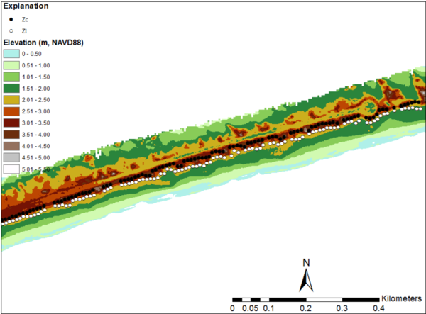
Image 2: Lidar-derived elevations from Santa Rosa Island, Florida, collected September 8, 2008, after Hurricane Gustav. White dots indicate the extracted position of the dune base, while black dots indicate the extracted position of the dune crest. Beach slope and shoreline can also be determined from this data.
Image 2: Lidar-derived elevations from Santa Rosa Island, Florida, collected September 8, 2008, after Hurricane Gustav. White dots indicate the extracted position of the dune base, while black dots indicate the extracted position of the dune crest. Beach slope and shoreline can also be determined from this data.
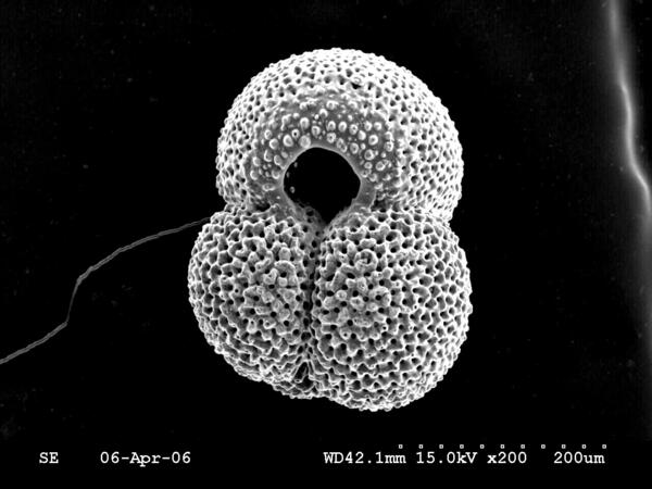
Scanning electron microsope image of the planktic foraminifer Globigerinoides ruber
Scanning electron microsope image of the planktic foraminifer Globigerinoides ruber
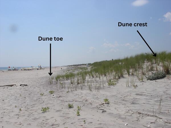
Image 1B. A coastal dune in Ponquogue Beach, Long Island, NY with the dune crest and dune toe labeled.
Image 1B. A coastal dune in Ponquogue Beach, Long Island, NY with the dune crest and dune toe labeled.