



SEABOSS 3.0 Reaches New Milestone with Successful Testing
Explore Global Coastal Research Using the COAWST Applications Catalog
USGS Coastal Change Products Help the EPA Safeguard Long Island Sound Shorelines
Sound Waves Newsletter
Explore coastal and marine science from across the USGS in Sound Waves.
Explore coastal and marine science from across the USGS in Sound Waves.
Woods Hole Coastal and Marine Science Center Newsletter: Spring 2026
Sharing science stories, popular social media posts, recent publications, fieldwork activities, and more center happenings.
Sharing science stories, popular social media posts, recent publications, fieldwork activities, and more center happenings.
A Path to National-Scale Coastal Change Projections
GeoPackage of Seabed Hazards: A Resource for Safeguarding Offshore Infrastructure
We Make Treasure Maps: USGS Charts the Seafloor to Help Locate Critical Minerals, Precious Metals, and Other Vital Resources
Woods Hole Coastal and Marine Science Center
Our center is one of three facilities serving the mission of the USGS Coastal and Marine Hazards and Resources Program.
We study extreme events and physical, biological, and chemical processes that shape our coastal and marine environments. Using this information, we identify hazards and provide critical information on our Nation’s resources. Our research and science-based products provide the strong scientific foundation needed by decisions makers, scientists, and state and federal agencies to address public safety, national security, and resource management across our Nation’s coastal and submerged lands.
Research
Research

Read about our science projects, find out where we are working and why it matters

Highlights
Highlights
- Sound Waves: Coastal and Marine Research News from Across the USGS
- Woods Hole Coastal and Marine Science Center Newsletter
- Annual Reports and General Information Product
- Woods Hole Coastal and Marine Science Center Field Activities
- Employment Opportunities
- Decadal Science Strategy
- Featured USGS Series Report
News
Woods Hole Coastal and Marine Science Center Newsletter: Summer 2026
Woods Hole Coastal and Marine Science Center Newsletter: Summer 2026
Sound Waves Newsletter: Summer 2026
Sound Waves Newsletter: Summer 2026
Woods Hole Coastal and Marine Science Center: 2025 Annual Report
Woods Hole Coastal and Marine Science Center: 2025 Annual Report
Publications
Probabilistic forecasting of coastal wetland elevation and soil carbon response to sea-level rise Probabilistic forecasting of coastal wetland elevation and soil carbon response to sea-level rise
Tidal wetlands build soil as a dynamic response to inundation, resulting in carbon sequestration and resilience to sea-level rise. Process models can be used to make site-specific forecasts, anticipate future changes, and plan management responses. But to be actionable, forecasts from these models need to be accompanied by descriptions of their confidence. In this study, we demonstrate...
Production of secondary microbial methane from a gas hydrate-bearing reservoir at the HYDRATE P1 Production Test Well (PTW-1) on the Alaskan North Slope Production of secondary microbial methane from a gas hydrate-bearing reservoir at the HYDRATE P1 Production Test Well (PTW-1) on the Alaskan North Slope
Gas hydrate in the Alaskan North Slope (ANS) is believed to contain as much methane as the known conventional gas accumulations in the Prudhoe Bay field. The JOGMEC-DOE-USGS Collaborative Gas Hydrate R&D Project conducted an extended-duration production test from the sub-permafrost, gas-hydrate saturated B1 sand reservoir (unit B) at the Kuparuk State 7-11-12 Site in the Prudhoe Bay Unit...
Depositional environment and diagenetic history of gas hydrate-bearing sediments of the Alaska North Slope (HYDRATE 02 Geo Data Well) Depositional environment and diagenetic history of gas hydrate-bearing sediments of the Alaska North Slope (HYDRATE 02 Geo Data Well)
We characterized the lithological, solid-phase geochemical, and rock magnetic properties of sediment cores from subpermafrost strata on the Alaska North Slope collected as part of the U.S. Department of Energy (DOE), the Japan Organization for Metals and Energy Security (JOGMEC), and the U.S. Geological Survey (USGS) Collaborative Gas Hydrate Research and Development (R&D) Project in...
Science

COAWST: A Coupled-Ocean-Atmosphere-Wave-Sediment Transport Modeling System
Understanding the processes responsible for coastal change is important for managing both our natural and economic coastal resources. Storms are one of the primary driving forces causing coastal change from a coupling of wave- and wind-driven flows. To better understand storm impacts and their effects on our coastlines, there is an international need to better predict storm paths and intensities...
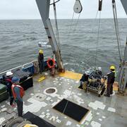
Coastal and Marine Science in Long Island Sound
Long Island Sound is a highly productive estuary and vital natural resource bordering New York and Connecticut. It’s essential for its massive economic impact, generating billions annually by supporting recreation, fisheries, and transportation, as well as its biodiversity, serving as a critical habitat for thousands of marine species. USGS research in Long Island Sound helps protect these...
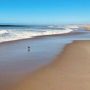
National Shoreline Change Data Publication Catalog
The U.S. Geological Survey (USGS) maintains shoreline positions for the United States from older sources, such as aerial photos and topographic surveys, and contemporary sources like digital elevation models (DEMs) and lidar elevation point cloud data. It's important to maintain, and make available, records of historical shoreline positions to allow monitoring of change over time, and to identify...