
Hurricane Florence - Forecast and Documentation of Coastal Change
Hurricane Florence coastal change forecast and pre- and post-storm photos documenting coastal change.
Forecast of Potential Coastal Change
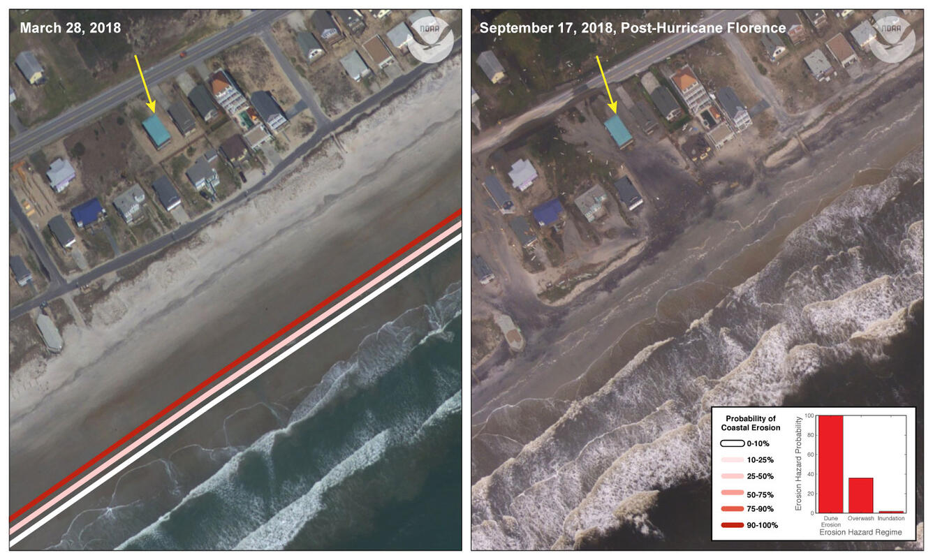
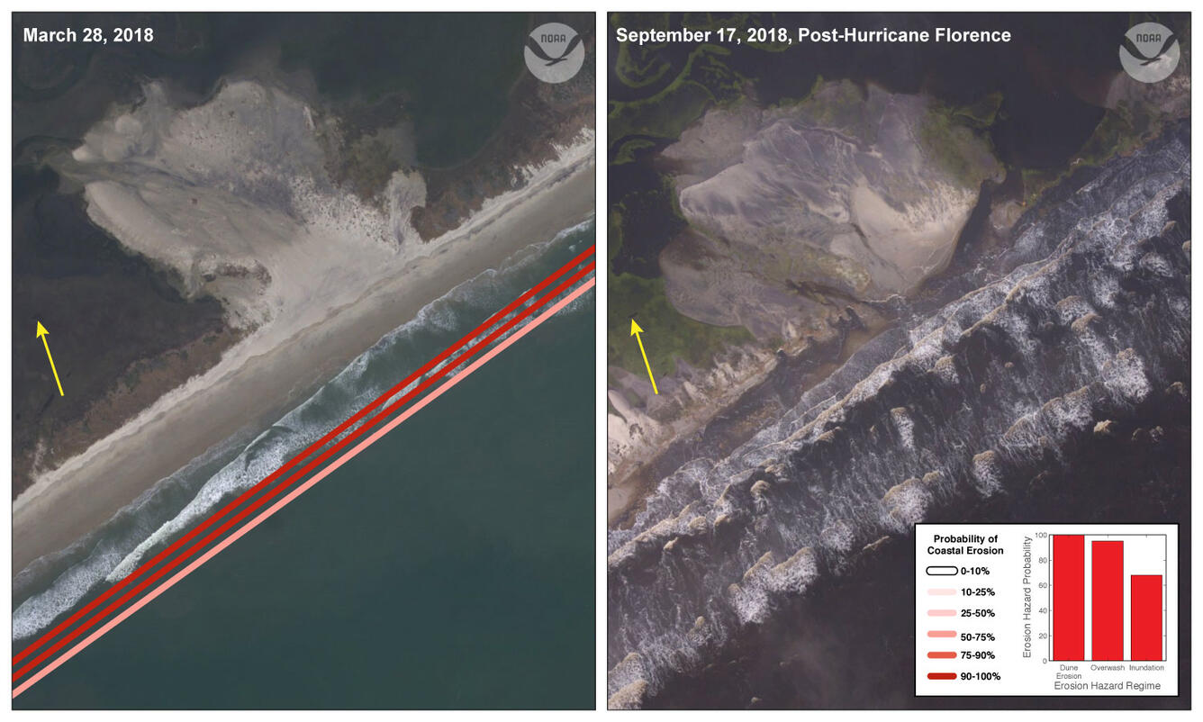
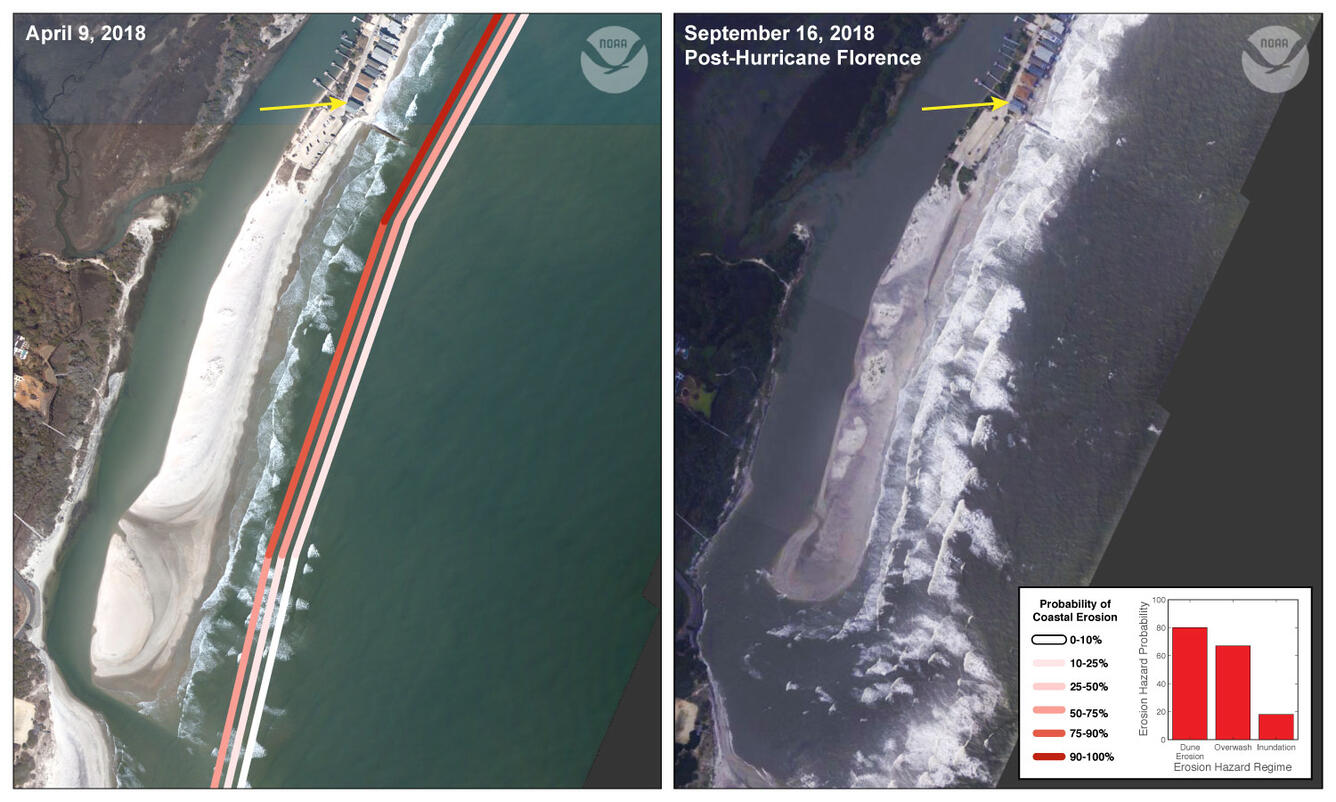
The coastal change forecast model predicts the probability of where and how sand dunes along the coast will be impacted by water levels during a storm. This includes the combined effect of surge and wave runup. The color band closest to the shoreline is the probability of dune erosion, the middle color band is the probability that sand dunes will be overtopped by waves during the storm, and the outer color band is the probability that the sand dunes will be completely inundated/flooded. The model forecast is available on the Coastal Change Hazards Portal and more information about the model can be found at: Scenario-Based Assessments for Coastal Change Hazard Forecasts.

Pre-and Post-Storm Photo Comparisons
Below is an initial comparison of imagery collected by the National Oceanic and Atmospheric Administration (NOAA) in 2018 with similar imagery taken a few days after Hurricane Florence’s landfall (https://storms.ngs.noaa.gov/). These photos provide information about how the coast was impacted by the storm and can be used as validation for the model.


Below are other science projects associated with this project.

Forecasting Coastal Change

National Assessment of Coastal Change Hazards
Hurricane Florence coastal change forecast and pre- and post-storm photos documenting coastal change.
Forecast of Potential Coastal Change
The coastal change forecast model predicts the probability of where and how sand dunes along the coast will be impacted by water levels during a storm. This includes the combined effect of surge and wave runup. The color band closest to the shoreline is the probability of dune erosion, the middle color band is the probability that sand dunes will be overtopped by waves during the storm, and the outer color band is the probability that the sand dunes will be completely inundated/flooded. The model forecast is available on the Coastal Change Hazards Portal and more information about the model can be found at: Scenario-Based Assessments for Coastal Change Hazard Forecasts.
Pre-and Post-Storm Photo Comparisons
Below is an initial comparison of imagery collected by the National Oceanic and Atmospheric Administration (NOAA) in 2018 with similar imagery taken a few days after Hurricane Florence’s landfall (https://storms.ngs.noaa.gov/). These photos provide information about how the coast was impacted by the storm and can be used as validation for the model.
Below are other science projects associated with this project.
Forecasting Coastal Change