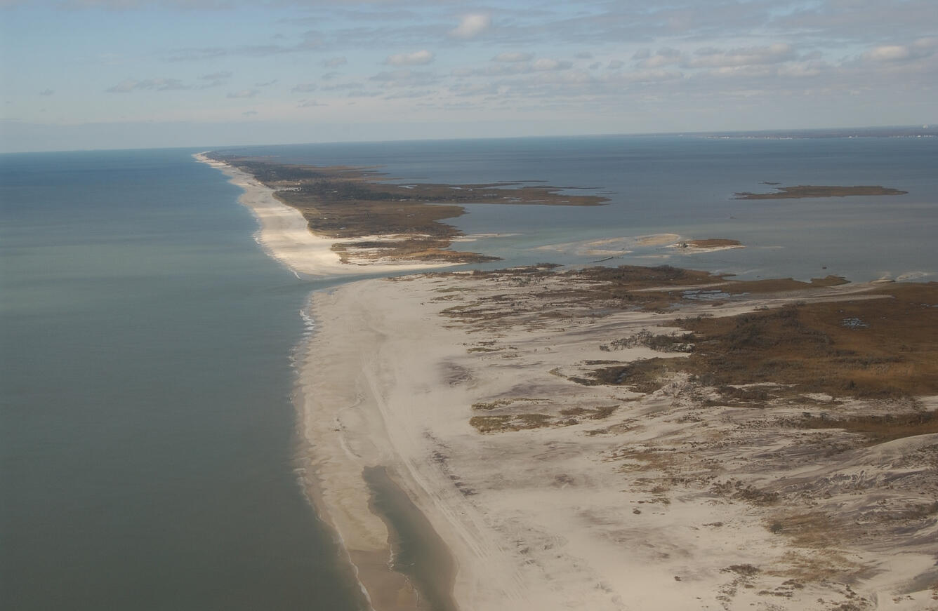
Storms quickly and dramatically alter barrier island environments by changing adjacent seafloor morphology, eroding beaches, scarping or leveling dunes, and sometimes creating new inlets. Measuring the magnitude of barrier island sediment movement during and after storms allows us to track rates of beach recovery, dune growth, and inlet-related alterations to barrier island sediment supply.
Introduction
Storms affect barrier islands immediately and dramatically, but they also drive sediment fluxes that help barriers adjust to changes in sea level. As part of the Coastal Sediment Availability and Flux project, we measure the changes storms make to barrier islands, such as how the volume of beaches and dunes change, where that sediment goes (either offshore or landward), and how developed and undeveloped parts of barrier islands respond differently. This information, coupled with an estimate of storm frequency, gives us some insight into the potential magnitude of long-term fluxes which we can integrate with models to make predictions about long-term barrier island vulnerability.
Barrier-estuary system change from Hurricane Sandy
Coastal Sediment Availability and Flux (CSAF)
Below are publications associated with this project.
Shoreface and Holocene sediment thickness offshore of Rockaway Peninsula, New York
Satellite-derived barrier response and recovery following natural and anthropogenic perturbations, northern Chandeleur Islands, Louisiana
Impacts of sediment removal from and placement in coastal barrier island systems
Executive SummaryOn June 24, 2019, Congressman Raul Grijalva of Arizona, Chair of the House Committee on Natural Resources, sent a letter to the directors of the U.S. Fish and Wildlife Service and the U.S. Geological Survey to request their assistance in answering questions regarding coastal sediment resource management within the Coastal Barrier Resources System as defined by the Coastal Barrier
Characterizing storm response and recovery using the beach change envelope: Fire Island, New York
Quantification of storm-induced bathymetric change in a back-barrier estuary
Evolution of mid-Atlantic coastal and back-barrier estuary environments in response to a hurricane: Implications for barrier-estuary connectivity
- Overview
Storms quickly and dramatically alter barrier island environments by changing adjacent seafloor morphology, eroding beaches, scarping or leveling dunes, and sometimes creating new inlets. Measuring the magnitude of barrier island sediment movement during and after storms allows us to track rates of beach recovery, dune growth, and inlet-related alterations to barrier island sediment supply.
Introduction
Storms affect barrier islands immediately and dramatically, but they also drive sediment fluxes that help barriers adjust to changes in sea level. As part of the Coastal Sediment Availability and Flux project, we measure the changes storms make to barrier islands, such as how the volume of beaches and dunes change, where that sediment goes (either offshore or landward), and how developed and undeveloped parts of barrier islands respond differently. This information, coupled with an estimate of storm frequency, gives us some insight into the potential magnitude of long-term fluxes which we can integrate with models to make predictions about long-term barrier island vulnerability.
Barrier-estuary system change from Hurricane Sandy
Big storms move sediment from the front of the barrier to the top and the back of the barrier through a process called overwash. In addition to causing a lot of overwash, Hurricane Sandy also cut through (breached) the island in two places on Island Beach near Mantoloking, NJ, resulting in deposition (shown in green shades) in the estuary.
Predictions of future vulnerability of Island Beach, NJ based on sediment flux estimates from Hurricane Sandy. The two panels display black and white vertical lines overlayed on a map of Island Beach, NJ. The top panel represents a sea-level rise rate of 7mm/year shows mostly black lines, while the bottom panel, represents a sea-level rise rate of 10mm/year, shows mostly white and gray lines. Black lines indicate that it is possible for the barrier to keep up with sea-level rise, whereas as white and gray lines indicate the barrier may be vulnerable to sea-level rise. - Science
Coastal Sediment Availability and Flux (CSAF)
Sediments are the foundation of coastal systems, including barrier islands. Their behavior is driven by not only sediment availability, but also sediment exchanges between barrier island environments. We collect geophysical, remote sensing, and sediment data to estimate these parameters, which are integrated with models to improve prediction of coastal response to extreme storms and sea-level rise... - Publications
Below are publications associated with this project.
Shoreface and Holocene sediment thickness offshore of Rockaway Peninsula, New York
During September and October 2019, the U.S. Geological Survey mapped the shoreface and inner continental shelf offshore of the Rockaway Peninsula in New York using high-resolution chirp seismic reflection and single-beam bathymetry geophysical techniques. The results from this study are important for assessing the Quaternary evolution of the Rockaway Peninsula and determining coastal sediment avaiAuthorsEmily A. Wei, Jennifer L. Miselis, Arnell S. FordeSatellite-derived barrier response and recovery following natural and anthropogenic perturbations, northern Chandeleur Islands, Louisiana
The magnitude and frequency of storm events, relative sea-level rise (RSLR), sediment supply, and anthropogenic alterations drive the morphologic evolution of barrier island systems, although the relative importance of any one driver will vary with the spatial and temporal scales considered. To explore the relative contributions of storms and human alterations to sediment supply on de-cadal changeAuthorsJulie Bernier, Jennifer L. Miselis, Nathaniel PlantImpacts of sediment removal from and placement in coastal barrier island systems
Executive SummaryOn June 24, 2019, Congressman Raul Grijalva of Arizona, Chair of the House Committee on Natural Resources, sent a letter to the directors of the U.S. Fish and Wildlife Service and the U.S. Geological Survey to request their assistance in answering questions regarding coastal sediment resource management within the Coastal Barrier Resources System as defined by the Coastal Barrier
AuthorsJennifer L. Miselis, James G. Flocks, Sara Zeigler, Davina Passeri, David R. Smith, Jill Bourque, Christopher R. Sherwood, Christopher G. Smith, Daniel J. Ciarletta, Kathryn Smith, Kristen Hart, David C. Kazyak, Alicia Berlin, Bianca Prohaska, Teresa Calleson, Kristi YanchisCharacterizing storm response and recovery using the beach change envelope: Fire Island, New York
Hurricane Sandy at Fire Island, New York presented unique challenges in the quantification of storm impacts using traditional metrics of coastal change, wherein measured changes (shoreline, dune crest, and volume change) did not fully reflect the substantial changes in sediment redistribution following the storm. We used a time series of beach profile data at Fire Island, New York to define a newAuthorsOwen T. Brenner, Erika Lentz, Cheryl J. Hapke, Rachel Henderson, Kathleen Wilson, Timothy NelsonQuantification of storm-induced bathymetric change in a back-barrier estuary
Geomorphology is a fundamental control on ecological and economic function of estuaries. However, relative to open coasts, there has been little quantification of storm-induced bathymetric change in back-barrier estuaries. Vessel-based and airborne bathymetric mapping can cover large areas quickly, but change detection is difficult because measurement errors can be larger than the actual changes oAuthorsNeil K. Ganju, Steven E. Suttles, Alexis Beudin, Daniel J. Nowacki, Jennifer L. Miselis, Brian D. AndrewsEvolution of mid-Atlantic coastal and back-barrier estuary environments in response to a hurricane: Implications for barrier-estuary connectivity
Assessments of coupled barrier island-estuary storm response are rare. Hurricane Sandy made landfall during an investigation in Barnegat Bay-Little Egg Harbor estuary that included water quality monitoring, geomorphologic characterization, and numerical modeling; this provided an opportunity to characterize the storm response of the barrier island-estuary system. Barrier island morphologic responsAuthorsJennifer L. Miselis, Brian D. Andrews, Robert S. Nicholson, Zafer Defne, Neil K. Ganju, Anthony S. Navoy