



Sediment Transport
Sediment Transport
Filter Total Items: 26
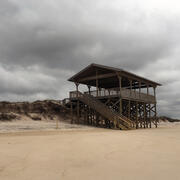
Collision Regime
This informational webpage provides an overview to community planners and emergency managers regarding the coastal hazards associated with collision, a regime within the storm impact scale. This page describes the conditions that lead to a collision regime and the risks it poses to local resources. Collision is the second of four storm impact regimes, and the first regime where substantial impacts...
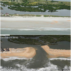
Inundation Regime
This informational webpage provides an overview to community planners and emergency managers regarding the coastal hazards associated with inundation, a regime within the storm impact scale. This page describes the conditions that lead to the inundation regime and the risks it poses to the beach and adjacent communities. Inundation is the fourth of four storm-impact regimes and is the most severe...

Overwash Regime
This informational webpage provides an overview to community planners and emergency managers regarding coastal hazards associated with overwash, a regime within the storm impact scale. This page describes the conditions that lead to the overwash regime and the risks it poses to the beach and local community. Overwash is the third of four storm-impact regimes and leads to considerable impacts on...

Let's Get Technical: Water Levels
This webpage provides a technical description of how water levels are defined and calculated during a coastal storm event (such as a hurricane). It describes how the USGS team calculates the peak water level against which a reference beach complex is modeled in order to determine risks.
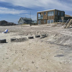
How Storm-Impact Regimes Affect Beach Complexes: Coastal Hazards
This webpage explains coastal hazards caused by high water at the coast. These high-water levels, called "total water levels," happen when tides, waves, and storms combine and push the ocean higher than normal. This page provides an overview for community planners, emergency managers, and anyone else who wants to understand these risks.

APPROACH (APplying Proxy-based Reconstruction Of Atlantic Climate CHange)
USGS scientists use marine geological archives to investigate how ocean temperature, salinity and circulation patterns changed over the past few centuries to millennia. This is done by analyzing the geochemical and physical clues about past environments that are preserved in fossil coral skeletons, clam shells, foraminifera and marine sediments.

Coastal Resource Evaluation for Management Application (CREMA)
Coastal environments are dynamic systems that provide high ecological, economical, recreational, and cultural value. Managing coastal systems requires a comprehensive understanding of the complex interactions between geological and ecological processes, as well as the ability to predict both the near-term and long-term impacts of storms and sea-level rise. The Coastal Resource Evaluation for...

Coastal Sediment Availability and Flux (CSAF)
Sediments are the foundation of coastal systems, including barrier islands. Their behavior is driven by not only sediment availability, but also sediment exchanges between barrier island environments. We collect geophysical, remote sensing, and sediment data to estimate these parameters, which are integrated with models to improve prediction of coastal response to extreme storms and sea-level rise...

Coastal System Change at Fire Island, New York
Fire Island is a 50-km long barrier island along the south shore of Long Island, New York. The island is comprised of seventeen year-round communities; federal, state, and county parks; and supports distinct ecosystems alongside areas of economic and cultural value. In addition to providing resources to its residents, the barrier island also protects the heavily-populated mainland from storm waves...

Sea-level and Storm Impacts on Estuarine Environments and Shorelines (SSIEES)
This project assesses the physical controls of sediment and material exchange between wetlands and estuarine environments along the northern Gulf of America (Grand Bay Alabama/Mississippi and Vermilion Bay, Louisiana) and the Atlantic coast (Chincoteague Bay, Virginia/Maryland).

Barrier Island Evolution - Applied Research
Assessments include depiction of trends (the past points to the future), updated observations (topography/bathymetry), and predicted sensitivity of barrier island evolution to possible climatologies and restoration plans.

Barrier Island Evolution - Geologic Analysis
Quantifying changes in morphology and sediment distribution over short time scales will demonstrate how geologic variability influences medium-term barrier island response and near-term barrier island trajectories and help to refine sedimentological boundary conditions for morphologic evolution models.