
Assessing stormwater reduction through green infrastructure: RecoveryPark (Detroit, Mich.)
The effectiveness of green infrastructure (including urban land conversion and bioswales) at reducing stormwater runoff is being assessed at RecoveryPark, a redeveloped urban farm in Detroit, Michigan. This study will monitor pre- and post-construction storm-sewer flow, groundwater levels, precipitation, and potential evapotranspiration (ET) to evaluate stormwater-volume reduction in response to implementation of green infrastructure.
Utilizing abandoned urban land for stormwater management
In many urban catchments, stormwater (excess rainfall or snowmelt that is not absorbed by the ground) can cause problems such as flooding,

erosion, and sedimentation; property and habitat damage; harm to fish and aquatic organisms; and degradation of water quality. Throughout the metropolitan Detroit area, adverse impacts from combined sewer overflows into the Detroit River have increased interest in stormwater management and control. Many areas of abandoned urban land have been identified as potential locations for the installation of stormwater control measures to mitigate these flows including green infrastructure, which uses natural processes to reduce or delay peak flows of stormwater runoff by holding stormwater on-site, encouraging infiltration, and enhancing ET.
One of these locations, RecoveryPark , is a 40-acre area located about 2.5 miles northeast of downtown Detroit. Until recently, most of this city-owned land was vacant, but the nonprofit RecoveryPark entered into a five-year agreement with the city to purchase the land and convert it into an urban farm staffed by people with barriers to employment. Sustainable resource management, including stormwater management, is one of the goals for the successful implementation of RecoveryPark.

Study Objectives
In collaboration with two program areas within the U.S. Environmental Protection Agency (EPA; Great Lakes National Program Office and Office of

Research and Development), and the Detroit Water and Sewerage Department (DWSD) this study will assess how stormwater control measures affect flow and water-budget dynamics in an urban setting. To quantify changes in stormwater flows resulting from the installation of green infrastructure, this study will:
- Improve the understanding of rainfall, runoff, and infiltration through collection of high-resolution data at water-level monitoring and sewer-flow monitoring sites.
- Evaluate hydrologic and meteorological data to analyze the hydraulic performance of the stormwater control measures after implementation.
- Quantify elements of the local water budget, estimate the effectiveness of stormwater control measures, and identify gaps in our understanding of the hydrologic processes affected by stormwater control measures.
Monitoring of site hydrology and hydraulics is needed to fully understand the effectiveness of stormwater control measures and to provide the performance data needed to design future phases of the proposed stormwater capture system envisioned for RecoveryPark.
Study Description
The area of RecoveryPark being redeveloped covers approximately 10 city blocks (40 acres) and includes installation of green infrastructure (grass swales). Assessment of the stormwater control measures implemented at RecoveryPark consists of two phases:
- Monitoring by the USGS included a weather station to collect data on precipitation and potential evapotranspiration plus 24 groundwater monitoring wells instrumented to collect groundwater levels, temperature, and specific conductance. Additionally, seven in-pipe flow meters were installed by DWSD to monitor flow within the sewer pipes. A dye study within the combined sewer, and evaluation of chloride derived from road salt were also included in the monitoring plan to examine sources and sinks of water and evaluate the potential for increased chloride concentrations in groundwater as a result of stormwater infiltration or leaky sewer pipes.
- Testing includes a feasibility assessment through measurement of soil moisture content around RecoveryPark and stage within the grass swales.
Benefits
This study addresses two major challenges facing the Great Lakes region: (1) mitigation of the adverse impacts of stormwater runoff, and (2) urban revitalization and approaches to reclaim abandoned land in urban settings. Stormwater control measures are often proposed to mitigate stormwater runoff impacts, yet in practice, the hydraulic response of various types of stormwater control measures have not been well documented. This study will provide information necessary to make informed decisions about the effectiveness of the RecoveryPark approach to both of these challenges.
The data collected during this study also could be used to design other stormwater control projects in urban areas around the Great Lakes. The urban-site methods developed here complement current work focused on agricultural runoff and could be implemented in other study areas. The data produced may improve the design and construction of stormwater control measures. Additional insights might inform how aging urban infrastructure (for example, leaking sewer pipes) can influence conveyance of stormwater.

Results
Monitoring at RecoveryPark ended in 2021. Click on the links below to view data and access historical measurements. (Some data may still be provisional.)
WEATHER STATION
422209083023603 WEATHER STATION AT CHENE STREET AT DETROIT, MI
422200083023901 RECOVERY PARK SOUTHWEST 02 SHALLOW (RP-SW 02 S)
422200083023902 RECOVERY PARK SOUTHWEST 02 DEEP (RP-SW 02 D)
422201083023701 RECOVERY PARK SOUTHEAST 01 SHALLOW (RP-SE 01 S)
422201083023702 RECOVERY PARK SOUTHEAST 01 DEEP (RP-SE 01 D)
422202083023101 RECOVERY PARK SOUTH 05 SHALLOW (RP-S-05 S)
422202083023102 RECOVERY PARK SOUTH 05 DEEP (RP-S-05 D)
422202083023301 RECOVERY PARK SOUTH 06 SHALLOW (RP-S-06 S)
422202083023302 RECOVERY PARK SOUTH 07 SHALLOW (RP-S-07 S)
**NEW** 422202083023303 RECOVERY PARK SOUTH 07 DEEP (RP-S-07 D)
https://waterdata.usgs.gov/mi/nwis/uv/?site_no=422202083023303&PARAmeter_cd=72019,72020
422202083023701 RECOVERY PARK CENTRAL 01 SHALLOW (RP-C-01 S)
422202083023702 RECOVERY PARK CENTRAL 01 DEEP (RP-C-01 D)
422203083023301 RECOVERY PARK CENTRAL 03 SHALLOW (RP-C-03 S)
**NEW** 422203083023304 RECOVERY PARK CENTRAL 03 DEEP (RP-C-03 D)
https://waterdata.usgs.gov/mi/nwis/uv/?site_no=422203083023304&PARAmeter_cd=72019,72020
422203083023401 RECOVERY PARK CENTRAL 04 SHALLOW (RP-C-04 S)
422203083023402 RECOVERY PARK CENTRAL 05 SHALLOW (RP-C-05 S)
422203083023403 RECOVERY PARK CENTRAL 05 DEEP (RP-C-05 D)
422203083023601 RECOVERY PARK CENTRAL 02 SHALLOW (RP-C-02 S)
422203083023602 RECOVERY PARK CENTRAL 02 DEEP (RP-C-02 D)
**NEW ** 422203083023603 R. PARK CENTRAL 02 SHALLOW REPLACED (RP-C-02 SR)
https://waterdata.usgs.gov/mi/nwis/uv/?site_no=422203083023603&PARAmeter_cd=72019,72020
422206083024401 RECOVERY PARK NORTHWEST 03 SHALLOW (RP-NW 03 S)
422206083024402 RECOVERY PARK NORTHWEST 03 DEEP (RP-NW 03 D)
422207083023501 RECOVERY PARK NORTH 06 SHALLOW (RP-N-06 S)
422207083023502 RECOVERY PARK NORTH 06 DEEP (RP-N-06 D)
422207083024101 RECOVERY PARK NORTHEAST 04 SHALLOW (RP-NE 04 S)
422207083024102 RECOVERY PARK NORTHEAST 04 DEEP (RP-NE 04 D)
422209083023601 RECOVERY PARK NORTH 05 SHALLOW (RP-N-05 S)
422209083023602 RECOVERY PARK NORTH 05 DEEP (RP-N-05 D)
Publications
In 2019, we published a paper describing the hydrology and water budget at RecoveryPark prior to implementation of green infrastructure. This paper serves as a baseline for additional study after the site is retrofitted with hoop houses and grass swales.
Hoard, C.J., Haefner, R.J., Shuster, W.D., Pieschek, R.L., and Beeler, S., 2019. Full Water-Cycle Monitoring in an Urban Catchment Reveals Unexpected Water Transfers (Detroit MI, USA): Journal of the American Water Resources Association, p. 1–18 https://doi.org/10.1111/1752-1688.12814.
Major observations following the assessment described in this paper included continuous flows within the sewers derived from a variety of sources. These flows represent a large volume of water compared to water derived from rainfall alone. Changes in groundwater storage can play a major role in increasing the dry-weather flow in sewers due to high groundwater tables relative to the elevation of the sewer pipes, allowing for substantial inflow and infiltration. The estimated volume of flow in the combined sewer exceeded 14,300 m3 of water per year in both 2015 and 2016 when only two houses within the sewershed contributed flow to the pipes. This research suggests a correlation between higher groundwater levels and higher pipe flow. This study aids in scoping efforts to eventually minimize the amount of flow in the conveyance system, with anticipated savings by maintaining system volume capacity and not treating relatively “clean” groundwater that was conveyed to the wastewater treatment plant.
Below are other science projects associated with GLRI Urban Stormwater Monitoring.

GLRI Urban Stormwater Monitoring

Rapid Assessment of Green Infrastructure to Inform Future Implementation in the Great Lakes
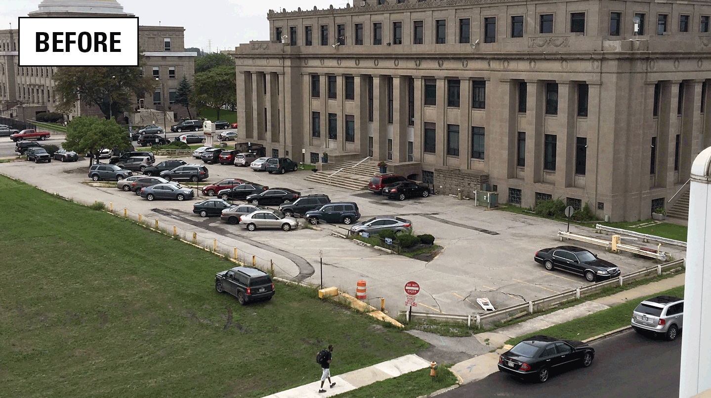
Assessing stormwater reduction using green infrastructure: Gary City Hall (Gary, Ind.)

Monitoring and predicting the impacts of trees on urban stormwater volume reduction

Assessing stormwater reduction using green infrastructure: Niagara River Greenway Project (Buffalo, NY)
The effectiveness of green infrastructure (including urban land conversion and bioswales) at reducing stormwater runoff is being assessed at RecoveryPark, a redeveloped urban farm in Detroit, Michigan. This study will monitor pre- and post-construction storm-sewer flow, groundwater levels, precipitation, and potential evapotranspiration (ET) to evaluate stormwater-volume reduction in response to implementation of green infrastructure.
Utilizing abandoned urban land for stormwater management
In many urban catchments, stormwater (excess rainfall or snowmelt that is not absorbed by the ground) can cause problems such as flooding,
erosion, and sedimentation; property and habitat damage; harm to fish and aquatic organisms; and degradation of water quality. Throughout the metropolitan Detroit area, adverse impacts from combined sewer overflows into the Detroit River have increased interest in stormwater management and control. Many areas of abandoned urban land have been identified as potential locations for the installation of stormwater control measures to mitigate these flows including green infrastructure, which uses natural processes to reduce or delay peak flows of stormwater runoff by holding stormwater on-site, encouraging infiltration, and enhancing ET.
One of these locations, RecoveryPark , is a 40-acre area located about 2.5 miles northeast of downtown Detroit. Until recently, most of this city-owned land was vacant, but the nonprofit RecoveryPark entered into a five-year agreement with the city to purchase the land and convert it into an urban farm staffed by people with barriers to employment. Sustainable resource management, including stormwater management, is one of the goals for the successful implementation of RecoveryPark.
Study Objectives
In collaboration with two program areas within the U.S. Environmental Protection Agency (EPA; Great Lakes National Program Office and Office of
Research and Development), and the Detroit Water and Sewerage Department (DWSD) this study will assess how stormwater control measures affect flow and water-budget dynamics in an urban setting. To quantify changes in stormwater flows resulting from the installation of green infrastructure, this study will:
- Improve the understanding of rainfall, runoff, and infiltration through collection of high-resolution data at water-level monitoring and sewer-flow monitoring sites.
- Evaluate hydrologic and meteorological data to analyze the hydraulic performance of the stormwater control measures after implementation.
- Quantify elements of the local water budget, estimate the effectiveness of stormwater control measures, and identify gaps in our understanding of the hydrologic processes affected by stormwater control measures.
Monitoring of site hydrology and hydraulics is needed to fully understand the effectiveness of stormwater control measures and to provide the performance data needed to design future phases of the proposed stormwater capture system envisioned for RecoveryPark.
Study Description
The area of RecoveryPark being redeveloped covers approximately 10 city blocks (40 acres) and includes installation of green infrastructure (grass swales). Assessment of the stormwater control measures implemented at RecoveryPark consists of two phases:
- Monitoring by the USGS included a weather station to collect data on precipitation and potential evapotranspiration plus 24 groundwater monitoring wells instrumented to collect groundwater levels, temperature, and specific conductance. Additionally, seven in-pipe flow meters were installed by DWSD to monitor flow within the sewer pipes. A dye study within the combined sewer, and evaluation of chloride derived from road salt were also included in the monitoring plan to examine sources and sinks of water and evaluate the potential for increased chloride concentrations in groundwater as a result of stormwater infiltration or leaky sewer pipes.
- Testing includes a feasibility assessment through measurement of soil moisture content around RecoveryPark and stage within the grass swales.
Benefits
This study addresses two major challenges facing the Great Lakes region: (1) mitigation of the adverse impacts of stormwater runoff, and (2) urban revitalization and approaches to reclaim abandoned land in urban settings. Stormwater control measures are often proposed to mitigate stormwater runoff impacts, yet in practice, the hydraulic response of various types of stormwater control measures have not been well documented. This study will provide information necessary to make informed decisions about the effectiveness of the RecoveryPark approach to both of these challenges.
The data collected during this study also could be used to design other stormwater control projects in urban areas around the Great Lakes. The urban-site methods developed here complement current work focused on agricultural runoff and could be implemented in other study areas. The data produced may improve the design and construction of stormwater control measures. Additional insights might inform how aging urban infrastructure (for example, leaking sewer pipes) can influence conveyance of stormwater.
Results
Monitoring at RecoveryPark ended in 2021. Click on the links below to view data and access historical measurements. (Some data may still be provisional.)
WEATHER STATION
422209083023603 WEATHER STATION AT CHENE STREET AT DETROIT, MI
422200083023901 RECOVERY PARK SOUTHWEST 02 SHALLOW (RP-SW 02 S)
422200083023902 RECOVERY PARK SOUTHWEST 02 DEEP (RP-SW 02 D)
422201083023701 RECOVERY PARK SOUTHEAST 01 SHALLOW (RP-SE 01 S)
422201083023702 RECOVERY PARK SOUTHEAST 01 DEEP (RP-SE 01 D)
422202083023101 RECOVERY PARK SOUTH 05 SHALLOW (RP-S-05 S)
422202083023102 RECOVERY PARK SOUTH 05 DEEP (RP-S-05 D)
422202083023301 RECOVERY PARK SOUTH 06 SHALLOW (RP-S-06 S)
422202083023302 RECOVERY PARK SOUTH 07 SHALLOW (RP-S-07 S)
**NEW** 422202083023303 RECOVERY PARK SOUTH 07 DEEP (RP-S-07 D)
https://waterdata.usgs.gov/mi/nwis/uv/?site_no=422202083023303&PARAmeter_cd=72019,72020
422202083023701 RECOVERY PARK CENTRAL 01 SHALLOW (RP-C-01 S)
422202083023702 RECOVERY PARK CENTRAL 01 DEEP (RP-C-01 D)
422203083023301 RECOVERY PARK CENTRAL 03 SHALLOW (RP-C-03 S)
**NEW** 422203083023304 RECOVERY PARK CENTRAL 03 DEEP (RP-C-03 D)
https://waterdata.usgs.gov/mi/nwis/uv/?site_no=422203083023304&PARAmeter_cd=72019,72020
422203083023401 RECOVERY PARK CENTRAL 04 SHALLOW (RP-C-04 S)
422203083023402 RECOVERY PARK CENTRAL 05 SHALLOW (RP-C-05 S)
422203083023403 RECOVERY PARK CENTRAL 05 DEEP (RP-C-05 D)
422203083023601 RECOVERY PARK CENTRAL 02 SHALLOW (RP-C-02 S)
422203083023602 RECOVERY PARK CENTRAL 02 DEEP (RP-C-02 D)
**NEW ** 422203083023603 R. PARK CENTRAL 02 SHALLOW REPLACED (RP-C-02 SR)
https://waterdata.usgs.gov/mi/nwis/uv/?site_no=422203083023603&PARAmeter_cd=72019,72020
422206083024401 RECOVERY PARK NORTHWEST 03 SHALLOW (RP-NW 03 S)
422206083024402 RECOVERY PARK NORTHWEST 03 DEEP (RP-NW 03 D)
422207083023501 RECOVERY PARK NORTH 06 SHALLOW (RP-N-06 S)
422207083023502 RECOVERY PARK NORTH 06 DEEP (RP-N-06 D)
422207083024101 RECOVERY PARK NORTHEAST 04 SHALLOW (RP-NE 04 S)
422207083024102 RECOVERY PARK NORTHEAST 04 DEEP (RP-NE 04 D)
422209083023601 RECOVERY PARK NORTH 05 SHALLOW (RP-N-05 S)
422209083023602 RECOVERY PARK NORTH 05 DEEP (RP-N-05 D)
Publications
In 2019, we published a paper describing the hydrology and water budget at RecoveryPark prior to implementation of green infrastructure. This paper serves as a baseline for additional study after the site is retrofitted with hoop houses and grass swales.
Hoard, C.J., Haefner, R.J., Shuster, W.D., Pieschek, R.L., and Beeler, S., 2019. Full Water-Cycle Monitoring in an Urban Catchment Reveals Unexpected Water Transfers (Detroit MI, USA): Journal of the American Water Resources Association, p. 1–18 https://doi.org/10.1111/1752-1688.12814.
Major observations following the assessment described in this paper included continuous flows within the sewers derived from a variety of sources. These flows represent a large volume of water compared to water derived from rainfall alone. Changes in groundwater storage can play a major role in increasing the dry-weather flow in sewers due to high groundwater tables relative to the elevation of the sewer pipes, allowing for substantial inflow and infiltration. The estimated volume of flow in the combined sewer exceeded 14,300 m3 of water per year in both 2015 and 2016 when only two houses within the sewershed contributed flow to the pipes. This research suggests a correlation between higher groundwater levels and higher pipe flow. This study aids in scoping efforts to eventually minimize the amount of flow in the conveyance system, with anticipated savings by maintaining system volume capacity and not treating relatively “clean” groundwater that was conveyed to the wastewater treatment plant.
Below are other science projects associated with GLRI Urban Stormwater Monitoring.
GLRI Urban Stormwater Monitoring
Rapid Assessment of Green Infrastructure to Inform Future Implementation in the Great Lakes
Assessing stormwater reduction using green infrastructure: Gary City Hall (Gary, Ind.)
Monitoring and predicting the impacts of trees on urban stormwater volume reduction