Streamflow Permanence Data Collection in Washington
Streamflow Permanence Data Collection in WashingtonA USGS hydrologist uses the FLOwPER mobile application to record an observation of streamflow conditions.

Official websites use .gov
A .gov website belongs to an official government organization in the United States.
Secure .gov websites use HTTPS
A lock () or https:// means you’ve safely connected to the .gov website. Share sensitive information only on official, secure websites.
Below are images associated with the Washington Water Science Center's science and staff. Images appear according to the year they were taken. To search, type a keyword or select a year from the dropdown menu. Or, click through the pages using the arrows at the bottom of the page.
A USGS hydrologist uses the FLOwPER mobile application to record an observation of streamflow conditions.
A USGS hydrologist uses the FLOwPER mobile application to record an observation of streamflow conditions.
A USGS hydrologist uses the FLOwPER mobile application to record an observation of streamflow conditions.
A USGS hydrologist uses the FLOwPER mobile application to record an observation of streamflow conditions.
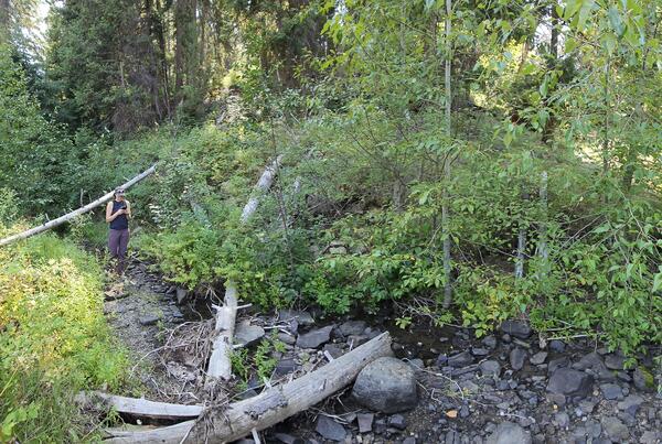
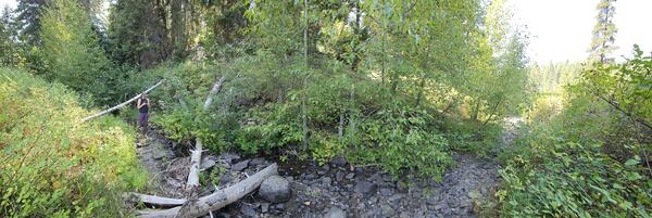
A small stream near Blewett Pass, Washington has water flowing in late summer. Scientists visited to record streamflow conditions with the FLOwPER mobile field form.
A small stream near Blewett Pass, Washington has water flowing in late summer. Scientists visited to record streamflow conditions with the FLOwPER mobile field form.

Scientists demonstrate equipment used to measure fluxes between groundwater and surface water. These interactions are particularly complex in tidally influenced shorelines such as Sinclair Inlet, WA.
Scientists demonstrate equipment used to measure fluxes between groundwater and surface water. These interactions are particularly complex in tidally influenced shorelines such as Sinclair Inlet, WA.

A seepage meter implanted in the sediment-water interface of a tidal beach. The meter allows scientists to measure interactions between groundwater and surface water.
A seepage meter implanted in the sediment-water interface of a tidal beach. The meter allows scientists to measure interactions between groundwater and surface water.

Scientists prepare for a geophysical survey of the shoreline at Sinclair Inlet, WA. The survey will provide information about the interactions between groundwater and surface water in this complex tidal system.
Scientists prepare for a geophysical survey of the shoreline at Sinclair Inlet, WA. The survey will provide information about the interactions between groundwater and surface water in this complex tidal system.

USGS Ecologist Julia David collects water quality data in the lower Stillaguamish Estuary near Stanwood, WA. Data will support a baseline assessment of PAH concentrations in fish in the Stillaguamish River, WA.
USGS Ecologist Julia David collects water quality data in the lower Stillaguamish Estuary near Stanwood, WA. Data will support a baseline assessment of PAH concentrations in fish in the Stillaguamish River, WA.

USGS Hydrologic Technicians David Bess, Kim Cesal, and Joe Gilbert prepare to make a discharge measurement with an ADCP from a cableway over a large river in Washington State.
USGS Hydrologic Technicians David Bess, Kim Cesal, and Joe Gilbert prepare to make a discharge measurement with an ADCP from a cableway over a large river in Washington State.
Pacific Lamprey ammocoetes in a measurement tank. Tissues collected from the lamprey will be analyzed for mercury as part of a study on mercury contamination in the Columbia River Basin.
Pacific Lamprey ammocoetes in a measurement tank. Tissues collected from the lamprey will be analyzed for mercury as part of a study on mercury contamination in the Columbia River Basin.
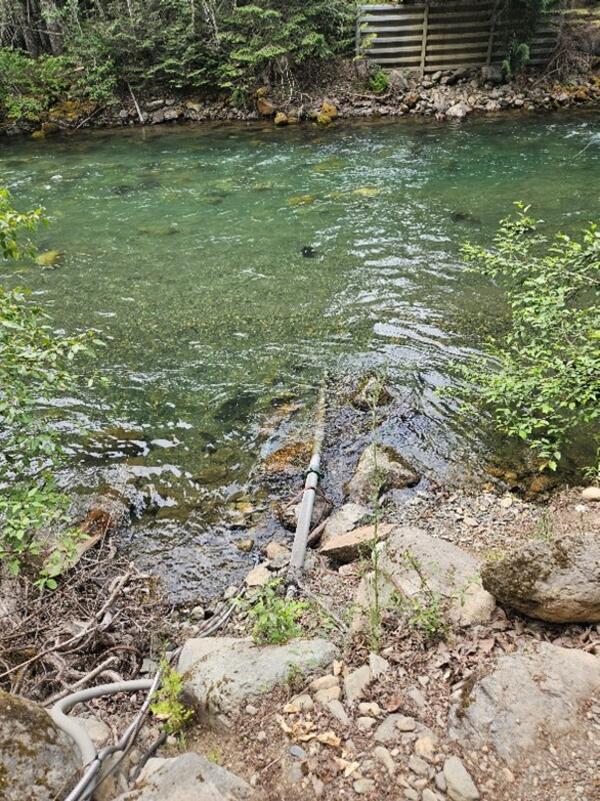
The USGS monitors water quality at the Skagit River Above Klesilkwa River Near Hope, BC - USGS-12170350.

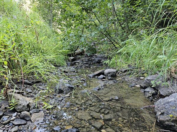
A small headwater stream forms whitewater cascades in the forested Pacific Northwest.
A small headwater stream forms whitewater cascades in the forested Pacific Northwest.
The USGS monitors water quality at the Skagit River Above Klesilkwa River Near Hope, BC - USGS-12170350.
The USGS monitors water quality at the Skagit River Above Klesilkwa River Near Hope, BC - USGS-12170350.

A shovel rests against a massive deposit of coarse sediment on the delta to Conconully Reservoir in Okanogan County, Washington. The sediment was deposited following the 2021 Muckamuck fire and a debris flow in July 2022. USGS scientists are studying the sediment and water quality in rivers and reservoirs impacted by the large fire.
A shovel rests against a massive deposit of coarse sediment on the delta to Conconully Reservoir in Okanogan County, Washington. The sediment was deposited following the 2021 Muckamuck fire and a debris flow in July 2022. USGS scientists are studying the sediment and water quality in rivers and reservoirs impacted by the large fire.

A shovel leans against the bank of the Conconully Reservoir in Okanogan County, Washington. Layers of legacy sediment are visible in the bank exposure.
A shovel leans against the bank of the Conconully Reservoir in Okanogan County, Washington. Layers of legacy sediment are visible in the bank exposure.
The USGS monitors streamflow in the South Fork Nooksack River. Access real-time water data at: SF Nooksack River at Saxon Bridge, WA - USGS Water Data for the Nation.
The USGS monitors streamflow in the South Fork Nooksack River. Access real-time water data at: SF Nooksack River at Saxon Bridge, WA - USGS Water Data for the Nation.

A headwater stream tumbles through a moss and fern filled ravine in the Pacific Norwest.
A headwater stream tumbles through a moss and fern filled ravine in the Pacific Norwest.

A sediment sample collection bag and jar sit on soils burned in the 2021 Muckamuck wildfire. Scientists are studying the sediment and water quality in rivers and reservoirs impacted by the large fire. The high temperatures of severe wildfires are capable of releasing and redepositing metals on the soil surface.
A sediment sample collection bag and jar sit on soils burned in the 2021 Muckamuck wildfire. Scientists are studying the sediment and water quality in rivers and reservoirs impacted by the large fire. The high temperatures of severe wildfires are capable of releasing and redepositing metals on the soil surface.

USGS Hydrologic Technician Chaska Boucher operates a remotely controlled Q-boat on Conconully Reservoir in Okanogan County, Washington. A portion of the watershed burned in the 2021 Muckamuck wildfire and a debris flow occurred in 2022.
USGS Hydrologic Technician Chaska Boucher operates a remotely controlled Q-boat on Conconully Reservoir in Okanogan County, Washington. A portion of the watershed burned in the 2021 Muckamuck wildfire and a debris flow occurred in 2022.

The Calawah River near Forks, WA at Highway 101. The view in the image is facing north and the flow direction is toward the foreground. High flows inundate the base of trees alongside the river. The water is turbid and transporting rafts of large wood.
The Calawah River near Forks, WA at Highway 101. The view in the image is facing north and the flow direction is toward the foreground. High flows inundate the base of trees alongside the river. The water is turbid and transporting rafts of large wood.

High flow on the Elwha River in 2021 at USGS streamgage 12045500. Flooding carried sediment and large wood as well as high volumes of water.
High flow on the Elwha River in 2021 at USGS streamgage 12045500. Flooding carried sediment and large wood as well as high volumes of water.

Hydrologic Technician Andy Cripps measures the flow of floodwaters inundating a roadway. The floodwaters occurred in 2021 from a side channel of the Cowlitz River at USGS streamgage 14231000.
Hydrologic Technician Andy Cripps measures the flow of floodwaters inundating a roadway. The floodwaters occurred in 2021 from a side channel of the Cowlitz River at USGS streamgage 14231000.