
Drought
Drought
USGS has a long and proven history delivering science and tools to help decision makers manage and mitigate the effects of drought, and we continue to improve data collection during and after drought events to gather critical, ephemeral information; synthesize datasets and models to better understand drought drivers, responses, and interactions; and deliver effective information to address drought through partnerships with stakeholders, policymakers, and the public.
Filter Total Items: 12
Watersheds and Fluvial Systems Team
The Watersheds and Fluvial Systems Team at the Washington Water Science Center provides reliable science to understand how watersheds, rivers, and streams function—and how they respond to a changing world. We aim to build partnerships that foster informed decision-making and effective resource management throughout the Pacific Northwest region and across the U.S.
PROSPER Puget Sound - Modeling Streamflow Permanence
The Issue: Knowing when streams have water and when they run dry—called streamflow permanence—is necessary for managing water resources, protecting ecosystems, and responding to regulations and policies. In the Pacific Northwest, a major research priority is understanding how streamflow permanence might change as snowpacks shrink and summers become hotter and drier. How USGS will help: USGS is...

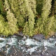
Streamflow Permanence in the Pacific Northwest
Not all rivers and streams flow year-round. Understanding when and where streams flow or go dry is critical for managing land use, water quality, and water availability on landscapes. The USGS and partners are studying streamflow permanence in the Pacific Northwest. We are gathering data, developing new models, and providing data visualization and outreach tools.

Mapping ecohydrological headwater refugia
The Issue: Forests in the Pacific Northwest have changed substantially over the past hundred years because of logging, changing forest management methods, and climate change. These forests contain a dense network of small headwater streams that supply cold, clean water and support 52 amphibian species. These amphibians live both in the cold streams and in the cool, moist areas nearby. Natural...

Water temperature modeling in Mount Rainier National Park
The Issue: Changes in the water temperature and flow regimes of rivers throughout the western United States have contributed to shifts in the ranges of aquatic species that they support. Cold-water species such as fish are sensitive to changes in water temperature, which regulates their physiological functions and behavior. How USGS will help: A spatial stream network (SSN) model was developed...

Ice Jams on Osoyoos Lake
The Issue: Ice jams can occur at the outlet of Osoyoos Lake on the border of Canada and the United States, resulting in a decrease or complete interruption in streamflow on the Okanogan River. Interruptions in streamflow can hinder the passage of anadromous fish and impact downstream water rights and water supply. How the USGS helped: USGS scientists at the Washington Water Science Center examined...

Updated classifications of flow permanence on streams in the Colville National Forest
The Issue: Streamflow permanence refers to the probability that a stream will lose surface flow (become a dry channel), as well as the timing, duration, and frequency of drying. Patterns of streamflow permanence drive important decisions regarding forest management and other land uses. The Colville National Forest Land and Resource Management Plan (2019), for example, specifies riparian management...

Analysis of USGS Surface Water Monitoring Networks
The issue: National interests in water information are important but challenging to incorporate into planning and operation of a monitoring network driven by local information needs. These interests include an understanding of the spatial variability in water availability across the United States, anthro-physical factors including climate and land use that affect water availability, and federal...
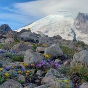
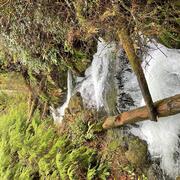
Drought preparedness in Mt. Rainier National Park
Small streams are an important source of water in Mount Rainier National Park. Some streams run year-round, while others go dry during the late summer. The USGS used crowd-sourced data to develop a localized model of Mount Rainier streams. The model provides predictions of whether streams are likely to flow year-round, helping park managers plan for a sustainable water supply.

Assess the utility of a regional aquifer system groundwater model to inform the USGS National Hydrologic Model
The Issue: In Washington State, groundwater (GW) inflow to streams, or baseflow, is essential for maintaining aquatic habitats, and for out-of-stream uses such as irrigated agriculture during the typically dry summers. However, the National Hydrologic Model (NHM) currently is most suited to predicting total daily streamflow. This project aims to assess the NHM’s performance in simulating baseflow...

Water use
The Issue: Comprehensive water-use data and analysis of water-use information are needed to quantify the stress on existing supplies and to better model and evaluate possible water-supply management options to supplement traditional water-supply approaches. Advances have been made in the ability to control, divert, and develop water, but little attention has been paid to keeping accurate accounts...

NWIFC Water Assessment
Water resources are essential to Native American Tribes in western Washington for instream and out-of-stream uses. As the demand for water across the region increases, western Washington Tribes need critical information about water availability, water use, and ecological needs for water in order to manage their resources. To assess tribal water resources comprehensively in western Washington, the...