
Ecological Modeling
Ecological Modeling
Filter Total Items: 43
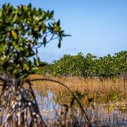
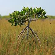
Engaging Indigenous Communities to Co-Design a Web Application to Protect Everglades Tree Islands
The USGS collaborated with the Miccosukee and Seminole Tribes to co-design a dashboard mock-up for a real-time web application that monitors tree island health in the Everglades.
Developing a Roadmap for the Future of Natural Resources in Everglades National Park
To sustain economic and ecologically viable ecosystems into the future, USGS is developing freshwater delivery targets for water flowing southward into Everglades National Park by integrating climate and sea level projections, hydrologic modeling, and ecological modeling to forecast ecosystem responses to future freshwater availability scenarios.

Integrating Remote Sensing and Numerical Modeling Technology to Detect and Manage Current and Future Harmful Algal Blooms in Louisiana’s Coastal and Tidal Waters
USGS is collaborating with partners to assess past and current CyanoHABs for the development of a predictive model and forecasting system for Lake Pontchartrain Estuary. This technology can be beneficial for informing future planning of water resource development projects, and the water management of the estuary.

Population Ecology of Florida Manatees
USGS is working with partners to understand how the federally protected Florida manatee ( Trichechus manatus latirostris) population changes over time and responds to threats.

Barriers and Opportunities for Landward Migration of Coastal Wetlands along Texas' Upper and Middle Coast
Researchers at WARC will use data and models to produce probabilistic maps of current and future wetland inundation, coastal wetland extent, and coastal and wetland trangression.

A Multiscale Approach to Understanding Migratory Landbird Habitat Use of Functional Stopover Habitat Types and Management Efforts
USGS scientists are using a spatially-explicit Bayesian network model to predict the difference between energetic value and energetic demand for stopover habitats for migrating landbirds.

Adapting to Climate Change: Trends and Severe Storm Responses by Migratory Landbirds and Their Habitats
USGS scientists will be analyzing weather surveillance radar observations of birds departing stopover habitats to measure responses to climate change.

Decision Support Tools for Everglades Ecosystem-Based Management
The USGS Joint Ecosystem Modeling team will work with partners to identify and develop decision support tools for Everglades water management.

Evaluating Population Viability and Habitat Suitability for the Cape Sable Seaside Sparrow Under Future Climate and Management Conditions
WARC will assess Cape Sable seaside sparrow population response and viability under different management and habitat change scenarios. The USGS EverSparrow model will be run on future scenarios, and differences in the predicted probability of presence and the efficacy of varying conservation strategies will be evaluated.

Population Persistence of the Ornate Chorus Frog Across Its Distribution
The ornate chorus frog, once common throughout its range, appears to be experiencing population declines. USGS has partnered with the Florida Fish and Wildlife Conservation Commission to assess the ornate chorus frog population status across its distribution.

Decision Support for Managers Restoring Texas Coastal Marshes with Beneficial Use of Dredged Material
USGS researchers will define the range of elevation targets supporting optimal plant performance and soil strength by identifying the lower and upper thresholds of marsh conversion, and characterize ecosystem development of restored marshes over time to identify the lifetime and sustainability of restored marsh during sea-level rise. This work addresses priority science needs to improve...

Future Aquatic Invaders of the Northeast U.S.: How Climate Change, Human Vectors, and Natural History Could Bring Southern and Western Species North
Researchers will evaluate the potential of aquatic species to invade the Northeast U.S. Following the identification of appropriate target species by regional stakeholders, researchers will gather data from the NAS database and develop models to determine habitat suitability for each species.