
Hydrology
Hydrology
Filter Total Items: 20
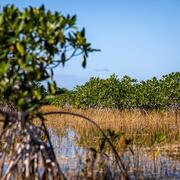
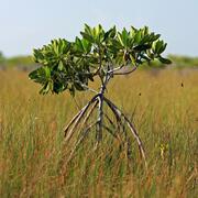
Engaging Indigenous Communities to Co-Design a Web Application to Protect Everglades Tree Islands
The USGS collaborated with the Miccosukee and Seminole Tribes to co-design a dashboard mock-up for a real-time web application that monitors tree island health in the Everglades.
Developing a Roadmap for the Future of Natural Resources in Everglades National Park
To sustain economic and ecologically viable ecosystems into the future, USGS is developing freshwater delivery targets for water flowing southward into Everglades National Park by integrating climate and sea level projections, hydrologic modeling, and ecological modeling to forecast ecosystem responses to future freshwater availability scenarios.

Beach Compaction and the Impacts of Tilling on Nesting Sea Turtles and Foraging Shorebirds
Researchers are investigating beach compaction, the incubation environment for turtle nests, and shorebird nest abundance at beaches throughout the southeastern United States to better understand the impacts of beach compaction to nesting turtles and foraging seabirds.

Decision Support Tools for Everglades Ecosystem-Based Management
The USGS Joint Ecosystem Modeling team will work with partners to identify and develop decision support tools for Everglades water management.

Salinity, Flooding, and Urban Impacts to Critical Habitat of the Endangered Red-cockaded Woodpecker
USGS researchers will collect data on salinity, water level, and flooding duration within Big Branch National Wildlife Refuge to improve the understanding of the hydrologic system, and how hydrology drives available red-cockaded woodpecker habitat use and availability across the landscape.

Investigation of Hydrology and Inundation of the Turtle Bayou Mitigation Area within Bayou Sauvage National Wildlife Refuge, Louisiana
USGS will monitor hydrologic and marsh conditions at the Turtle Bayou mitigation area. This effort will help provide a long-term water level dataset for Turtle Bayou.

Demographic Analysis of the Endangered Cape Sable Seaside Sparrow
USGS researchers will examine how hydrology and landscape vegetation changes impact Cape Sable Seaside Sparrow survival and population growth.

Comparing EverForecast to the South Florida Water Management District’s Position Analysis
USGS will compare the EverForecast hydrologic forecast, the South Florida Water Management District's Position Analysis, and observed water level recordings from gages located across the Everglades landscape to examine which forecast performs better during the wet and dry seasons; wet, dry, or average years; or in different areas of the Everglades.

Geospatially Enabled, Web-based Groundwater Information Tool for Utah
The USGS Utah Water Science Center and the State of Utah collaborated with WARC's Advanced Applications Team to build a data driven, interactive web application to provide groundwater conditions for Utah.

Ecological Modeling in Support of the Lake Okeechobee Water Management
The Joint Ecosystem Modeling team will be running a suite of ecological models to evaluate scenarios and provide insight into how alternative restorations plans compare, indicate whether alternatives could lead to unintended consequences, and determine effects of alternatives that could conflict with other goals.

Delivery of Strategically Placed Sediment through Tidal Creeks to Adjacent Coastal Wetlands
In the summer of 2021, instrumented platforms were deployed at Seven Mile Island Living Laboratory, New Jersey to conduct time series measurements of tidal velocity, turbidity, surface elevation, sediment concentration, and suspended sediment characteristics. The collected data will be used to provide decision support to the U.S. Army Corps of Engineers as they plan dredging activities in the Gulf...

Strategic Habitat Conservation for Gulf Sturgeon
WARC researchers partnered with Gulf Sturgeon decision makers and biologists to develop a Bayesian network model that uses habitat characteristics to predict the quantity of juvenile winter foraging habitat under alternative river discharge and timing of juvenile arrival scenarios.