
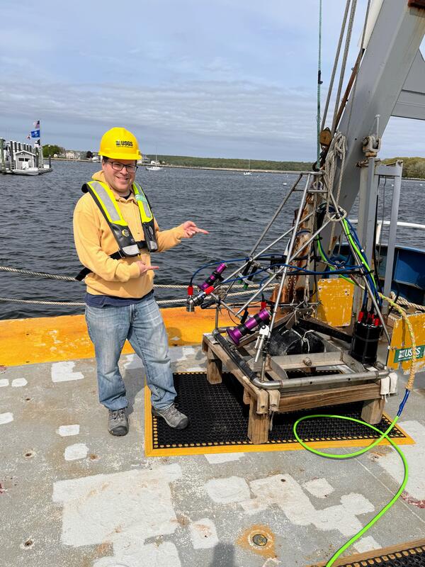
A seafloor mapping survey in Long Island Sound took place in May with collaborators from the University of Connecticut and the University of New Haven. They are mapping the area’s geology and biota to identify seasonal changes from their previous survey in November 2024.
Images
Woods Hole Coastal and Marine Science Center images
Filter Total Items: 1298
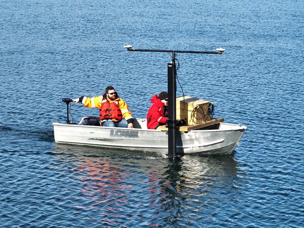
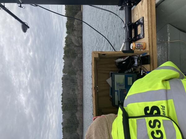
Long Island Sound SEABOSS Survey
A seafloor mapping survey in Long Island Sound took place in May with collaborators from the University of Connecticut and the University of New Haven. They are mapping the area’s geology and biota to identify seasonal changes from their previous survey in November 2024.
CCL accuracy journal article figure
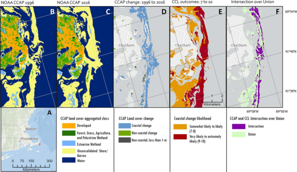
(A) Inset: Map showing location of (B–F). (B), (C) The C-CAP land cover for 1996 and 2016, respectively. (D) Land cover in the C-CAP datasets changed for coastal, noncoastal and low elevation (less than 1 m), and noncoastal land classes between 1996 and 2016.
(A) Inset: Map showing location of (B–F). (B), (C) The C-CAP land cover for 1996 and 2016, respectively. (D) Land cover in the C-CAP datasets changed for coastal, noncoastal and low elevation (less than 1 m), and noncoastal land classes between 1996 and 2016.
USGS Unit Award for Excellence of Service
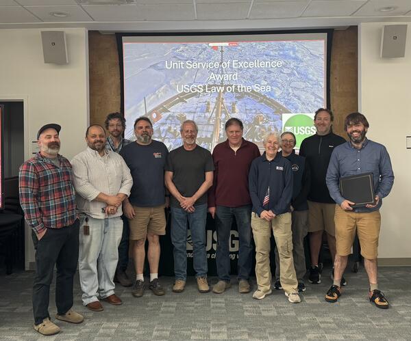
The Extended Continental Shelf team was awarded the USGS Unit Award for Excellence of Service, an award that recognizes groups of employees who have worked together as a unit to achieve exceptional results. This team was part of a Federal interagency effort to identify the outer limits of the U.S.
The Extended Continental Shelf team was awarded the USGS Unit Award for Excellence of Service, an award that recognizes groups of employees who have worked together as a unit to achieve exceptional results. This team was part of a Federal interagency effort to identify the outer limits of the U.S.
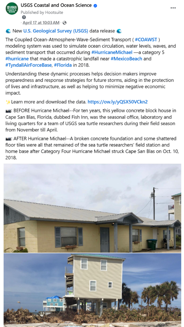
COAWST data release social media post
Social media post on USGS Coastal and Ocean Science Facebook page highlighting COAWST data release.
Warner, J.C., 2025, U.S. Geological Survey simulations of hydrodynamics and morphodynamics during Hurricane Michael (2018): U.S. Geological Survey data release, https://doi.org/10.5066/P14AGJAN.
Social media post on USGS Coastal and Ocean Science Facebook page highlighting COAWST data release.
Warner, J.C., 2025, U.S. Geological Survey simulations of hydrodynamics and morphodynamics during Hurricane Michael (2018): U.S. Geological Survey data release, https://doi.org/10.5066/P14AGJAN.
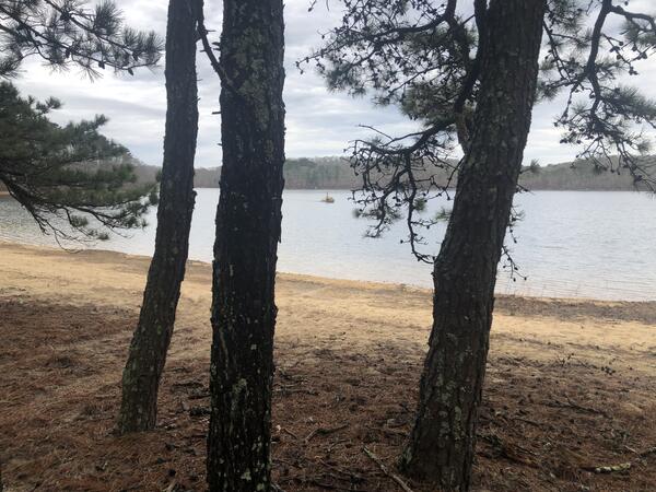
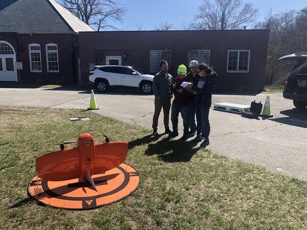
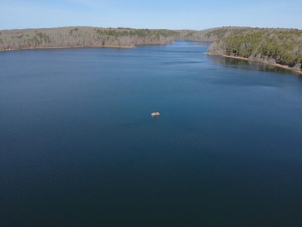
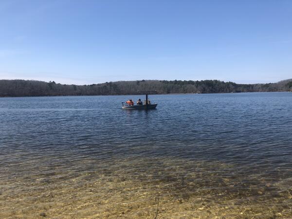
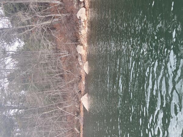
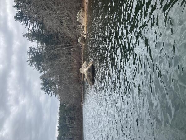
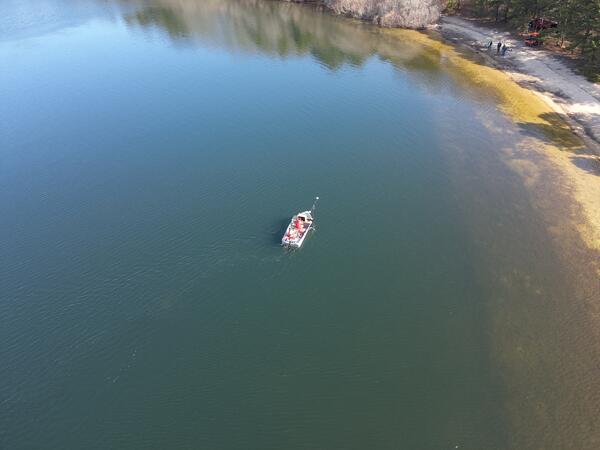
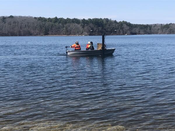
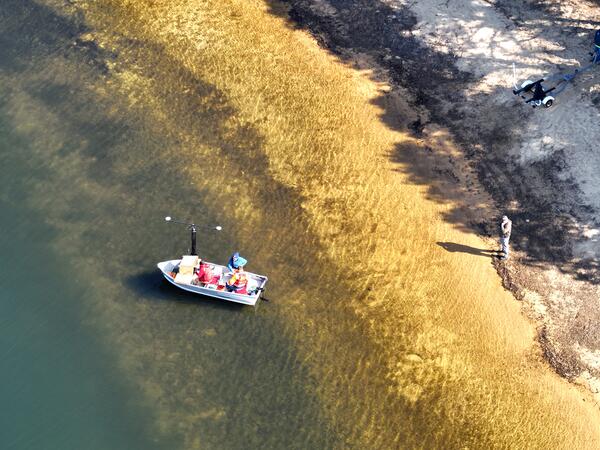
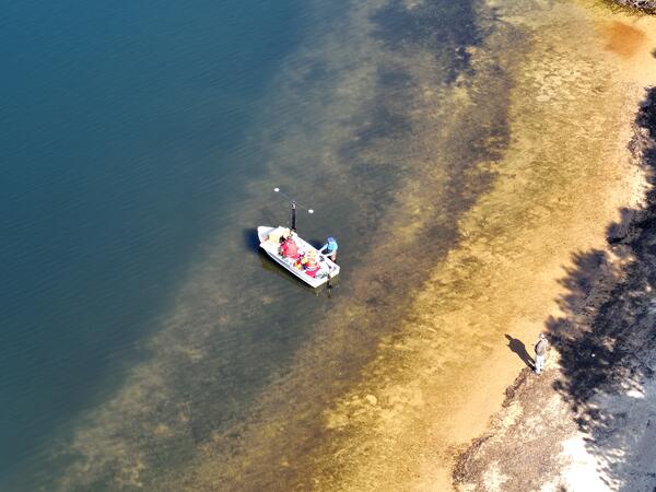
Long Pond mapping survey
USGS conducted a mapping survey of Long Pond in Falmouth, Massachusetts, at the request of the Town to determine total water volume of the reservoir, as well as the volumes available depending on fluctuating elevations of the water surface.
USGS conducted a mapping survey of Long Pond in Falmouth, Massachusetts, at the request of the Town to determine total water volume of the reservoir, as well as the volumes available depending on fluctuating elevations of the water surface.
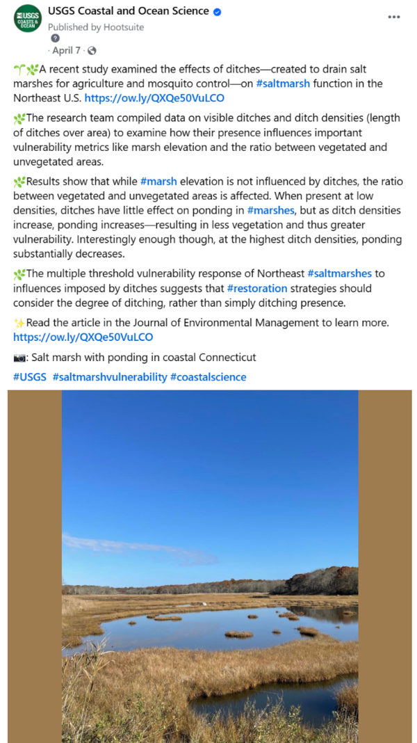
Salt marsh ditching social media post
Social media post on USGS Coastal and Ocean Science Facebook page highlighting a study examining the effects of ditches on salt marsh function in the Northeast U.S. https://doi.org/10.1016/j.jenvman.2025.124444
Social media post on USGS Coastal and Ocean Science Facebook page highlighting a study examining the effects of ditches on salt marsh function in the Northeast U.S. https://doi.org/10.1016/j.jenvman.2025.124444
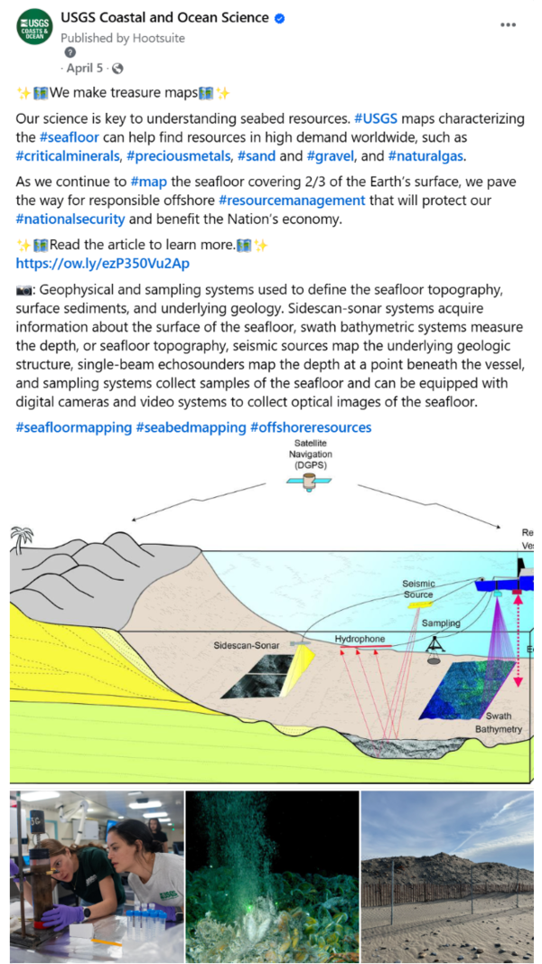
We Make Treasure Maps social media
Social media post on the USGS Coastal and Ocean Science Facebook account highlighting the science story titled, "We Make Treasure Maps: USGS Charts the Seafloor to Help Locate Critical Minerals, Precious Metals, and Other Vital Resources."&
Social media post on the USGS Coastal and Ocean Science Facebook account highlighting the science story titled, "We Make Treasure Maps: USGS Charts the Seafloor to Help Locate Critical Minerals, Precious Metals, and Other Vital Resources."&