
Learn how wetlands can naturally help with climate change impacts
Happy American Wetlands Month! Throughout the month of May, the U.S. Geological Survey is celebrating the importance of healthy wetlands to local communities, economies and wildlife across the United States.

The USGS conducts a wide variety of wetlands research to help provide federal, state, and local organizations with the information they need to make restoration, conservation, and land use management decisions.
A key focus for USGS wetlands research is the role of these ecosystems in climate change mitigation.
Wetlands can capture large quantities of carbon dioxide and other greenhouse gasses from the atmosphere and store it in their soil and plants—a process known as carbon sequestration. In fact, they are such powerful carbon sinks that they can store carbon that has accumulated over hundreds to thousands of years. The carbon stored in coastal and ocean ecosystems is called blue carbon.
The USGS collects, analyzes, and synthesizes blue carbon data in both degraded and healthy wetlands to improve estimates of carbon sequestration and methane emissions on a local, regional, and national scale. USGS scientists use this information to determine how land use management like infrastructure development and environmental changes like sea level rise can affect carbon capture and storage. Working with land management agencies and other partners, the USGS assesses opportunities for soil carbon sequestration and methane emissions reduction and integrates wetlands within programs for reducing greenhouse gas emissions.
Managers and planners can use USGS blue carbon research to better understand the impacts of different land use decisions and make choices that will enhance the climate change mitigation capabilities of wetlands.
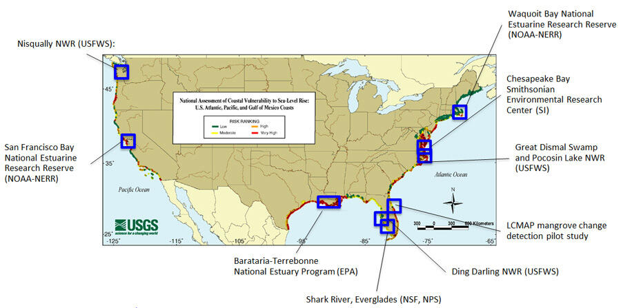
Blue carbon study sites are in Massachusetts, Maryland, North Carolina, Florida, Louisiana, California, and Washington. USGS scientists conduct field studies at specific locations within these states to measure and monitor carbon sequestration and greenhouse gas emissions. They also use remote sensing techniques to detect land cover change across the United States. Erosion and elevation and vegetation loss can each signal carbon storage degradation and an increase in methane emissions, while accretion is associated with healthy, resilient wetlands. The site-specific studies help to validate the large spatial scale data and modeling. This research can help advance blue carbon management as a natural climate change solution.
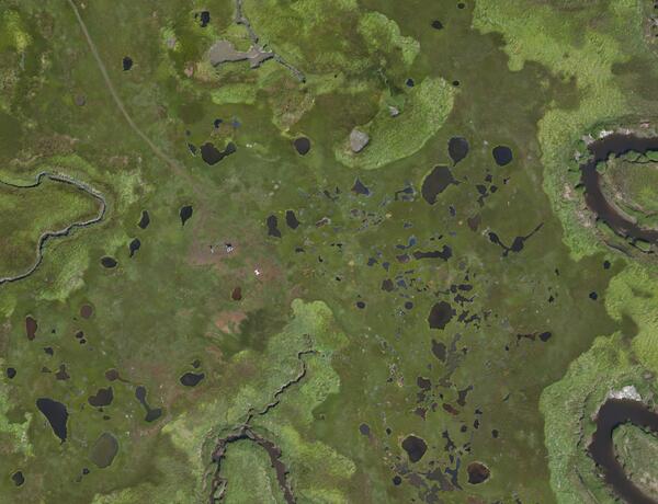
In conjunction with studying blue carbon, the USGS studies past and present wetland conditions to better understand and predict how physical processes, storms, and land use could affect wetlands and the many services they provide to society in the future. Our science, data, and tools assess wetland vulnerability, water-quality, and resilience on national, regional, and local scales, and identify human activities that are causing wetland degradation and loss.
Healthy wetlands can help protect communities, infrastructure, and ecosystems from storms and flooding by absorbing waves and slowing the flow of water across the watershed. Growing populations along the Nation’s coast have led to more nutrients and pollutants such as fertilizer and sewage that can runoff into the watershed, and wetlands can help filter out those contaminants. Wetlands also provide critical habitat for animals, including migratory birds, and commercially important fish and shellfish, and provide opportunities for recreation like hiking and bird watching.
USGS wetland research can be used to identify degraded and vulnerable wetlands, as well as healthy and resilient wetlands and help make management decisions that will most benefit humans and the environment.


Subscribe to the Sound Waves Newsletter to stay updated on coastal and marine news from across the USGS!
Related

Delta Wetlands and Resilience: Blue Carbon and Marsh Accretion

USGS Blue Carbon Projects

Global Science and Data Network for Coastal Blue Carbon (SBC)
NASA-USGS National Blue Carbon Monitoring System

Environmental Geochemistry

Coastal Wetland Blue Carbon
Related
Delta Wetlands and Resilience: Blue Carbon and Marsh Accretion
USGS Blue Carbon Projects
Global Science and Data Network for Coastal Blue Carbon (SBC)
NASA-USGS National Blue Carbon Monitoring System
Environmental Geochemistry