
USGS Coastal Change Products Help the EPA Safeguard Long Island Sound Shorelines
The U.S. Environmental Protection Agency partnered with the USGS to expand and update the National Shoreline Change database and the Coastal Change Likelihood assessment for Long Island Sound. These products help improve understanding of past, present, and future shoreline and coastal landscape change that may impact communities, resources, and infrastructure along the Long Island Sound coast.
Our coasts are dynamic, continually changing in response to extreme weather events, high tide flooding, and coastal erosion. Coastal change associated with these hazards can threaten communities, infrastructure, critical resources, and ecosystem services along the coast.
USGS coastal change products provide high resolution information about ‘where’ and ‘when’ coastal change may occur and can be used to support public safety, resource management, and decision making.
The U.S. Environmental Protection Agency (EPA) partnered with the USGS to better understand shoreline positions and coastal landscape change along Long Island Sound. Identifying erosional hot spots, naturally resilient shores, and the location and timing of expected future change enables the development of proactive strategies to protect assets and resources that enhance investments in coastal communities, improves public safety, and ensures adaptable coastal communities.
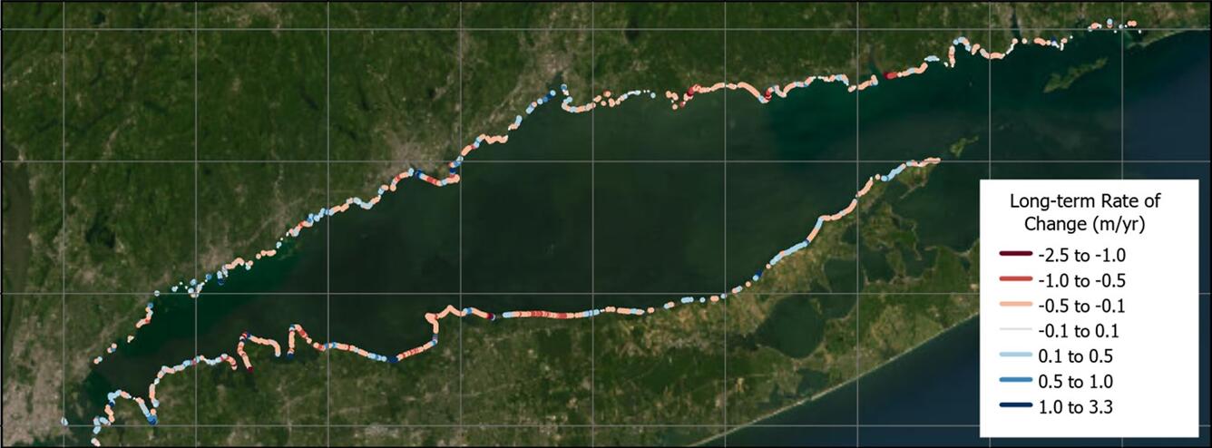
Shoreline Change
The USGS National Shoreline Change project analyzes historical shoreline changes in the United States. Traditionally, studies have been limited to open-ocean sandy coasts, however, this collaboration expanded coverage into the semi-protected environment of Long Island Sound. More information on USGS National Shoreline Change can be found in the geonarrative.
Coastal Change Likelihood
The USGS Coastal Change Likelihood assessment addresses the likelihood of our coasts resisting or responding to coastal hazards by changing their form, function, or identity.
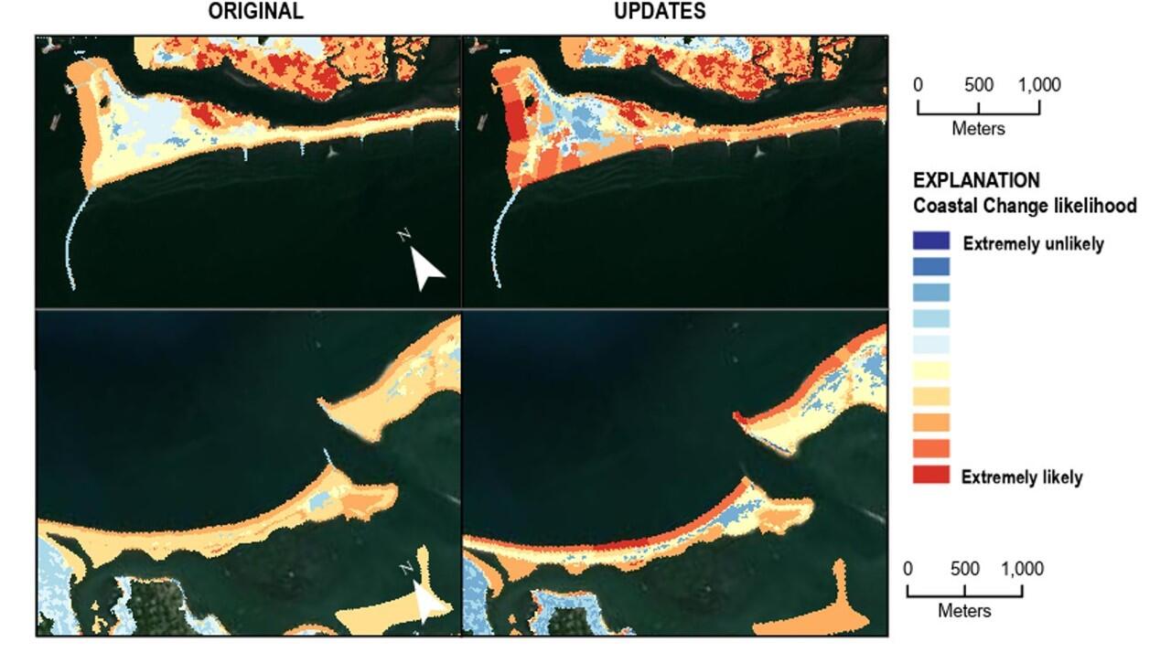
Together, these products can highlight where adaptation and mitigation resources can be prioritized, areas that may be naturally more resilient or resistant to change, and what hazards are of highest concern. This information will support both near- and long-term planning objectives of the EPA.
For more information on the Coastal Resiliency Assessment and Near-term Coastal Change along the Shorelines of Long Island Sound, please contact Rachel Henderson, rehenderson@usgs.gov.
Related
Coastal and Marine Science in Long Island Sound

National Shoreline Change Data Publication Catalog

Coastal Change Likelihood
Related
Coastal and Marine Science in Long Island Sound
National Shoreline Change Data Publication Catalog