



Coastal and Marine Science in Long Island Sound
Long Island Sound is a highly productive estuary and vital natural resource bordering New York and Connecticut. It’s essential for its massive economic impact, generating billions annually by supporting recreation, fisheries, and transportation, as well as its biodiversity, serving as a critical habitat for thousands of marine species.
USGS research in Long Island Sound helps protect these benefits by improving our understanding of the seafloor, shoreline change, and coastal resilience. Scientists work with partners across the region to provide the data needed for decision makers to manage resources, support sustainable communities, and prepare for future coastal challenges.
Our science helps ensure that Long Island Sound remains healthy, resilient, and thriving for generations to come.
Seafloor Mapping
SEABOSS Long Island Sound project
The USGS is a long-time collaborator in the Long Island Sound Partnership, a coordinated effort involving researchers, regulators, user groups, and other concerned organizations and individuals to protect and improve the health of the Sound.
Over the past two decades, the Woods Hole Coastal and Marine Science Center's Sea Floor Mapping Group has actively participated in the Long Island Sound Seafloor Habitat Mapping Initiative. This group is focused on applying advanced technologies and predictive models to collect data, characterize the ecological and physical environment, and develop map products to guide decisions for improved management of the Sound.
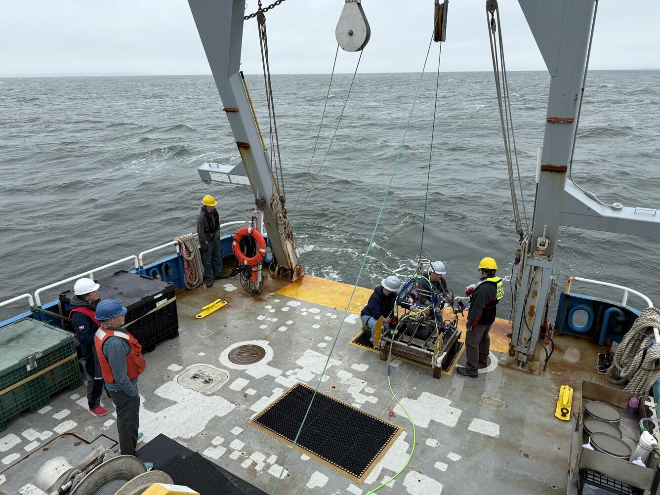
Most recently, we conducted imagery and sediment sampling surveys in 2017, 2018, 2023, 2024, and 2025, providing scientific and technical expertise using our SEABed Observation and Sampling System (SEABOSS) to support the team’s multidisciplinary science goals. We surveyed alongside scientists from the University of Connecticut and University of New Haven, and have also worked closely with research partners from the Connecticut Department of Energy and Environmental Protection, Lamont-Doherty Earth Observatory, and Stony Brook University.
Current in-progress work includes:
2023 SEABOSS Sampling Survey (Field Activity Number 2023-008-FA)
Photo, video, and sediment sampling at 91 sites during a 6-day survey on the R/V Connecticut. Data release in progress.
2024–2025 SEABOSS Sampling Surveys (Field Activity Numbers 2024-005-FA and 2025-001-FA)
Photo, video, and sediment sampling at 149 sites during two 7-day surveys on the R/V Connecticut. Data processing in progress.
2026/2027 SEABOSS Sampling: Long Island Sound Partnership - Phase V
Two research cruises are planned. The first survey is scheduled for late October 2026 on the R/V Connecticut. A second survey is planned for 2027.
Coastal Change & Resilience
Coastal Resiliency Assessment of Near-term Coastal Change
The U.S. Environmental Protection Agency (EPA) partnered with the USGS to better understand shoreline positions and coastal landscape change along Long Island Sound. They are supporting the development of two USGS products:
- Expansion of the USGS National Shoreline Change Data Publication Catalog—home of historical shoreline change data for open-ocean sandy coasts in the United States—to include the semi-protected environment of Long Island Sound.
- The Coastal Change Likelihood update in Long Island Sound. This assessment addresses the likelihood of our coasts resisting or responding to coastal hazards by changing their form, function, or identity.
These products will help the EPA better understand past, present, and future shoreline positions and adjacent coastal landscape change that could impact communities, resources, and infrastructure along the coast of Long Island Sound.
National Shoreline Change geonarrative
National Shoreline Change Data Publication Catalog
Coastal Change Likelihood
U.S. Coastal Wetland Synthesis
The USGS is assessing the physical condition of coastal wetlands and their response to external forces using field observations and remote-sensing data. We developed multiple geospatial products to help inform coastal wetland research and management for federal, state, and local agencies.
Explore applications and data for Long Island Sound:
Connecticut Coastal Wetlands Synthesis Web App
Coastal Wetlands of Connecticut Data
New York Coastal Wetlands Synthesis Web App
New York Coastal Wetlands Data

National Shoreline Change Data Publication Catalog

Coastal Change Likelihood

Estuarine Processes, Hazards, and Ecosystems

Sea Floor Mapping Group
Long Island Sound is a highly productive estuary and vital natural resource bordering New York and Connecticut. It’s essential for its massive economic impact, generating billions annually by supporting recreation, fisheries, and transportation, as well as its biodiversity, serving as a critical habitat for thousands of marine species.
USGS research in Long Island Sound helps protect these benefits by improving our understanding of the seafloor, shoreline change, and coastal resilience. Scientists work with partners across the region to provide the data needed for decision makers to manage resources, support sustainable communities, and prepare for future coastal challenges.
Our science helps ensure that Long Island Sound remains healthy, resilient, and thriving for generations to come.
Seafloor Mapping
SEABOSS Long Island Sound project
The USGS is a long-time collaborator in the Long Island Sound Partnership, a coordinated effort involving researchers, regulators, user groups, and other concerned organizations and individuals to protect and improve the health of the Sound.
Over the past two decades, the Woods Hole Coastal and Marine Science Center's Sea Floor Mapping Group has actively participated in the Long Island Sound Seafloor Habitat Mapping Initiative. This group is focused on applying advanced technologies and predictive models to collect data, characterize the ecological and physical environment, and develop map products to guide decisions for improved management of the Sound.
Most recently, we conducted imagery and sediment sampling surveys in 2017, 2018, 2023, 2024, and 2025, providing scientific and technical expertise using our SEABed Observation and Sampling System (SEABOSS) to support the team’s multidisciplinary science goals. We surveyed alongside scientists from the University of Connecticut and University of New Haven, and have also worked closely with research partners from the Connecticut Department of Energy and Environmental Protection, Lamont-Doherty Earth Observatory, and Stony Brook University.
Current in-progress work includes:
2023 SEABOSS Sampling Survey (Field Activity Number 2023-008-FA)
Photo, video, and sediment sampling at 91 sites during a 6-day survey on the R/V Connecticut. Data release in progress.
2024–2025 SEABOSS Sampling Surveys (Field Activity Numbers 2024-005-FA and 2025-001-FA)
Photo, video, and sediment sampling at 149 sites during two 7-day surveys on the R/V Connecticut. Data processing in progress.
2026/2027 SEABOSS Sampling: Long Island Sound Partnership - Phase V
Two research cruises are planned. The first survey is scheduled for late October 2026 on the R/V Connecticut. A second survey is planned for 2027.
Coastal Change & Resilience
Coastal Resiliency Assessment of Near-term Coastal Change
The U.S. Environmental Protection Agency (EPA) partnered with the USGS to better understand shoreline positions and coastal landscape change along Long Island Sound. They are supporting the development of two USGS products:
- Expansion of the USGS National Shoreline Change Data Publication Catalog—home of historical shoreline change data for open-ocean sandy coasts in the United States—to include the semi-protected environment of Long Island Sound.
- The Coastal Change Likelihood update in Long Island Sound. This assessment addresses the likelihood of our coasts resisting or responding to coastal hazards by changing their form, function, or identity.
These products will help the EPA better understand past, present, and future shoreline positions and adjacent coastal landscape change that could impact communities, resources, and infrastructure along the coast of Long Island Sound.
National Shoreline Change geonarrative
National Shoreline Change Data Publication Catalog
Coastal Change Likelihood
U.S. Coastal Wetland Synthesis
The USGS is assessing the physical condition of coastal wetlands and their response to external forces using field observations and remote-sensing data. We developed multiple geospatial products to help inform coastal wetland research and management for federal, state, and local agencies.
Explore applications and data for Long Island Sound:
Connecticut Coastal Wetlands Synthesis Web App
Coastal Wetlands of Connecticut Data
New York Coastal Wetlands Synthesis Web App
New York Coastal Wetlands Data
National Shoreline Change Data Publication Catalog
Coastal Change Likelihood
Estuarine Processes, Hazards, and Ecosystems