Salt-tolerant Salicornia Rubra in wetland at Medicine Lake NWR
Salt-tolerant Salicornia Rubra in wetland at Medicine Lake NWRWetland at Medicine Lake National Wildflie Refuge. Salt-tolerant Salicornia Rubra (saltwort or pickleweed) in foreground.

Official websites use .gov
A .gov website belongs to an official government organization in the United States.
Secure .gov websites use HTTPS
A lock () or https:// means you’ve safely connected to the .gov website. Share sensitive information only on official, secure websites.
Some collected images in Wyoming and Montana.

Wetland at Medicine Lake National Wildflie Refuge. Salt-tolerant Salicornia Rubra (saltwort or pickleweed) in foreground.
Wetland at Medicine Lake National Wildflie Refuge. Salt-tolerant Salicornia Rubra (saltwort or pickleweed) in foreground.

Wetland at Medicine Lake NWR

Pothole pond landscape with oil well in background at Medicine Lake NWR.
Pothole pond landscape with oil well in background at Medicine Lake NWR.

Tara Chesley-Preston takes a water sample at Medicine Lake NWR.
Tara Chesley-Preston takes a water sample at Medicine Lake NWR.

USGS sampling vehicle and oil well at Medicine Lake NWR.
USGS sampling vehicle and oil well at Medicine Lake NWR.

Stressed vegetation in oil fields at Medicine Lake NWR.
Stressed vegetation in oil fields at Medicine Lake NWR.

Flaring shale gas with full moon at Medicine Lake NWR.
Flaring shale gas with full moon at Medicine Lake NWR.

USGS hydrologist Rod Caldwell observed by cows at O'Fallon Creek near Mildred, Montana
USGS hydrologist Rod Caldwell observed by cows at O'Fallon Creek near Mildred, Montana

Measuring streamflow using ADCP, Fish Creek

Photo of O'Fallon Creek near Mildred, Montana taken for the Montana Fisheries project.
Photo of O'Fallon Creek near Mildred, Montana taken for the Montana Fisheries project.

Montana State University fisheries biologist Bob Bramblett at a pool along a tributary to O'Fallon Creek near Mildred, Montana
Montana State University fisheries biologist Bob Bramblett at a pool along a tributary to O'Fallon Creek near Mildred, Montana

Pine Creek tributary to O'Fallon Creek near Mildred, Montana
Pine Creek tributary to O'Fallon Creek near Mildred, Montana

Clinker is formed when rock units that overlie exposed burning coal seams are baked and fused. The red and brown clinker is more resistant to erosion than non-baked adjacent Tongue River Formation sandstones and forms caps of many plateaus and buttes. Photo taken north of Lame Deer, Montana.
Clinker is formed when rock units that overlie exposed burning coal seams are baked and fused. The red and brown clinker is more resistant to erosion than non-baked adjacent Tongue River Formation sandstones and forms caps of many plateaus and buttes. Photo taken north of Lame Deer, Montana.

Clinker outcrop along Highway 212 west of Ashland, Montana
Clinker outcrop along Highway 212 west of Ashland, Montana

USGS hydrographer Jerrod Wheeler (in cablecar) measures flood flows right before the gagehouse washes away.
06225500 Wind River near Crowheart, WY: Jul 01 2011; 13,900 ft3/s
USGS hydrographer Jerrod Wheeler (in cablecar) measures flood flows right before the gagehouse washes away.
06225500 Wind River near Crowheart, WY: Jul 01 2011; 13,900 ft3/s

Gagehouse at 06225500 Wind River near Crowheart WY right before it washed away.
Jul 01 2011; 13,900 ft3/s
Gagehouse at 06225500 Wind River near Crowheart WY right before it washed away.
Jul 01 2011; 13,900 ft3/s

Real-time Groundwater Streamgage equipment set up

Collecting a groundwater sample using a mobile laboratory at Jackson Hole Airport
Collecting a groundwater sample using a mobile laboratory at Jackson Hole Airport

View of Jackson Hole Airport and the Teton Range
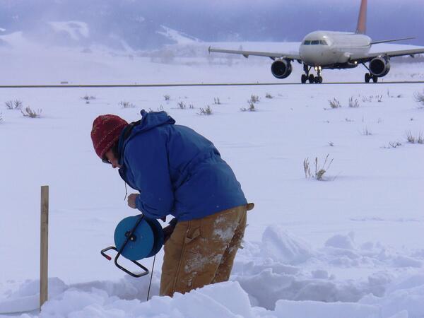
Taking a water-level measurement in a monitoring well at Jackson Hole Airport.
Taking a water-level measurement in a monitoring well at Jackson Hole Airport.

Collecting habitat data at 06324970