Birch Cr bl Heart Butte Road, nr Heart Butte, MT 06094900
Birch Cr bl Heart Butte Road, nr Heart Butte, MT 06094900Birch Creek below Heart Butte Road, near Heart Butte, Montana (06094900) during fall

Official websites use .gov
A .gov website belongs to an official government organization in the United States.
Secure .gov websites use HTTPS
A lock () or https:// means you’ve safely connected to the .gov website. Share sensitive information only on official, secure websites.
Some collected images in Wyoming and Montana.
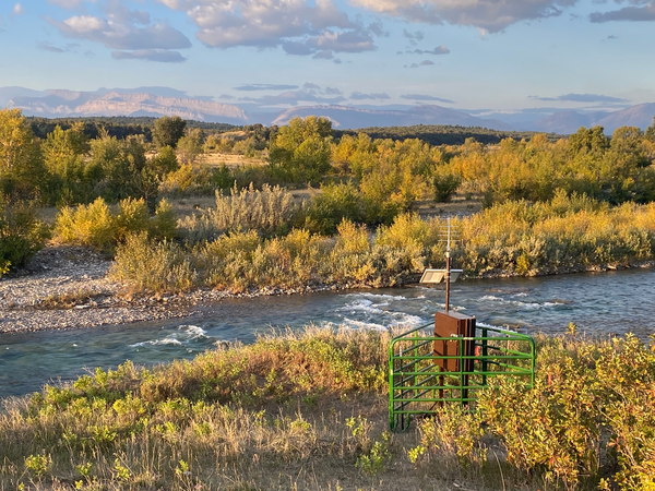
Birch Creek below Heart Butte Road, near Heart Butte, Montana (06094900) during fall
Birch Creek below Heart Butte Road, near Heart Butte, Montana (06094900) during fall

USGS Hydrologist Rodney Caldwell collects suspended sediment at USGS Gage 12334550 Clark Fork at Turah Bridge nr Bonner, MT.
USGS Hydrologist Rodney Caldwell collects suspended sediment at USGS Gage 12334550 Clark Fork at Turah Bridge nr Bonner, MT.

USGS Hydrologist Rodney Caldwell collects suspended sediment at USGS Gage 12334550 Clark Fork at Turah Bridge nr Bonner, MT.
USGS Hydrologist Rodney Caldwell collects suspended sediment at USGS Gage 12334550 Clark Fork at Turah Bridge nr Bonner, MT.

Groundwater-level data retrieval with Thomas Bauer at the Fox Hills well in Montana.
Groundwater-level data retrieval with Thomas Bauer at the Fox Hills well in Montana.

View from USGS Streamgage at Nashua, MT in the fall along the Milk River upstream of the confluence with the Missouri River.
View from USGS Streamgage at Nashua, MT in the fall along the Milk River upstream of the confluence with the Missouri River.

Wading across Salt River at Etna, streamgage 13027500, to collect samples
Wading across Salt River at Etna, streamgage 13027500, to collect samples

Open-pit mining has created tailings piles over 1,000 feet tall in the Elk River Valley.
Open-pit mining has created tailings piles over 1,000 feet tall in the Elk River Valley.

Panoramic photograph of Lake Koocanusa, a reservoir straddling the border between the United States and Canada.
Panoramic photograph of Lake Koocanusa, a reservoir straddling the border between the United States and Canada.

Streamgage at Birch Creek near Heart Butte, Montana install cooperator and owners.
Streamgage at Birch Creek near Heart Butte, Montana install cooperator and owners.

Hydrologist installs streamgage at Birch Creek below Heart Butte Road, near Heart Butte, MT (06094900) as part of the surface water phase of the Hydrologic Assessment of the Blackfeet Reservation, Montana project.
Hydrologist installs streamgage at Birch Creek below Heart Butte Road, near Heart Butte, MT (06094900) as part of the surface water phase of the Hydrologic Assessment of the Blackfeet Reservation, Montana project.

Muddy Creek near Dad streamgage, zero flow

Little Snake River near Dixon low streamflow

Low Flows at Little Snake River near Dixon streamgage
Low Flows at Little Snake River near Dixon streamgage

USGS survey vessel conducting bathymetric surveys near Kootenai River at Leonia, ID (USGS site 12305000).
USGS survey vessel conducting bathymetric surveys near Kootenai River at Leonia, ID (USGS site 12305000).

Another scenic site on the eastern side of the Wind River Range. Streamflow in the South Fork Little Wind River above Washakie Reservoir is currently running about average for the 37 years of record.
Another scenic site on the eastern side of the Wind River Range. Streamflow in the South Fork Little Wind River above Washakie Reservoir is currently running about average for the 37 years of record.

Another scenic site on the eastern side of the Wind River Range. Streamflow in the South Fork Little Wind River above Washakie Reservoir is currently running about average for the 37 years of record.
Another scenic site on the eastern side of the Wind River Range. Streamflow in the South Fork Little Wind River above Washakie Reservoir is currently running about average for the 37 years of record.

USGS Scientist collecting data at USGS 13013650 at Moose, Wyoming on the Snake River Bridge
USGS Scientist collecting data at USGS 13013650 at Moose, Wyoming on the Snake River Bridge


