
The Steamboat replica at Steamboat Park along the Missouri River in Bismarck, North Dakota.
Images
Images
Filter Total Items: 9448

Steamboat Replica in Steamboat Park
The Steamboat replica at Steamboat Park along the Missouri River in Bismarck, North Dakota.

Hay Bales Surrounded by Water
Hay bales surrounded by water from the Souris River at Bantry, North Dakota.
Hay bales surrounded by water from the Souris River at Bantry, North Dakota.

Garrison Dam
The Garrison Dam on June 4, 2011, between Riverdale and Pick City, North Dakota.
The Garrison Dam on June 4, 2011, between Riverdale and Pick City, North Dakota.

Garrison Dam Flooding
The Garrison Dam flooding the boat ramp and boat dock.
The Garrison Dam flooding the boat ramp and boat dock.

Tailrace at Garrison Dam
Looking at Tailrace at Garrison Dam located between Pick City and Riverdale, North Dakota.
Looking at Tailrace at Garrison Dam located between Pick City and Riverdale, North Dakota.

Downstream of Hydropower Turbines
Looking downstream of the hydropower turbines at the Garrison Dam, located between Pick City and Riverdale, North Dakota.
Looking downstream of the hydropower turbines at the Garrison Dam, located between Pick City and Riverdale, North Dakota.

Dike Protecting Homes Along the Missouri River
A large dike on the west side of the Missouri River in Mandan, North Dakota.
A large dike on the west side of the Missouri River in Mandan, North Dakota.

Large Dike Surrounding Homes
Large dike surrounding homes along the west side of the Missouri River.
Large dike surrounding homes along the west side of the Missouri River.

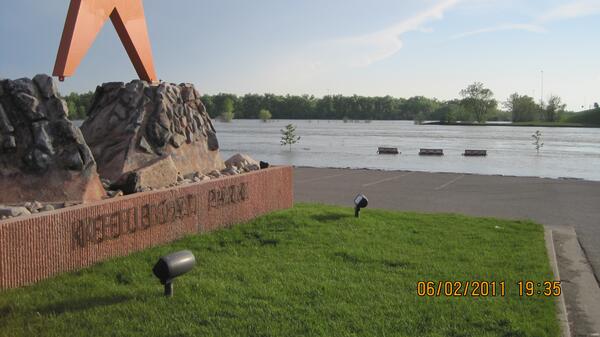
Missouri River Inching its Way to Keelboat Park
The Missouri River is inching its way to the Keelboat Park. It has already covered the Keelboat Park Boat Ramp. To the right of the tree there is a USGS boat collecting flood data.
The Missouri River is inching its way to the Keelboat Park. It has already covered the Keelboat Park Boat Ramp. To the right of the tree there is a USGS boat collecting flood data.

Flooding in Northwest Colorado
Floodwaters partially submerge a USGS streamgage station near Slater, CO.
Floodwaters partially submerge a USGS streamgage station near Slater, CO.

Tie Gang
A tie gang traveling to the site to change ties or traveling away to pack up for the night. Tie gangs are part of the maintenance crew.
A tie gang traveling to the site to change ties or traveling away to pack up for the night. Tie gangs are part of the maintenance crew.

Trucks Making Way Along the Grant Marsh Bridge
Trucks hauling sand and clay to the to the areas that are sandbagging and building dikes.
Trucks hauling sand and clay to the to the areas that are sandbagging and building dikes.

Flooding in Northwest Colorado
A roadway is broken down due to high streamflow near Slater, CO. A USGS streamgage can be seen next to the road.
A roadway is broken down due to high streamflow near Slater, CO. A USGS streamgage can be seen next to the road.

Drilling in Cinder Lake, Arizona
Boreholes being drilled at Cinder Lake as part of a U.S. Geological Survey study to determine the feature's floodwater storage capacity. Cinder Lake, which is located on the Coconino National Forest, has been used to store runoff from areas affected by the 2010 Schultz Fire outside of Flagstaff, Arizona.
Boreholes being drilled at Cinder Lake as part of a U.S. Geological Survey study to determine the feature's floodwater storage capacity. Cinder Lake, which is located on the Coconino National Forest, has been used to store runoff from areas affected by the 2010 Schultz Fire outside of Flagstaff, Arizona.

Steamboat Replica
The steamboat replica along the shore of the Missouri River at Steamboat Park in Bismarck, North Dakota.
The steamboat replica along the shore of the Missouri River at Steamboat Park in Bismarck, North Dakota.
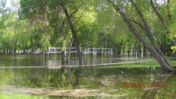
Volleyball Courts Underwater
The Missouri River flooded the volleyball courts at Pioneer Park in Bismarck, North Dakota.
The Missouri River flooded the volleyball courts at Pioneer Park in Bismarck, North Dakota.
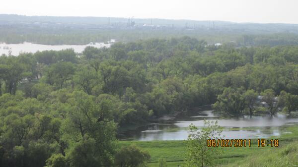
Missouri River from Chief Lookings' Village
Looking from Chief Lookings' Village at Missouri River flooding in North Dakota.
Looking from Chief Lookings' Village at Missouri River flooding in North Dakota.
Keelboat Park
The Missouri River inching its way to Keelboat Park in Bismarck, North Dakota.
The Missouri River inching its way to Keelboat Park in Bismarck, North Dakota.
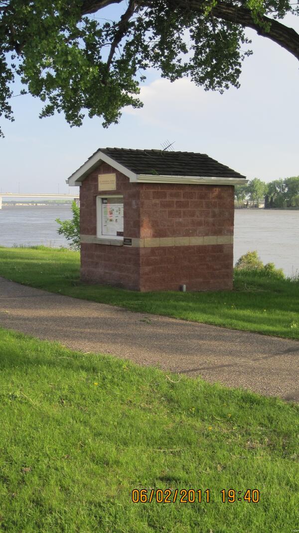
Gage House
The Bismarck, North Dakota gage house located on River Road.
The Bismarck, North Dakota gage house located on River Road.
Rising Water at Keelboat Park
Missouri River rising at Keelboat Park in Bismarck, North Dakota.
Missouri River rising at Keelboat Park in Bismarck, North Dakota.
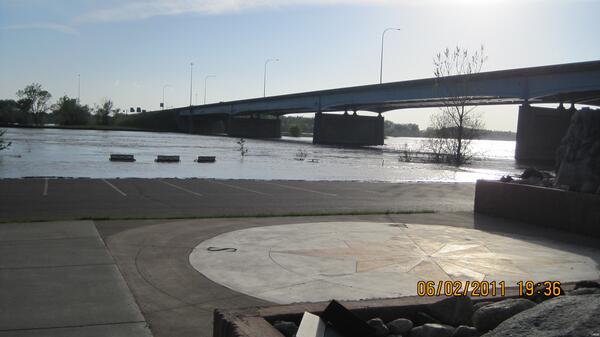
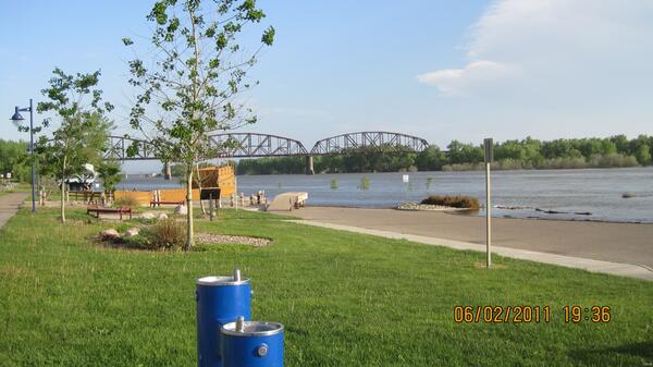
Grant Marsh Bridge
The Grant Marsh Bridge at Keelboat Park in Bismarck, North Dakota.
The Grant Marsh Bridge at Keelboat Park in Bismarck, North Dakota.