
Missouri River at Bismarck, North Dakota flooding the palyground at Pioneer Park.
Images
Images
Filter Total Items: 9448

Pioneer Park Playground
Missouri River at Bismarck, North Dakota flooding the palyground at Pioneer Park.

Wire Weight with Housing
Wire weight is lowered to water surface to measure stage at a site. Levels are made to the wire weights elevation from known benchmarks to ensure correct readings. In the background there is housing protected with dikes along the Missouri River in Mandan, ND.
Wire weight is lowered to water surface to measure stage at a site. Levels are made to the wire weights elevation from known benchmarks to ensure correct readings. In the background there is housing protected with dikes along the Missouri River in Mandan, ND.
Northern Pacific Railroad Bridge and Wire Weight
Wire weight is lowered to water surface to measure stage at a site. Levels are made to the wire weights elevation from known benchmarks to ensure correct readings. This wire weight is located along the Missouri River in Bismarck, ND.
Wire weight is lowered to water surface to measure stage at a site. Levels are made to the wire weights elevation from known benchmarks to ensure correct readings. This wire weight is located along the Missouri River in Bismarck, ND.

Pioneer Park Flooded
Pioneer Park in Bismarck, ND flooded by the Missouri River.
Pioneer Park in Bismarck, ND flooded by the Missouri River.

Missouri River
Looking upstream from Chief Lookings' Indian Village, at the Missouri River in Bismarck, North Dakota with is rising waters.
Looking upstream from Chief Lookings' Indian Village, at the Missouri River in Bismarck, North Dakota with is rising waters.

Pioneer Park Underwater
The Missouri River flooding Pioneer Park in Bismarck, North Dakota.
The Missouri River flooding Pioneer Park in Bismarck, North Dakota.

Keelboat Replica
The Keelboat replica located in Keelboat Park along the Missouri River and River Road in Bismarck, North Dakota.
The Keelboat replica located in Keelboat Park along the Missouri River and River Road in Bismarck, North Dakota.
Rip Rap Creation
Crews add rip rap around key river structures to inhibit erosion and scouring from occuring and possibly underminding the stability of the structure. Creating rip rap around the Grant Marsh Bridge between Mandan and Bismarck, ND.
Crews add rip rap around key river structures to inhibit erosion and scouring from occuring and possibly underminding the stability of the structure. Creating rip rap around the Grant Marsh Bridge between Mandan and Bismarck, ND.

Constructing Rip Rap
Crews add rip rap around key river structures to inhibit erosion and scouring from occuring and possibly underminding the stability of the structure. Creating rip rap around the Grant Marsh Bridge between Mandan and Bismarck, ND.
Crews add rip rap around key river structures to inhibit erosion and scouring from occuring and possibly underminding the stability of the structure. Creating rip rap around the Grant Marsh Bridge between Mandan and Bismarck, ND.

Wild Turkeys Roaming
Wild turkeys roaming diked homes located in South Bismarck, North Dakota.
Wild turkeys roaming diked homes located in South Bismarck, North Dakota.

Landsat Photo: Wallow Fire, Arizona
This Landsat imagery was taken on June 7, 2011. Path/Row: 35/36 and 37 Lat/Long: 33.820/-109.330
This Landsat imagery was taken on June 7, 2011. Path/Row: 35/36 and 37 Lat/Long: 33.820/-109.330

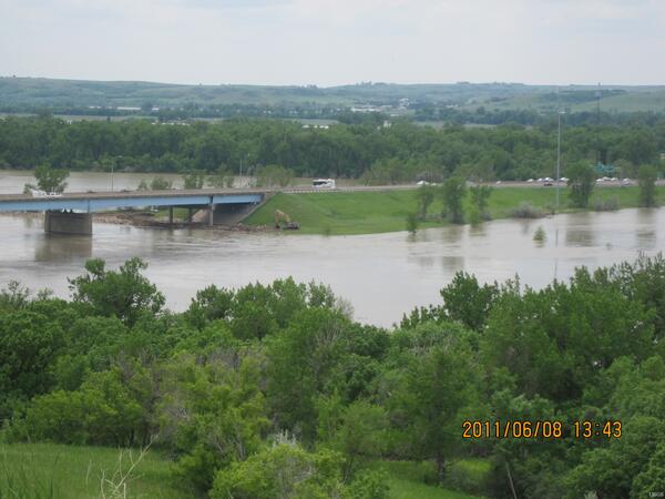
Missouri River Flooding in Pierre, S.D.
Runoff due to recent wide-scale rainfall in South Dakota has led to very high streamflows for local Missouri River tributaries, according to several U.S.
Runoff due to recent wide-scale rainfall in South Dakota has led to very high streamflows for local Missouri River tributaries, according to several U.S.

Neighborhood Dikes
Neighborhood dikes with temporary access located in Bismarck, North Dakota.
Neighborhood dikes with temporary access located in Bismarck, North Dakota.

Flooding in Northwest Colorado
High floodwaters on the Elk River upstream of Routt County Road 42 near Milner, CO.
High floodwaters on the Elk River upstream of Routt County Road 42 near Milner, CO.

Flooding in Northwest Colorado
High floodwaters on the Elk River upstream of Routt County Road 42 near Milner, CO
High floodwaters on the Elk River upstream of Routt County Road 42 near Milner, CO

Steamboat Replica
The Steamboat replica at Steamboat Park along the Missouri River in Bismarck, North Dakota.
The Steamboat replica at Steamboat Park along the Missouri River in Bismarck, North Dakota.

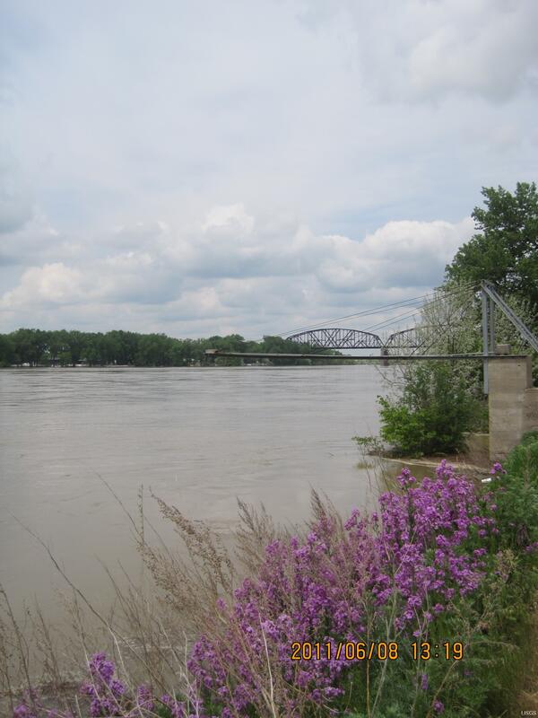
Keelboat Park and the Grant Marsh Bridge
Looking upstream of the Missouri River at Keelboat Park and the Grant Marsh Bridge.
Looking upstream of the Missouri River at Keelboat Park and the Grant Marsh Bridge.

Flooded Keelboat Park Boat Ramp
The boat ramp sign at Keelboat Park Boat Ramp in Bismarck, North Dakota.
The boat ramp sign at Keelboat Park Boat Ramp in Bismarck, North Dakota.

Flooded Keelboat Park
Keelboat Park flooded by the Missouri River in Bismarck, North Dakota.
Keelboat Park flooded by the Missouri River in Bismarck, North Dakota.

Bantry Gage House
Souris River gage house 05122000 near Bantry, North Dakota. USGS personnel were there to measure the streamflow. Streamflow was approximately 17,600 cubic feet per second, stage approximately 15.75 feet.
Souris River gage house 05122000 near Bantry, North Dakota. USGS personnel were there to measure the streamflow. Streamflow was approximately 17,600 cubic feet per second, stage approximately 15.75 feet.

Steamboat Replica in Steamboat Park
The Steamboat replica at Steamboat Park along the Missouri River in Bismarck, North Dakota.
The Steamboat replica at Steamboat Park along the Missouri River in Bismarck, North Dakota.