
Just after sunrise on a beach in eastern Maui.
Images
Images
Filter Total Items: 9454

Sunrise on a Hawaiian Beach 2
Just after sunrise on a beach in eastern Maui.

Hawaiian Monk Seal (Monachus schauinslandi)
Hawaiian Monk Seal on a sandy beach near the western tip of the Hawaiian island of Moloka´i.
Hawaiian Monk Seal on a sandy beach near the western tip of the Hawaiian island of Moloka´i.

Sunrise on a Hawaiian Beach 2
Just after sunrise on a beach in eastern Maui.
Just after sunrise on a beach in eastern Maui.

Sunrise on a Hawaiian Beach 1
Just after sunrise on a beach in eastern Maui.
Just after sunrise on a beach in eastern Maui.

Hatching Spiders
Unidentified species of baby spiders hatching and dispersing.
Unidentified species of baby spiders hatching and dispersing.

Cratered cones near Hephaestus Fossae
Cratered cones near Hephaestus Fossae, Mars. This might look at first glance like a cinder cone, but it is more likely an impact crater. Using the shadow, one can tell that its floor is at a lower elevation than the surrounding landscape. A cinder cone would rise above the landscape.
Cratered cones near Hephaestus Fossae, Mars. This might look at first glance like a cinder cone, but it is more likely an impact crater. Using the shadow, one can tell that its floor is at a lower elevation than the surrounding landscape. A cinder cone would rise above the landscape.
Screwpine Tree (Pandanus sp.) and Beach Naupaka (Scaevola sericea)
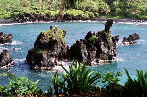
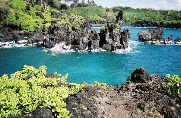
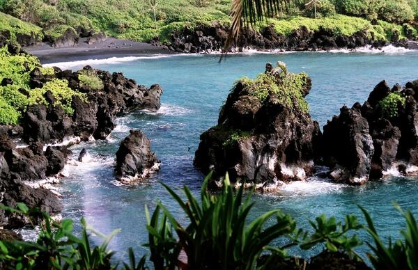
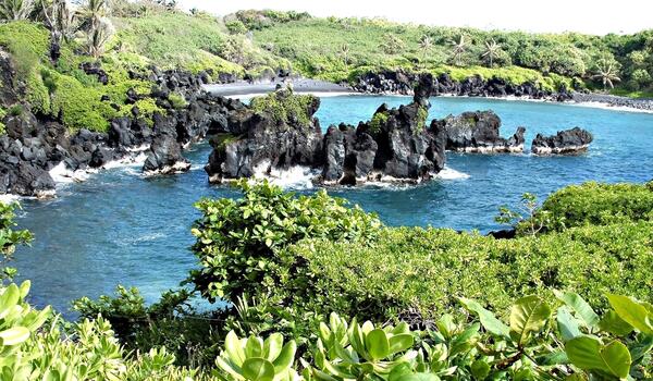
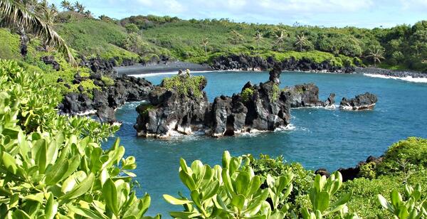
Screwpine Tree (Pandanus sp.) and Beach Naupaka (Scaevola sericea)Lava islands, vegetated seaside cliffs, a black sand beach, and waves breaking against the steep ragged shoreline of a Hawaiian bay.
Screwpine Tree (Pandanus sp.) and Beach Naupaka (Scaevola sericea)
Screwpine Tree (Pandanus sp.) and Beach Naupaka (Scaevola sericea)Lava islands, vegetated seaside cliffs, a black sand beach, and waves breaking against the steep ragged shoreline of a Hawaiian bay.
Screwpine Tree (Pandanus sp.) and Beach Naupaka (Scaevola sericea)
Screwpine Tree (Pandanus sp.) and Beach Naupaka (Scaevola sericea)Lava islands, vegetated seaside cliffs, a black sand beach, and waves breaking against the steep ragged shoreline of a Hawaiian bay.
Screwpine Tree (Pandanus sp.) and Beach Naupaka (Scaevola sericea)
Screwpine Tree (Pandanus sp.) and Beach Naupaka (Scaevola sericea)Lava islands, vegetated seaside cliffs, a black sand beach, and waves breaking against the steep ragged shoreline of a Hawaiian bay.
Screwpine Tree (Pandanus sp.) and Beach Naupaka (Scaevola sericea)
Screwpine Tree (Pandanus sp.) and Beach Naupaka (Scaevola sericea)Lava islands, vegetated seaside cliffs, a black sand beach, and waves breaking against the steep ragged shoreline of a Hawaiian bay.
Screwpine Tree (Pandanus sp.) and Beach Naupaka (Scaevola sericea)
Screwpine Tree (Pandanus sp.) and Beach Naupaka (Scaevola sericea)Lava islands, vegetated seaside cliffs, a black sand beach, and waves breaking against the steep ragged shoreline of a Hawaiian bay.

Screwpine Tree (Pandanus sp.) and Beach Naupaka (Scaevola sericea)
Screwpine Tree (Pandanus sp.) and Beach Naupaka (Scaevola sericea)Lava islands, vegetated seaside cliffs, a black sand beach, and waves breaking against the steep ragged shoreline of a Hawaiian bay.
Screwpine Tree (Pandanus sp.) and Beach Naupaka (Scaevola sericea)
Screwpine Tree (Pandanus sp.) and Beach Naupaka (Scaevola sericea)Lava islands, vegetated seaside cliffs, a black sand beach, and waves breaking against the steep ragged shoreline of a Hawaiian bay.
Screwpine Tree (Pandanus sp.) and Beach Naupaka (Scaevola sericea)
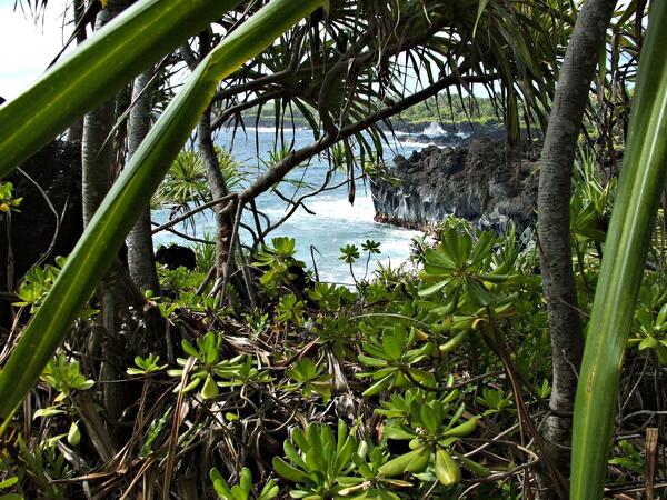
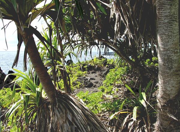
Screwpine Tree (Pandanus sp.) and Beach Naupaka (Scaevola sericea)A forest on an old seaside lava flow vegetated almost entirely by just two plant species: Pandanus trees with an understory of Beach naupaka.
Screwpine Tree (Pandanus sp.) and Beach Naupaka (Scaevola sericea)
Screwpine Tree (Pandanus sp.) and Beach Naupaka (Scaevola sericea)A forest on an old seaside lava flow vegetated almost entirely by just two plant species: Pandanus trees with an understory of Beach naupaka.
Screwpine Tree (Pandanus sp.) and Beach Naupaka (Scaevola sericea)
Screwpine Tree (Pandanus sp.) and Beach Naupaka (Scaevola sericea)Lava islands, vegetated seaside cliffs, a black sand beach, and waves breaking against the steep ragged shoreline of a Hawaiian bay.
Screwpine Tree (Pandanus sp.) and Beach Naupaka (Scaevola sericea)
Screwpine Tree (Pandanus sp.) and Beach Naupaka (Scaevola sericea)Lava islands, vegetated seaside cliffs, a black sand beach, and waves breaking against the steep ragged shoreline of a Hawaiian bay.
Screwpine Tree (Pandanus sp.) and Beach Naupaka (Scaevola sericea)
Screwpine Tree (Pandanus sp.) and Beach Naupaka (Scaevola sericea)Lava islands, vegetated seaside cliffs, a black sand beach, and waves breaking against the steep ragged shoreline of a Hawaiian bay.
Screwpine Tree (Pandanus sp.) and Beach Naupaka (Scaevola sericea)
Screwpine Tree (Pandanus sp.) and Beach Naupaka (Scaevola sericea)Lava islands, vegetated seaside cliffs, a black sand beach, and waves breaking against the steep ragged shoreline of a Hawaiian bay.
Screwpine Tree (Pandanus sp.) and Beach Naupaka (Scaevola sericea)
Screwpine Tree (Pandanus sp.) and Beach Naupaka (Scaevola sericea)A hiking trail along seaside lava cliffs. Trail winds through an unusual Pandanus forest shared with an understory of Beach naupaka.
Screwpine Tree (Pandanus sp.) and Beach Naupaka (Scaevola sericea)
Screwpine Tree (Pandanus sp.) and Beach Naupaka (Scaevola sericea)A hiking trail along seaside lava cliffs. Trail winds through an unusual Pandanus forest shared with an understory of Beach naupaka.
Screwpine Tree (Pandanus sp.) and Beach Naupaka (Scaevola sericea)
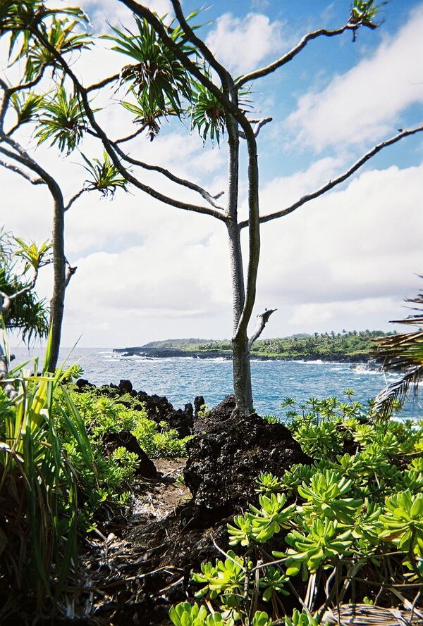
Screwpine Tree (Pandanus sp.) and Beach Naupaka (Scaevola sericea)This hiking trail, Pandanus trees, an understory of Beach naupaka, and crashing waves characterize the windy cliff-tops along this jagged coast of solidified lava in Hawaii.
Screwpine Tree (Pandanus sp.) and Beach Naupaka (Scaevola sericea)
Screwpine Tree (Pandanus sp.) and Beach Naupaka (Scaevola sericea)This hiking trail, Pandanus trees, an understory of Beach naupaka, and crashing waves characterize the windy cliff-tops along this jagged coast of solidified lava in Hawaii.

Fiber Optic Temperature Sensing in Hydrology
USGS hydrologists deploy fiber-optic distributed temperature sensing equipment in Ashumet Pond, Mashpee, Massachusetts. Fiber-optic distributed temperature sensing is an emerging technology that has promise for characterizing estuary-aquifer interaction. The technology evaluation was conducted by the USGS Office of Groundwater Branch of Geophysics in 2007.
USGS hydrologists deploy fiber-optic distributed temperature sensing equipment in Ashumet Pond, Mashpee, Massachusetts. Fiber-optic distributed temperature sensing is an emerging technology that has promise for characterizing estuary-aquifer interaction. The technology evaluation was conducted by the USGS Office of Groundwater Branch of Geophysics in 2007.

Elk River Development
Development along the mouth of the Elk River, a tributory of the Chesapeake Bay.
Development along the mouth of the Elk River, a tributory of the Chesapeake Bay.

Mud Volcano
A surface expression of geothermal activity.
A surface expression of geothermal activity.

Burrowing Owl
Birds found in and around the Salton Sea, California.
Birds found in and around the Salton Sea, California.

Burrowing Owl
Birds found in and around the Salton Sea, California.
Birds found in and around the Salton Sea, California.

Burrowing Owl
Birds found in and around the Salton Sea, California.
Birds found in and around the Salton Sea, California.