
Weather station site, Shenandoah National Park.
Images
Images
Filter Total Items: 9454
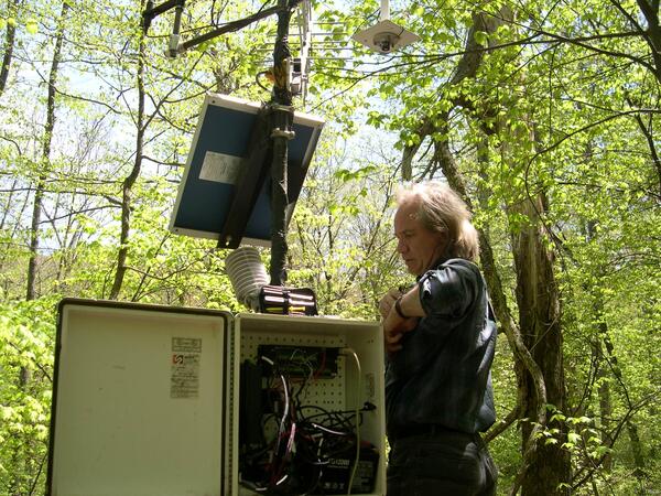
Dr. Douglas Muchoney Working on a Weather Station

Breakout at the End of Highway 130
By August 17, the breakout which started on August 16 had reached the end Highway 130. The flows, however, had slowed considerably and were making little forward progress.
By August 17, the breakout which started on August 16 had reached the end Highway 130. The flows, however, had slowed considerably and were making little forward progress.

End of Dry Season
Dead molluscs and raccoon tracks are concentrated in cracks in mud in the substrate of a dried-down tidal pond. Increased frequency and duration of droughts are predicted by some climate models.
Dead molluscs and raccoon tracks are concentrated in cracks in mud in the substrate of a dried-down tidal pond. Increased frequency and duration of droughts are predicted by some climate models.
Detritius Cruiser
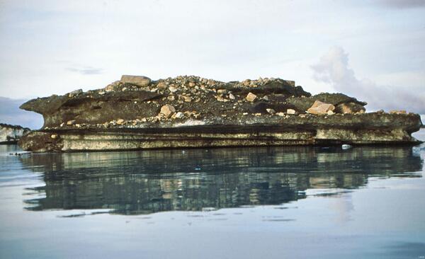
Block of ice on Vitus Lake, Bering Glacier, Alaska.
Block of ice on Vitus Lake, Bering Glacier, Alaska.

Hidden Lake
This picture was taken during sediment coring field work for a project evaluating atmospheric loading of nutrients to high alpine lakes.
This picture was taken during sediment coring field work for a project evaluating atmospheric loading of nutrients to high alpine lakes.

Fireweed and Beaver Creek, Alaska
Fireweed gains a foothold in a burn area of the White Mountains in Alaska.
Fireweed gains a foothold in a burn area of the White Mountains in Alaska.

Low-flying Research Helicopter
This low-level helicopter survey is designed to remotely study geologic units that lie below land surface. It is part of an ongoing USGS program to identify features such as changes in rock types, ultimately providing a better understanding of the geology and hydrology of the area.
This low-level helicopter survey is designed to remotely study geologic units that lie below land surface. It is part of an ongoing USGS program to identify features such as changes in rock types, ultimately providing a better understanding of the geology and hydrology of the area.

Puhi-o-Kalaikini Western Entry
The small western entry point at Puhi-o-Kalaikini stopped this week, leaving just main entry point at the central tip of the delta. The delta is now 985 m (3230 ft) long and reaches up to about 170 m (560 ft) out into the ocean from the old sea cliff. It has a surface area of 28 acres.
The small western entry point at Puhi-o-Kalaikini stopped this week, leaving just main entry point at the central tip of the delta. The delta is now 985 m (3230 ft) long and reaches up to about 170 m (560 ft) out into the ocean from the old sea cliff. It has a surface area of 28 acres.

Mammoth Fossils
Excavation of the initial Columbian mammoth remains found at the Ziegler Reservoir site.
Excavation of the initial Columbian mammoth remains found at the Ziegler Reservoir site.

Alaska Coastal Marsh
Coastal Marsh along Cook Inlet across from Anchorage Alaska.
Coastal Marsh along Cook Inlet across from Anchorage Alaska.

Dead Ponderosas in Jemez, N.M.
Drought and climate change are causing extensive forest dieback in the U.S. West as well as worldwide. These photos show dead ponderosa pines in the Jemez Mountains of New Mexico killed by a combination of drought stress and attacks by bark beetles on weakened trees.
Drought and climate change are causing extensive forest dieback in the U.S. West as well as worldwide. These photos show dead ponderosa pines in the Jemez Mountains of New Mexico killed by a combination of drought stress and attacks by bark beetles on weakened trees.

Niagara Falls
Great Lakes water availability studies conducted by the U.S. Geological Survey aim to help characterize how much water the Basin has now, how water availability is changing, and how much water it can expect to have in the future.
Great Lakes water availability studies conducted by the U.S. Geological Survey aim to help characterize how much water the Basin has now, how water availability is changing, and how much water it can expect to have in the future.

CVO Mobile Telemetry Trailer
Photograph of new mobile telemetry trailer for the Cascades Volcano Observatory (CVO). The purpose of the trailer is to provide a communication link in the event that CVO needs to respond to a Cascade volcanic crisis at a volcano that is currently under-monitored (includes all Cascade volcanoes except Mount St. Helens).
Photograph of new mobile telemetry trailer for the Cascades Volcano Observatory (CVO). The purpose of the trailer is to provide a communication link in the event that CVO needs to respond to a Cascade volcanic crisis at a volcano that is currently under-monitored (includes all Cascade volcanoes except Mount St. Helens).

Red River of the North Gage House
USGS river gage at Hickson, ND along the Red River of the North.
USGS river gage at Hickson, ND along the Red River of the North.

Augustine Volcano Sampling
Students climb out of ravine on north flank of Augustine Volcano during descent from sampling the 2006 lava flow during 2010 summer field campaign.
Students climb out of ravine on north flank of Augustine Volcano during descent from sampling the 2006 lava flow during 2010 summer field campaign.

Drill Rig
This image shows part of a gas drilling rig in Colorado.
This image shows part of a gas drilling rig in Colorado.

Solar Power
This image is of solar panels in Colorado.

Drill Rig
This image shows part of a drill rig in Colorado.
This image shows part of a drill rig in Colorado.

Drill Rig
This image shows part of a gas drilling rig in Colorado.
This image shows part of a gas drilling rig in Colorado.

Measuring Pembina River Streamflow
A bridge board and current meter being used to measure the streamflow on Pembina River at Neche, ND.
A bridge board and current meter being used to measure the streamflow on Pembina River at Neche, ND.

Buoys
Buoys are attached to trotlines deployed in the Lower Missouri River.
Buoys are attached to trotlines deployed in the Lower Missouri River.