
Dauphin Island moderate waves weather scenario.
Images
Images
Filter Total Items: 9454
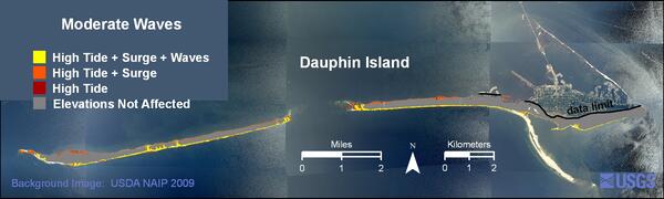
Dauphin Island high moderate weather scenario
Dauphin Island moderate waves weather scenario.

Aquatic Bacteria Samples
On April 20, 2010, the BP Deepwater Horizon drilling platform collapsed and sank in the Gulf of Mexico, causing one of the largest oil spills in history. One of the big dilemmas in responding to the oil spil is how to clean up the oil itself. One way currently under research is to use bacteria that naturally break down oil.
On April 20, 2010, the BP Deepwater Horizon drilling platform collapsed and sank in the Gulf of Mexico, causing one of the largest oil spills in history. One of the big dilemmas in responding to the oil spil is how to clean up the oil itself. One way currently under research is to use bacteria that naturally break down oil.

Harmful Algal Blooms
You may notice a green, red or brown film on your favorite boating or swimming area in the summer. This coloring could mean that the water is affected by harmful algal blooms. Harmful algal blooms are an accumulation of tiny organisms known as algae and can release harmful toxins into the environment. Pictured here is Binder Lake in Iowa covered in algal blooms.
You may notice a green, red or brown film on your favorite boating or swimming area in the summer. This coloring could mean that the water is affected by harmful algal blooms. Harmful algal blooms are an accumulation of tiny organisms known as algae and can release harmful toxins into the environment. Pictured here is Binder Lake in Iowa covered in algal blooms.

New Map Turtle in Louisiana and Mississippi
USGS researchers discovered a new species of turtle. The Pearl River map turtle makes its home in the Pearl River of Louisiana and Mississippi.
USGS researchers discovered a new species of turtle. The Pearl River map turtle makes its home in the Pearl River of Louisiana and Mississippi.
Coastal Landslide Caused by the 2010 Haiti Earthquake
Coastal Landslide Caused by the 2010 Haiti EarthquakeEarthquake-triggered landslide on south coast of Haiti near village of Nan Diamant.
Coastal Landslide Caused by the 2010 Haiti Earthquake
Coastal Landslide Caused by the 2010 Haiti EarthquakeEarthquake-triggered landslide on south coast of Haiti near village of Nan Diamant.

Lava Burning Brush near Kalapana Gardens
Lava burns through thick brush just north of Highway 130, near Kalapana Gardens.
Lava burns through thick brush just north of Highway 130, near Kalapana Gardens.

Awaiting High Tide to Set Block Nets
Sampling fish within the intertidal zone of a mangrove forest requires setting a block net at the interface between forest and river at high tide, then retrieving the net at low tide. Here researchers await high tide to set the nets seen in the boat.
Sampling fish within the intertidal zone of a mangrove forest requires setting a block net at the interface between forest and river at high tide, then retrieving the net at low tide. Here researchers await high tide to set the nets seen in the boat.

Turtle
Turtle in Shenandoah National Park.
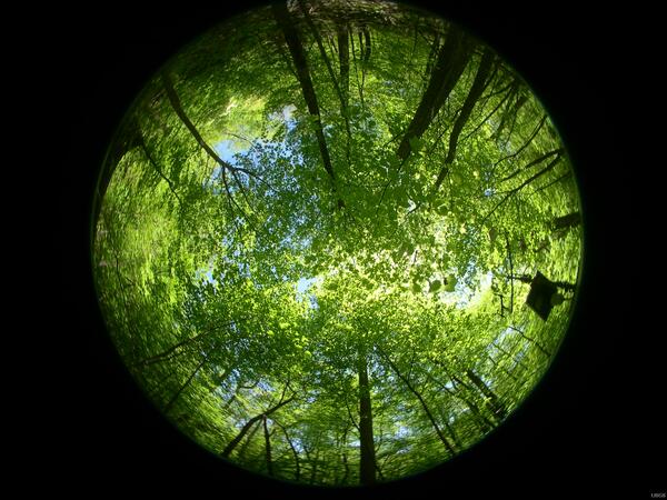
Hemispherical Photo
Pocosin weather station site, Shenandoah National Park.
Pocosin weather station site, Shenandoah National Park.
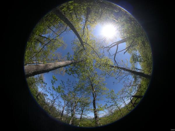
Hemispherical Photo
Meadows spring weather station site, Shenandoah National Park.
Meadows spring weather station site, Shenandoah National Park.

The Ivotuk Hills, Alaska North Slope, Viewed From Ivotuk Camp
The Ivotuk Hills, Alaska North Slope, Viewed From Ivotuk CampExposures of sedimentary rocks in the western Brooks Range, Alaska were evaluated for their contents of metals and phosphate and for their petroleum maturation histories to determine the potential for undiscovered resources in the southern National Petroleum Reserve Alaska.

Food For Vulcan
Rim of Kilauea Volcano.
Rim of Kilauea Volcano.

GCC BSC Set Block Net
Setting block net across an intertidal rivulet draining a hurricane-derived mudflat. Net is retrieved at low tide to obtain an estimate of fish catch. Fish density was found to be greater in waters draining natural tidal forests than in waters from mudflats formed as a result of landfall of a Category 5 hurricane on Cape Sable, Everglades National Park i
Setting block net across an intertidal rivulet draining a hurricane-derived mudflat. Net is retrieved at low tide to obtain an estimate of fish catch. Fish density was found to be greater in waters draining natural tidal forests than in waters from mudflats formed as a result of landfall of a Category 5 hurricane on Cape Sable, Everglades National Park i
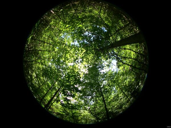
Hemispherical Photo
Madison river weather station site, Shenandoah National Park.
Madison river weather station site, Shenandoah National Park.

Honeycomb Weathering of Limestone Formations
Honeycomb weathering of sandstone located on the shores of Puget Sound occurs when expanding salt crystals break fragments of rock, creating a small hole that becomes larger as the process repeats itself over time.
Honeycomb weathering of sandstone located on the shores of Puget Sound occurs when expanding salt crystals break fragments of rock, creating a small hole that becomes larger as the process repeats itself over time.

Purple Mass
The ochre sea star is a common starfish found along the shores of Puget Sound. This intertidal dweller feeds primarily on mussels and snails, and may live as long as twenty years.
The ochre sea star is a common starfish found along the shores of Puget Sound. This intertidal dweller feeds primarily on mussels and snails, and may live as long as twenty years.

Rainbow Over Yukon River, Eagle, Alaska, June 2002
Rainbow Over Yukon River, Eagle, Alaska, June 2002Eagle was our put-in point for our first synoptic cruise down the Yukon River.
Rainbow Over Yukon River, Eagle, Alaska, June 2002
Rainbow Over Yukon River, Eagle, Alaska, June 2002Eagle was our put-in point for our first synoptic cruise down the Yukon River.

Measuring the Morning Mist
Sunrise on an evapotranspiration-monitoring site in a riparian grassland along the Platte River, Nebraska on September 25, 2007.
Sunrise on an evapotranspiration-monitoring site in a riparian grassland along the Platte River, Nebraska on September 25, 2007.

Fuzzy Balls
Backscattered electron image of radiating fibers of kaolinite growing in volcanic rock altered by fluids connected to hot springs near Lassen Volcanic National Park. Associated with the kaolinite are rounded masses of silica and iron oxides (bright areas) that formed from pyrite. The composition and textures help us evaluate the origin of ore deposits and
Backscattered electron image of radiating fibers of kaolinite growing in volcanic rock altered by fluids connected to hot springs near Lassen Volcanic National Park. Associated with the kaolinite are rounded masses of silica and iron oxides (bright areas) that formed from pyrite. The composition and textures help us evaluate the origin of ore deposits and

Taryn Lopez Measuring Temperature of Gas Emissions
Taryn Lopez Measuring Temperature of Gas EmissionsTaryn Lopez measuring the temperature of gas emissions near summit of Augustine Volcano.
Taryn Lopez Measuring Temperature of Gas Emissions
Taryn Lopez Measuring Temperature of Gas EmissionsTaryn Lopez measuring the temperature of gas emissions near summit of Augustine Volcano.

Snail on the March
I took this picture while setting up a study of this invasive spp. Of snail.
I took this picture while setting up a study of this invasive spp. Of snail.