
Used in field work by Thomas B. Nolan, who served as the seventh Director of the U.S. Geological Survey (1956-1965).
Object ID: USGS-000214
Images
Images
Filter Total Items: 9454
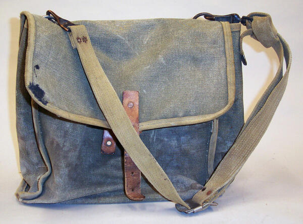
Canvas Plane Table Case
Used in field work by Thomas B. Nolan, who served as the seventh Director of the U.S. Geological Survey (1956-1965).
Object ID: USGS-000214

Denver Display
Director's Display in Denver Colorado. It displays surveying equipment used by USGS field scientists. Some of the instruments included are engineer's levels, transits, hand-held transits, altimeters and microscopes.
Object ID: USGS-DenverDisplay(1of2)
Director's Display in Denver Colorado. It displays surveying equipment used by USGS field scientists. Some of the instruments included are engineer's levels, transits, hand-held transits, altimeters and microscopes.
Object ID: USGS-DenverDisplay(1of2)

Altimeter
Pocket Model used to measure altitude. Accurate to 15,000 ft. Made in Aug. 1968 by Revue Thommen AG, Switzerland.
Object ID: USGS-000646
Pocket Model used to measure altitude. Accurate to 15,000 ft. Made in Aug. 1968 by Revue Thommen AG, Switzerland.
Object ID: USGS-000646
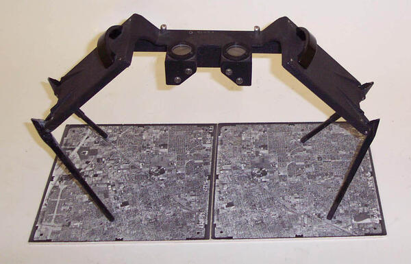
Stereoscope
Manufactured by Q-O-S Corporation, New York for the U.S. Army Corp of Engineers. Although originally designed for military reconnaissance work, this type of instrument was used for map reading of aerial photographs up to 8".
Object ID: USGS-000235
Manufactured by Q-O-S Corporation, New York for the U.S. Army Corp of Engineers. Although originally designed for military reconnaissance work, this type of instrument was used for map reading of aerial photographs up to 8".
Object ID: USGS-000235
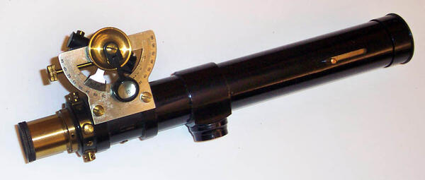
Abney Level
A pocket instrument used in surveying which consists of a fixed sighting tube, a movable spirit level connected to a pointing arm and an arced scale graduated 0 to 90º in both directions. When correctly used, the Abney Level is an accurate surveying tool used to measure degrees, percent of grade and topographic elevation. Manufactured by E.R.
A pocket instrument used in surveying which consists of a fixed sighting tube, a movable spirit level connected to a pointing arm and an arced scale graduated 0 to 90º in both directions. When correctly used, the Abney Level is an accurate surveying tool used to measure degrees, percent of grade and topographic elevation. Manufactured by E.R.
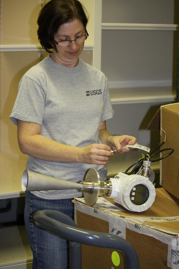
Radar Stage Sensor
USGS Hydrologic Instrumentation Facilities employee Robin Dailey examines a recently received radar stage sensor purchased with ARRA funds.
USGS Hydrologic Instrumentation Facilities employee Robin Dailey examines a recently received radar stage sensor purchased with ARRA funds.
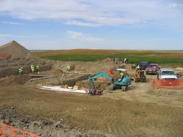
North Wing 1
This photo shows work being completed at the site for the North Wing of the new Audubon NWR Headquarters and Visitor Center. Construction of the building will be completed in September 2010.
This photo shows work being completed at the site for the North Wing of the new Audubon NWR Headquarters and Visitor Center. Construction of the building will be completed in September 2010.
North Wing 2
This photo shows work being completed at the site for the North Wing of the new Audubon NWR Headquarters and Visitor Center. This building will be certified through the Leadership in Energy and Environmental Design (LEED) process and constructed using sustainable design and energy conservation technology.
This photo shows work being completed at the site for the North Wing of the new Audubon NWR Headquarters and Visitor Center. This building will be certified through the Leadership in Energy and Environmental Design (LEED) process and constructed using sustainable design and energy conservation technology.
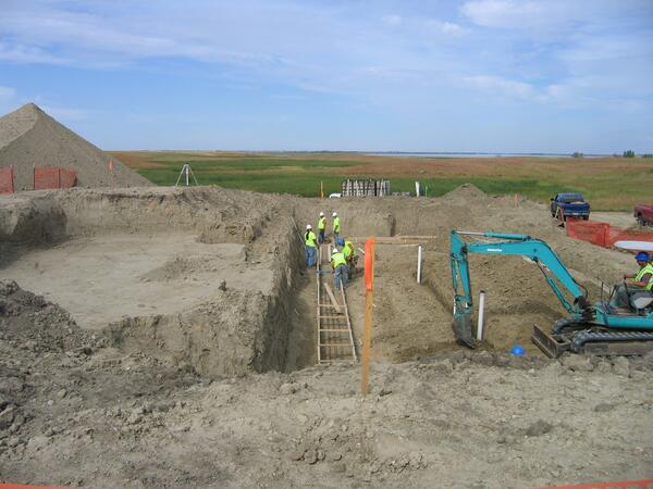
Foundation at Visitor Center
This photo shows workers creating the foundation for the new Visitor Center at Audubon NWR. The new facility, funded by the Recovery Act, will replace a building that has developed and exposed some serious health and safety problems, including asbestos, extensive rodent encroachment, water leakage, and mold.
This photo shows workers creating the foundation for the new Visitor Center at Audubon NWR. The new facility, funded by the Recovery Act, will replace a building that has developed and exposed some serious health and safety problems, including asbestos, extensive rodent encroachment, water leakage, and mold.
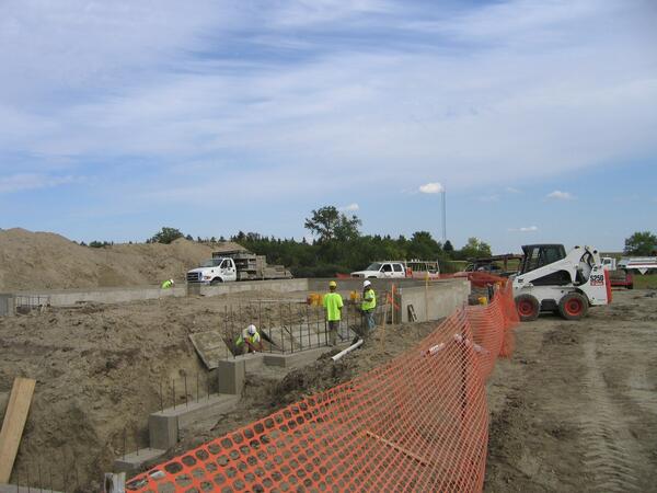
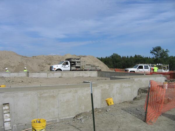
Foundation Walls at Visitor Center
This photo shows workers constructing the foundation walls for the new Visitor Center at Audubon NWR. The visitor contact wing will include an 884 square foot exhibit hall and a 1,038 square foot multipurpose room.
This photo shows workers constructing the foundation walls for the new Visitor Center at Audubon NWR. The visitor contact wing will include an 884 square foot exhibit hall and a 1,038 square foot multipurpose room.

BEN Sampling in Serbia
USGS scientists Bill Orem (left) and Terry Lerch (right) recording data and collecting samples at a Balkan endemic nephropathy (BEN) household in Serbia. BEN patients typically come from small villages and are often farmers.
USGS scientists Bill Orem (left) and Terry Lerch (right) recording data and collecting samples at a Balkan endemic nephropathy (BEN) household in Serbia. BEN patients typically come from small villages and are often farmers.

Pliocene Lignite Bed
Seam or bed of Pliocene lignite from a mine in the Balkan endemic nephropathy (BEN) area of Romania. Rainwater falling onto the surface penetrates into the ground, becoming ground water, and leaches toxic organic substances from this coal.
Seam or bed of Pliocene lignite from a mine in the Balkan endemic nephropathy (BEN) area of Romania. Rainwater falling onto the surface penetrates into the ground, becoming ground water, and leaches toxic organic substances from this coal.

BEN Sampling in Serbia
USGS scientist Bill Orem (left) and Adrian Muntean, a colleague from Romania, sampling water from a well in a Balkan endemic nephropathy (BEN) household in Serbia. The scientists will analyze the water for the presence of coal-derived organic substances dissolved in the water.
USGS scientist Bill Orem (left) and Adrian Muntean, a colleague from Romania, sampling water from a well in a Balkan endemic nephropathy (BEN) household in Serbia. The scientists will analyze the water for the presence of coal-derived organic substances dissolved in the water.

Eskimo Volunteers Helping with Banding
Two Yupik Eskimo students from Chevak, Alaska holding a tundra swan cygnet. These student volunteers were helping with an annual USGS waterfowl banding program along the Kashunuk River near the Bering Sea coast in western Alaska.
Two Yupik Eskimo students from Chevak, Alaska holding a tundra swan cygnet. These student volunteers were helping with an annual USGS waterfowl banding program along the Kashunuk River near the Bering Sea coast in western Alaska.

Green Anaconda
Green anaconda in Brazil. The snake pictured is a representative of a species discussed in the USGS snake risk assessment. This snake was photographed in its native range.
Green anaconda in Brazil. The snake pictured is a representative of a species discussed in the USGS snake risk assessment. This snake was photographed in its native range.

Yellow Anaconda
Yellow anaconda in Argentina. The snake pictured is a representative of a species discussed in the USGS snake risk assessment. This snake was photographed in its native range.
Yellow anaconda in Argentina. The snake pictured is a representative of a species discussed in the USGS snake risk assessment. This snake was photographed in its native range.
An Invasive Boa Constrictor at a Miami County Park
An Invasive Boa Constrictor at a Miami County ParkBoa Constrictor (Boa constrictor) at a county park in southeastern Miami. Photo courtesy of Mike Rochford, University of Florida. Used with permission.
An Invasive Boa Constrictor at a Miami County Park
An Invasive Boa Constrictor at a Miami County ParkBoa Constrictor (Boa constrictor) at a county park in southeastern Miami. Photo courtesy of Mike Rochford, University of Florida. Used with permission.
Invasive Burmese Python on Her Nest in South Florida
Invasive Burmese Python on Her Nest in South FloridaA female Burmese python (Python molurus) on her nest with eggs. Photo by Jemeema Carrigan, University of Florida. Courtesy of Skip Snow, National Park Service. Used with permission.
Invasive Burmese Python on Her Nest in South Florida
Invasive Burmese Python on Her Nest in South FloridaA female Burmese python (Python molurus) on her nest with eggs. Photo by Jemeema Carrigan, University of Florida. Courtesy of Skip Snow, National Park Service. Used with permission.

Wind Energy Facility
Wind energy facility in the Northeastern United States. An unexpected number of dead bats began appearing beneath industrial-scale wind turbines in North America and Europe during the past 10 years.
Wind energy facility in the Northeastern United States. An unexpected number of dead bats began appearing beneath industrial-scale wind turbines in North America and Europe during the past 10 years.

Wind Turbine
Most modern wind turbines are taller than a 30-story building. Field biologist Apple Snider stands at the base of a turbine in New York for scale.
Most modern wind turbines are taller than a 30-story building. Field biologist Apple Snider stands at the base of a turbine in New York for scale.

Hoary Bat Victim
A hoary bat (Lasiurus cinereus) found dead beneath a wind turbine, an apparent victim of a blade strike or near-contact barotrauma (lung failure from severe and abrupt pressure change; here, caused by the spinning blades). Prior to the problem of bat fatalities at wind turbines, biologists rarely encountered hoary bats.
A hoary bat (Lasiurus cinereus) found dead beneath a wind turbine, an apparent victim of a blade strike or near-contact barotrauma (lung failure from severe and abrupt pressure change; here, caused by the spinning blades). Prior to the problem of bat fatalities at wind turbines, biologists rarely encountered hoary bats.