
Natural Hazards
How do volcanoes erupt?
Can you predict earthquakes?
What is the difference between a tsunami and a tidal wave?
What is a landslide and what causes one?
The USGS monitors and conducts research on a wide range of natural hazards to help decision-makers prepare for and respond to hazard events that threaten life and property.

Why are there no faults in the Great Valley of central California?
The Great Valley is a basin, initially forming ~100 million years ago as a low area between the subducting ocean plate on the west (diving down under the North American plate) and the volcanoes to the east (now the Sierra Nevada mountains). Since its formation, the Great Valley has continued to be low in elevation. Starting about 20 million years ago the tectonics changed in California and instead...

Why are there so many earthquakes and faults in the Western United States?
This region of the United States has been tectonically active since the supercontinent Pangea broke up roughly 200 million years ago, and in large part because it is close to the western boundary of the North American plate. Since the formation of the San Andreas Fault system 25-30 million years ago, the juxtaposition of the Pacific and North American plates has formed many faults in California...

How do I find fault or hazard maps for California?
An online map of faults ( Quaternary Fault and Fold Database of the United States ) that includes California is in the Faults section of the Earthquake Hazards Program website. Choose the Interactive Fault Map, or download KML files and GIS shapefiles from the links on the page. USGS hazard maps, data, and tools for California and other parts of the United States are in the Seismic Hazard Maps and...

How do I find the nearest fault to a property or specific location?
If you are looking for faults in California use: How Close to a Fault Do You Live? (Bay Area Earthquake Alliance) For faults in California and the rest of the United States (as well as the latest earthquakes) use the Latest Earthquakes Map : click on the "Basemaps and Overlays" icon in the upper right corner of the map. check the box for "U.S. Faults". mouse-over each fault to get a pop-up window...

What is a "Quaternary" fault?
A Quaternary fault is one that has been recognized at the surface and that has moved in the past 1,600,000 years (1.6 million years). That places fault movement within the Quaternary Period , which covers the last 2.6 million years.

Where can I find a fault map of the United States? Is one available in GIS format?
An online map of United States Quaternary faults (faults active in the last 1.6 million years which places them within the Quaternary Period) is available via the Quaternary Fault and Fold Database . There is an interactive map application to view the faults online and a separate database search function. KML (Google Earth-type) files and GIS shape files are also available for download from the...

What is a fault and what are the different types?
A fault is a fracture or zone of fractures between two blocks of rock. Faults allow the blocks to move relative to each other. This movement may occur rapidly, in the form of an earthquake - or may occur slowly, in the form of creep. Faults may range in length from a few millimeters to thousands of kilometers. Most faults produce repeated displacements over geologic time. During an earthquake, the...

What is the relationship between faults and earthquakes? What happens to a fault when an earthquake occurs?
Earthquakes occur on faults - strike-slip earthquakes occur on strike-slip faults, normal earthquakes occur on normal faults, and thrust earthquakes occur on reverse or thrust faults. When an earthquake occurs on one of these faults, the rock on one side of the fault slips with respect to the other. The fault surface can be vertical, horizontal, or at some angle to the surface of the earth. The...
Can we cause earthquakes? Is there any way to prevent earthquakes?
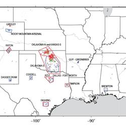
Earthquakes induced by human activity have been documented at many locations in the United States and in many other countries around the world. Earthquakes can be induced by a wide range of causes including impoundment of reservoirs, surface and underground mining, withdrawal of fluids and gas from the subsurface, and injection of fluids into underground formations. While most induced earthquakes...

Do earthquakes occur in Antarctica?
Earthquakes do occur in Antarctica, but not very often. There have been some big earthquakes--including one magnitude 8.1 --in the Balleny Islands (between Antarctica and New Zealand). The boundary between the Scotia Plate and the Antarctic Plate just grazes the north tip of the Antarctic Peninsula (look "northwest" from the Pole toward South America). There is also a hint of a line of seismicity...
Where can I find earthquake educational materials?
Start with our Earthquake Hazards Education site. That includes: Earthquakes for Kids Cool Earthquake Facts Earthquake Science for Everyone Other good starting points include: State Geological Surveys for states in earthquake-prone regions The Great ShakeOut Earthquake Drills website SAGE (Seismological Facility for the Advancement of Geoscience), which is a non-profit consortium

At what depth do earthquakes occur? What is the significance of the depth?
Earthquakes occur in the crust or upper mantle, which ranges from the earth's surface to about 800 kilometers deep (about 500 miles). The strength of shaking from an earthquake diminishes with increasing distance from the earthquake's source, so the strength of shaking at the surface from an earthquake that occurs at 500 km deep is considerably less than if the same earthquake had occurred at 20...