
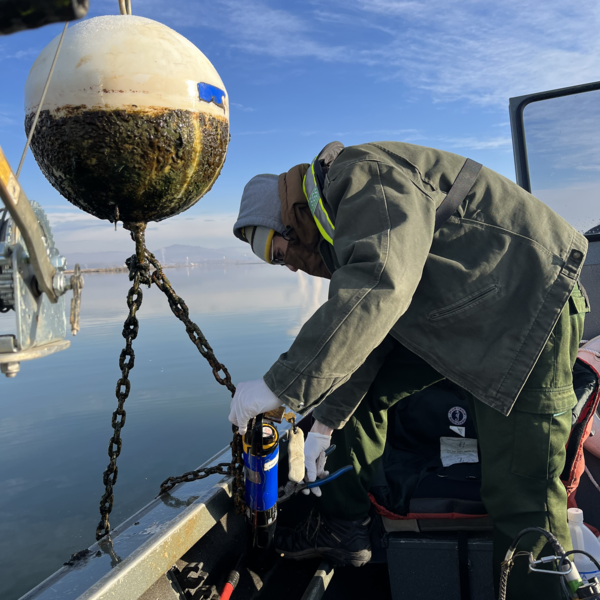
Hydrologic Technician, Will Ault, examines a water quality sensor in the Klamath River during a routine inspection.
Images
Check out photos of some of the awesome work USGS scientists and field technicians have done over the years.
Filter Total Items: 365
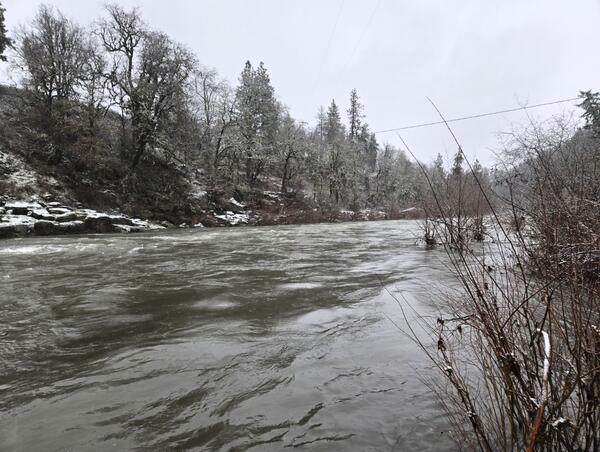
Klamath River water quality site inspection
Hydrologic Technician, Will Ault, examines a water quality sensor in the Klamath River during a routine inspection.
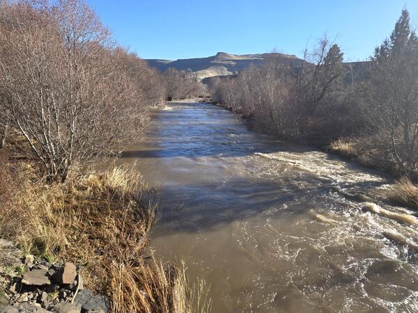
Measuring the Chewaucan River
Klamath Falls Field Office Hydrologic Technician collects a streamflow measurement on the Chewaucan River at Mouth near Valley Falls, OR (10387110). The Chewaucan River flows into Lake Abert, OR.
Klamath Falls Field Office Hydrologic Technician collects a streamflow measurement on the Chewaucan River at Mouth near Valley Falls, OR (10387110). The Chewaucan River flows into Lake Abert, OR.
Chewaucan River field work
Pulling measurement equipment through shallow waters on the banks of the Chewaucan River.
Pulling measurement equipment through shallow waters on the banks of the Chewaucan River.
Lake Abert inflow measurement
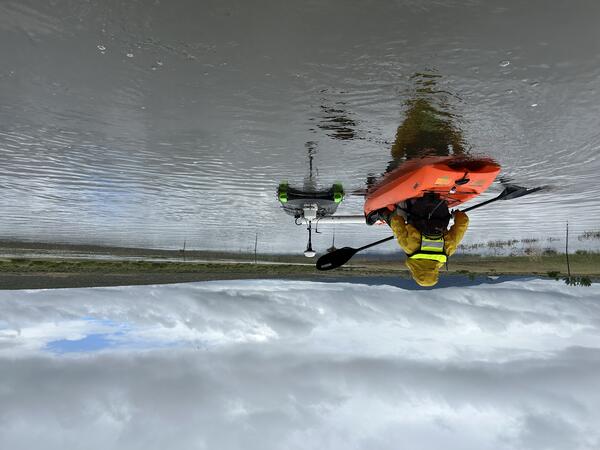
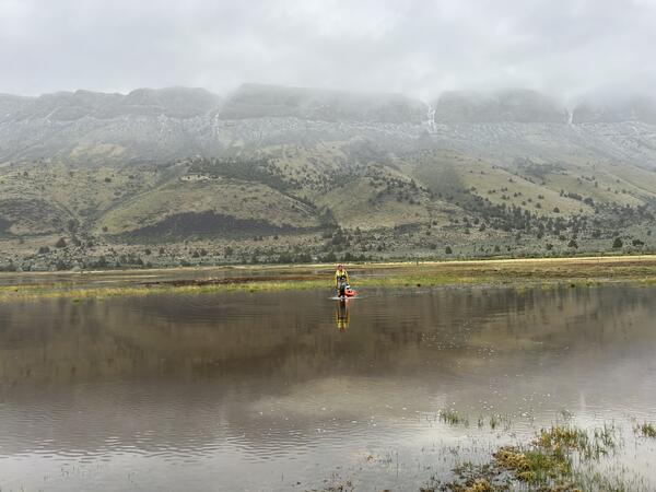
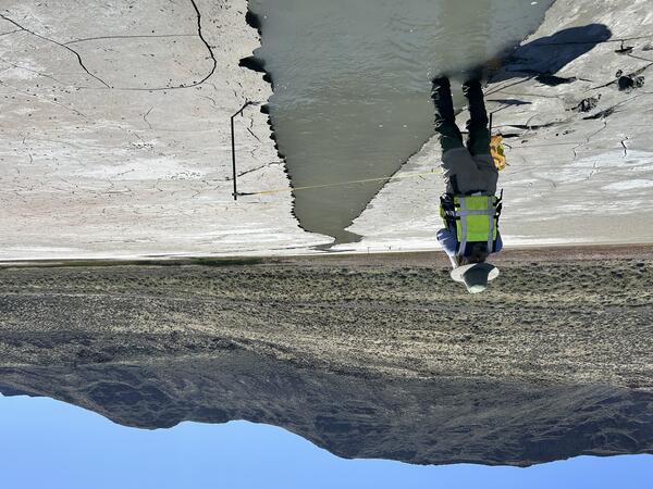
Hydrologic Technician, Ali Moss, measures a shallow spring fed channel at Lake Abert, Oregon. Lake Abert is one of the 20 plus terminal lakes identified by USGS partners as priority ecosystems for study by the Saline Lakes Ecosystems IWAA.
Hydrologic Technician, Ali Moss, measures a shallow spring fed channel at Lake Abert, Oregon. Lake Abert is one of the 20 plus terminal lakes identified by USGS partners as priority ecosystems for study by the Saline Lakes Ecosystems IWAA.
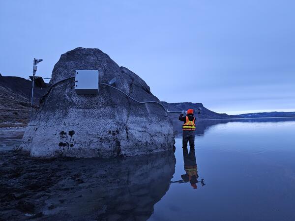
Lake Abert installation
Hydrologic Technician, Ali Moss, installs a radar unit on a large boulder in the shallow water of Lake Abert, OR. The radar unit records the water level in near real-time at this saline lake.
Hydrologic Technician, Ali Moss, installs a radar unit on a large boulder in the shallow water of Lake Abert, OR. The radar unit records the water level in near real-time at this saline lake.
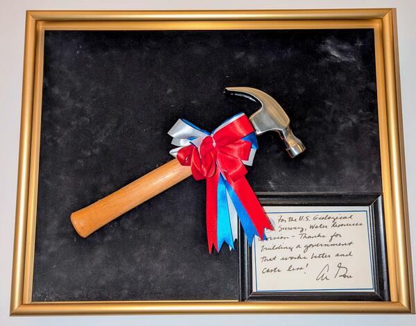
USGS Oregon District Hammer Award
In 1996 the USGS Water Resources Division (now called Water Mission Area) received Vice President Gore's Hammer Award. It was presented by Assistant Secretary for Water and Science, Patricia Beneke, at the Carnegie Center in Oregon City, Oregon, with Dennis Lynch, District Chief, Oregon, accepting on behalf of the Division.
In 1996 the USGS Water Resources Division (now called Water Mission Area) received Vice President Gore's Hammer Award. It was presented by Assistant Secretary for Water and Science, Patricia Beneke, at the Carnegie Center in Oregon City, Oregon, with Dennis Lynch, District Chief, Oregon, accepting on behalf of the Division.
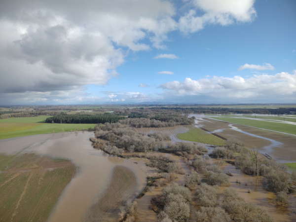
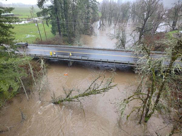
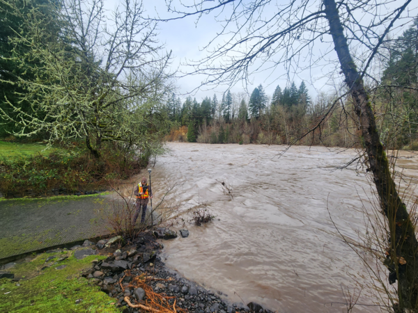
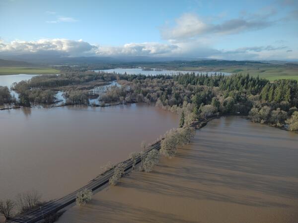
Aerial image of Marys River
USGS Hydrologic Technicians captured this aerial image above Marys River during the December 2025 flood event.
USGS Hydrologic Technicians captured this aerial image above Marys River during the December 2025 flood event.
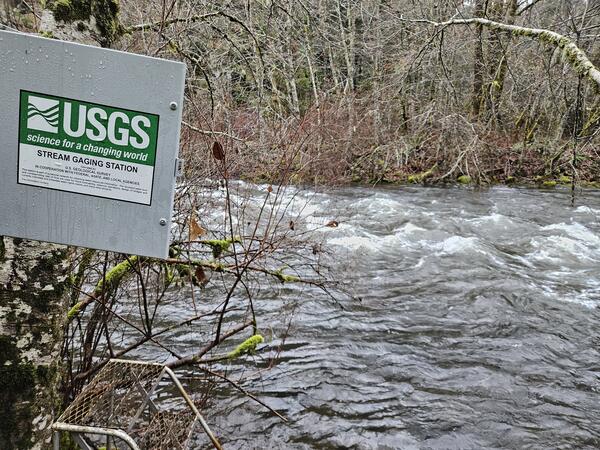
Shitike Creek near Warm Springs, Oregon
Downstream view of Shitike Creek near Warm Springs, Oregon. This gage is operated in partnership with the Confederated Tribes of the Warm Springs Reservation's Natural Resources Department.
Downstream view of Shitike Creek near Warm Springs, Oregon. This gage is operated in partnership with the Confederated Tribes of the Warm Springs Reservation's Natural Resources Department.
Aerial view of the Mohawk River
Oregon Water Science Center Hydrologic Technicians, Ben Thorpe, Kyle Flannery, and Itziar Zandueta Lopez, measured high flows on the Mohawk River Near Springfield, OR (14165000), concurrently using an Acoustic Dopple
Oregon Water Science Center Hydrologic Technicians, Ben Thorpe, Kyle Flannery, and Itziar Zandueta Lopez, measured high flows on the Mohawk River Near Springfield, OR (14165000), concurrently using an Acoustic Dopple
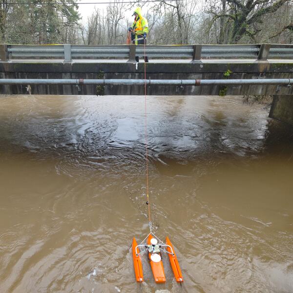
Mohawk River high-flow measurement
Oregon Water Science Center Eugene Field Office Hydrologic Technician Itziar Zandueta Lopez, measuring high-flows at Mohawk River Near Springfield, OR (14165000) concurrently using an Acoustic Doppler Current Profile
Oregon Water Science Center Eugene Field Office Hydrologic Technician Itziar Zandueta Lopez, measuring high-flows at Mohawk River Near Springfield, OR (14165000) concurrently using an Acoustic Doppler Current Profile
Clackamas River high-flow survey
USGS scientist, wearing a personal protection device, or PFD, surveys water levels and debris line on the Clackamas River, Milo McIver park boat ramp. These measurements are used to validate a 2D hydraulic model of the Clackamas River.
USGS scientist, wearing a personal protection device, or PFD, surveys water levels and debris line on the Clackamas River, Milo McIver park boat ramp. These measurements are used to validate a 2D hydraulic model of the Clackamas River.
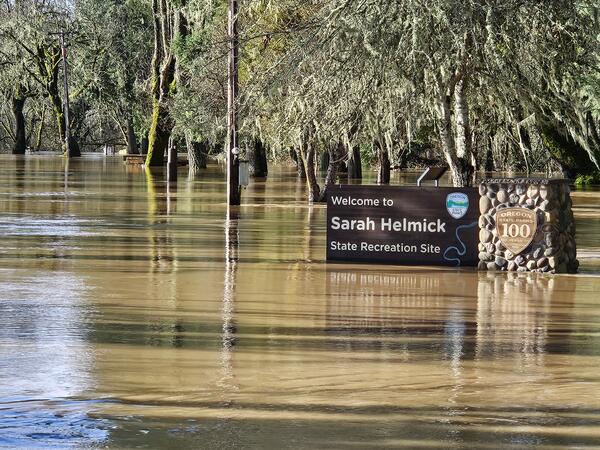
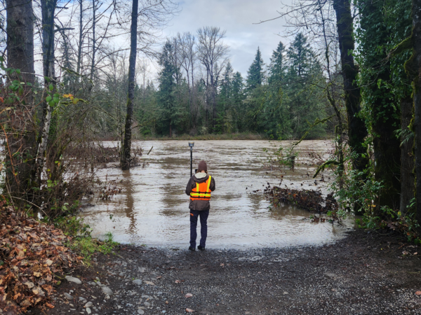
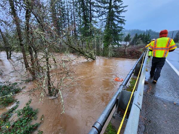
Flooded Sarah Helmick State Recreation Site along the Luckiamute River
Flooded Sarah Helmick State Recreation Site along the Luckiamute RiverField technicians braved the flooded park to collect critical streamflow measurements nearby. The Luckiamute River Near Suver, OR (# 14190500) is operated in cooperation with the US Army Corps of Engineers and is a USGS Federal Priority Streamgage.
Clackamas River floods Barton Park
In December 2025 USGS field crews captured photos of Clackamas River flooding at Barton Park while surveying the scale of the flood.
In December 2025 USGS field crews captured photos of Clackamas River flooding at Barton Park while surveying the scale of the flood.
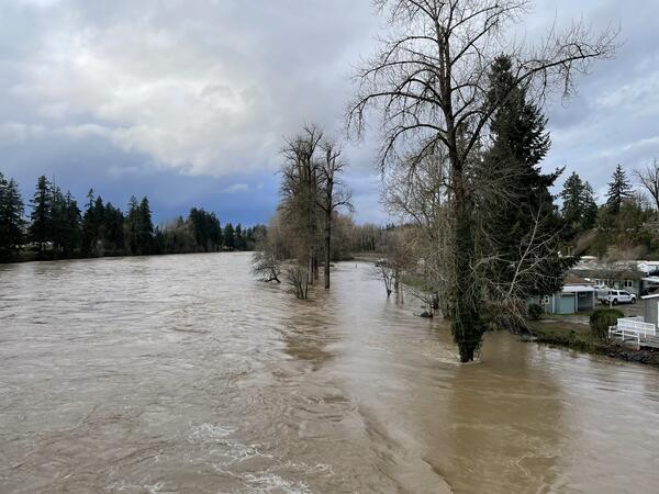
Flood waters on the Clackamas River
High-flows on the Clackamas River seen from the Carver Bridge, in Carver Oregon.
High-flows on the Clackamas River seen from the Carver Bridge, in Carver Oregon.
Nearly flooded Buena Vista Road near Luckiamute River
Nearly flooded Buena Vista Road near Luckiamute RiverUSGS Hydrologic Technicians captured this aerial image with a drone during field. The USGS Oregon Water Science Center operates a streamflow gaging station nearby on the Luckiamute River.
Nearly flooded Buena Vista Road near Luckiamute River
Nearly flooded Buena Vista Road near Luckiamute RiverUSGS Hydrologic Technicians captured this aerial image with a drone during field. The USGS Oregon Water Science Center operates a streamflow gaging station nearby on the Luckiamute River.
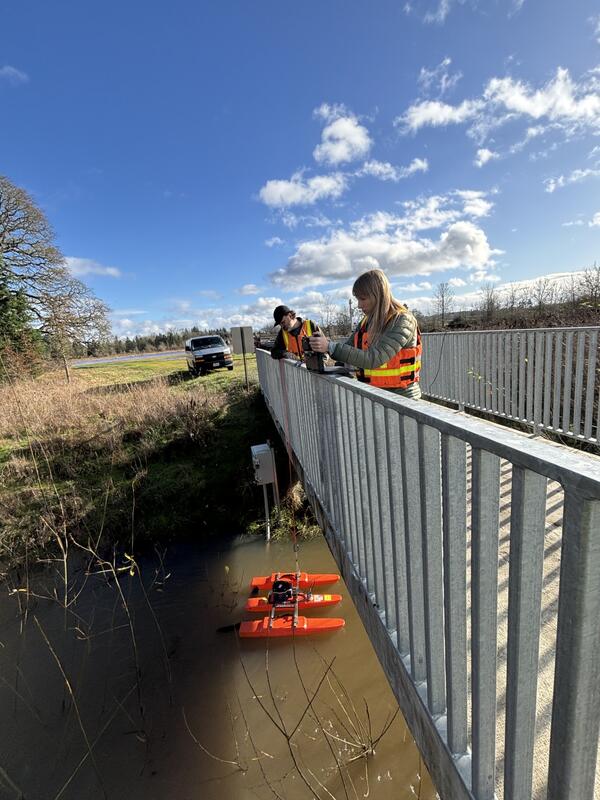
Chicken Creek high-flow measurement
Hydrologic technicians Adam and Vanessa make a flow measurement using an acoustic doppler current profiler (ADCP). The ADCP is tethered to a rope and is pulled across the channel so it can collect channel depth and flow velocity measurements. The technicians did a great job getting a measurement close to the peak flow at this site on December 19, 2025.
Hydrologic technicians Adam and Vanessa make a flow measurement using an acoustic doppler current profiler (ADCP). The ADCP is tethered to a rope and is pulled across the channel so it can collect channel depth and flow velocity measurements. The technicians did a great job getting a measurement close to the peak flow at this site on December 19, 2025.
Mohawk River high-flow measurement
Oregon Water Science Center Eugene Field Office Hydrologic Technicians, Ben Thorpe, Kyle Flannery, and Itziar Zandueta Lopez, measured high-flows at Mohawk River Near Springfield, OR - USGS-14165000 concurrently usin
Oregon Water Science Center Eugene Field Office Hydrologic Technicians, Ben Thorpe, Kyle Flannery, and Itziar Zandueta Lopez, measured high-flows at Mohawk River Near Springfield, OR - USGS-14165000 concurrently usin
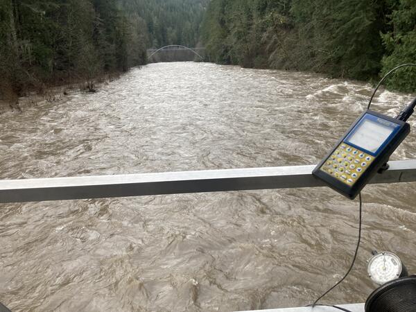
Hood River at Tucker Bridge, near Hood River Oregon
Hood River at Tucker Bridge, near Hood River OregonRising waters near the USGS streamflow gage along Hood River.
Hood River at Tucker Bridge, near Hood River Oregon
Hood River at Tucker Bridge, near Hood River OregonRising waters near the USGS streamflow gage along Hood River.