
Pennsylvania and the Chesapeake Bay Watershed
USGS Releases new fact sheet on conservation practices
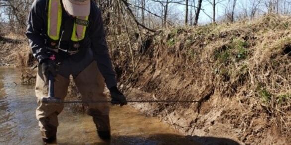
Your land, your water—Using research to guide conservation practices on local farms in the Chesapeake Bay watershed
USGS Evaluates Effects of Agricultural Conservation Practices
A new study on best management practices and nitrogen in streams of the Chesapeake Bay Watershed
Nitrogen in the Chesapeake Bay Watershed — A Century of Change
Groundwater is a major source of nitrate to Chesapeake Bay
Land use, organic carbon in soils, and geology can explain where groundwater contributions are the most important
Removal of Legacy Sediments Effects Nutrient Loads in Streamflow
Effects of Legacy Sediment Removal on Nutrients and Sediment in Big Spring Run, Lancaster County, Pennsylvania, 2009–15
USGS provides monitoring, analysis, modeling and research on streams and water quality to better understand the fate and transport of nutrients and sediment to the Susquehanna and other rivers, and their tributaries, and eventually to the Chesapeake Bay. Additional research focuses on emerging contaminants and other stressors that effect human and aquatic life in the watershed and estuary.

Sediment Response of Stream Restoration Practices
Assessing stream restoration effectiveness by quantifying sediment erosion and deposition along restored and eroded agricultural stream reaches
Water Quality to Inform Conservation Management

The occurrence and distribution of nutrients, and an understanding of biogeochemical processes aims to help aid conservation efforts.
The Susquehanna River drains the largest watershed (48 percent) and supplies 55 percent of the freshwater flowing into the Chesapeake Bay. In 2010, the largest and most complex total maximum daily load (TMDL) in the Nation was initiated in the Chesapeake Bay for nitrogen, phosphorus, and sediment. These pollution allocations were further divided by major river basins and states. Pennsylvania contributes approximately 44 percent of the nitrogen load and 24 percent of the phosphorus load to the Bay (Chesapeake Bay TMDL Document).


Susquehanna River Story — What does the science say about water quality?
Narrated presentation that provides a unique synthesis of the story of nutrient water quality in the Susquehanna watershed.
USGS provides monitoring, analysis, modeling and research on streams and water quality to better understand the fate and transport of nutrients and sediment to the Susquehanna and other rivers, and their tributaries, and eventually to the Chesapeake Bay. Additional research focuses on emerging contaminants and other stressors that effect human and aquatic life in the watershed and estuary.
Sediment Response of Stream Restoration Practices
Assessing stream restoration effectiveness by quantifying sediment erosion and deposition along restored and eroded agricultural stream reaches
Water Quality to Inform Conservation Management
The occurrence and distribution of nutrients, and an understanding of biogeochemical processes aims to help aid conservation efforts.
The Susquehanna River drains the largest watershed (48 percent) and supplies 55 percent of the freshwater flowing into the Chesapeake Bay. In 2010, the largest and most complex total maximum daily load (TMDL) in the Nation was initiated in the Chesapeake Bay for nitrogen, phosphorus, and sediment. These pollution allocations were further divided by major river basins and states. Pennsylvania contributes approximately 44 percent of the nitrogen load and 24 percent of the phosphorus load to the Bay (Chesapeake Bay TMDL Document).
Susquehanna River Story — What does the science say about water quality?
Narrated presentation that provides a unique synthesis of the story of nutrient water quality in the Susquehanna watershed.