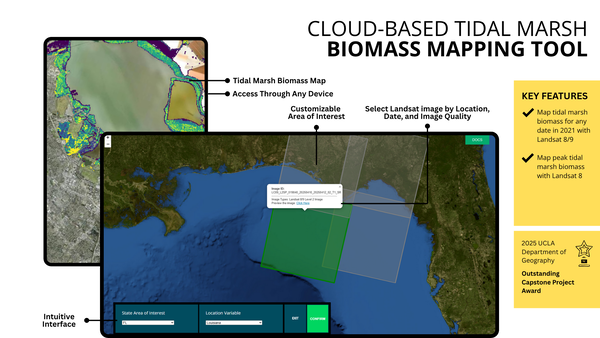
Rapid remote sensing Updates of land cover for Storm and Hurricane forecast models (RUSH) tool fact sheet
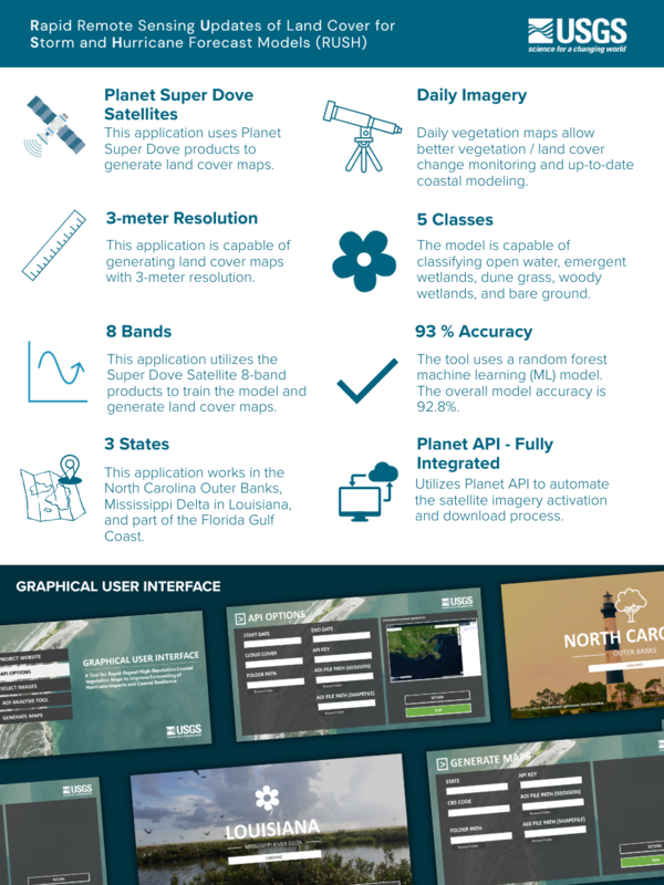
Rapid remote sensing Updates of land cover for Storm and Hurricane forecast models (RUSH) tool fact sheetA fact sheet that shows the RUSH tool’s characteristics and graphical user interface.