
Figure 2.
Multimedia
Images
Las Moras.jpg
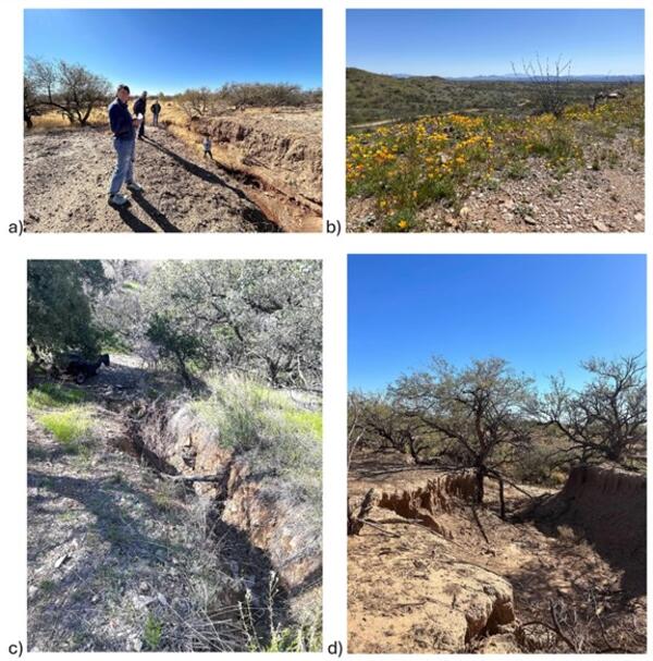
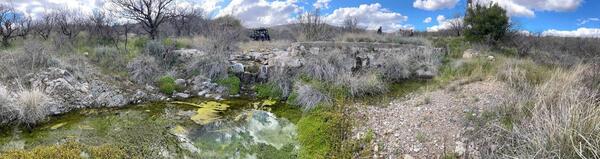
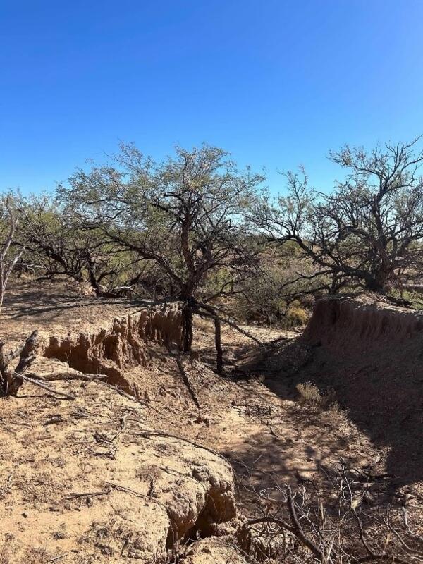
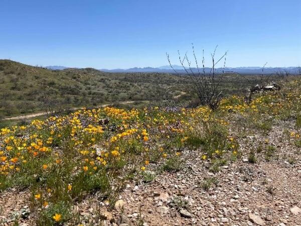
The Las Moras Wash, within the Santa Margarita Ranch, Altar Valley, AZ, exhibits channel incision, gully expansion, head‑cut migration, vegetation loss, and reduced hydrologic connectivity between upper watershed and floodplains
The Las Moras Wash, within the Santa Margarita Ranch, Altar Valley, AZ, exhibits channel incision, gully expansion, head‑cut migration, vegetation loss, and reduced hydrologic connectivity between upper watershed and floodplains
las moras fig 1.jpg
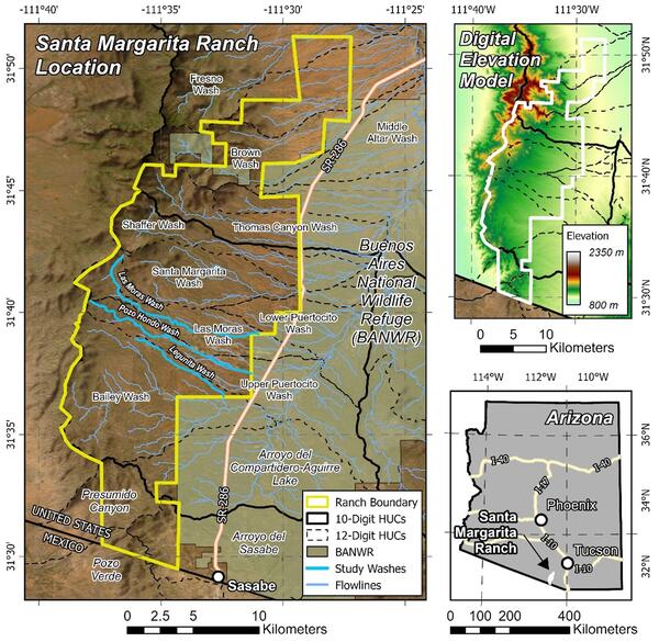
Figure 1. Location map showing the study area and property boundary of the Santa Margarita Ranch
Figure 1. Location map showing the study area and property boundary of the Santa Margarita Ranch
Las Moras b.jpg - Copy - Copy
Figure 2.
las moras fig 3.jpg
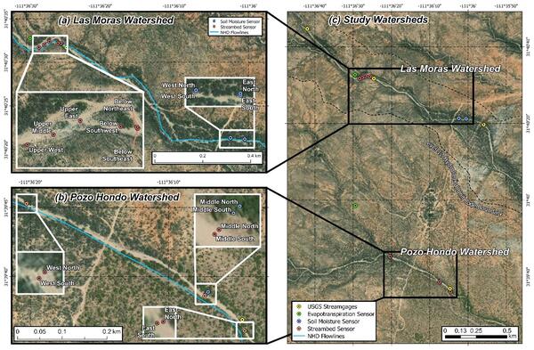
Figure 3. Map of paired watershed monitoring devices INSTALLED AT Santa Margarita Ranch.
Figure 3. Map of paired watershed monitoring devices INSTALLED AT Santa Margarita Ranch.
Videos

RUSH: Rapid Remote Sensing Updates of landcover for Storm and Hurricane forecasts
RUSH: Rapid Remote Sensing Updates of landcover for Storm and Hurricane forecastsRUSH is a tool for rapid repeat high resolution coastal vegetation maps to improve forecasting of hurricane impacts and coastal resilience. Vegetation cover in coastal settings significantly controls flooding, erosion, and barrier island breaching during extreme storms by reducing wave energy.

Lessons learned using stream morphology and simple erosion control structures from the past decade that improve longevity and project performance
Lessons learned using stream morphology and simple erosion control structures from the past decade that improve longevity and project performanceThe use of simple erosion control structures, one-rock-dams, rock sills, trincheras, etc have gained great popularity in recent years. Ease of construction, relative cost and effectiveness are driving increased and widespread use.

Hydrological Restoration of Degraded Grasslands in Arid and Semi-Arid Communities
Hydrological Restoration of Degraded Grasslands in Arid and Semi-Arid CommunitiesWe live in the Anthropocene. The entire surface of the earth has been impacted by human activity and our land management decisions. In this context, most of the grasslands in arid and semiarid regions are experiencing severe and continuing degradation.

10-Years Experience in Building Rock Gabions and Check Dams in the Cacachilas Mountain Range, Mexico
10-Years Experience in Building Rock Gabions and Check Dams in the Cacachilas Mountain Range, MexicoRancho Cacachilas is a land restoration and ecotourism project in the Sierra Cacachilas mountain range, 30km east of the city of La Paz, Baja California Sur, Mexico.

Hinge-Felling, Best & Cheapest
Lucinda Cole and I retired to the Pitchfork Ranch in southwest New Mexico two decades ago. We’ve overseen 17 government grants to install grade-control structures in 31 side-drainages and the ranches’ 9-mile reach of the 48-mile-long Burro Ciénaga riparian watercourse, 1.5-miles perennial ciénaga.
Lucinda Cole and I retired to the Pitchfork Ranch in southwest New Mexico two decades ago. We’ve overseen 17 government grants to install grade-control structures in 31 side-drainages and the ranches’ 9-mile reach of the 48-mile-long Burro Ciénaga riparian watercourse, 1.5-miles perennial ciénaga.

Re-Watering the Ground
We have experienced the placement of rocks on hillsides in eroded areas. The rock dams capture silt and water. A great many dams placed close together in all drainages capture so much water that the hills become sponges.
We have experienced the placement of rocks on hillsides in eroded areas. The rock dams capture silt and water. A great many dams placed close together in all drainages capture so much water that the hills become sponges.