
Woods Hole Coastal and Marine Science Center Newsletter: January-March 2025
Our Science Stories
-
Valuable Data Collected on M7.0 Earthquake Offshore Cape Mendocino, California Valuable Data Collected on M7.0 Earthquake Offshore Cape Mendocino, California
In the first real-world deployment of the new rapid response ocean bottom seismograph fleet, hundreds of aftershocks were successfully recorded on the seafloor offshore Cape Mendocino, California. These data will help seismologists better understand hazards—onshore and offshore—from future earthquakes in the region.
-

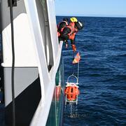
Get Ready to Explore a Little Deeper: SEABOSS 3.0 is Coming Get Ready to Explore a Little Deeper: SEABOSS 3.0 is Coming
The SEABOSS—used to collect images, videos, and samples of the seafloor—is being updated to improve overall capabilities and allow for deep water deployment up to 500 meters. These enhancements are inspired by cross-center knowledge sharing, continuing a long history of collaboration within the USGS Coastal and Marine Hazards and Resources Program to develop new systems and advance capabilities.
-
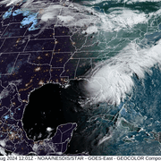
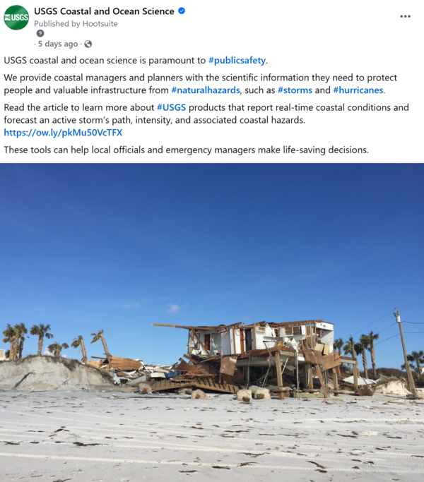
Approaching Storms Approaching Storms
The USGS Coastal and Marine Hazards and Resources Program has various products that report near real-time coastal conditions and forecast an active storm’s path, intensity, and associated coastal change hazards. These tools provide local officials and emergency managers with the scientific information they need to help make life-saving decisions before a storm makes landfall.
-
Seafloor Seismographs Rapidly Deployed Following Major Earthquake Offshore Northern California Seafloor Seismographs Rapidly Deployed Following Major Earthquake Offshore Northern California
The rapid response ocean bottom seismograph fleet, jointly developed and maintained by the Woods Hole Oceanographic Institution and USGS, was swiftly deployed after a major earthquake hit Northern California and the Pacific Northwest. The quick deployment of these instruments will enable the collection of the high-value data needed to produce the most accurate and useful hazard assessment.
-

Sound Waves Newsletter: October 2024-January 2025 Sound Waves Newsletter: October 2024-January 2025
Read stories about responding to natural hazards, a coral reef restoration cost benefit study, marine resources, and much more in this issue of Sound Waves.
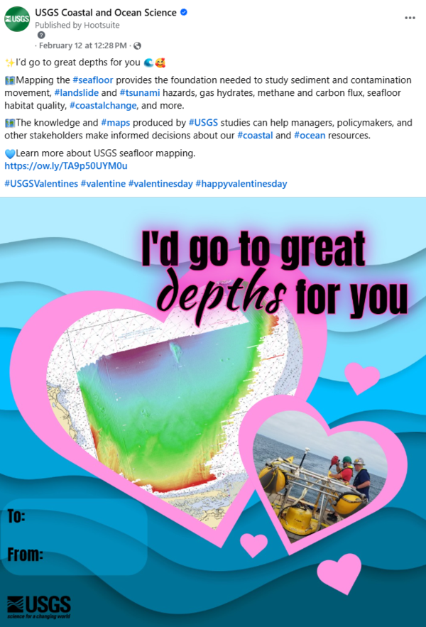
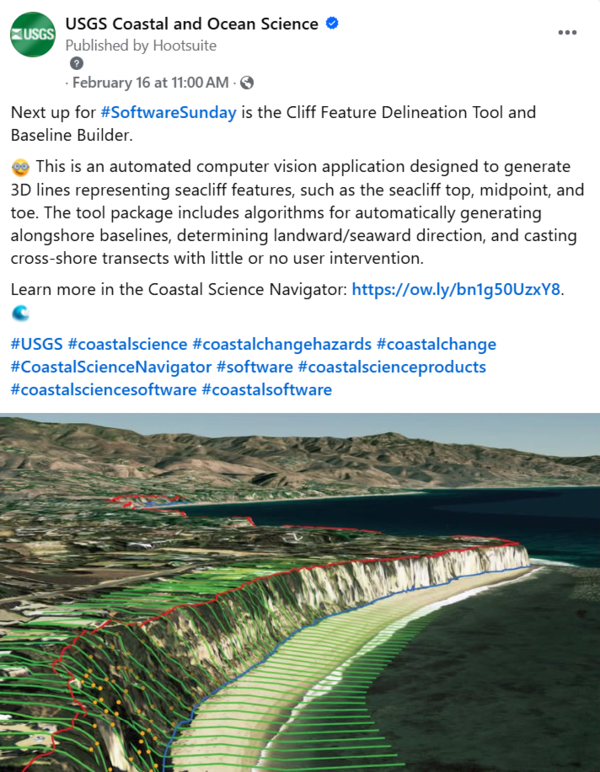
Social Media Corner
Some of our most popular posts from the past couple months.
Publications & Data Releases
Publications
Peck, E.K., Walker, J.E., Ackerman, K.V., Carr, J., Correll, M.D., Defne, Z., Deegan, L.A., Eaton, M.J., Ganju, N.K., Hartley, M., Johnson, C., Mercer, J., Ruskin, K.J., Woodruff, J.D., and Yellen, B., 2025, Distribution and disturbances of ditches across salt marshes of the Northeast U.S. with implications for management and restoration: Journal of Environmental Management, Volume 376, #124444, https://doi.org/10.1016/j.jenvman.2025.124444.
Philips, S.C., Johnson, J.E., Clyde, W.C., Hong, W.,Setera, J.B., and Torres, M.E., 2025, Tracking diagenetic alteration of magnetic susceptibility in thrust ridge and slope basin sediments of the Cascadia margin (ODP Sites 1249 and 1252; IODP Site U1325): Marine Geology, Volume 483, #107519, https://doi.org/10.1016/j.margeo.2025.107519.
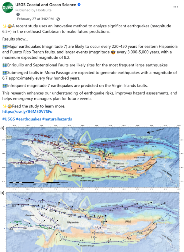
ten Brink, U.S. and Geist, E.L., 2025, Earthquake Recurrence Estimates for Northern Caribbean Faults from Combinatorial Optimization: The Seismic Record, 5 (1), p. 44-54, https://doi.org/10.1785/0320240034.
Ernst, S., 2025, Woods Hole Coastal and Marine Science Center--2023 annual report: U.S. Geological Survey Circular 1548, https://doi.org/10.3133/cir1548.
Data Releases
Defne, Z., Ackerman, K.V., Andrews, B.D., and Ganju, N.K., 2025, Chesapeake Bay marsh migration potential under sea-level rise: U.S. Geological Survey data release, https://doi.org/10.5066/P18BWN2U.
Traylor, S., Pohlman, J.W., Casso, M., Boze, L-G., Youngs, S., and Burkitt-Gray, M., 2025, Dissolved methane and CO2 concentrations and stable carbon isotopes from a coastal Arctic landscape collected in the Greiner Lake watershed of Cambridge Bay, Nunavut, Canada in June 2022 and June-July 2023: U.S. Geological Survey data release, https://doi.org/10.5066/P1UECHWK.
Fieldwork
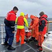
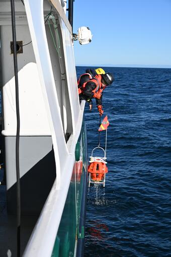
Successfully Recovered RROBS Offshore Northern California
8 out of 9 Rapid Response Ocean Bottom Seismometers (RROBS) were successfully recovered in late January, offshore Cape Mendocino. The instruments were deployed on December 15 to record aftershocks from the December 5 M7.0 earthquake. This looks to be one of the best earthquake datasets ever recorded on an oceanic transform fault. Learn more in our science story.
Validating the Total Water Level & Coastal Change Forecast Viewer
A nanopod was recovered offshore Marconi Beach, Cape Cod National Seashore in early March. Data collected on waves, currents, grain size, water levels, conductivity, and temperature will help validate the Total Water Level forecast model.
Herring River Restoration
The Cape Cod National Seashore initiated restoration of approximately 1,000 acres of salt marsh habitat within the Herring River Estuary. Restoration began in January, 2023, and is projected to be complete in 2026. The USGS has been an active collaborator in the Herring River Restoration Project since 2015. Working with our U.S. National Park Service Partners, we are developing data, products, and guidance on restoration impacts on a variety of ecosystem services and functions. This work is ongoing and multiple field activities are planned throughout the year.
Deciphering Drivers and Variability in Salt Marsh Lateral Export
The USGS, Woods Hole Oceanographic Institution, and Old Dominion University are collaborating to study hydrologic drivers of export from salt marshes to the ocean. This will help us better understand how marshes respond to changes in the duration and magnitude of tidal flooding. Multiple fieldwork activities are planned throughout the year at salt marshes on Cape Cod, Massachusetts including Harding's Beach, Chatham and Dog Marsh, Mashpee.
Understanding Cold-Season Coastal Wetland Hydrology and Freeze-Thaw Dynamics
In collaboration with the Woods Hole Oceanographic Institution and Old Dominion University, we are assessing winter hydrological, thermal, and biogeochemical processes occurring in North Atlantic salt marshes across a latitudinal gradient for improved annual estimates of water and organic matter outwelling to the coastal ocean. Multiple fieldwork activities are planned throughout the year.

Other Activities
Pacific Coastal and Marine Science Center Visit for SEABOSS 3.0 Development
Scientists and technologists traveled to the Pacific Coastal and Marine Science Center to learn about their seafloor imaging and sampling instrument--the Benthic Observation camera Sled, or BOBSled. Gerry Hatcher spent the week sharing knowledge he accrued over his long career and even gave our team a tutorial on working with fiber optic cable. Learn more in our science story.
