
Landsat Collection 2 Full Resolution Browse Images
Landsat Collection 2 Full Resolution Browse (FRB) images are created for quick and efficient image selection and for visual interpretation.
FRB files are created from Landsat 1- 9 Level-1 products, and are distributed in Cloud Optimized Geographic (COG) Tagged Image File Format (TIFF) and Joint Photographic Experts Group (JPEG) files.
Return to Landsat Collection 2 Level-1 Data information
Reflective Browse
The Reflective Browse image is a composite of three bands. Reflectance values were calculated from the calibrated scaled digital number (DN) image data, and the values were scaled to a 1-255 range using a gamma stretch with a gamma=2.0. This stretch was designed to emphasize vegetation without clipping the extreme values. The following bands are used for each sensor:
- Landsat 8-9 OLI = Bands 6,5,4
- Landsat 7 ETM+ and Landsat 4-5 TM = Bands 5,4,3
- Landsat 4-5 MSS = Bands 2,4,1
- Landsat 1-3 MSS = Bands 5,7,4
Thermal Browse
The Thermal Browse is a one-band gray scale image that displays thermal properties. Image brightness temperature values were calculated from the calibrated scaled digital number (DN) image data, and a 2 percent clip and a linear stretch to 1-255 were applied to brightness temperature values.
- Landsat 8-9 TIRS = Band 10
- Landsat 7 ETM+ = Band 6.1-high gain
- Landsat 4-5 TM = Band 6
- Landsat 1-5 MSS = not available
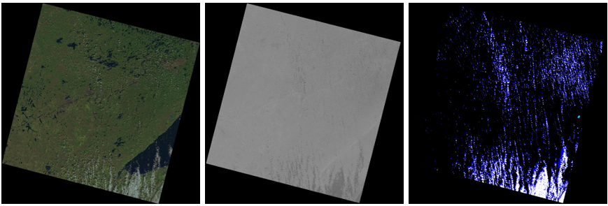
Quality Browse
The Quality Browse is an 8-bit file generated from the Landsat Level-1 Quality Band to provide a quick view of the quality of the pixels within the scene to determine if a particular scene would work best for the user's application. This file includes values representing bit-packed combinations of surface, atmosphere, and sensor conditions that can affect the overall usefulness of a given pixel. Color mapping assignments are shown in the image below.

Data Access
Landsat 1-9 Collection 2 Full Resolution Browse images can be downloaded as individual files from the Landsat Level-1 datasets on EarthExplorer.
Documentation
LSDS-1823 Landsat Full Resolution Browse Data Format Control Book (DFCB)