
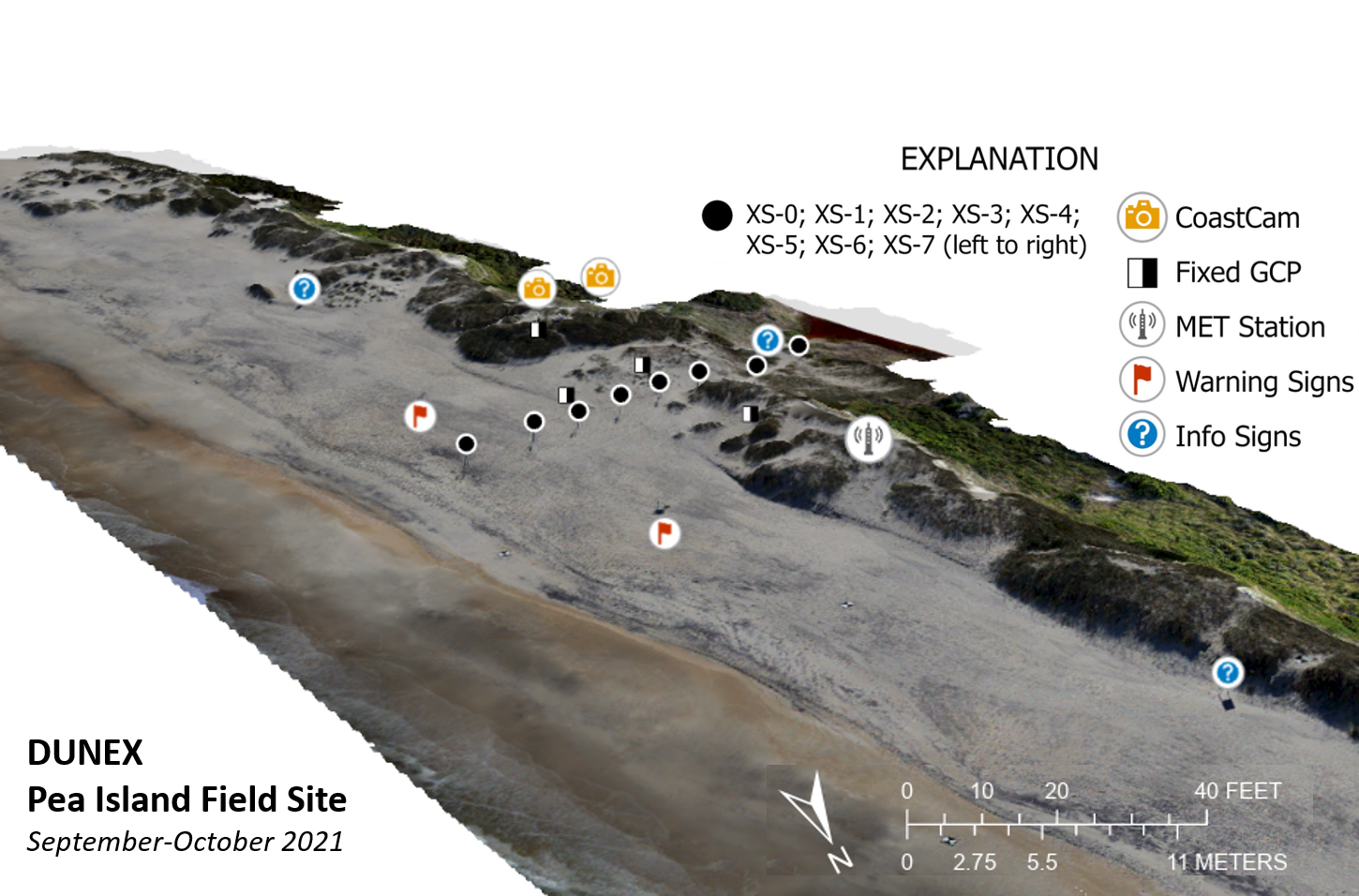
Diagram of the DUNEX Pea Island Field Site
By Sound Waves Newsletter
October 2021 (approx.)

Detailed Description
A view of the Pea Island instrumentation using preliminary imagery data to create structure-from-motion products (orthoimage and elevation model) of the site. The color change on the beach roughly corresponds to the lower beach where cusps form and the lighter sand is the upper beach.
- Fixed GCP – Fixed Ground Control Point. These checkerboard-patterned symbols are set in place on the ground so aerial imagery collected during the experiment had specific reference points to ensure accurate positioning and measurements.
- MET Station – Meteorological Station. These stations collected measurements on temperature, wind speed and direction, humidity, rainfall, and barometric pressure.
- XS-# - Cross-shore Poles - These numbers indicate the numbers of each instrumentation station attached to poles across the beach. Each of these stations had many sensors attached to measure water levels and more.
Sources/Usage
Public Domain.
Related

DUNEX Pea Island Experiment
The DUring Nearshore Event eXperiment (DUNEX) is an aggregation of multiple scientific organizations collaborating to increase understanding of nearshore processes. The U.S. Geological Survey (USGS) has chosen Pea Island National Wildlife Refuge as a study location to investigate and characterize the magnitude and timing of changes to coastal morphology (i.e., dunes, shorelines), bathymetry, and...

USGS DUNEX Operations on the Outer Banks
DUring Nearshore Event eXperiment (DUNEX) is a multi-agency, academic, and non-governmental organization (NGO) collaborative community experiment designed to study nearshore coastal processes during storm events. The experiment began in 2019 and is scheduled for completion in the fall of 2021. USGS participation in DUNEX will contribute new measurements and models that will increase our...
Related
DUNEX Pea Island Experiment
The DUring Nearshore Event eXperiment (DUNEX) is an aggregation of multiple scientific organizations collaborating to increase understanding of nearshore processes. The U.S. Geological Survey (USGS) has chosen Pea Island National Wildlife Refuge as a study location to investigate and characterize the magnitude and timing of changes to coastal morphology (i.e., dunes, shorelines), bathymetry, and...
USGS DUNEX Operations on the Outer Banks
DUring Nearshore Event eXperiment (DUNEX) is a multi-agency, academic, and non-governmental organization (NGO) collaborative community experiment designed to study nearshore coastal processes during storm events. The experiment began in 2019 and is scheduled for completion in the fall of 2021. USGS participation in DUNEX will contribute new measurements and models that will increase our...