Algal blooms occur annually on Milford Lake in the summer and can be harmful to fragile wetland ecosystems. The USGS Kansas Water Science Center uses multispectral sensors on board drones to identify harmful algal blooms and study how they affect local businesses and human and animal health.
Kansas and Landsat

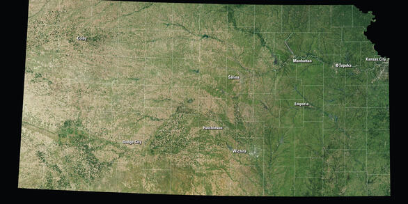
See Kansas from Space
Use the links below to explore more Landsat resources highlighting Kansas
Detailed Description
Eighty-seven percent of Kansas land is devoted to it. As a key contributor to the State’s economy, agriculture makes Kansas one of the top producers of wheat, grain sorghum, and cattle in the country, but the State at the geographic center of the conterminous United States contains much more than fields and pastures.
Deciduous woodlands sprawl throughout the east. Tallgrass prairie—the only extensive stand remaining in the country—covers the east-central Flint Hills with more than 500 species of plants, many of them wildflowers, including the Sunflower State’s nickname inspiration. Near the center of Kansas, Cheyenne Bottoms—the largest marsh in the interior United States at 41,000 acres—welcomes migrating birds, including the endangered Grus americana (Linnaeus, 1758; whooping crane), by the thousands in the spring and fall. To the south, the inland saltwater marshes of Quivira National Wildlife Refuge attract many more.
Farther west, chalk outcroppings like Castle Rock and Monument Rocks rise above the landscape as fossil-bearing remnants of a sea floor from millions of years ago. Oil and natural gas fields exist throughout the State. After two University of Kansas professors discovered helium in a sample from one natural gas well in 1905, Kansas became a substantial supplier. The Landsat Program provides tools for monitoring and managing our conservation lands and their many resources.
Visit Landsat Benefits, State By State to learn more about how Landsat brings science to your state.
Sources/Usage
Public Domain.


