
Santa Barbara survey

Detailed Description
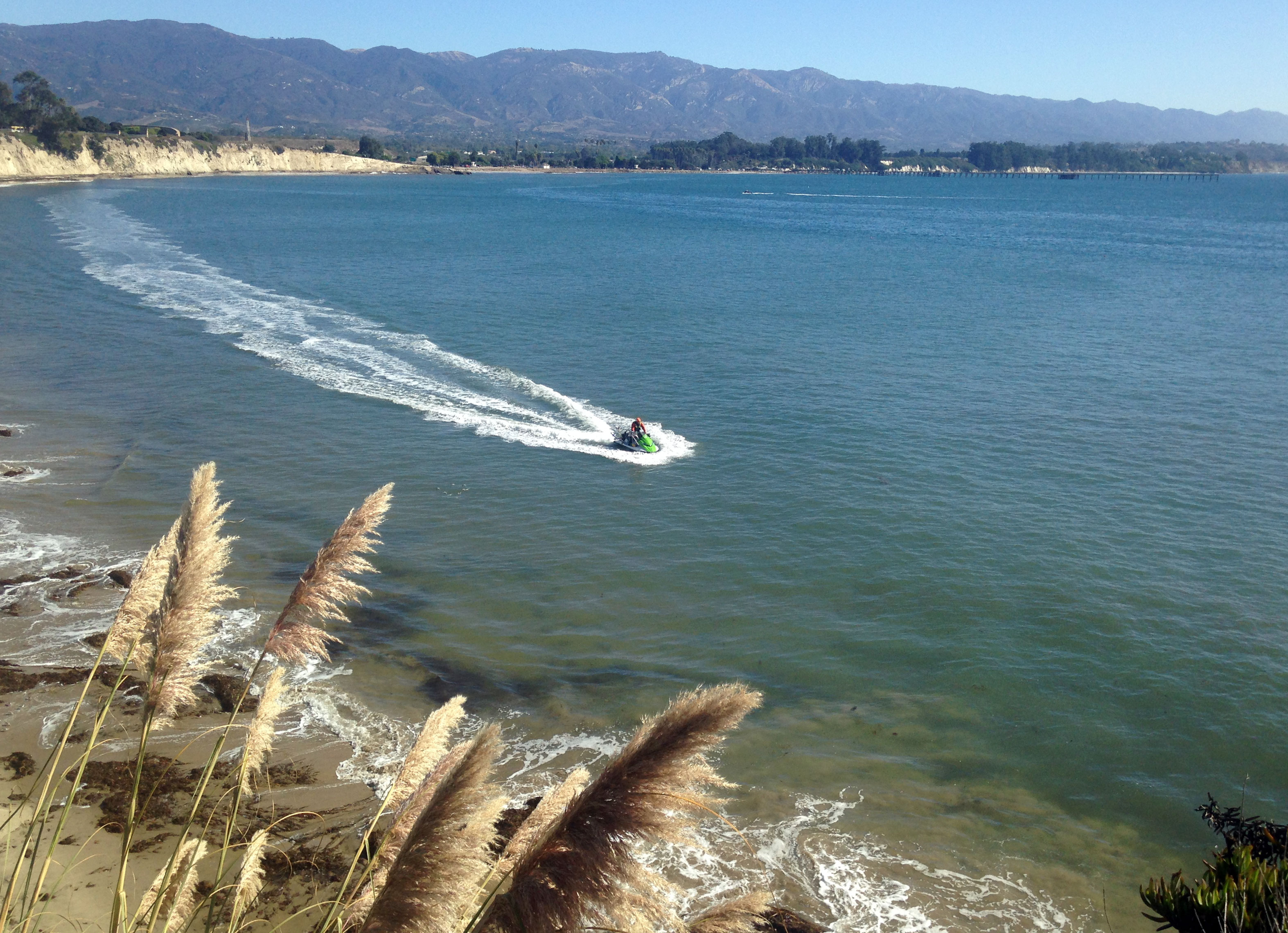
Goleta Beach in Santa Barbara experienced an unusual storm and large wave event in the Spring of 2014. Gaviota Pier, seen far off in the background, sustained heavy damage as did the restaurants on the pier and nearby. The USGS conducts seasonal surveys throught the year to see how the beaches are changing through time. Here, a USGS scientist navigates a personal watercraft equipped with GPS and sonar to measure seafloor depths near the beach. The GPS system enables the driver to follow a precise path and to revisit the same path in future surveys.
Sources/Usage
Public Domain.
Related

Dynamic coastlines along the western U.S.
The west coast of the United States is extremely complex and changeable because of tectonic activity, mountain building, and land subsidence. These active environments pose a major challenge for accurately assessing climate change impacts, since models were historically developed for more passive sandy coasts.

Coastal Change Hazards
Natural processes such as waves, tides, and weather, continually change coastal landscapes. The integrity of coastal homes, businesses, and infrastructure can be threatened by hazards associated with event-driven changes, such as extreme storms and their impacts on beach and dune erosion, or longer-term, cumulative changes associated with coastal and marine processes, such as sea-level rise...
By
Natural Hazards Mission Area, Coastal and Marine Hazards and Resources Program, Pacific Coastal and Marine Science Center, St. Petersburg Coastal and Marine Science Center, Woods Hole Coastal and Marine Science Center, Supplemental Appropriations for Disaster Recovery Activities, Hurricanes, USGS Science in Long Island Sound and its Watershed
Related
Dynamic coastlines along the western U.S.
The west coast of the United States is extremely complex and changeable because of tectonic activity, mountain building, and land subsidence. These active environments pose a major challenge for accurately assessing climate change impacts, since models were historically developed for more passive sandy coasts.
Coastal Change Hazards
Natural processes such as waves, tides, and weather, continually change coastal landscapes. The integrity of coastal homes, businesses, and infrastructure can be threatened by hazards associated with event-driven changes, such as extreme storms and their impacts on beach and dune erosion, or longer-term, cumulative changes associated with coastal and marine processes, such as sea-level rise...
By
Natural Hazards Mission Area, Coastal and Marine Hazards and Resources Program, Pacific Coastal and Marine Science Center, St. Petersburg Coastal and Marine Science Center, Woods Hole Coastal and Marine Science Center, Supplemental Appropriations for Disaster Recovery Activities, Hurricanes, USGS Science in Long Island Sound and its Watershed