
Artificial Intelligence in the USGS Ecosystems Mission Area
As a data-driven bureau, the USGS Ecosystem Mission Area (EMA) relies on artificial intelligence (AI) to efficiently gather, analyze, and deliver natural resource information to Federal, State, Tribal, academic, and industry partners. USGS EMA scientists are developing and testing innovative uses of AI, including machine learning, deep neural network models, and photogrammetry, to streamline the scientific process and ensure partners receive timely and accurate information on ecosystem related topics.
Fish and Wildlife
Invasive Species
Natural Hazards
Water Resources
Environmental Health
Land Use and Habitat Mapping
Fish and Wildlife
USGS Ecosystems Mission Area (EMA) scientists are developing and testing artificial intelligence (AI) techniques, including machine learning and neural networks, to streamline the processing of images, videos, and audio recordings to provide critical information on species presence, abundance, and habitat use. Artificial intelligence is also improving USGS EMA's ability to detect wildlife disease, monitor and assess fish and wildlife populations, understand animal behavior and movement, and efficiently share critical information with partners and communities.

Autonomous recording devices and remote cameras can collect large volumes of species’ occurrence data over long periods of time with relatively low cost. However, processing audio, imagery, and video data can be complicated and time-consuming. USGS EMA scientists are developing AI techniques to streamline data processing for quicker and more accurate wildlife detection and identification.
USGS EMA scientists use audio recording devices to collect large volumes of vocalization data for birds and bats. USGS’ North American Bat Monitoring Program has developed a fully automated machine learning algorithm to detect and classify bat calls in ultrasonic recordings to more efficiently assess status and trends of bat populations.
In Hawaii, USGS EMA scientists are using AI to more efficiently count the population size and track the movement of endangered Hawaiian forest bird species. By using AI, USGS EMA can promote more timely data analyses and ensure information is passed quickly to communities and land managers to enact relevant management and conservation actions.
USGS is a leader in wildlife health research and disease surveillance, prioritizing the health and safety of American communities, lands and waters, and fish and wildlife populations.
USGS EMA scientists are implementing AI techniques to help improve automatic disease detection and reporting. This includes using AI to assess pre- and post-white nose syndrome effects on western bat populations by tracking bat distribution across the landscape in summer and winter and evaluate whether chronic wasting disease can be detected using wildlife movement data to improve early diagnosis and to help answer questions about disease transmission.
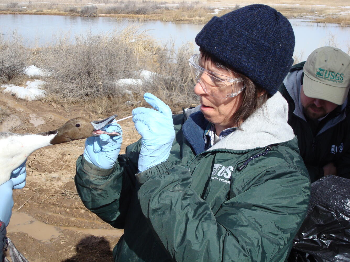

Artificial intelligence tools are being developed by USGS EMA scientists to improve species population surveys and better understand animal behavior and movement.
Media Sources/Usage: Public Domain. View Media Details
USGS EMA uses sonar to monitor prey fish populations to support fisheries management decision making for the Great Lakes states, U.S. Fish and Wildlife Service, and Tribes. New AI technologies are being developed to improve the accuracy and precision of annual prey fish abundance estimates and to accelerate data processing. To help identify recruitment and restoration threats to fishes in the Great Lakes, specifically, ciscoes and whitefishes, USGS EMA is using machine learning methods to identify and rank drivers of year-class strength (an index of recruitment) for key stocks in each of the Great Lakes.

Invasive Species
USGS EMA scientists are developing novel AI-based tools to provide critical information on invasive species in terrestrial and aquatic habitats. Machine vision, machine learning, and deep learning methods are helping scientists build distribution and habitat suitability models, assess control techniques, and detect the presence and abundance of invasive species across the landscape.
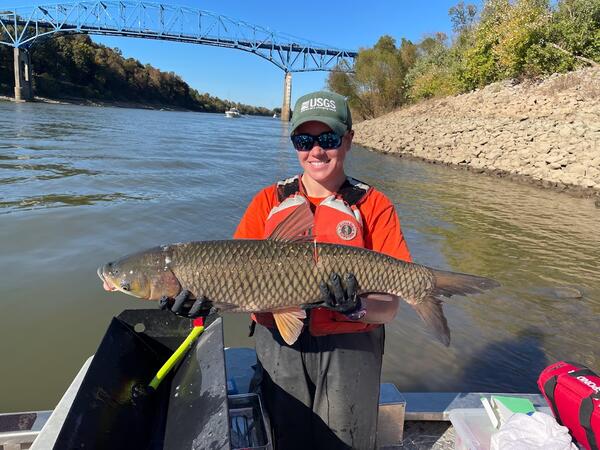
As part of USGS EMA’s critical invasive carp science, AI is being used to develop and assess control tools and techniques.
Because imagery can be complicated by environmental structure and invasive carp schooling and swimming behavior, USGS EMA scientists are building large, high-quality training data sets to ensure machine learning is reliable and scalable and to improve the accuracy of the AI models. USGS EMA is also testing AI techniques to model invasive carp populations in support of an adaptive management framework. This includes testing if machine learning tools might help automatically age images of otoliths, which are fish ear bones that grow rings each year, much like a tree. The age of a fish is critical for population estimates, stock assessments, and other fisheries management needs.
USGS EMA scientists have coupled underwater drones with machine vision and deep learning to assess lakebed features and invasive species in the Great Lakes. Automated image analysis routines can be used to detect, quantify, and estimate the size of invasive species, such as fish and freshwater mussels.
While Image detection algorithms that are developed using artificial intelligence, such as neural networks, are an emerging tool in wildlife surveillance, many are notoriously bad at identifying reptiles. USGS scientists have partnered with a developer to improve an algorithm’s ability to detect invasive tegu lizards. After providing >2,000,000 images from five years of tegu surveillance to train the model to detect tegus, scientists are now applying the tegu-specific algorithm to an independently collected dataset of images. This will help them understand detection rates and develop thresholds for the number of cameras and the length of time cameras should be deployed to detect a tegu if it is present in an area of interest.
Additionally, USGS scientists are developing an automated pipeline for image analysis. They are testing the use of cellular- and satellite-enabled devices that can be attached to trail cameras. The devices can also house the AI algorithm for detecting tegus. Thus, when the camera is triggered and one or more images is taken, the device will automatically run the images through the AI algorithm and send information over the cellular or satellite network if a tegu is observed.
Putting the real-time automated pipeline together- from camera deployment to image detection to an alert system when a tegu is detected- is still a work in progress, but researchers hope that this will serve as a tool to help monitor new areas for the arrival of tegus and guide managers as to where to focus trapping efforts, while greatly reducing the resources needed for surveillance.
USGS EMA biosecurity science aims to inform the prevention and management of invasive species by including machine learning methods to estimate statistical models of invasion status and risk based on information on species biogeography, species traits and invasion history, and species environmental associations and impacts.

The USGS-led Pacific Northwest Aquatic Monitoring Partnership is working with entities conducting regional and national scale monitoring to provide tools that facilitate the design, documentation, and opportunities for coordination of invasive species monitoring programs. Recent USGS efforts led by EMA to coordinate a community of practitioners conducting AI and machine learning modeling provides an opportunity to vet the application of these state-of-the-art techniques to dreissenid mussel risk assessments in the Columbia River Basin.
Artificial intelligence techniques, particularly machine learning algorithms, are being used by USGS EMA to develop species distribution models to inform management of invasive species. The USGS Nonindigenous Aquatic Species (NAS) database documents the introduction and spread of aquatic non-native plants and animals nationwide. The data supports multiple tools, including maps that indicate the potential spread of species through storm floodwaters. Machine learning techniques are being investigated as a possible way to analyze reported data for accuracy and to detect trends. Machine learning algorithms will also be used in an ensemble approach to static species distribution modelling to assess the suitability of invasive freshwater fishes as environmental conditions change in the southeastern U.S.
To help identify calls of invasive American bullfrogs in the western states, USGS EMA teamed up with the USGS Core Science Systems' Advanced Research Computing group to process vocalization data using the Tallgrass supercomputer. A convolutional neural network, a type of machine learning model, extracts important acoustic signals from bullfrog call waveforms and learns to recognize bullfrog calls from the soundscape. The model was tuned and optimized, resulting in a final recognizer that was 96% accurate in predicting bullfrog calls in new audio from the autonomous recording units deployed across Oregon and Washington. Using CSS High Performance Computing data storage and computing resources, USGS researchers and partners are developing a framework to process large volumes of amphibian call data through AMMonitor, an open-source R package. This project is developing the means to use cloud-based data storage and analysis to facilitate collaboration with organizations across North America – an effort that could expand to citizen-science data collection.
USGS scientists are building an AI-powered automated pipeline for early detection of invasive tegu lizards.
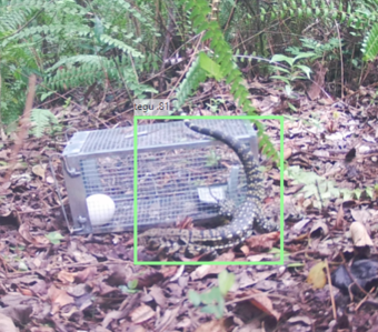
While Image detection algorithms that are developed using artificial intelligence, such as neural networks, are an emerging tool in wildlife surveillance, many are notoriously bad at identifying reptiles. USGS scientists have partnered with a developer to improve an algorithm’s ability to detect invasive tegu lizards. After providing >2,000,000 images from five years of tegu surveillance to train the model to detect tegus, scientists are now applying the tegu-specific algorithm to an independently collected dataset of images. This will help them understand detection rates and develop thresholds for the number of cameras and the length of time cameras should be deployed to detect a tegu if it is present in an area of interest.
Additionally, USGS scientists are developing an automated pipeline for image analysis. They are testing the use of cellular- and satellite-enabled devices that can be attached to trail cameras. The devices can also house the AI algorithm for detecting tegus. Thus, when the camera is triggered and one or more images is taken, the device will automatically run the images through the AI algorithm and send information over the cellular or satellite network if a tegu is observed.
Putting the real-time automated pipeline together- from camera deployment to image detection to an alert system when a tegu is detected- is still a work in progress, but researchers hope that this will serve as a tool to help monitor new areas for the arrival of tegus and guide managers as to where to focus trapping efforts, while greatly reducing the resources needed for surveillance.

Natural Hazards
USGS EMA science is developing and implementing innovative AI techniques to better address public safety, infrastructure, and security issues surrounding natural disasters and changing landscapes, strengthening readiness and operational effectiveness to be a hazard ready Nation.
Artificial intelligence techniques are being used to help inform wildfire science: USGS EMA is developing predictive models of fuel loads and wildfire risk using existing, large ecological databases and acquisition of new field- and remote sensing-based data on Department of the Interior (DOI) lands. In partnership with the Department of War, USGS EMA scientists are testing machine learning techniques to improve wildland fuels assessment relevant to fire risk and fire behavior modeling.
USGS EMA scientists are developing a machine learning framework that evaluates vulnerability to coastal hazards over the next decade using existing regional and local coastal change datasets, metrics, and assessments, and support restoration of the Great Lakes by identifying coastal change drivers, variables, and timescales most important for assessing change likelihood at the regional scale.

Water Resources
Artificial intelligence tools and technologies developed by the USGS EMA helps ensure safe and abundant domestic water supplies, ensuring all Americans access to livelihoods and traditions that connect generations with each other and the outdoors and strengthen America’s self-reliance. USGS EMA science is used by decision makers at all levels to understand how the quality of America’s food supply is directly connected to the health of America’s lands and waters, and the fish and wildlife they support.
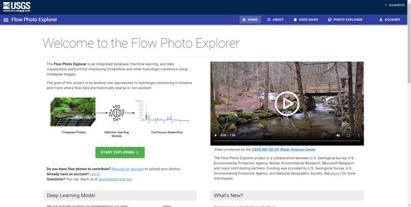
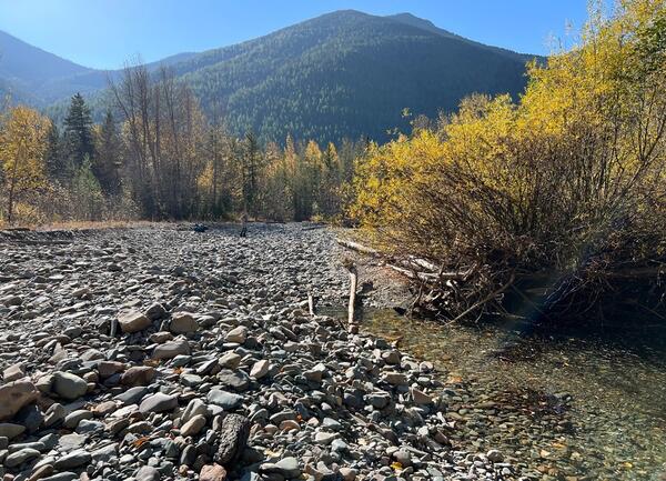
USGS EMA scientists through the Next Generation Water Observing System R&D Program and the USGS Northeast Region AI/Machine Learning team have developed the USGS Flow Photo Explorer tool. This online application allows users to upload timelapse imagery of streams and then uses an AI model to predict relative streamflow from the image time series data. This will provide information about streamflow dynamics in otherwise sparsely monitored, small headwater streams that play an increasingly important role in current and future coldwater habitat.
Deep learning techniques are being used by USGS EMA to predict streamflow using images. An AI model will be developed to recognize and reproduce patterns in large and complex datasets, such as long-term timelapse photos coupled with detailed environmental data. This will help track changes in small streams, which provide important habitat for plants and animals, and will provide a better understanding of the patterns and changes of both flow and temperatures in small streams so scientists can evaluate which streams are most likely suitable for plants and animals as environmental conditions change.
USGS EMA also supports efforts to analyze historical change and variability at hundreds of streamflow gages across the U.S. for a suite of environmental streamflows and using machine-learning methods to estimate environmental streamflows for thousands of ungaged stream reaches.
Environmental Health
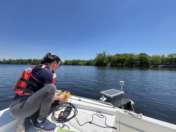
The USGS Environmental Health Program uses AI and machine learning to enhance the monitoring and management of potential contaminants and assess any impacts on ecosystems and public health. USGS EMA scientists are developing advanced algorithms for rapid field characterization of contaminants and pathogens, accurately mapping contaminant gradients, predicting the presence of harmful substances like per- and polyfluoroalkyl substances (PFAS) and arsenic in water supplies, and modeling interactions between environmental factors and contaminants. These efforts include innovative tools for identifying toxic algae, geospatial mapping of pollutants, and statistical models to forecast risks, ultimately contributing to informed decision-making and proactive measures to protect water quality and public health.
USGS EMA is committed to harnessing environmental data alongside machine learning methodologies to predict the presence of contaminants in American lands and waters. Beyond public health concerns, AI tools are also leveraged to locate critical minerals and energy resources, as well as to predict regions with a likelihood of resource abundance and minimal negative impact, thus supporting sustainable resource management strategies and expediting permitting routines.
USGS EMA scientists are investigating the application of random forest models, boosted regression trees, structural equation modelling and Bayesian analysis as statistical tools to predict scenarios that may lead to the production of cyanotoxins, which are toxic compounds produced by certain species of cyanobacteria, commonly known as blue-green algae. This research aims to understand the complex interactions between environmental variables and the conditions that facilitate the growth and toxin production of cyanobacterial blooms. The development of this approach will enable stakeholders to implement preventive measures, such as adjusting nutrient management practices or enhancing monitoring efforts in vulnerable water bodies. Ultimately, this research will contribute to improved water quality management and safeguards public health by mitigating the risks associated with harmful algal blooms and cyanotoxin exposure.

USGS EMA scientists are developing advanced machine learning tools designed for rapid characterization of chemical contaminants directly in the field. These innovative tools aim to enhance and modernize USGS water quality sensor technologies, allowing for more efficient and accurate monitoring of water quality metrics in real-time, which can greatly assist in environmental assessments and management.
In a significant advancement, USGS EMA scientists have trained computers to accurately discriminate between stamp sands (sand containing heavy metals that are generated by historical copper mining activities) and native sands. This capability enables rapid and accurate mapping of toxic gradients within critical fish spawning habitats, providing essential data that can inform conservation efforts and help mitigate the impacts on aquatic ecosystems.
Currently, USGS EMA scientists are in the early stages of collecting data to develop multi-element models that can simultaneously predict the levels of arsenic, uranium, and manganese in North Carolina. This effort is intended to serve as a foundation for creating national-scale models that will enhance our understanding of these contaminants across the U.S.
USGS EMA scientists also use AI to visualize the distribution of pollutants, facilitating the identification of areas that present a potential risk of exposure. Beyond public health concerns, AI algorithms allow researchers to analyze extensive datasets related to environmental contaminants and pathogens across various sample media, including air, soil and water. By identifying patterns and trends in these datasets, researchers can uncover potential exposure routes, offering critical insights that inform risk assessments and public health initiatives.

Land Use and Habitat Mapping
Artificial intelligence techniques are used by USGS EMA scientists to map habitats and larger landscapes to track changes over time. Accurately quantifying and mapping changes to land use and habitat over time is critical for managing plants and animals, and other natural resources.
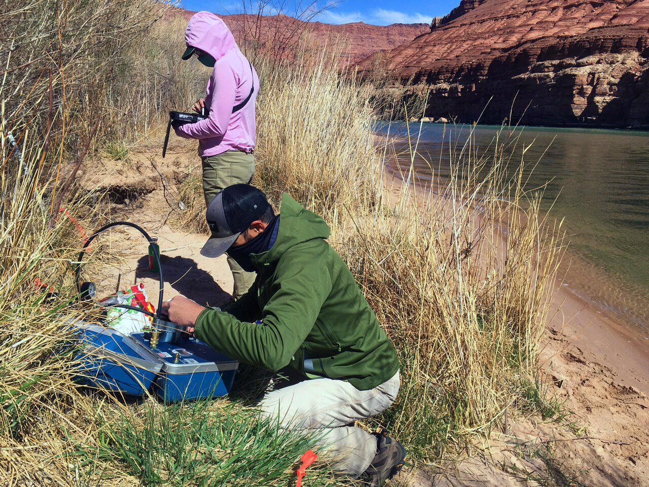

USGS EMA scientists are integrating ground-based lidar and structure-from-motion photogrammetry to generate high-resolution topographic datasets to monitor erosion within cultural resource sites along the Colorado River in Grand Canyon. Aerial image classification using statistical and machine learning algorithms, such as maximum likelihood and support vector machine classification, are incorporated to generate input data for a novel system developed to automate interpretation of measured geomorphic changes, providing a reproducible method for interpreting how natural and anthropogenic factors are influencing archaeological site conditions. Neural networks and machine learning are being used to classify and characterize Colorado River bed sediments in the Grand Canyon from multibeam backscatter mosaics. The DOI, specifically Bureau of Reclamation and the National Park Service will use this information to better understand the effects of Glen Canyon Dam operations and how experimental high flow releases can be used to manage limited sediment resources to rebuild eroded beaches and sandbars in Grand Canyon National Park.
Artificial intelligence tools are being used to identify and determine suitability and quality of habitat for many species. piping plover breeding habitat suitability and quality for Missouri River sandbars. To define breeding habitat at multiple scales and evaluate quality of habitat for riverine nesting piping plovers, USGS EMA scientists will use remotely sensed imagery to update land cover products using a machine learning approach. This includes training a classification algorithm with existing imagery and past land cover products to develop consistent rules for classifying imagery. USGS EMA is also assessing the use of hydro-acoustics to identify current habitat, prioritize restoration sites, and predict changing environmental conditions for native imperiled mussels in the Midwest. As part of this effort, machine learning was used to determine if underwater videos could be input to models to determine grain size.
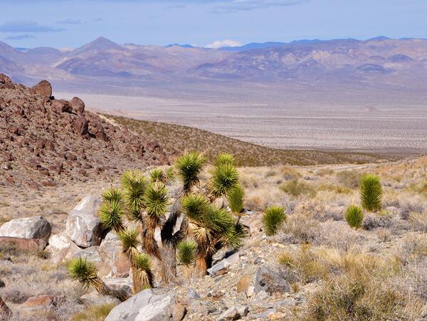
USGS EMA is using data from the Sagebrush-Steppe Treatment Evaluation Project (SageSTEP) as well as environmental and topographic data to build on advances in remote sensing, high speed computing, and machine learning to estimate how total ecosystem carbon varies across the Great Basin and is altered by disturbance, landcover change, and management actions.
USGS EMA scientists are working with land managers to identity risks along the Upper Mississippi River and use machine learning to model and assess thresholds for landcover changes.

As a data-driven bureau, the USGS Ecosystem Mission Area (EMA) relies on artificial intelligence (AI) to efficiently gather, analyze, and deliver natural resource information to Federal, State, Tribal, academic, and industry partners. USGS EMA scientists are developing and testing innovative uses of AI, including machine learning, deep neural network models, and photogrammetry, to streamline the scientific process and ensure partners receive timely and accurate information on ecosystem related topics.
Fish and Wildlife
Invasive Species
Natural Hazards
Water Resources
Environmental Health
Land Use and Habitat Mapping
Fish and Wildlife
USGS Ecosystems Mission Area (EMA) scientists are developing and testing artificial intelligence (AI) techniques, including machine learning and neural networks, to streamline the processing of images, videos, and audio recordings to provide critical information on species presence, abundance, and habitat use. Artificial intelligence is also improving USGS EMA's ability to detect wildlife disease, monitor and assess fish and wildlife populations, understand animal behavior and movement, and efficiently share critical information with partners and communities.
Autonomous recording devices and remote cameras can collect large volumes of species’ occurrence data over long periods of time with relatively low cost. However, processing audio, imagery, and video data can be complicated and time-consuming. USGS EMA scientists are developing AI techniques to streamline data processing for quicker and more accurate wildlife detection and identification.
USGS EMA scientists use audio recording devices to collect large volumes of vocalization data for birds and bats. USGS’ North American Bat Monitoring Program has developed a fully automated machine learning algorithm to detect and classify bat calls in ultrasonic recordings to more efficiently assess status and trends of bat populations.
In Hawaii, USGS EMA scientists are using AI to more efficiently count the population size and track the movement of endangered Hawaiian forest bird species. By using AI, USGS EMA can promote more timely data analyses and ensure information is passed quickly to communities and land managers to enact relevant management and conservation actions.
USGS is a leader in wildlife health research and disease surveillance, prioritizing the health and safety of American communities, lands and waters, and fish and wildlife populations.
USGS EMA scientists are implementing AI techniques to help improve automatic disease detection and reporting. This includes using AI to assess pre- and post-white nose syndrome effects on western bat populations by tracking bat distribution across the landscape in summer and winter and evaluate whether chronic wasting disease can be detected using wildlife movement data to improve early diagnosis and to help answer questions about disease transmission.
Artificial intelligence tools are being developed by USGS EMA scientists to improve species population surveys and better understand animal behavior and movement.
MediaSources/Usage: Public Domain. View Media Details
USGS EMA uses sonar to monitor prey fish populations to support fisheries management decision making for the Great Lakes states, U.S. Fish and Wildlife Service, and Tribes. New AI technologies are being developed to improve the accuracy and precision of annual prey fish abundance estimates and to accelerate data processing. To help identify recruitment and restoration threats to fishes in the Great Lakes, specifically, ciscoes and whitefishes, USGS EMA is using machine learning methods to identify and rank drivers of year-class strength (an index of recruitment) for key stocks in each of the Great Lakes.
Invasive Species
USGS EMA scientists are developing novel AI-based tools to provide critical information on invasive species in terrestrial and aquatic habitats. Machine vision, machine learning, and deep learning methods are helping scientists build distribution and habitat suitability models, assess control techniques, and detect the presence and abundance of invasive species across the landscape.
As part of USGS EMA’s critical invasive carp science, AI is being used to develop and assess control tools and techniques.
Because imagery can be complicated by environmental structure and invasive carp schooling and swimming behavior, USGS EMA scientists are building large, high-quality training data sets to ensure machine learning is reliable and scalable and to improve the accuracy of the AI models. USGS EMA is also testing AI techniques to model invasive carp populations in support of an adaptive management framework. This includes testing if machine learning tools might help automatically age images of otoliths, which are fish ear bones that grow rings each year, much like a tree. The age of a fish is critical for population estimates, stock assessments, and other fisheries management needs.
USGS EMA scientists have coupled underwater drones with machine vision and deep learning to assess lakebed features and invasive species in the Great Lakes. Automated image analysis routines can be used to detect, quantify, and estimate the size of invasive species, such as fish and freshwater mussels.
While Image detection algorithms that are developed using artificial intelligence, such as neural networks, are an emerging tool in wildlife surveillance, many are notoriously bad at identifying reptiles. USGS scientists have partnered with a developer to improve an algorithm’s ability to detect invasive tegu lizards. After providing >2,000,000 images from five years of tegu surveillance to train the model to detect tegus, scientists are now applying the tegu-specific algorithm to an independently collected dataset of images. This will help them understand detection rates and develop thresholds for the number of cameras and the length of time cameras should be deployed to detect a tegu if it is present in an area of interest.
Additionally, USGS scientists are developing an automated pipeline for image analysis. They are testing the use of cellular- and satellite-enabled devices that can be attached to trail cameras. The devices can also house the AI algorithm for detecting tegus. Thus, when the camera is triggered and one or more images is taken, the device will automatically run the images through the AI algorithm and send information over the cellular or satellite network if a tegu is observed.
Putting the real-time automated pipeline together- from camera deployment to image detection to an alert system when a tegu is detected- is still a work in progress, but researchers hope that this will serve as a tool to help monitor new areas for the arrival of tegus and guide managers as to where to focus trapping efforts, while greatly reducing the resources needed for surveillance.
USGS EMA biosecurity science aims to inform the prevention and management of invasive species by including machine learning methods to estimate statistical models of invasion status and risk based on information on species biogeography, species traits and invasion history, and species environmental associations and impacts.
The USGS-led Pacific Northwest Aquatic Monitoring Partnership is working with entities conducting regional and national scale monitoring to provide tools that facilitate the design, documentation, and opportunities for coordination of invasive species monitoring programs. Recent USGS efforts led by EMA to coordinate a community of practitioners conducting AI and machine learning modeling provides an opportunity to vet the application of these state-of-the-art techniques to dreissenid mussel risk assessments in the Columbia River Basin.
Artificial intelligence techniques, particularly machine learning algorithms, are being used by USGS EMA to develop species distribution models to inform management of invasive species. The USGS Nonindigenous Aquatic Species (NAS) database documents the introduction and spread of aquatic non-native plants and animals nationwide. The data supports multiple tools, including maps that indicate the potential spread of species through storm floodwaters. Machine learning techniques are being investigated as a possible way to analyze reported data for accuracy and to detect trends. Machine learning algorithms will also be used in an ensemble approach to static species distribution modelling to assess the suitability of invasive freshwater fishes as environmental conditions change in the southeastern U.S.
To help identify calls of invasive American bullfrogs in the western states, USGS EMA teamed up with the USGS Core Science Systems' Advanced Research Computing group to process vocalization data using the Tallgrass supercomputer. A convolutional neural network, a type of machine learning model, extracts important acoustic signals from bullfrog call waveforms and learns to recognize bullfrog calls from the soundscape. The model was tuned and optimized, resulting in a final recognizer that was 96% accurate in predicting bullfrog calls in new audio from the autonomous recording units deployed across Oregon and Washington. Using CSS High Performance Computing data storage and computing resources, USGS researchers and partners are developing a framework to process large volumes of amphibian call data through AMMonitor, an open-source R package. This project is developing the means to use cloud-based data storage and analysis to facilitate collaboration with organizations across North America – an effort that could expand to citizen-science data collection.
USGS scientists are building an AI-powered automated pipeline for early detection of invasive tegu lizards.
While Image detection algorithms that are developed using artificial intelligence, such as neural networks, are an emerging tool in wildlife surveillance, many are notoriously bad at identifying reptiles. USGS scientists have partnered with a developer to improve an algorithm’s ability to detect invasive tegu lizards. After providing >2,000,000 images from five years of tegu surveillance to train the model to detect tegus, scientists are now applying the tegu-specific algorithm to an independently collected dataset of images. This will help them understand detection rates and develop thresholds for the number of cameras and the length of time cameras should be deployed to detect a tegu if it is present in an area of interest.
Additionally, USGS scientists are developing an automated pipeline for image analysis. They are testing the use of cellular- and satellite-enabled devices that can be attached to trail cameras. The devices can also house the AI algorithm for detecting tegus. Thus, when the camera is triggered and one or more images is taken, the device will automatically run the images through the AI algorithm and send information over the cellular or satellite network if a tegu is observed.
Putting the real-time automated pipeline together- from camera deployment to image detection to an alert system when a tegu is detected- is still a work in progress, but researchers hope that this will serve as a tool to help monitor new areas for the arrival of tegus and guide managers as to where to focus trapping efforts, while greatly reducing the resources needed for surveillance.
Natural Hazards
USGS EMA science is developing and implementing innovative AI techniques to better address public safety, infrastructure, and security issues surrounding natural disasters and changing landscapes, strengthening readiness and operational effectiveness to be a hazard ready Nation.
Artificial intelligence techniques are being used to help inform wildfire science: USGS EMA is developing predictive models of fuel loads and wildfire risk using existing, large ecological databases and acquisition of new field- and remote sensing-based data on Department of the Interior (DOI) lands. In partnership with the Department of War, USGS EMA scientists are testing machine learning techniques to improve wildland fuels assessment relevant to fire risk and fire behavior modeling.
USGS EMA scientists are developing a machine learning framework that evaluates vulnerability to coastal hazards over the next decade using existing regional and local coastal change datasets, metrics, and assessments, and support restoration of the Great Lakes by identifying coastal change drivers, variables, and timescales most important for assessing change likelihood at the regional scale.
Water Resources
Artificial intelligence tools and technologies developed by the USGS EMA helps ensure safe and abundant domestic water supplies, ensuring all Americans access to livelihoods and traditions that connect generations with each other and the outdoors and strengthen America’s self-reliance. USGS EMA science is used by decision makers at all levels to understand how the quality of America’s food supply is directly connected to the health of America’s lands and waters, and the fish and wildlife they support.
USGS EMA scientists through the Next Generation Water Observing System R&D Program and the USGS Northeast Region AI/Machine Learning team have developed the USGS Flow Photo Explorer tool. This online application allows users to upload timelapse imagery of streams and then uses an AI model to predict relative streamflow from the image time series data. This will provide information about streamflow dynamics in otherwise sparsely monitored, small headwater streams that play an increasingly important role in current and future coldwater habitat.
Deep learning techniques are being used by USGS EMA to predict streamflow using images. An AI model will be developed to recognize and reproduce patterns in large and complex datasets, such as long-term timelapse photos coupled with detailed environmental data. This will help track changes in small streams, which provide important habitat for plants and animals, and will provide a better understanding of the patterns and changes of both flow and temperatures in small streams so scientists can evaluate which streams are most likely suitable for plants and animals as environmental conditions change.
USGS EMA also supports efforts to analyze historical change and variability at hundreds of streamflow gages across the U.S. for a suite of environmental streamflows and using machine-learning methods to estimate environmental streamflows for thousands of ungaged stream reaches.
Environmental Health
The USGS Environmental Health Program uses AI and machine learning to enhance the monitoring and management of potential contaminants and assess any impacts on ecosystems and public health. USGS EMA scientists are developing advanced algorithms for rapid field characterization of contaminants and pathogens, accurately mapping contaminant gradients, predicting the presence of harmful substances like per- and polyfluoroalkyl substances (PFAS) and arsenic in water supplies, and modeling interactions between environmental factors and contaminants. These efforts include innovative tools for identifying toxic algae, geospatial mapping of pollutants, and statistical models to forecast risks, ultimately contributing to informed decision-making and proactive measures to protect water quality and public health.
USGS EMA is committed to harnessing environmental data alongside machine learning methodologies to predict the presence of contaminants in American lands and waters. Beyond public health concerns, AI tools are also leveraged to locate critical minerals and energy resources, as well as to predict regions with a likelihood of resource abundance and minimal negative impact, thus supporting sustainable resource management strategies and expediting permitting routines.
USGS EMA scientists are investigating the application of random forest models, boosted regression trees, structural equation modelling and Bayesian analysis as statistical tools to predict scenarios that may lead to the production of cyanotoxins, which are toxic compounds produced by certain species of cyanobacteria, commonly known as blue-green algae. This research aims to understand the complex interactions between environmental variables and the conditions that facilitate the growth and toxin production of cyanobacterial blooms. The development of this approach will enable stakeholders to implement preventive measures, such as adjusting nutrient management practices or enhancing monitoring efforts in vulnerable water bodies. Ultimately, this research will contribute to improved water quality management and safeguards public health by mitigating the risks associated with harmful algal blooms and cyanotoxin exposure.
USGS EMA scientists are developing advanced machine learning tools designed for rapid characterization of chemical contaminants directly in the field. These innovative tools aim to enhance and modernize USGS water quality sensor technologies, allowing for more efficient and accurate monitoring of water quality metrics in real-time, which can greatly assist in environmental assessments and management.
In a significant advancement, USGS EMA scientists have trained computers to accurately discriminate between stamp sands (sand containing heavy metals that are generated by historical copper mining activities) and native sands. This capability enables rapid and accurate mapping of toxic gradients within critical fish spawning habitats, providing essential data that can inform conservation efforts and help mitigate the impacts on aquatic ecosystems.
Currently, USGS EMA scientists are in the early stages of collecting data to develop multi-element models that can simultaneously predict the levels of arsenic, uranium, and manganese in North Carolina. This effort is intended to serve as a foundation for creating national-scale models that will enhance our understanding of these contaminants across the U.S.
USGS EMA scientists also use AI to visualize the distribution of pollutants, facilitating the identification of areas that present a potential risk of exposure. Beyond public health concerns, AI algorithms allow researchers to analyze extensive datasets related to environmental contaminants and pathogens across various sample media, including air, soil and water. By identifying patterns and trends in these datasets, researchers can uncover potential exposure routes, offering critical insights that inform risk assessments and public health initiatives.
Land Use and Habitat Mapping
Artificial intelligence techniques are used by USGS EMA scientists to map habitats and larger landscapes to track changes over time. Accurately quantifying and mapping changes to land use and habitat over time is critical for managing plants and animals, and other natural resources.
USGS EMA scientists are integrating ground-based lidar and structure-from-motion photogrammetry to generate high-resolution topographic datasets to monitor erosion within cultural resource sites along the Colorado River in Grand Canyon. Aerial image classification using statistical and machine learning algorithms, such as maximum likelihood and support vector machine classification, are incorporated to generate input data for a novel system developed to automate interpretation of measured geomorphic changes, providing a reproducible method for interpreting how natural and anthropogenic factors are influencing archaeological site conditions. Neural networks and machine learning are being used to classify and characterize Colorado River bed sediments in the Grand Canyon from multibeam backscatter mosaics. The DOI, specifically Bureau of Reclamation and the National Park Service will use this information to better understand the effects of Glen Canyon Dam operations and how experimental high flow releases can be used to manage limited sediment resources to rebuild eroded beaches and sandbars in Grand Canyon National Park.
Artificial intelligence tools are being used to identify and determine suitability and quality of habitat for many species. piping plover breeding habitat suitability and quality for Missouri River sandbars. To define breeding habitat at multiple scales and evaluate quality of habitat for riverine nesting piping plovers, USGS EMA scientists will use remotely sensed imagery to update land cover products using a machine learning approach. This includes training a classification algorithm with existing imagery and past land cover products to develop consistent rules for classifying imagery. USGS EMA is also assessing the use of hydro-acoustics to identify current habitat, prioritize restoration sites, and predict changing environmental conditions for native imperiled mussels in the Midwest. As part of this effort, machine learning was used to determine if underwater videos could be input to models to determine grain size.
USGS EMA is using data from the Sagebrush-Steppe Treatment Evaluation Project (SageSTEP) as well as environmental and topographic data to build on advances in remote sensing, high speed computing, and machine learning to estimate how total ecosystem carbon varies across the Great Basin and is altered by disturbance, landcover change, and management actions.
USGS EMA scientists are working with land managers to identity risks along the Upper Mississippi River and use machine learning to model and assess thresholds for landcover changes.