U.S. flag

An official website of the United States government

Images

Hawaiian Volcano Observatory images of eruptive activity, field work, and more.

Filter Total Items: 4072
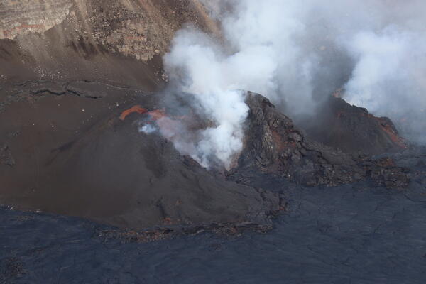
Color photograph of lava flows at base of crater
December 27, 2024 — Kīlauea eruptive activity December, 26-27, 2024

During a helicopter overflight on December 27, 2024, USGS Hawaiian Volcano Observatory field crews captured this view of the lava "pad" that formed during weak effusive activity from December 26-27, 2024, during weak effusive activity.

During a helicopter overflight on December 27, 2024, USGS Hawaiian Volcano Observatory field crews captured this view of the lava "pad" that formed during weak effusive activity from December 26-27, 2024, during weak effusive activity.

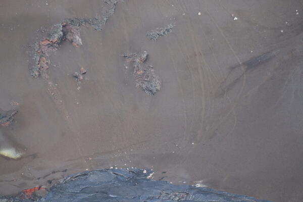
Color photograph of new lava flows at edge of caldera floor
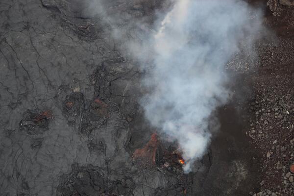
December 27, 2024 — Low-level view of eruptive vents in western wall of Halema‘uma‘u, Kīlauea

During a helicopter overflight on the morning of Friday, December 27, 2024, USGS Hawaiian Volcano Observatory geologists were provided a low-level view of the eruptive vents in the western wall of Halema‘uma‘u crater at the summit of Kīlauea volcano.

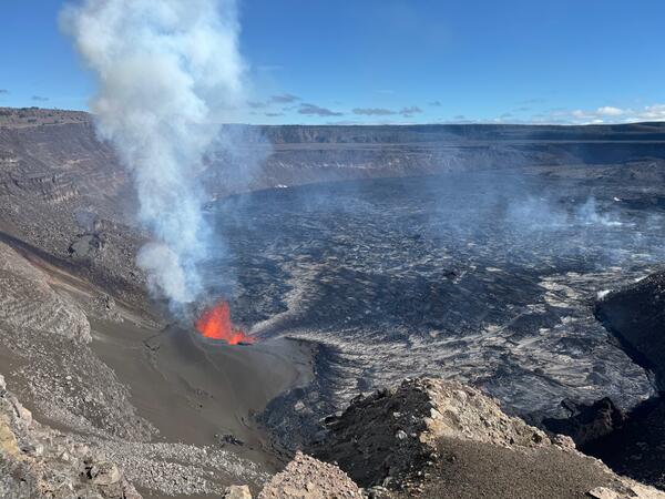
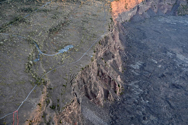
Color photograph of scientist on rim of caldera
December 25, 2024 — Scientist monitoring Kīlauea

A USGS Hawaiian Volcano Observatory geologist stands on the south rim of Halema‘uma‘u crater and takes photos documenting the recent pause in activity at the vent located in the southwest part Kaluapele (Kīlauea summit caldera). USGS photo by L. Gallant.

A USGS Hawaiian Volcano Observatory geologist stands on the south rim of Halema‘uma‘u crater and takes photos documenting the recent pause in activity at the vent located in the southwest part Kaluapele (Kīlauea summit caldera). USGS photo by L. Gallant.

Color photograph of volcanic material deposited on road
December 25, 2024 — Kīlauea tephra accumulation on closed road

Another photo of tephra covering a portion of Crater Rim Drive, at the summit of Kīlauea, that is within the closed area of Hawai‘i Volcanoes National Park. The road is immediately downwind of the lava fountains that have been active over the past few days, resulting in significant tephra accumulation. USGS photo by M. Patrick.

Another photo of tephra covering a portion of Crater Rim Drive, at the summit of Kīlauea, that is within the closed area of Hawai‘i Volcanoes National Park. The road is immediately downwind of the lava fountains that have been active over the past few days, resulting in significant tephra accumulation. USGS photo by M. Patrick.

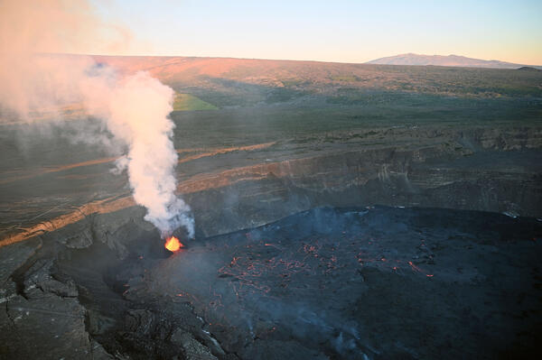
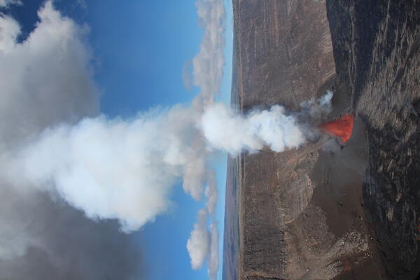
Color photograph of eruptive vent in a caldera
December 25, 2024 — Kīlauea eruptive pause this morning

The eruption at the summit of Kīlauea paused again the morning of December 25—resumption of activity as happened yesterday is possible, but not certain. USGS Hawaiian Volcano Observatory geologists arrived at Halema‘uma‘u crater rim just after the eruption pause, observing very weak spattering and drainback of lava into the vent. USGS photo by M. Patrick.

The eruption at the summit of Kīlauea paused again the morning of December 25—resumption of activity as happened yesterday is possible, but not certain. USGS Hawaiian Volcano Observatory geologists arrived at Halema‘uma‘u crater rim just after the eruption pause, observing very weak spattering and drainback of lava into the vent. USGS photo by M. Patrick.

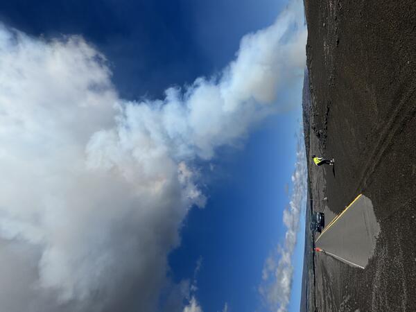
Color photograph of scientist standing near road
December 25, 2024 — Kīlauea tephra accumulation on closed road

Tephra accumulated in deep drifts downwind of the lava fountains at the summit of Kīlauea. The thickest portion was approximately a half meter (yard) deep, requiring USGS Hawaii Volcano Observatory geologists to use 4WD to navigate through this closed portion of Hawai‘i Volcanoes National Park. USGS photo by M. Patrick.

Tephra accumulated in deep drifts downwind of the lava fountains at the summit of Kīlauea. The thickest portion was approximately a half meter (yard) deep, requiring USGS Hawaii Volcano Observatory geologists to use 4WD to navigate through this closed portion of Hawai‘i Volcanoes National Park. USGS photo by M. Patrick.

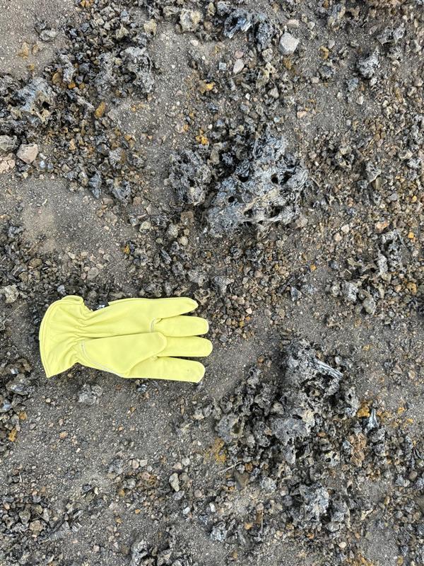
Color photograph of scientist holding a sample of lava
December 25, 2024 — Kīlauea December 2024 eruption tephra

A close up of a large clast from the recent lava fountaining at the summit of Kīlauea deposited on Crater Rim Drive within the closed area of Hawai‘i Volcanoes National Park. The lava was very gas rich so this clast was very light, akin to the density of a kitchen sponge. USGS photo by M. Patrick.

A close up of a large clast from the recent lava fountaining at the summit of Kīlauea deposited on Crater Rim Drive within the closed area of Hawai‘i Volcanoes National Park. The lava was very gas rich so this clast was very light, akin to the density of a kitchen sponge. USGS photo by M. Patrick.

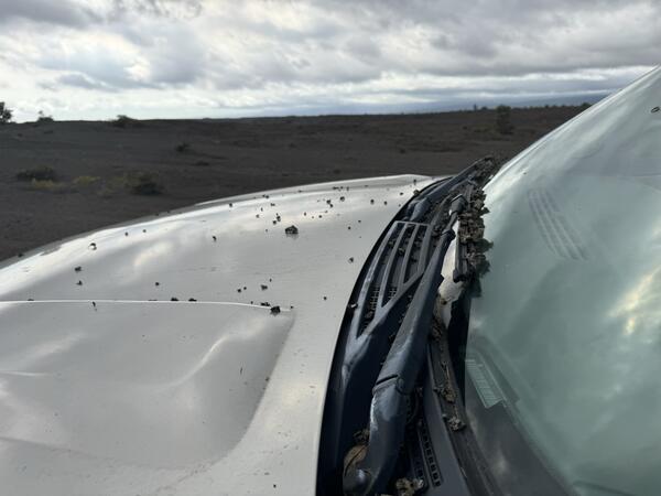
Color photograph of tephra on road
December 25, 2024 — Kīlauea tephra accumulation on closed road

Tephra ejected by the lava fountains between December 23 and 25, 2024, was carried in the gas plume and deposited on the nearby section of Crater Rim Drive that has been closed to the public for years due to intermittent Kīlauea summit eruptive activity. USGS photo by M. Patrick.

Tephra ejected by the lava fountains between December 23 and 25, 2024, was carried in the gas plume and deposited on the nearby section of Crater Rim Drive that has been closed to the public for years due to intermittent Kīlauea summit eruptive activity. USGS photo by M. Patrick.

Hazy view of a crater wall with some vegetation in the foreground and a shield-shaped mountain in the background
Hazy conditions caused by sulfur dioxide emissions from Kīlauea, Hawai‘i

Hazy conditions caused by sulfur dioxide (SO2) emissions from Halema‘uma‘u crater, Kīlauea, Hawai‘i.  USGS photo by Jennifer Lewicki, December 25, 2024.

Color photograph of volcanic plume
December 25, 2024 — Kīlauea summit eruption plume

This photo was taken at 9:20 a.m. HST on Christmas Day, December 25, and shows vigorous lava fountains and a towering gas plume at the summit of Kīlauea. Just an hour later, eruptive activity at the vent began to greatly decrease. USGS photo by L. Gallant.

This photo was taken at 9:20 a.m. HST on Christmas Day, December 25, and shows vigorous lava fountains and a towering gas plume at the summit of Kīlauea. Just an hour later, eruptive activity at the vent began to greatly decrease. USGS photo by L. Gallant.

Color photograph of scientist monitoring eruption
December 24, 2024 - Monitoring Kīlauea summit eruption

USGS Hawaiian Volcano Observatory scientists used a laser rangefinder to measure the height of the lava fountains erupting in Kaluapele (Kīlauea summit caldera) on December 24. Between 2:30 and 4:15 p.m. HST, the lava fountains were reaching heights of about 75 meters (246 feet). USGS photo by C. Sealing. 

USGS Hawaiian Volcano Observatory scientists used a laser rangefinder to measure the height of the lava fountains erupting in Kaluapele (Kīlauea summit caldera) on December 24. Between 2:30 and 4:15 p.m. HST, the lava fountains were reaching heights of about 75 meters (246 feet). USGS photo by C. Sealing. 

Color photograph of lava fountain
December 24, 2024 - Kīlauea summit lava fountain

A telephoto view of lava fountains erupting within Kaluapele (Kīlauea summit caldera) the afternoon of December 24. This eruption began on December 23 with vigorous lava and volcanic gas effusion, which decreased throughout the day until the eruption paused around 4:00 p.m. HST. Renewed, low-level eruption of sluggish lava began around 8 a.m.

A telephoto view of lava fountains erupting within Kaluapele (Kīlauea summit caldera) the afternoon of December 24. This eruption began on December 23 with vigorous lava and volcanic gas effusion, which decreased throughout the day until the eruption paused around 4:00 p.m. HST. Renewed, low-level eruption of sluggish lava began around 8 a.m.

Color photograph of eruption and eruption plume
December 24, 2024 - Kīlauea summit eruption plume

The eruption at Kīlauea summit lights up Christmas Eve, as viewed from the overlook at Volcano House within Hawaiʻi Volcanoes National Park. A plume of volcanic gas and fine volcanic particles rises above the erupting vents before it is transported downwind, generally in a southwest direction within a closed area of the National Park. USGS photo by H.
The eruption at Kīlauea summit lights up Christmas Eve, as viewed from the overlook at Volcano House within Hawaiʻi Volcanoes National Park. A plume of volcanic gas and fine volcanic particles rises above the erupting vents before it is transported downwind, generally in a southwest direction within a closed area of the National Park. USGS photo by H.

Color photograph of erupting lava fountains within a crater
December 24, 2024 - Kīlauea summit eruption resumes

The eruption at Kīlauea volcano that began yesterday, December 23, slowed starting around 3 p.m. HST yesterday. The eruption paused through the night and reactivated this morning at several of the vents along the southwest of Halema‘uma‘u crater floor.

The eruption at Kīlauea volcano that began yesterday, December 23, slowed starting around 3 p.m. HST yesterday. The eruption paused through the night and reactivated this morning at several of the vents along the southwest of Halema‘uma‘u crater floor.

color graphic map of recent lava flow coverage within summit caldera
December 23, 2024—Kīlauea summit eruption reference map

This reference map depicts the new Kīlauea summit eruption within Halema‘uma‘u crater on December 23, 2024, constructed using data captured during a USGS Hawaiian Volcano Observatory helicopter overflight at 9:30 a.m.

This reference map depicts the new Kīlauea summit eruption within Halema‘uma‘u crater on December 23, 2024, constructed using data captured during a USGS Hawaiian Volcano Observatory helicopter overflight at 9:30 a.m.

Color photograph of active lava fountains
December 23, 2024 - Lava fountains in the west part of Kīlauea caldera

This aerial view, captured during a USGS Hawaiian Volcano Observatory monitoring overflight, shows the lava fountains active in the west part of Kīlauea caldera. The eruption began this morning at 2:20 a.m. HST, December 23, and fountains reached up to 90 meters (290 feet) overnight.

This aerial view, captured during a USGS Hawaiian Volcano Observatory monitoring overflight, shows the lava fountains active in the west part of Kīlauea caldera. The eruption began this morning at 2:20 a.m. HST, December 23, and fountains reached up to 90 meters (290 feet) overnight.

Color photograph of active lava flowing
December 23, 2024 - Lava flowing on the floor of Kīlauea summit caldera

A lobe of molten pāhoehoe lava on the floor of Kaluapele (Kīlauea caldera) on December 23, 2024. USGS photo by M. Patrick. 

Color photograph of two people loading a machine with geologic samples for analysis
December 23, 2024 - Analyzing Kīlauea's recent eruption samples

After sample preparation, University of Hawai‘i at Hilo faculty and an undergraduate research student load the most recent Kīlauea eruption sample into the ED-XRF (energy dispersive x-ray fluorescence) for chemical analysis. Within 6 hours of sample collection, the chemical analysis of the lava was completed. USGS photo by K. Lynn.

After sample preparation, University of Hawai‘i at Hilo faculty and an undergraduate research student load the most recent Kīlauea eruption sample into the ED-XRF (energy dispersive x-ray fluorescence) for chemical analysis. Within 6 hours of sample collection, the chemical analysis of the lava was completed. USGS photo by K. Lynn.

Color photograph of eruption within volcanic crater in summit caldera
B1cam view of Halemaʻumaʻu eruption episode 1 at the summit of Kīlauea on December 23, 2024

View of Kaluapele (Kīlauea's summit caldera) from the B1 webcam on December 23, 2024, acquired during lava fountaining episode 1. USGS webcam image.

Color photograph of active lava flows
December 23, 2024 - New eruption in Kīlauea summit caldera

Kīlauea volcano began erupting within the summit caldera at approximately 2:20 a.m. HST this morning, December 23, 2024, following an increase in seismicity that began beneath the summit just a half hour earlier, at approximately 2:00 a.m. HST.

Kīlauea volcano began erupting within the summit caldera at approximately 2:20 a.m. HST this morning, December 23, 2024, following an increase in seismicity that began beneath the summit just a half hour earlier, at approximately 2:00 a.m. HST.

Color photograph of eruptive vents
December 23, 2024 - View from the west rim of Kaluapele

From the closed area of Hawaiʻi Volcanoes National Park, USGS Hawaiian Volcano Observatory geologists documented the new eruption within Kalupele that started this morning at 2:20 a.m. HST.

From the closed area of Hawaiʻi Volcanoes National Park, USGS Hawaiian Volcano Observatory geologists documented the new eruption within Kalupele that started this morning at 2:20 a.m. HST.

Was this page helpful?