September 19, 2024 —Kīlauea middle East Rift Zone eruption reference map
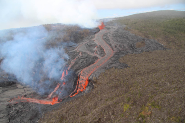
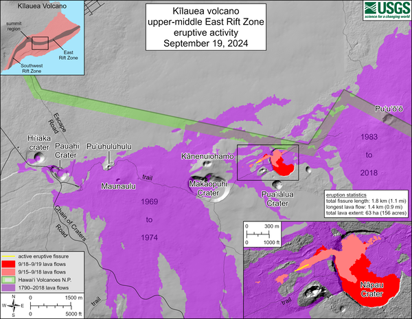
September 19, 2024 —Kīlauea middle East Rift Zone eruption reference mapThis reference map depicts fissures and lava flows from the Kīlauea middle East Rift Zone eruption on Thursday, September 19, 2024. Map data are current as of the Hawaiian Volcano Observatory helicopter overflight that occurred between 9:00 and 10:00 a.m.