
Miller collecting geospatial data as part of his dissertation research on drought resources in East Africa.
Images
Explore our planet through photography and imagery, including climate change and water all the way back to the 1800s when the USGS was surveying the country by horse and buggy.
Filter Total Items: 21352

Miller collecting geospatial data in East Africa
Miller collecting geospatial data as part of his dissertation research on drought resources in East Africa.
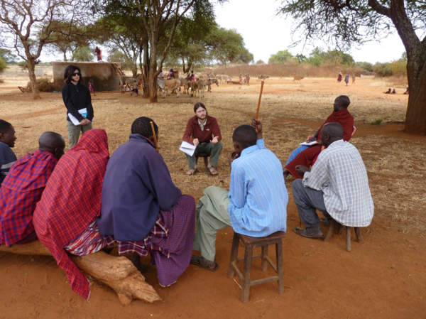
Miller interviewing Maasai pastoralists about drought adaptation
Miller interviewing Maasai pastoralists about drought adaptationMiller interviewing Maasai pastoralists about how they have coped with drought amidst conservation and land use changes.
Miller interviewing Maasai pastoralists about drought adaptation
Miller interviewing Maasai pastoralists about drought adaptationMiller interviewing Maasai pastoralists about how they have coped with drought amidst conservation and land use changes.

Mineral-laden water emerging from a hydrothermal vent
Mineral-laden water emerging from a hydrothermal ventMineral-laden water emerging from a hydrothermal vent on the Niua underwater volcano in the Lau Basin, southwest Pacific Ocean. As the water cools, minerals precipitate to form tower-like “chimneys.” Image taken during 2016 cruise “Virtual Vents.”

Mining water withdrawals in 2015
Mining water withdrawals in 2015

Mount Shasta, a steep-sided Cascade Range stratovolcano in Northern Ca
Mount Shasta, a steep-sided Cascade Range stratovolcano in Northern CaMount Shasta, a steep-sided Cascade Range stratovolcano in Northern California, looms above Little Glass Mountain, a thick obsidian flow erupted from the Medicine Lake shield volcano about 1,000 years ago. These are just two of the young volcanic areas monitored by the USGS California Volcano Observatory. USGS photo.

Nantucket and Marthas Vineyard geologic illustrations
Nantucket and Marthas Vineyard geologic illustrationsGeologic sections (C-C', D-D', and E-E') illustrating the general distributions and thicknesses of seismic stratigraphic units and major unconformities in the Martha’s Vineyard and Nantucket study areas.

New HVO Deputy Scientist-in-Charge David Phillips
New Hawaiian Volcano Observatory Deputy Scientist-in-Charge David Phillips and his wife Francine Coloma with Japan's iconic Mt. Fuji in the background.
New Hawaiian Volcano Observatory Deputy Scientist-in-Charge David Phillips and his wife Francine Coloma with Japan's iconic Mt. Fuji in the background.

NHD Twitter banner
NHD Twitter banner photo of lake surrounded by mountains
NHD Twitter banner photo of lake surrounded by mountains

Ocean Bottom Seismometer Recovery
A WHCMSC and WHOI team recovered six intermediate period ocean bottom seismographs from the continental slope offshore New England in Georges Bank. The instruments had been deployed for about ten months to record background, ambient seismic noise.
A WHCMSC and WHOI team recovered six intermediate period ocean bottom seismographs from the continental slope offshore New England in Georges Bank. The instruments had been deployed for about ten months to record background, ambient seismic noise.

On-site data processing of geophysical data from Fire Island, New York
On-site data processing of geophysical data from Fire Island, New YorkFire Island is a 50-km long barrier island along the south shore of Long Island, NY. The island is comprised of seventeen year-round communities; federal, state, and county parks; and supports distinct ecosystems alongside areas of economic and cultural value.
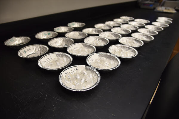
Otoliths Waiting to be Aged
Hundreds of alewife otoliths, all stored in separate vials, wait to be aged at the GLSC Lake Ontario Biological Station.
Hundreds of alewife otoliths, all stored in separate vials, wait to be aged at the GLSC Lake Ontario Biological Station.

Overview of Water Quality in Principal Aquifers
Overview of Water Quality in Principal Aquifers

Percentage Change in Population by State and Decade: 1980 - 1990 to 20
Percentage Change in Population by State and Decade: 1980 - 1990 to 20Percentage Change in Population by State and Decade: 1980 - 1990 to 2000 - 2010. For information on confidentiality protection, nonsampling error, and definitions, see http://www.census.gov/prod/cen2010/doc/p194-171.pdf

Photo collage of images from Fire Island
Photo collage of images from Fire Island showing dunes and beaches
Photo collage of images from Fire Island showing dunes and beaches

Piping Plover Habitat, Cedar Island
The beach-dependent shorebirds project at the Woods Hole Coastal and Marine Science Center models current and future habitat availability for nesting shorebirds in an effort to map current and likely future habitat availability on a range of sites along the U.S. Atlantic coast.
The beach-dependent shorebirds project at the Woods Hole Coastal and Marine Science Center models current and future habitat availability for nesting shorebirds in an effort to map current and likely future habitat availability on a range of sites along the U.S. Atlantic coast.

Plot of Kīlauea ground motion
Plot of ground motion as recorded by a GPS station at Kīlauea's summit (red) and the Pu‘u ‘Ō‘ō vent (blue) for the 8 months leading up to the 2018 eruption. Note the sharp increase indicating pressurization beginning in March. Image shows an aerial view of Halema‘uma‘u crater and the actively overflowing lava lake on April 23, 2018.
Plot of ground motion as recorded by a GPS station at Kīlauea's summit (red) and the Pu‘u ‘Ō‘ō vent (blue) for the 8 months leading up to the 2018 eruption. Note the sharp increase indicating pressurization beginning in March. Image shows an aerial view of Halema‘uma‘u crater and the actively overflowing lava lake on April 23, 2018.

pockets of natural gas from the burning plant material can ignite
pockets of natural gas from the burning plant material can igniteWhen molten lava encroaches on grassland, forests, or other vegetated land, subsurface pockets of natural gas from the burning plant material can ignite, causing a blast known as a "methane explosion." To avoid this hazard, keep a safe distance—at least tens of yards—from the margin of an active lava flow in vegetated areas.

Power Generation Plant
Source: U.S. Nuclear Regulatory Commission
Source: U.S. Nuclear Regulatory Commission

progression of the magmatic intrusion from Kīlauea
progression of the magmatic intrusion from KīlaueaEarthquakes (red dots) track the progression of the magmatic intrusion from Kīlauea Volcano's middle East Rift Zone to the lower East Rift Zone between April 30 and May 3, 2018. Orange triangles show the locations of fissure 1 (right), which erupted on May 3, and Pu‘u ‘Ō‘ō (left).

PROSPER in StreamStats screenshot
PROSPER in StreamStats screenshot
PROSPER in StreamStats screenshot

Public Supply Water Use in 2015
Public Supply Water Use in 2015