'I'iwi (Drepanis coccinea), or scarlet honeycreeper.
'I'iwi (Drepanis coccinea), or scarlet honeycreeper.'I'iwi (Drepanis coccinea), or scarlet honeycreeper.

Official websites use .gov
A .gov website belongs to an official government organization in the United States.
Secure .gov websites use HTTPS
A lock () or https:// means you’ve safely connected to the .gov website. Share sensitive information only on official, secure websites.
Explore our planet through photography and imagery, including climate change and water all the way back to the 1800s when the USGS was surveying the country by horse and buggy.

'I'iwi (Drepanis coccinea), or scarlet honeycreeper.
'I'iwi (Drepanis coccinea), or scarlet honeycreeper.

Andrew Reeves retrieving samples within Izembek National Wildlife Refuge, Alaska as part of USGS research to investigate the persistence of avian influenza viruses in North American wetlands. USGS scientists and colleagues found that influenza A viruses may remain infectious in surface waters of northern wetlands for more than seven months.
Andrew Reeves retrieving samples within Izembek National Wildlife Refuge, Alaska as part of USGS research to investigate the persistence of avian influenza viruses in North American wetlands. USGS scientists and colleagues found that influenza A viruses may remain infectious in surface waters of northern wetlands for more than seven months.

Fish biologist Carolyn Malecha with the Klamath Falls Field Station catches adult suckers as part of a long-term monitoring program that estimates survival and recruitment of suckers.
Fish biologist Carolyn Malecha with the Klamath Falls Field Station catches adult suckers as part of a long-term monitoring program that estimates survival and recruitment of suckers.

Lauren Toth (Research Physical Scientist, SPCMSC) and collaborator Mike Colella (Florida Fish and Wildlife Conservation Commission) collect measurements of reef erosion at Molasses reef off Key Largo, FL.
Lauren Toth (Research Physical Scientist, SPCMSC) and collaborator Mike Colella (Florida Fish and Wildlife Conservation Commission) collect measurements of reef erosion at Molasses reef off Key Largo, FL.

HVO scientists inspect a seismic station on Mauna Loa to evaluate for a possible equipment upgrade in the near future.
HVO scientists inspect a seismic station on Mauna Loa to evaluate for a possible equipment upgrade in the near future.

HVO scientists measure a GPS instrument to ensure its stability during a multi-day deployment in the Kahuku Unit of Hawai‘i Volcanoes National Park.
HVO scientists measure a GPS instrument to ensure its stability during a multi-day deployment in the Kahuku Unit of Hawai‘i Volcanoes National Park.

Snow covered banks but the channel is still free flowing at Soda Butte Creek near the Yellowstone National Park boundary.
Snow covered banks but the channel is still free flowing at Soda Butte Creek near the Yellowstone National Park boundary.

Ongoing camera monitoring efforts in Southern Arizona to monitor wildlife for the goal of detecting endangered jaguars and ocelots have covered 20 mountain ranges, off and on, from 2012 to 2019.
Ongoing camera monitoring efforts in Southern Arizona to monitor wildlife for the goal of detecting endangered jaguars and ocelots have covered 20 mountain ranges, off and on, from 2012 to 2019.

Ongoing camera monitoring efforts in Southern Arizona to monitor wildlife for the goal of detecting endangered jaguars and ocelots have covered 20 mountain ranges, off and on, from 2012 to 2019.
Ongoing camera monitoring efforts in Southern Arizona to monitor wildlife for the goal of detecting endangered jaguars and ocelots have covered 20 mountain ranges, off and on, from 2012 to 2019.

Ongoing camera monitoring efforts in Southern Arizona to monitor wildlife for the goal of detecting endangered jaguars and ocelots have covered 20 mountain ranges, off and on, from 2012 to 2019.
Ongoing camera monitoring efforts in Southern Arizona to monitor wildlife for the goal of detecting endangered jaguars and ocelots have covered 20 mountain ranges, off and on, from 2012 to 2019.


A high-precision GPS unit (on white "T" in foreground) records its position at a ground control point along Pohoiki Road. This marker was painted in July 2018 and is visible in numerous aerial photographs taken by USGS Hawaiian Volcano Observatory geologists throughout Kīlauea's lower East Rift Zone eruption last summer.
A high-precision GPS unit (on white "T" in foreground) records its position at a ground control point along Pohoiki Road. This marker was painted in July 2018 and is visible in numerous aerial photographs taken by USGS Hawaiian Volcano Observatory geologists throughout Kīlauea's lower East Rift Zone eruption last summer.

Mangrove forest on the island of Pohnpei, Micronesia, dominated by Bruguiera gymnorrhiza (locally called sohmw).
The USGS and partners are studying how mangrove forests in the Federated States of Micronesia may respond to sea-level rise over the coming century. Their projections will help Micronesian communities plan for the future.
Map of moderate, high and very high threat volcanoes monitored by the California
Map of moderate, high and very high threat volcanoes monitored by the California

Weather at Kīlauea Point National Wildlife Refuge

USGS Staff running levels-Green River at Spottsville, KY.
USGS Staff running levels-Green River at Spottsville, KY.

USGS gage number 05051522, Red River of The North at Hickson, ND. This gage is managed by the Dakota Water Science Center.
USGS gage number 05051522, Red River of The North at Hickson, ND. This gage is managed by the Dakota Water Science Center.

USGS gage 05079000 Red Lake River at Crookston, MN manged by Dakota Water Science Center.
USGS gage 05079000 Red Lake River at Crookston, MN manged by Dakota Water Science Center.

USGS gage number 02310678 Homosassa Springs at Homosassa Springs, FL
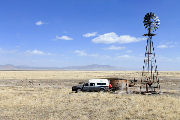
USGS scientist Mike Carlson works to collect a water quality sample from a windmill in the western Plains of San Agustin. Photo taken by Jeff Pepin on April 10th, 2019.
USGS scientist Mike Carlson works to collect a water quality sample from a windmill in the western Plains of San Agustin. Photo taken by Jeff Pepin on April 10th, 2019.

A close-up of the active fumarole field on the north wall of the pit.
A close-up of the active fumarole field on the north wall of the pit.