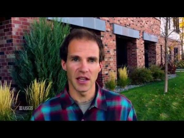
Elliott Barnhart, a hydrologist with the USGS Wyoming-Montana Water Science Center, describes his work developing what could be a cleaner way to develop coal.
Videos
The USGS is a science organization that provides impartial information on the health of our ecosystems and environment, the natural hazards that threaten us, the natural resources we rely on, the impacts of climate and land-use change, and the core science systems that help us provide timely, relevant, and useable information.
 What's the Big Idea? — Creating Cleaner Energy from Coal
Elliott Barnhart, a hydrologist with the USGS Wyoming-Montana Water Science Center, describes his work developing what could be a cleaner way to develop coal.
 What's the Big Idea?— Turning to eDNA to Detect Invasive Species
Adam Sepulveda, research zoologist at the USGS Northern Rocky Mountain Science Center, explains a scientists at NOROCK are using environmental DNA — the identification of species through biological information they leave behind in their habitat — to detect invasive species and how this method could change the way scientists find evidence of biodiversity in
Adam Sepulveda, research zoologist at the USGS Northern Rocky Mountain Science Center, explains a scientists at NOROCK are using environmental DNA — the identification of species through biological information they leave behind in their habitat — to detect invasive species and how this method could change the way scientists find evidence of biodiversity in
 What's the Big Idea?—Using Weather Equip. to Monitor Animal Movement
Robb Diehl, research ecologist at the USGS Northern Rocky Mountain Science Center, explains how he uses remote sensing technology — particularly weather radar — to better understand how flying animals affect human activities.
Producer: Jacob Massey, USGS
Camera: Paul Laustsen, USGS
Robb Diehl, research ecologist at the USGS Northern Rocky Mountain Science Center, explains how he uses remote sensing technology — particularly weather radar — to better understand how flying animals affect human activities.
Producer: Jacob Massey, USGS
Camera: Paul Laustsen, USGS
This Quicktime video shows lava sample collection from the perspective of an HVO geologist.
An animated GIF of the sampling shot can be found at: https://www.usgs.gov/media/images/lava-sampling-0
This Quicktime video shows lava sample collection from the perspective of an HVO geologist.
An animated GIF of the sampling shot can be found at: https://www.usgs.gov/media/images/lava-sampling-0
This video was created as part of the Climate Change Science and Management Webinar Series hosted by the U.S. Geological Survey's National Climate Change and Wildlife Science Center and the U.S. Fish and Wildlife Service's National Conservation Training Center.
This video was created as part of the Climate Change Science and Management Webinar Series hosted by the U.S. Geological Survey's National Climate Change and Wildlife Science Center and the U.S. Fish and Wildlife Service's National Conservation Training Center.
The USGS Hydrography Webinar Series shares success stories from users, provides information on The National Hydrography Dataset (NHD) and other related products, and provides a forum for users to learn more about Hydrography-related topics.
The USGS Hydrography Webinar Series shares success stories from users, provides information on The National Hydrography Dataset (NHD) and other related products, and provides a forum for users to learn more about Hydrography-related topics.
 PubTalk 9/2015 — Coral Reefs, Climate Change, and Atoll Sustainability
Will Micronesians become the U.S.'s first climate change refugees?
by Curt Storlazzi, USGS Research Geologist and Oceanographer
Will Micronesians become the U.S.'s first climate change refugees?
by Curt Storlazzi, USGS Research Geologist and Oceanographer
 Field Office Chief Craig Painter on UAVs for Better Discharge Data
USGS field office chief Craig Painter shares his thoughts about the What's the Big Idea? innovation event at Kansas Water Science Center on Sept 2., 2015.
USGS field office chief Craig Painter shares his thoughts about the What's the Big Idea? innovation event at Kansas Water Science Center on Sept 2., 2015.
 Hydrologist Arin Peters on Real-time Streamgage Cameras
USGS hydrologist Arin Peters shares his thoughts about the What's the Big Idea? innovation event at Kansas Water Science Center on Sept 2., 2015.
USGS hydrologist Arin Peters shares his thoughts about the What's the Big Idea? innovation event at Kansas Water Science Center on Sept 2., 2015.
Barter Island sits at the top of the Arctic National Wildlife Refuge in Alaska, and with the Arctic facing quickly rising temperatures, USGS wants to investigate what’s causing the North Slope bluffs to erode so quickly.
Barter Island sits at the top of the Arctic National Wildlife Refuge in Alaska, and with the Arctic facing quickly rising temperatures, USGS wants to investigate what’s causing the North Slope bluffs to erode so quickly.
 PubTalk 8/2015 — Yes, Humans Really Are Causing Earthquakes
by Justin Rubinstein, USGS Research Geophysicist
by Justin Rubinstein, USGS Research Geophysicist
Permanent Site: K1 West Transect; Depth: 6.0 Meters (19.8 Feet); Distance from river mouth: 4.5 Kilometers (2.8 Miles) east; Pre/Post Dam Removal: 4 years post-dam removal; Lat/Long: 48.13592923,-123.51082988; Site Description: This is a shallow site. Sediment is a gravel/sand mixture.
Permanent Site: K1 West Transect; Depth: 6.0 Meters (19.8 Feet); Distance from river mouth: 4.5 Kilometers (2.8 Miles) east; Pre/Post Dam Removal: 4 years post-dam removal; Lat/Long: 48.13592923,-123.51082988; Site Description: This is a shallow site. Sediment is a gravel/sand mixture.
Permanent Site: A2 East Transect; Depth: 12.4 Meters (Feet 40.8); Distance from river mouth: Kilometers 1.8 (1.1 Miles); Pre/Post Dam Removal: 4 years post-dam removal; Lat/Long: 48.14130295, -123.58766124; Site Description: One of our deeper sites at over 40 feet. Sediment is primarily sand/sandy mud.
Permanent Site: A2 East Transect; Depth: 12.4 Meters (Feet 40.8); Distance from river mouth: Kilometers 1.8 (1.1 Miles); Pre/Post Dam Removal: 4 years post-dam removal; Lat/Long: 48.14130295, -123.58766124; Site Description: One of our deeper sites at over 40 feet. Sediment is primarily sand/sandy mud.
Permanent Site: A2 West Transect; Depth: 12.9 Meters (Feet 42.3); Distance from river mouth: Kilometers 1.8 (1.1 Miles); Pre/Post Dam Removal: 4 years post-dam removal; Lat/Long: 48.14130295, -123.5883331; Site Description: One of our deeper sites at over 40 feet. Sediment is primarily sand/sandy mud with a few scattered boulders.
Permanent Site: A2 West Transect; Depth: 12.9 Meters (Feet 42.3); Distance from river mouth: Kilometers 1.8 (1.1 Miles); Pre/Post Dam Removal: 4 years post-dam removal; Lat/Long: 48.14130295, -123.5883331; Site Description: One of our deeper sites at over 40 feet. Sediment is primarily sand/sandy mud with a few scattered boulders.
Permanent Site: F2 West Transect; Depth: 11.2 Meters (36.9 Feet); Distance from river mouth: 1.5 Kilometers (0.9 Miles) east; Pre/Post Dam Removal: 4 years post-dam removal; Lat/Long: 48.15672004,-123.55036603; Site Description: Visibility is poor on video due to a large amount of surge on the day of the dive.
Permanent Site: F2 West Transect; Depth: 11.2 Meters (36.9 Feet); Distance from river mouth: 1.5 Kilometers (0.9 Miles) east; Pre/Post Dam Removal: 4 years post-dam removal; Lat/Long: 48.15672004,-123.55036603; Site Description: Visibility is poor on video due to a large amount of surge on the day of the dive.
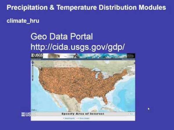
Presents the USGS Precipitation Runoff Modeling System (PRMS) climate distribution modules.
Presents the USGS Precipitation Runoff Modeling System (PRMS) climate distribution modules.
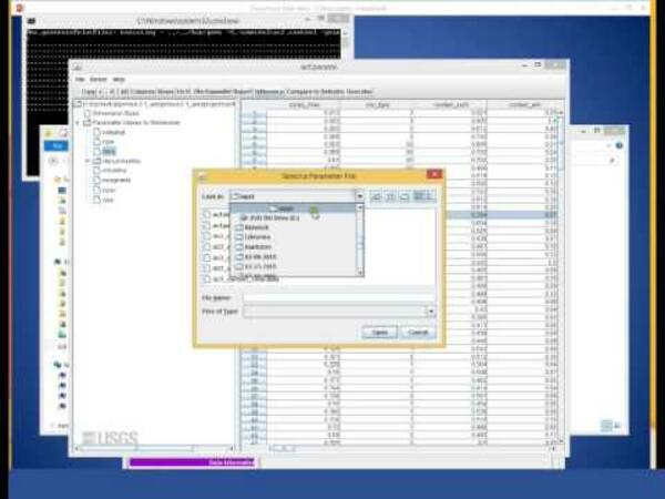
Demonstration of how to run USGS Precipitation Runoff Modeling System (PRMS) with the graphical user interface.
Demonstration of how to run USGS Precipitation Runoff Modeling System (PRMS) with the graphical user interface.
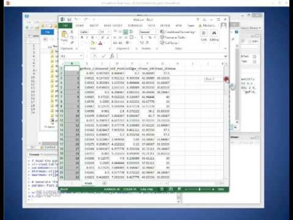
Parameter sensitivity analysis of USGS Precipitation Runoff Modeling System (PRMS) using the Fourier Amplitude Sensitivity Test algorithm.
Parameter sensitivity analysis of USGS Precipitation Runoff Modeling System (PRMS) using the Fourier Amplitude Sensitivity Test algorithm.
Permanent Site: L1 East Transect; Depth: 11.6 Meters (38.0 Feet); Distance from river mouth: 2.3 Kilometers (1.4 Miles) west; Pre/Post Dam Removal: 4 years post-dam removal; Lat/Long: 48.13957527,-123.59359993; Site Description: This transect is medium depth. Substrate is mainly fine sediment/sand/mud with a few scattered boulders (1:15 seconds).
Permanent Site: L1 East Transect; Depth: 11.6 Meters (38.0 Feet); Distance from river mouth: 2.3 Kilometers (1.4 Miles) west; Pre/Post Dam Removal: 4 years post-dam removal; Lat/Long: 48.13957527,-123.59359993; Site Description: This transect is medium depth. Substrate is mainly fine sediment/sand/mud with a few scattered boulders (1:15 seconds).
Permanent Site: L1 West Transect; Depth: 11.4 Meters (37.3 Feet); Distance from river mouth: 2.3 Kilometers (1.4 Miles) west; Pre/Post Dam Removal: 4 years post-dam removal; Lat/Long: 48.13957527,-123.59427175; Site Description: This transect is medium depth. The first 20 meters contains scattered boulders (0:18 seconds).
Permanent Site: L1 West Transect; Depth: 11.4 Meters (37.3 Feet); Distance from river mouth: 2.3 Kilometers (1.4 Miles) west; Pre/Post Dam Removal: 4 years post-dam removal; Lat/Long: 48.13957527,-123.59427175; Site Description: This transect is medium depth. The first 20 meters contains scattered boulders (0:18 seconds).
Permanent Site: A1 East Transect; Depth: 8.3 Meters (27.1 Feet); Distance from river mouth: 1.8 Kilometers (1.1 Miles) West; Pre/Post Dam Removal: 4 years post-dam removal; Lat/Long: 48.13870775, -123.5855312; Site Description: Transect is in eastern part of Freshwater Bay. Sediment is primarily sand/sandy mud. Previous small boulders appear to be buried.
Permanent Site: A1 East Transect; Depth: 8.3 Meters (27.1 Feet); Distance from river mouth: 1.8 Kilometers (1.1 Miles) West; Pre/Post Dam Removal: 4 years post-dam removal; Lat/Long: 48.13870775, -123.5855312; Site Description: Transect is in eastern part of Freshwater Bay. Sediment is primarily sand/sandy mud. Previous small boulders appear to be buried.


