
How Science Helps Manage Changing Water Availability and Quality: Droughts, Floods, Avalanches and More
Droughts, floods, and avalanches are extreme events in the water cycle that can have catastrophic and lasting impacts on ecosystems and society. In addition to these extreme events, human changes to the landscape (including land use changes) can have substantial impacts on freshwater resources as well. Science from the USGS Ecosystems Land Change Science Program helps managers and decision-makers understand the impact of these events and changes, as well as anticipate and mitigate their effects in the near and distant future.
Helping people and the economy adapt to drought
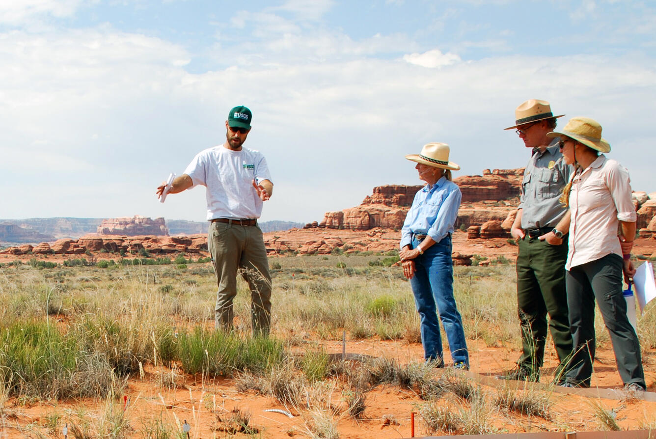
Several regions out West are experiencing severe drought conditions, including the Colorado Plateau and surrounding areas. Many of the region’s drylands are managed for domestic livestock grazing and recreation, which generates billions of dollars of revenue for the federal government and contributes hundreds of millions of dollars to local communities.
Over the past two decades, the region has experienced three droughts so extreme they are considered 1-in-100-year events based on long-term climate records. These conditions are placing stress on native plant communities and posing serious challenges for the ranching and tourism economies that rely on healthy, functioning lands.
To address these challenges, USGS scientists at Southwest Biological Science Center work with public land managers and ranchers to develop strategies to help avoid the most deleterious impacts of drought and invasives through management and restoration.
For example, USGS is working with National Park Service to test new restoration techniques to address drought-driven land degradation in Canyonlands and Arches National Parks, which together welcomed over 1.5 million visitors in 2024. The USGS is also working with ranchers and partners to test livestock breeds, like heritage breeds, and management techniques that may help mitigate impacts of drought on ranchers and rangelands.
USGS science also provides ranchers in the western U.S. with information and decision support to manage drylands to receive carbon payments, which produces value for the economy. There are approximately 770 million acres of range and pastureland in the U.S., with about 360 million of those being public lands. Many U.S. ranchers are currently being paid by companies to manage for carbon on public lands where they graze their livestock. Getting paid for the carbon stored in soils is a way that many ranchers are diversifying their incomes streams while still ranching cattle.
USGS scientists from Southwest Biological Science Center are working side-by-side with U.S. ranchers in local and regional communities to better quantify, map, and provide management options for them to receive carbon economic benefits. Price per metric ton tends to be around \$16-20 which means that USGS science could be helping ranchers access as much as an additional over $7 billion in revenue on public lands alone.
Because the increase of organic carbon in soils has several co-benefits that result in increased plant and forage amount and quality, soil fertility, and the ability of soil to hold water, as well as reduced erosion, the science can help support further value for the economy through its support of practices that improve forage amount and quality for livestock.

Protecting infrastructure and communities from sea-level rise and coastal storms
More than a third of the United States population lives in counties directly on the shoreline, making these communities vulnerable to hazards associated with changing sea level and storm surges associated with hurricanes and severe storms.
One way to help protect people and the infrastructure in these communities is by using nature-based solutions such as restoring or conserving existing wetlands. A recent review by Land Change Science program scientists examined the storm protection value of coastal wetlands examining how much wave energy could be reduced by wetlands. They determined that tidal wetlands are effective in weakening normal short-period waves or small storm-induced waves. At the same time, however, they also determined that long-period (larger) storm surges, which elevate sea levels up to several meters for up to more than a day, are attenuated less effectively, especially when wetland fringes are narrow. Thus, it depends on the storm conditions as to how much storm protection can be expected from coastal wetlands.

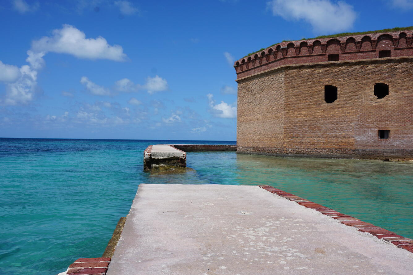
Along the Gulf of America and Atlantic coasts, national parks and preserves are vulnerable to sea-level rise, which threatens to inundate irreplaceable historic buildings, archeological sites, and other infrastructure located in low-lying areas.
USGS scientists at the Wetland and Aquatic Research Center partnered with the National Park Service to develop maps projecting future sea-level rise for federally managed units in the region. They also published a series of USGS Fact Sheets about projected sea-level rise and high tide flooding at six parks in the region, in collaboration with their partners.
National Park Service and other federal land managers are using this information to inform park infrastructure and resource plans.
Supporting communities adapting to changes in snow and ice
Changes in winter snow and ice are having impacts on communities both during the winter months, but also during the remainder of the year, since the snow and ice that build up during the winter often provide important freshwater resources through the spring, summer and fall. Research to better understand winter precipitation and changing patterns is helping people plan for changing hydrologic conditions all year.
Glaciers
Mountain glaciers are dynamic reservoirs of frozen water, deeply interconnected with surrounding ecosystems, downstream communities, and the global Earth system. The meltwater from glaciers buffers runoff from rain and snow and provides important water resources for boat navigation, fisheries, drinking water, and agriculture. However, as glaciers in North America diminish, there are increasing, societally relevant consequences for water resources, natural hazards, tourism, fisheries, and global sea level change. For example, glacier retreat has led to record-breaking outburst floods from glacier-dammed lakes in Mendenhall Valley near Juneau, Alaska, and landslides in the recently deglaciated valleys of South Sawyer Arm in Southeast Alaska.
Understanding and quantifying precise connections between changing glaciers and the surrounding landscape is critical to decision makers and land managers who need to determine how best to protect people, infrastructure, and ecosystems. The USGS Benchmark Glacier Project is at the forefront of enhancing monitoring, analysis, and prediction of mountain glacier change. The project combines long-term glacier monitoring with remote sensing and contemporary analytical methods to create novel insight and deliver relevant, actionable science to local communities and agency partners including National Park Service and NASA.

Snow, ice, and avalanches
Changes in the amount of snowpack, the timing of snow arrival and melt, and changing winter storm conditions all have impacts on freshwater availability for people and communities, particularly as winter snows start to melt providing key spring and summer water to support ecosystems, people, and tourism in remote locations of the West.
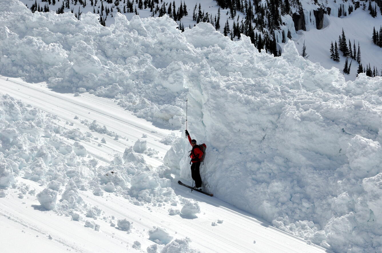
Scientists with the Ecosystems’ Land Change Science program are investigating how differences in snowpack conditions, changing snowmelt dynamics, and also rain on snow events are impacting water availability and natural hazards, which can cause major economic impacts and even loss of life. As winters on average are warmer, it means that snowpack may be less deep, and changes to snowmelt timing and rain on snow events may lead to reductions in streamflow during critical times of the year as well as more late winter/early spring avalanches.
This is why scientists are working closely with Glacier National Park to forecast avalanche risk so that the iconic Going-to-the-sun road is not plowed and opened too early while there is still a substantial risk of avalanches which would put both the park staff and visitors at risk. Forecasts and research are also used to help keep railway tracks and major highways open for commerce as much as possible. This is science in action to save lives and property.
Sleepers River watershed is a long-term research site which began in the 1950s by USDA and then was taken over by USGS and monitoring has continued for decades. The site was established to better understand inflow and outflow dynamics of watersheds. Data from the site have been critical to inform scientists’ understanding of nutrient cycling as well as hydrological patterns of Eastern watersheds.
Not only do the data help us understand how changing temperatures and climate patterns are impacting instream flows, of particular importance are the snow data from the watershed. Snow data can be very challenging to collect. Sleepers snow data are sent every two weeks to the National Weather Service and are used to ground truth the regional snow forecast models because the Sleepers project collects data across a wide range of elevations (700’ to 2100’). Sleepers data also provide key data to inform winter recreation endeavors like skiing in the region as well as helping loggers determine if the ground is frozen but not covered with snow, which are the conditions they need for harvesting. Snow data are also useful to help with forecasts of potential spring flooding risk as temperatures start to warm, and then in the longer-term about freshwater availability for the coming summer.
Although the East coast is not typically thought of as a place hard hit by drought, long-term data suggest that changes in freshwater availability are occurring with earlier snow melt, less snowmelt recharge of the groundwater, the potential for higher spring peak floods, and lower flow waters later in the summer and fall. Program data can help inform local managers so that they can plan for ongoing changes in freshwater availability or the timing of key events like spring melts.

Helping water managers navigate changing water quality
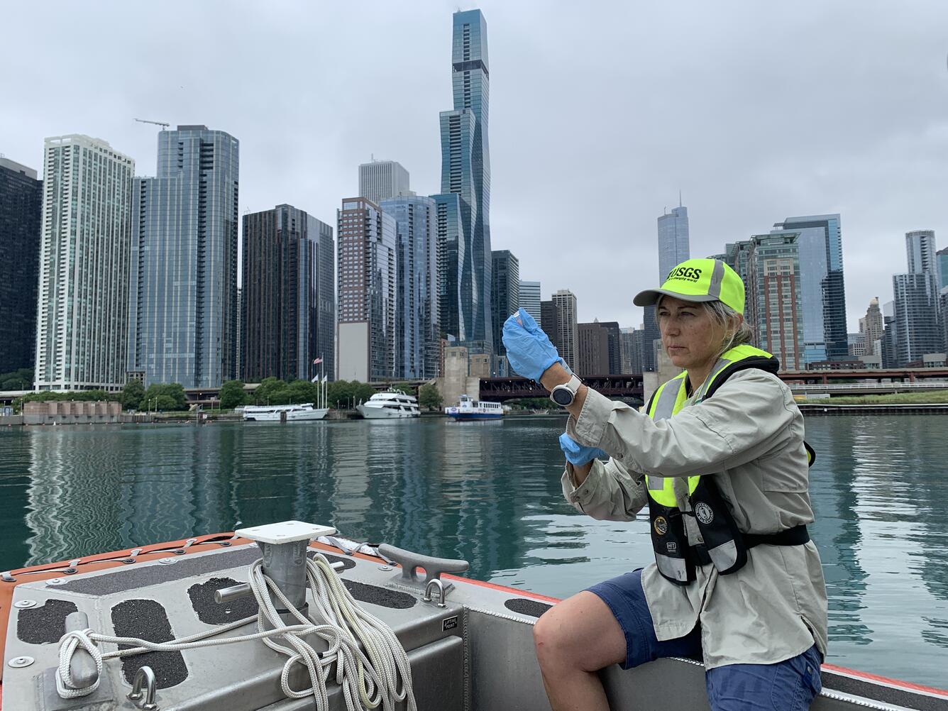
Freshwater resources are being affected by changes in the environment, including inputs of treated wastewater from cities and stormwater runoff from the land that impact downstream water quality. When extra nutrients, carbon, and contaminants enter streams and rivers from treated wastewater or stormwater runoff they can change the biogeochemistry of freshwater resources and disrupt habitats for fish and other aquatic life. Scientists in the Ecosystems’ Land Change Science program are working with water managers in the Midwest to better understand the impacts of wastewater inputs particularly around large metropolitan areas such as Chicago. This research helps guide decisions about future wastewater plant upgrades and other opportunities to improve water quality in urban areas.
When it comes to land use changes impacting freshwater resources, major land use change, from forests to agricultural areas, for example, can have dramatic impacts on water quality. For example, USGS scientists at the Earth Resources Observation and Science Center are working with the city of Minneapolis and the Environmental Protection Agency to help model and predict changes in land use and corresponding impacts on freshwater quality in the headwaters of the Mississippi river that impact the city’s drinking water. USGS has mapped and modeled past, present, and potential future changes in land use, such as conversion of forest or grassland to grow potatoes with subsequent increases in sediment and phosphorus in the river water. The city is now treating the water it pulls from the river with more chemicals to help reduce the pollution from the upstream land use changes. This ensures that Minneapolis still has clean, safe drinking water.

Droughts, floods, and avalanches are extreme events in the water cycle that can have catastrophic and lasting impacts on ecosystems and society. In addition to these extreme events, human changes to the landscape (including land use changes) can have substantial impacts on freshwater resources as well. Science from the USGS Ecosystems Land Change Science Program helps managers and decision-makers understand the impact of these events and changes, as well as anticipate and mitigate their effects in the near and distant future.
Helping people and the economy adapt to drought
Several regions out West are experiencing severe drought conditions, including the Colorado Plateau and surrounding areas. Many of the region’s drylands are managed for domestic livestock grazing and recreation, which generates billions of dollars of revenue for the federal government and contributes hundreds of millions of dollars to local communities.
Over the past two decades, the region has experienced three droughts so extreme they are considered 1-in-100-year events based on long-term climate records. These conditions are placing stress on native plant communities and posing serious challenges for the ranching and tourism economies that rely on healthy, functioning lands.
To address these challenges, USGS scientists at Southwest Biological Science Center work with public land managers and ranchers to develop strategies to help avoid the most deleterious impacts of drought and invasives through management and restoration.
For example, USGS is working with National Park Service to test new restoration techniques to address drought-driven land degradation in Canyonlands and Arches National Parks, which together welcomed over 1.5 million visitors in 2024. The USGS is also working with ranchers and partners to test livestock breeds, like heritage breeds, and management techniques that may help mitigate impacts of drought on ranchers and rangelands.
USGS science also provides ranchers in the western U.S. with information and decision support to manage drylands to receive carbon payments, which produces value for the economy. There are approximately 770 million acres of range and pastureland in the U.S., with about 360 million of those being public lands. Many U.S. ranchers are currently being paid by companies to manage for carbon on public lands where they graze their livestock. Getting paid for the carbon stored in soils is a way that many ranchers are diversifying their incomes streams while still ranching cattle.
USGS scientists from Southwest Biological Science Center are working side-by-side with U.S. ranchers in local and regional communities to better quantify, map, and provide management options for them to receive carbon economic benefits. Price per metric ton tends to be around \$16-20 which means that USGS science could be helping ranchers access as much as an additional over $7 billion in revenue on public lands alone.
Because the increase of organic carbon in soils has several co-benefits that result in increased plant and forage amount and quality, soil fertility, and the ability of soil to hold water, as well as reduced erosion, the science can help support further value for the economy through its support of practices that improve forage amount and quality for livestock.
Protecting infrastructure and communities from sea-level rise and coastal storms
More than a third of the United States population lives in counties directly on the shoreline, making these communities vulnerable to hazards associated with changing sea level and storm surges associated with hurricanes and severe storms.
One way to help protect people and the infrastructure in these communities is by using nature-based solutions such as restoring or conserving existing wetlands. A recent review by Land Change Science program scientists examined the storm protection value of coastal wetlands examining how much wave energy could be reduced by wetlands. They determined that tidal wetlands are effective in weakening normal short-period waves or small storm-induced waves. At the same time, however, they also determined that long-period (larger) storm surges, which elevate sea levels up to several meters for up to more than a day, are attenuated less effectively, especially when wetland fringes are narrow. Thus, it depends on the storm conditions as to how much storm protection can be expected from coastal wetlands.
Along the Gulf of America and Atlantic coasts, national parks and preserves are vulnerable to sea-level rise, which threatens to inundate irreplaceable historic buildings, archeological sites, and other infrastructure located in low-lying areas.
USGS scientists at the Wetland and Aquatic Research Center partnered with the National Park Service to develop maps projecting future sea-level rise for federally managed units in the region. They also published a series of USGS Fact Sheets about projected sea-level rise and high tide flooding at six parks in the region, in collaboration with their partners.
National Park Service and other federal land managers are using this information to inform park infrastructure and resource plans.
Supporting communities adapting to changes in snow and ice
Changes in winter snow and ice are having impacts on communities both during the winter months, but also during the remainder of the year, since the snow and ice that build up during the winter often provide important freshwater resources through the spring, summer and fall. Research to better understand winter precipitation and changing patterns is helping people plan for changing hydrologic conditions all year.
Glaciers
Mountain glaciers are dynamic reservoirs of frozen water, deeply interconnected with surrounding ecosystems, downstream communities, and the global Earth system. The meltwater from glaciers buffers runoff from rain and snow and provides important water resources for boat navigation, fisheries, drinking water, and agriculture. However, as glaciers in North America diminish, there are increasing, societally relevant consequences for water resources, natural hazards, tourism, fisheries, and global sea level change. For example, glacier retreat has led to record-breaking outburst floods from glacier-dammed lakes in Mendenhall Valley near Juneau, Alaska, and landslides in the recently deglaciated valleys of South Sawyer Arm in Southeast Alaska.
Understanding and quantifying precise connections between changing glaciers and the surrounding landscape is critical to decision makers and land managers who need to determine how best to protect people, infrastructure, and ecosystems. The USGS Benchmark Glacier Project is at the forefront of enhancing monitoring, analysis, and prediction of mountain glacier change. The project combines long-term glacier monitoring with remote sensing and contemporary analytical methods to create novel insight and deliver relevant, actionable science to local communities and agency partners including National Park Service and NASA.
Snow, ice, and avalanches
Changes in the amount of snowpack, the timing of snow arrival and melt, and changing winter storm conditions all have impacts on freshwater availability for people and communities, particularly as winter snows start to melt providing key spring and summer water to support ecosystems, people, and tourism in remote locations of the West.
Scientists with the Ecosystems’ Land Change Science program are investigating how differences in snowpack conditions, changing snowmelt dynamics, and also rain on snow events are impacting water availability and natural hazards, which can cause major economic impacts and even loss of life. As winters on average are warmer, it means that snowpack may be less deep, and changes to snowmelt timing and rain on snow events may lead to reductions in streamflow during critical times of the year as well as more late winter/early spring avalanches.
This is why scientists are working closely with Glacier National Park to forecast avalanche risk so that the iconic Going-to-the-sun road is not plowed and opened too early while there is still a substantial risk of avalanches which would put both the park staff and visitors at risk. Forecasts and research are also used to help keep railway tracks and major highways open for commerce as much as possible. This is science in action to save lives and property.
Sleepers River watershed is a long-term research site which began in the 1950s by USDA and then was taken over by USGS and monitoring has continued for decades. The site was established to better understand inflow and outflow dynamics of watersheds. Data from the site have been critical to inform scientists’ understanding of nutrient cycling as well as hydrological patterns of Eastern watersheds.
Not only do the data help us understand how changing temperatures and climate patterns are impacting instream flows, of particular importance are the snow data from the watershed. Snow data can be very challenging to collect. Sleepers snow data are sent every two weeks to the National Weather Service and are used to ground truth the regional snow forecast models because the Sleepers project collects data across a wide range of elevations (700’ to 2100’). Sleepers data also provide key data to inform winter recreation endeavors like skiing in the region as well as helping loggers determine if the ground is frozen but not covered with snow, which are the conditions they need for harvesting. Snow data are also useful to help with forecasts of potential spring flooding risk as temperatures start to warm, and then in the longer-term about freshwater availability for the coming summer.
Although the East coast is not typically thought of as a place hard hit by drought, long-term data suggest that changes in freshwater availability are occurring with earlier snow melt, less snowmelt recharge of the groundwater, the potential for higher spring peak floods, and lower flow waters later in the summer and fall. Program data can help inform local managers so that they can plan for ongoing changes in freshwater availability or the timing of key events like spring melts.
Helping water managers navigate changing water quality
Freshwater resources are being affected by changes in the environment, including inputs of treated wastewater from cities and stormwater runoff from the land that impact downstream water quality. When extra nutrients, carbon, and contaminants enter streams and rivers from treated wastewater or stormwater runoff they can change the biogeochemistry of freshwater resources and disrupt habitats for fish and other aquatic life. Scientists in the Ecosystems’ Land Change Science program are working with water managers in the Midwest to better understand the impacts of wastewater inputs particularly around large metropolitan areas such as Chicago. This research helps guide decisions about future wastewater plant upgrades and other opportunities to improve water quality in urban areas.
When it comes to land use changes impacting freshwater resources, major land use change, from forests to agricultural areas, for example, can have dramatic impacts on water quality. For example, USGS scientists at the Earth Resources Observation and Science Center are working with the city of Minneapolis and the Environmental Protection Agency to help model and predict changes in land use and corresponding impacts on freshwater quality in the headwaters of the Mississippi river that impact the city’s drinking water. USGS has mapped and modeled past, present, and potential future changes in land use, such as conversion of forest or grassland to grow potatoes with subsequent increases in sediment and phosphorus in the river water. The city is now treating the water it pulls from the river with more chemicals to help reduce the pollution from the upstream land use changes. This ensures that Minneapolis still has clean, safe drinking water.