
Mass Balance Methods: Measuring Glacier Change
Nearly all of Earth's alpine glaciers are losing mass, with consequences for freshwater resources, landscape stability, regional ecosystems, and global sea level. Rates of glacier mass loss in Western North America and Alaska are among the highest on Earth (The GlaMBIE Team, 2025).
Return to Glaciers and Landscape Change
The USGS Glaciers Project measures glacier change to inform understanding of water resources, landscape and ecosystem impacts, and infrastructure planning. With a focus on glacier mass balance, the USGS Glaciers Project provides long-term data on glacier change to the public, researchers, land managers, and policy makers.
Glacier Mass Balance
Glaciers gain and lose mass primarily through winter snowfall and summer temperatures driving snow and ice ablation (melt). When more snow accumulates on a glacier than snow and ice ablate away, a glacier gains mass. Vice versa, if snow and ice ablation exceeds snow accumulation, a glacier loses mass. Glacier mass balance is defined as "the change in a glacier's mass, over a stated period of time” —akin to the accounting system for a glacier. Like balancing a glacier's checkbook, scientists measure the income (snow accumulation) of a glacier, and its expenses (snow and ice ablation), to calculate a glacier’s mass balance.
Mass Balance Methods
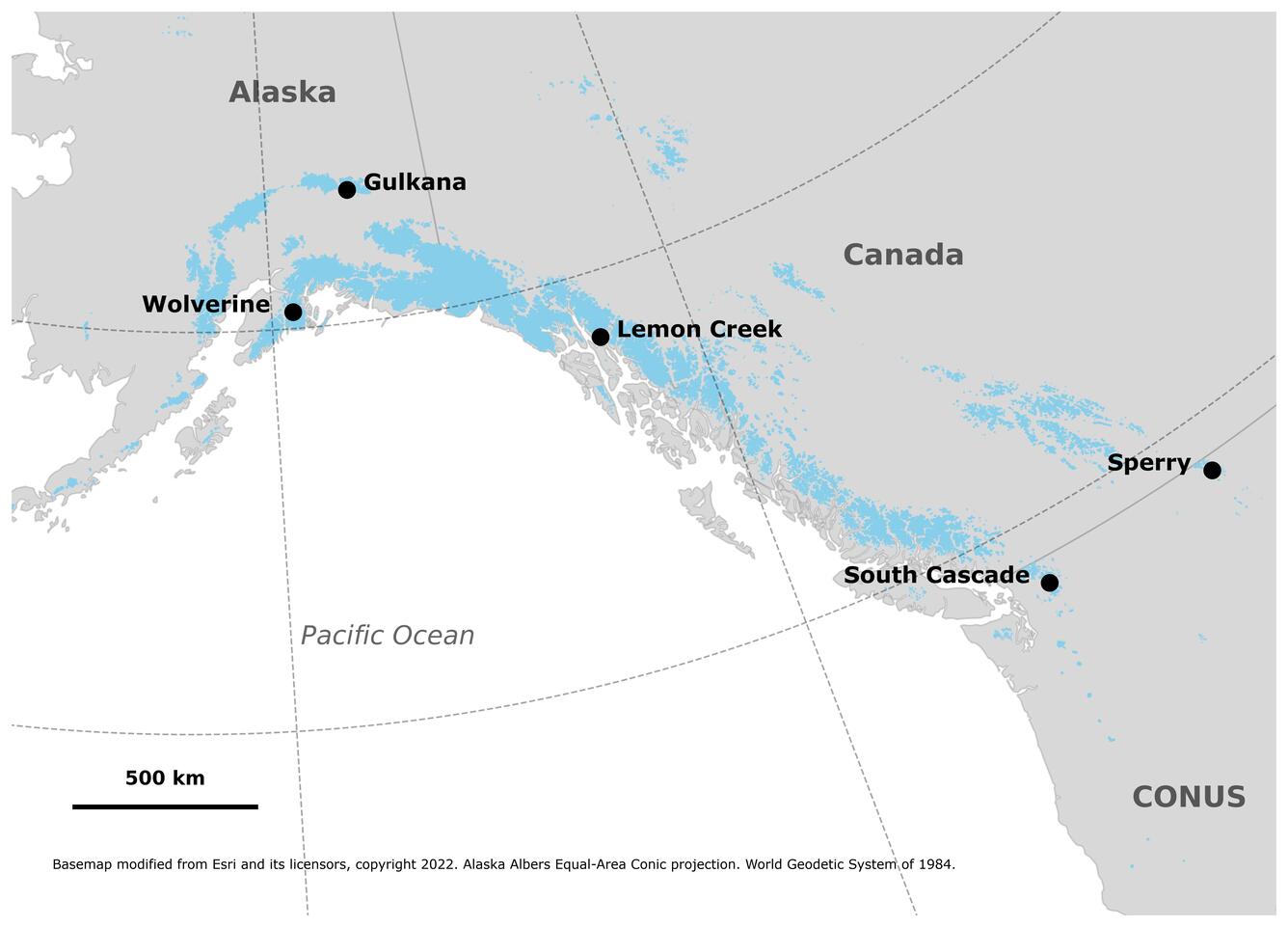
The U.S. Geological Survey Glacier Project's core glacier monitoring network stretching from Alaska to the Pacific Northwest, are known as the Benchmark Glaciers (Fig. 1). These five glacier sites — Gulkana, Wolverine, Lemon Creek, Sperry, and South Cascade glaciers — are among the longest-monitored and best-studied glaciers globally. Each year, project staff conduct field and remote sensing studies to measure each glacier's mass balance.
Field Sites
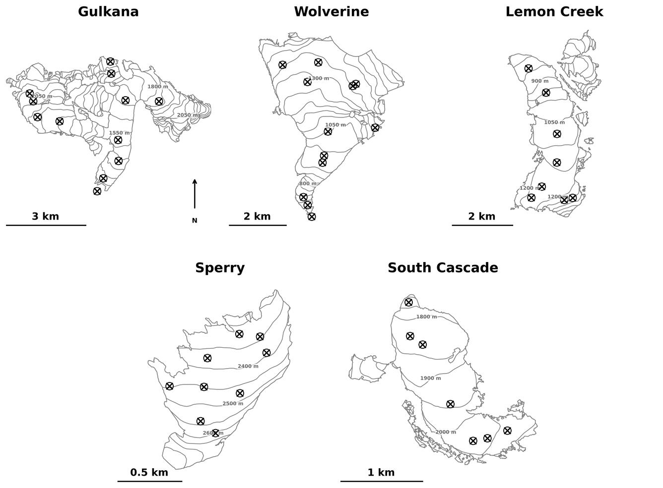
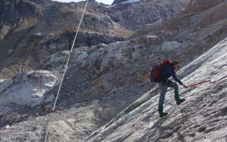
At each benchmark glacier, USGS researchers visit numerous field sites across each glacier's elevation range (Fig. 2).
Glacier Mass Measurements
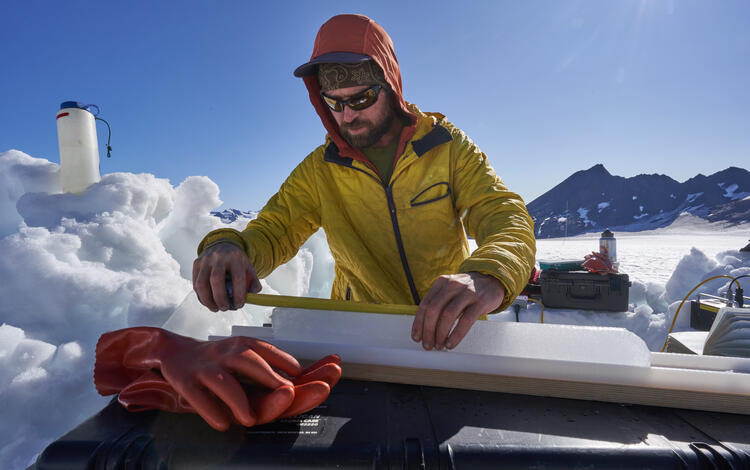
In the spring, measurements are focused on determining the glacier's mass increase over the winter — largely due to snowfall — using snow probes, pits, and cores to measure both the depth and density of the winter snowpack (left image). Researchers then return in the fall to measure the mass loss of the glacier, using ablation stakes to measure snow and ice ablation during the summer (right image). These field measurements are extrapolated over the glacier area to calculate the glacier-wide annual mass balance, quantifying the change in the glacier's mass since the previous year.
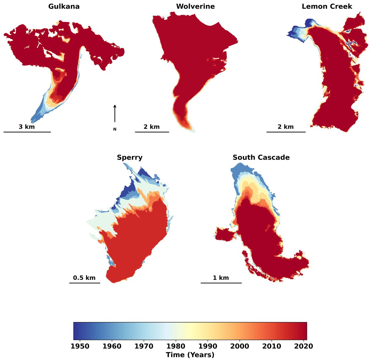
The USGS Glacier Project additionally leverages remotely sensed data capturing multi-year and decadal changes. Data collected via aerial photography, Light Detection and Ranging (LiDAR), and commercial satellite imagery allow project staff to quantify glacier area (Fig. 3) and volume change through time. The remotely sensed data also serve as an independent check on field measurements, allowing researchers to identify and correct any potential bias in the glacier-wide annual mass balance record. Direct field measurements capture year-to-year variability and remotely sensed measurements capture long-term cumulative change. Combining methods yields high-confidence, quantitative assessments of mass change across both short and long-time scales for each glacier.
Finally, weather stations maintained adjacent to each glacier provide essential means of relating glacier mass balance field measurements to weather factors like winter precipitation (resulting in snow accumulation and mass gain) and summer temperatures (driving ablation and mass loss). These weather stations further inform USGS researchers the timing of when either the accumulation or ablation seasons of the glacier begin and end— important for accurately calculating glacier-wide mass balance.

The USGS Benchmark Glacier Project annually updates glacier mass balance time series data through a USGS data release. Data are submitted to the World Glacier Monitoring Service. The most recent Benchmark Glacier mass balance results are available on the executive summary webpage. For more detailed description of methods see: O’Neel et al., 2019, McNeil et al., 2020, and Florentine et al., 2023.
Data Release: Glacier-Wide Mass Balances
World Glacier Monitoring Service
Benchmark Glaciers Executive Summary

Glaciers and Landscape Change

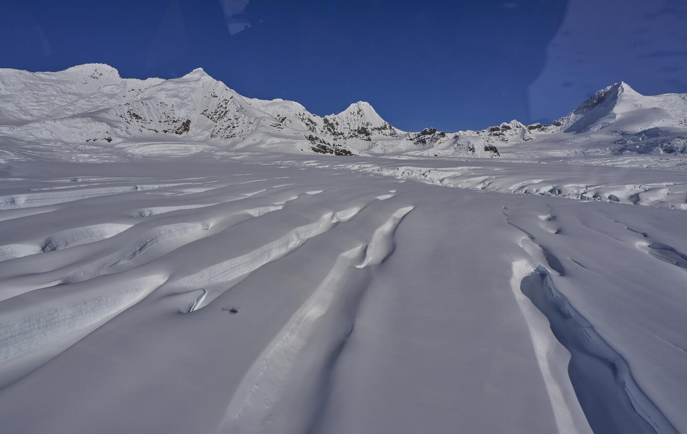
Sperry Glacier
Nearly all of Earth's alpine glaciers are losing mass, with consequences for freshwater resources, landscape stability, regional ecosystems, and global sea level. Rates of glacier mass loss in Western North America and Alaska are among the highest on Earth (The GlaMBIE Team, 2025).
Return to Glaciers and Landscape Change
The USGS Glaciers Project measures glacier change to inform understanding of water resources, landscape and ecosystem impacts, and infrastructure planning. With a focus on glacier mass balance, the USGS Glaciers Project provides long-term data on glacier change to the public, researchers, land managers, and policy makers.
Glacier Mass Balance
Glaciers gain and lose mass primarily through winter snowfall and summer temperatures driving snow and ice ablation (melt). When more snow accumulates on a glacier than snow and ice ablate away, a glacier gains mass. Vice versa, if snow and ice ablation exceeds snow accumulation, a glacier loses mass. Glacier mass balance is defined as "the change in a glacier's mass, over a stated period of time” —akin to the accounting system for a glacier. Like balancing a glacier's checkbook, scientists measure the income (snow accumulation) of a glacier, and its expenses (snow and ice ablation), to calculate a glacier’s mass balance.
Mass Balance Methods
The U.S. Geological Survey Glacier Project's core glacier monitoring network stretching from Alaska to the Pacific Northwest, are known as the Benchmark Glaciers (Fig. 1). These five glacier sites — Gulkana, Wolverine, Lemon Creek, Sperry, and South Cascade glaciers — are among the longest-monitored and best-studied glaciers globally. Each year, project staff conduct field and remote sensing studies to measure each glacier's mass balance.
Field Sites
At each benchmark glacier, USGS researchers visit numerous field sites across each glacier's elevation range (Fig. 2).
Glacier Mass Measurements
In the spring, measurements are focused on determining the glacier's mass increase over the winter — largely due to snowfall — using snow probes, pits, and cores to measure both the depth and density of the winter snowpack (left image). Researchers then return in the fall to measure the mass loss of the glacier, using ablation stakes to measure snow and ice ablation during the summer (right image). These field measurements are extrapolated over the glacier area to calculate the glacier-wide annual mass balance, quantifying the change in the glacier's mass since the previous year.
The USGS Glacier Project additionally leverages remotely sensed data capturing multi-year and decadal changes. Data collected via aerial photography, Light Detection and Ranging (LiDAR), and commercial satellite imagery allow project staff to quantify glacier area (Fig. 3) and volume change through time. The remotely sensed data also serve as an independent check on field measurements, allowing researchers to identify and correct any potential bias in the glacier-wide annual mass balance record. Direct field measurements capture year-to-year variability and remotely sensed measurements capture long-term cumulative change. Combining methods yields high-confidence, quantitative assessments of mass change across both short and long-time scales for each glacier.
Finally, weather stations maintained adjacent to each glacier provide essential means of relating glacier mass balance field measurements to weather factors like winter precipitation (resulting in snow accumulation and mass gain) and summer temperatures (driving ablation and mass loss). These weather stations further inform USGS researchers the timing of when either the accumulation or ablation seasons of the glacier begin and end— important for accurately calculating glacier-wide mass balance.
The USGS Benchmark Glacier Project annually updates glacier mass balance time series data through a USGS data release. Data are submitted to the World Glacier Monitoring Service. The most recent Benchmark Glacier mass balance results are available on the executive summary webpage. For more detailed description of methods see: O’Neel et al., 2019, McNeil et al., 2020, and Florentine et al., 2023.
Data Release: Glacier-Wide Mass Balances
World Glacier Monitoring Service
Benchmark Glaciers Executive Summary
Glaciers and Landscape Change