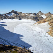
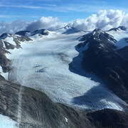
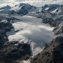
I research the cryosphere (frozen Earth) using an approach that integrates in situ data collected in the field, remotely-sensed data, and simple numerical models. My main research interest is in quantitative glaciology, especially regarding the physics of glacier flow and glacier-climate relationships.
Research Interests
The snow and ice systems I study are intimately linked to the lithosphere, biosphere, and hydrosphere. My research therefore often overlaps with avalanche science, geology, geomorphology, ecology, and hydrology in alpine and Arctic settings. Currently I work with the U.S. Geological Survey Glaciers and Climate Project and the Climate Change in Mountain Ecosystems group.
Education and Certifications
Ph.D. Geosciences. 2018. University of Montana, Missoula, Montana
M.S. Earth Sciences. 2011. Montana State University, Bozeman, Montana
B.A. Geology. 2007. Colorado College, Colorado Springs, Colorado
Science and Products
Glaciers and Climate Project
Sperry Glacier
Lemon Creek Glacier
Additional Research Glaciers
Wolverine Glacier
South Cascade Glacier
Gulkana Glacier
Mass Balance Summary
Mass Balance Methods - Measuring Glacier Change
Glaciers—Understanding Climate Drivers
Assessing the Vulnerability of Alaska’s Glaciers in a Changing Climate
USGS Benchmark Glacier Project
Firn Density and Stratigraphy Observations from USGS Benchmark Glaciers
Scanned field notebooks from a USGS Benchmark Glacier: South Cascade Glacier, Washington,1957 - 2022
USGS Benchmark Glacier Mass Balance and Project Data
Glacier-Wide Mass Balance and Compiled Data Inputs: USGS Benchmark Glaciers
Raw Ground Penetrating Radar Data on North American Glaciers
Historical Structure from Motion (HSfM): Automated processing of historical aerial photographs for long-term topographic change analysis
Uncertainty of ICESat-2 ATL06- and ATL08-derived snow depths for glacierized and vegetated mountain regions
U.S. Geological Survey Benchmark Glacier Project
The U.S. Geological Survey Benchmark Glacier Project combines decades of direct glaciological data with remote sensing data to advance the quantitative understanding of glacier-climate interactions. The global loss of glaciers, and consequent implications for water resources, sea level rise, and ecosystem function underscores the importance of U.S. Geological Survey glaciology research to facilit
Specialized meltwater biodiversity persists despite widespread deglaciation
Parsing complex terrain controls on mountain glacier response to climate forcing
Glacier retreat in Glacier National Park, Montana
Reanalysis of the U.S. Geological Survey Benchmark Glaciers: Long-term insight into climate forcing of glacier mass balance
Local topography increasingly influences the mass balance of a retreating cirque glacier
Non-USGS Publications**
reflects the present-day internal flow field in the ablation zone of western
Greenland Ice Sheet. Frontiers in Earth Science 6, 1-11. https://doi.org/10.3389/feart.2018.00044
and internal deformation at Lone Peak rock glacier, Big Sky, Montana, USA.
Journal of Glaciology 60, 453-462. https://doi.org/10.3189/2014JoG13J160
**Disclaimer: The views expressed in Non-USGS publications are those of the author and do not represent the views of the USGS, Department of the Interior, or the U.S. Government.
Glacier Dashboard
The U.S. Geological Survey Alaska Climate Adaptation Science Center collaborated with the Alaska Science Center and Northern Rocky Mountain Science Center to compile available datasets on glacier outlines, ice thickness, ice velocity, and glacier surface elevation change to assess the vulnerability of Alaskan glaciers. This data viewer reflects that effort.
The Glacier - Climate Connection
The Glacier-Climate Connection geonarrative tells the story of the U.S. Geological Survey Benchmark Glacier Project, one of the longest running studies of glaciers on Earth.
Science and Products
- Science
Filter Total Items: 19
Glaciers and Climate Project
Mountain glaciers are dynamic reservoirs of frozen water closely coupled to ecosystems and climate. Glacier change in North America has major socioeconomic impacts, including global sea level change, tourism disruption, natural hazard risk, fishery effects, and water resource alteration. Understanding and quantifying precise connections between glaciers and climate is critical to decision makers...Sperry Glacier
Sperry Glacier is located along the Continental Divide within Glacier National Park, Montana. It represents the midlatitude continental or transitional climate. Glacier observations began at this site in 2005.Lemon Creek Glacier
Lemon Creek Glacier is located in the high-latitude maritime region of Alaska, at the southernmost tip of the Juneau Icefield. Glacier observations began at this site in 1953.Additional Research Glaciers
Black Rapids, Columbia and Hubbard glaciers are also researched by the USGS.Wolverine Glacier
Wolverine Glacier is located in the high-latitude maritime climate regime of Alaska’s Kenai Mountains. Glacier observations began at this site in 1966.South Cascade Glacier
South Cascade Glacier is located in the midlatitude maritime climate of the North Cascade Mountains of Washington State. Glacier observations began at this site in 1958.Gulkana Glacier
Gulkana Glacier is located in the high-latitude continental climate regime of Alaska’s Delta Mountains. Glacier observations began at this site in 1966.Mass Balance Summary
The USGS Benchmark Glacier Project measures changes in mass balance at five benchmark glaciers: Gulkana (AK), Wolverine (AK), Lemon Creek (AK), South Cascade (WA), and Sperry (MT).Mass Balance Methods - Measuring Glacier Change
Nearly all Earth's alpine glaciers are losing ice, usually expressed as loss of mass. Rates of mass loss for North American glaciers are among the highest on Earth (Gardner, 2013) and shrinking glaciers are often the most visible indicators of mountain ecosystems responding to climate change.Glaciers—Understanding Climate Drivers
Across the globe, glaciers are decreasing in volume and number in response to climate change. Glaciers are important for agriculture, hydropower, recreation, tourism, and biological communities. Loss of glaciers contributes to sea-level rise, creates environmental hazards and can alter aquatic habitats. These are among the cascading effects linked to glacier loss which impact ecosystems and human...Assessing the Vulnerability of Alaska’s Glaciers in a Changing Climate
Retreating glaciers are an iconic image of climate change;yet not all glaciers in Alaska are actively retreating, and a few glaciers are even advancing. While this contrasting behavior can be misleading for the casual observer, variable responses between glaciers in a changing climate are expected. Glaciers act as conveyor belts that transport snow and ice from high elevations, where it does not mUSGS Benchmark Glacier Project
Scientists with the USGS Benchmark Glacier Project study the process and impacts of glacier change, including sea-level rise, water resources, environmental hazards and ecosystem links. At the core of this research are mass balance measurements at five glaciers in the United States. Since the 1960s, these glaciers have been studied using direct observations of glaciers and meteorology. The project... - Data
Firn Density and Stratigraphy Observations from USGS Benchmark Glaciers
This dataset contains observations of snow and firn density and stratigraphy from Site EC on Wolverine Glacier. Site EC is located in the accumulation zone on the northwest flank of the upper glacier at 1350m. Cores were recovered using a FELICS corer to approximately 25m depth at the end of the accumulation season and the end of ablation season starting in 2016. Additional cores were drilled throScanned field notebooks from a USGS Benchmark Glacier: South Cascade Glacier, Washington,1957 - 2022
This data release is a collection of data and field notes documenting snow and ice changes on South Cascade Glacier, Washington, USA. The field records relate to glaciological research and reflect evolving interpretations of glacier mass balance, climatology, hydrology, and other glacier-related research conducted at the site between 1957 to 2022 in association with the USGS Benchmark Glacier ProjUSGS Benchmark Glacier Mass Balance and Project Data
Since the late 1950s, the USGS has maintained a long-term glacier mass-balance program at three North American glaciers. Measurements began on South Cascade Glacier, WA in 1958, expanding to Gulkana and Wolverine glaciers, AK in 1966, and later Sperry Glacier, MT in 2005. Additional measurements have been made on Lemon Creek Glacier, AK to compliment data collected by the Juneau Icefield ResearchGlacier-Wide Mass Balance and Compiled Data Inputs: USGS Benchmark Glaciers
Since the late 1950s, the USGS has maintained a long-term glacier mass-balance program at three North American glaciers. Measurements began on South Cascade Glacier, WA in 1958, expanding to Gulkana and Wolverine glaciers, AK in 1966, and later Sperry Glacier, MT in 2005. Additional measurements have been made on Lemon Creek Glacier, AK to compliment data collected by the Juneau Icefield ResearchRaw Ground Penetrating Radar Data on North American Glaciers
U.S. Geological Survey researchers conducted time-series ground-penetrating radar (GPR) surveys with a Sensors and Software 500-MHz Pulse Ekko Pro system. This data release contains ground-based (ski and snowmobile) as well as airborne common-offset profiles. All profiles are linked to coincident GPS observations. Additionally, common-midpoint data was collected at specific glacier locations. Coin - Multimedia
- Publications
Historical Structure from Motion (HSfM): Automated processing of historical aerial photographs for long-term topographic change analysis
Precisely measuring the Earth’s changing surface on decadal to centennial time scales is critical for many science and engineering applications, yet long-term records of quantitative landscape change are often temporally and geographically sparse. Archives of scanned historical aerial photographs provide an opportunity to augment these records with accurate elevation measurements that capture theAuthorsFriedrich Knuth, David Shean, Shashank Bhushan, Eli Schwat, Oleg Alexandrov, Christopher J. McNeil, Amaury Dehecq, Caitlyn Florentine, Shad O'NeelUncertainty of ICESat-2 ATL06- and ATL08-derived snow depths for glacierized and vegetated mountain regions
Seasonal snow melt dominates the hydrologic budget across a large portion of the globe. Snow accumulation and melt vary over a broad range of spatial scales, preventing accurate extrapolation of sparse in situ observations to watershed scales. The lidar onboard the Ice, Cloud, and land Elevation, Satellite (ICESat-2) was designed for precise mapping of ice sheets and sea ice, and here we assess thAuthorsEllyn Enderlin, Colten Elkin, Madeline Gendreau, H. P. Marshall, Shad O'Neel, Christopher J. McNeil, Caitlyn Florentine, Louis C. SassU.S. Geological Survey Benchmark Glacier Project
The U.S. Geological Survey Benchmark Glacier Project combines decades of direct glaciological data with remote sensing data to advance the quantitative understanding of glacier-climate interactions. The global loss of glaciers, and consequent implications for water resources, sea level rise, and ecosystem function underscores the importance of U.S. Geological Survey glaciology research to facilit
AuthorsCaitlyn Florentine, Lisa L. MckeonSpecialized meltwater biodiversity persists despite widespread deglaciation
Glaciers are important drivers of environmental heterogeneity and biological diversity across mountain landscapes. Worldwide, glaciers are receding rapidly due to climate change, with important consequences for biodiversity in mountain ecosystems. However, the effects of glacier loss on biodiversity have never been quantified across a mountainous region, primarily due to a lack of adequate data atAuthorsClint C. Muhlfeld, Timothy Joseph Cline, J. Joseph Giersch, Erich Peitzsch, Caitlyn Florentine, Dean Jacobsen, Scott HotalingParsing complex terrain controls on mountain glacier response to climate forcing
Glaciers are a key indicator of changing climate in the high mountain landscape. Glacier variations across a mountain range are ultimately driven by regional climate forcing. However, changes also reflect local, topographically driven processes such as snow avalanching, snow wind-drifting, and radiation shading as well as the initial glacier conditions such as hypsometry and ice thickness. Here weAuthorsCaitlyn Elizabeth Florentine, Joel T. Harper, Daniel B. FagreGlacier retreat in Glacier National Park, Montana
Currently, the volume of land ice on Earth is decreasing, driving consequential changes to global sea level and local stream habitat. Glacier retreat in Glacier National Park, Montana, U.S.A., is one example of land ice loss and glacier change. The U.S. Geological Survey Benchmark Glacier Project conducts glaciological research and collects field measurements across select North American glaciers,AuthorsCaitlyn FlorentineReanalysis of the U.S. Geological Survey Benchmark Glaciers: Long-term insight into climate forcing of glacier mass balance
Mountain glaciers integrate climate processes to provide an unmatched signal of regional climate forcing. However, extracting the climate signal via intercomparison of regional glacier mass balance records can be problematic when methods for extrapolating and calibrating direct glaciological measurements are mixed or inconsistent. To address this problem, we reanalyzed and compared long-term massAuthorsShad O'Neel, Christopher J. McNeil, Louis C. Sass, Caitlyn Florentine, Emily Baker, Erich Peitzsch, Daniel J McGrath, Andrew G. Fountain, Daniel B. FagreLocal topography increasingly influences the mass balance of a retreating cirque glacier
Local topographically driven processes – such as wind drifting, avalanching, and shading – are known to alter the relationship between the mass balance of small cirque glaciers and regional climate. Yet partitioning such local effects from regional climate influence has proven difficult, creating uncertainty in the climate representativeness of some glaciers. We address this problem for Sperry GlaAuthorsCaitlyn Florentine, Joel T. Harper, Daniel B. Fagre, Johnnie Moore, Erich H. PeitzschNon-USGS Publications**
Florentine, C., J. Harper, J. Johnson, T. Meierbachtol. 2018. Radiostratigraphy
reflects the present-day internal flow field in the ablation zone of western
Greenland Ice Sheet. Frontiers in Earth Science 6, 1-11. https://doi.org/10.3389/feart.2018.00044Florentine, C., M. Skidmore, M. Speece, C. Link, C. Shaw. 2014. Surface morphology
and internal deformation at Lone Peak rock glacier, Big Sky, Montana, USA.
Journal of Glaciology 60, 453-462. https://doi.org/10.3189/2014JoG13J160**Disclaimer: The views expressed in Non-USGS publications are those of the author and do not represent the views of the USGS, Department of the Interior, or the U.S. Government.
- Web Tools
Glacier Dashboard
The U.S. Geological Survey Alaska Climate Adaptation Science Center collaborated with the Alaska Science Center and Northern Rocky Mountain Science Center to compile available datasets on glacier outlines, ice thickness, ice velocity, and glacier surface elevation change to assess the vulnerability of Alaskan glaciers. This data viewer reflects that effort.
The Glacier - Climate Connection
The Glacier-Climate Connection geonarrative tells the story of the U.S. Geological Survey Benchmark Glacier Project, one of the longest running studies of glaciers on Earth.
- News