
Known Issues - topoBuilder and OnDemand Topo
This page contains the most up-to-date documentation of known issues for the topoBuilder application and OnDemand Topo map products.
Create an OnDemand Topo
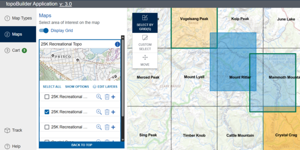
Build a USGS topographic map with choice of format, area of interest, scale, and National Map content.
Release Notes

Read about bug fixes, enhancements, and other changes to topoBuilder and OnDemand Topos. Notes on both the current and previous releases are available.
Last Update: June 10, 2026
For technical questions not covered below, please consult the topoBuilder User Guide or contact The National Map Help Desk (tnm_help@usgs.gov).
Page Navigation: Web Application - topoBuilder | Map Products - OnDemand Topo | RESOLVED ISSUES
Web Application - topoBuilder
Enhancements to both the functionality and user experience of the topoBuilder application are ongoing. Known issues are listed below and are in the queue to be resolved.
- File Format: The TIFF file format is temporarily unavailable for selection. Two alternative solutions for obtaining a geoTIFF are 1) converting a PDF to a geoTIFF within a GIS platform like ArcGIS Pro or QGIS, or 2) converting to a TIFF using a free, online Adobe service. [ADDED 5/27/2026]
- Track Tab: The Contour Smoothing selection is not shown in the Table View of the Track Tab for 7.5-Minute Topos. [ADDED 02/03/2026]
- Map Selection: Maps are unable to be selected if they touch the date line in Alaska. [ADDED 07/29/2025]
- Mobile: Track tab card for 100K Topo incorrectly includes Contour Smoothing. [ADDED 03/18/2025]
Map Products - OnDemand Topo
The issues outlined in this section apply to the map products (known as OnDemand Topos). Known issues are listed below and are in the queue to be resolved.
Map Type – 250K Topo
- North Arrow: The north arrow is not updating correctly. [ADDED 06/10/2026]
- Map Failures: All-water maps containing slivers of boundary data may fail to process. [ADDED 06/10/2026]
- PDF Table of Contents: Some layers may appear in the table of contents even though they were removed for export. [ADDED 5/27/2026]
- 250K Cartographic Data: Limited data coverage or data errors may exist. The generalized data is currently only intended for cartographic display at a scale of 1:250,000. [ADDED 09/30/2025]
- Shaded Relief: Shaded Relief is tiled, especially when viewed as a PDF with the “Enhance Thin Lines” option enabled. [ADDED 09/30/2025]
- Grid Labels: Grid labels may overlap the map area. [ADDED 09/30/2025]
- Contours: Contours in coastal areas may be absent, and contours may be seen in oceans, lakes, and rivers. [ORIGINALLY POSTED 09/30/2025; REVISED 05/27/2026]
- Label Overflow: Some map labels appear outside the map frame. [ADDED 09/30/2025]
- PLSS Diagram: Red map extent box may appear in areas where PLSS data does not exist. [ADDED 09/30/2025]
- Map Title: Primary state in map title is reflective of state with majority area in the map frame and may not reflect the location of feature used in the on-grid product name. [ADDED 09/30/2025]
- Map Failures: Maps that touch the date line in Alaska are unable to be generated. [ADDED 09/30/2025]
Map Type - 100K Topo
- North Arrow: The north arrow is not updating correctly. [ADDED 06/10/2026]
- Map Failures: All-water maps containing slivers of boundary data may fail to process. [ADDED 06/10/2026]
- Map Failures: Maps that touch the date line in Alaska are unable to be selected and/or generated. [ADDED 06/05/2026]
- PDF Table of Contents: Some layers may appear in the table of contents even though they were removed for export. An extra folder layer may also be present. [ADDED 05/27/2026]
- Boundary Symbology: Certain boundary symbology may have holes within polygon areas filled in [ADDED 02/05/2026]
- Northern Mariana Islands: Some Northern Mariana Islands maps will fail to export due to missing elevation data. [ADDED 07/29/2025]
- Northern Mariana Islands: Some Northern Mariana Islands maps will include an extra folder layer in the table of contents that includes hydrography. [ADDED 07/29/2025]
- Product Metadata: 100K Topo metadata does not conform to the Content Standard for Digital Geospatial Metadata (CSDGM), otherwise known as the FGDC metadata standard, Document Type Definition (DTD), which establishes the formalized XML metadata structure and content. XML Metadata is missing a space in “100KTopo” [ORIGINALLY POSTED 10/30/2023; REVISED 07/29/2025].
- Contours: The Contours for Provisional Guam 2 are incomplete topologically. [ADDED 03/18/2025]
- Contours: Contours may be seen in oceans, lakes, and rivers. [ORIGINALLY POSTED 10/30/2024; REVISED 05/27/2026]
- Grid and Graticules: Grid and Graticules are cut off or incomplete in Hawaii near Kahului and in Puerto Rico. [ADDED 03/18/2025]
- Grid Labels: Certain maps in Alaska and Hawaii have incorrect Grid and Graticule labels. [ADDED 03/18/2025; REVISED 02/03/2026]
- US Capitol: Washington DC does not include the US Capitol point and symbol. [ADDED 03/18/2025]
- TIFF Output: Cannot extract TIFFs with long names. Rename the zip file before trying to extract it. [ADDED 03/18/2025]
- Map Title: Washington, D.C. maps have incorrect state attribution - Virginia (VA) or Maryland (MD) instead of D.C. [ADDED 03/18/2025]
- Locator Map: U.S. Virgin Islands and Puerto Rico locator maps may be incorrect; it is cut off and does not accurately show the map extent as a result. [ADDED 03/18/2025; REVISED 5/27/2026]
- Shaded Relief: Shaded Relief is tiled, especially when viewed as a PDF with the “Enhance Thin Lines” option enabled. [ADDED 03/18/2025]
- TIFF Output: May appear oversized when brought into GIS software. [ADDED 01/19/2024]
- Grid Labels: Grid labels may overlap the map area. [ADDED 10/30/2023]
- 100K Cartographic Data: Limited data coverage or minor data errors may exist. The generalized data is currently only intended for cartographic display at a scale of 1:100,000. [ADDED 10/30/2023]
Map Type – 25K Recreational Topo
- North Arrow: The north arrow is not updating correctly. [ADDED 06/10/2026]
- Boundary Symbology: Certain boundary symbology may have holes within polygon areas filled in [ADDED 06/05/2026]
- PDF Table of Contents: Some layers may appear in the table of contents even if there is no data. [ADDED 5/27/2026]
- Map Collar: Export date is missing from the map collar. [ADDED 5/27/2026]
- Shaded Relief: Shaded Relief is tiled when viewed as a PDF with the “Enhance Thin Lines” option enabled in Adobe. [ADDED 07/29/2025]
- Label Overflow: Some map labels appear outside the map frame. [ADDED 07/29/2025]
- Contours: Contours may be seen in oceans, lakes, and rivers. [ORIGNALLY POSTED 07/29/2025; REVISED 05/27/2026]
- Northern Mariana Islands: Some Northern Mariana Islands maps will fail to export due to missing elevation data. [ADDED 07/29/2025]
- Guam, the Northern Mariana Islands, & American Samoa: Due to limited data features may be absent from one or more of the following themes. [ADDED 07/29/2025]:
- Structures
- Hydrography (Streams, Rivers, Lakes, and Ocean)
- Elevation (Shaded Relief and/or Contours)
- Transportation
- Populated Places
Map Type – 7.5-Minute Topo
- North Arrow: The north arrow is not updating correctly. [ADDED 06/10/2026]
- Boundary Symbology: Certain boundary symbology may have holes within polygon areas filled in [ADDED 06/05/2026]
- Label Overflow: Some map labels appear outside the map frame. [ADDED 05/27/2026]
- PDF Table of Contents: Some layers may appear in the table of contents even though they were removed for export. An “Extra OCGs” folder may also be present. [ADDED 05/27/2026]
- Contours: Contours may be seen in oceans, lakes, and rivers. [ORIGINALLY POSTED 10/30/2024; REVISED 05/27/2026]
- Contours: Contours in coastal areas may have relics that are inaccurate and contours may be seen in oceans, lakes, and rivers. [ORIGINALLY POSTED 10/30/2024; REVISED 03/18/2025]
- Shaded Relief: Shaded Relief is tiled, especially when viewed as a PDF with the “Enhance Thin Lines” option enabled in Adobe. [ADDED 10/30/2023]
- Imagery: Imagery may be incomplete or unavailable in certain quads. [ADDED 10/30/2023; REVISED 02/03/2026]
- Northern Mariana Islands: Some Northern Mariana Islands maps will fail to export due to missing elevation data. [ADDED 10/30/2023]
- Guam, the Northern Mariana Islands, & American Samoa: Due to limited data available for these areas, features may be absent from one or more of the following themes. [ADDED 02/22/2022]:
- Structures
- Hydrography (Streams, Rivers, Lakes, and Ocean)
- Elevation (Shaded Relief and/or Contours)
- Transportation
- Populated Places
- Imagery
Recently Resolved Issues
Issues identified above will move to this section once a solution or fix has been implemented. Bug fixes, changes, enhancements, & new features are also documented on the topoBuilder Release Notes page.
- Tool Tips: Tool tips are not displayed for the View buttons in the Track tab. [ADDED 03/18/2025; RESOLVED 5/27/2026] (Web Application)
- Map Selection: Map panning functionality may not work as expected after moving a custom-selected extent for any map type. [ADDED 03/05/2026; RESOLVED 5/27/2026]
- Track Tab: The progress bar does not change color to green or red when an order has Completed or Failed, respectively. [ADDED 02/03/2026; RESOLVED 05/27/2026] (Web Application)
- Edit Layers: Edit Layers selections are not being reset to the default (all layers on) after an order has been submitted or after the page is refreshed. [ADDED 02/03/2026; RESOLVED 05/27/2026] (Web Application)
- Track Tab: The order status is not updating when the Refresh button is clicked. Re-enter the Order Confirmation Number and click the Track button to see the updated status. [ADDED 9/30/2025; RESOLVED 05/27/2026] (Web Application)
- U.S. Web Design System Links: The E-Gov URL at the bottom of the page is broken. [ORIGINALLY POSTED 03/18/2025, REVISED 07/29/2025; RESOLVED 05/27/2026] (Web Application)
- Basemaps: USGS Topo Basemap icon is blank. [ADDED 03/18/2025; RESOLVED 05/27/2026] (Web Application)
- Tool Tips: Tool tips are not displayed for “+” and “-” in the Map Types window. [ADDED 03/18/2025; RESOLVED 05/27/2026] (Web Application)
- Cart: Map Type Cards may remain in the cart even if no maps are included in the cart for that Map Type. [ADDED 07/29/2025; RESOLVED 05/27/2026] (Web Application)
- Map Title: Some Map names include an extra “ – “. [ADDED 03/18/2025; RESOLVED 05/27/2026] (100K Topo)
- Quadrangle Location Diagram: Some maps have the text “QUADRANGLE LOCATION” overprinting the quadrangle location diagram. [ADDED 9/30/2025; RESOLVED 05/27/2026] (7.5-Minute Topo)
- Locator Map: Isolated maps have overprinting state locator and quad diagrams. [ADDED 10/30/2023; RESOLVED 05/27/2026] (7.5-Minute Topo)
- Contours: Contours in coastal areas may have relics that are inaccurate. [ADDED 10/30/2024; RESOLVED 05/27/2026] (All map products)
- Page Size: Page sizes may be inconsistent between on grid and custom map extents requested over the same area. [ADDED 09/30/2025; RESOLVED 02/03/2026] (250K Topo)
- Edit Layers: Some layers are not being removed when toggled off in the Edit Layers option in topoBuilder: Populated Places, Boundary datasets including National Monument, Wilderness, US Fish and Wildlife Services, and National Cemetery, and Land Cover. Some of these will be present in the PDF Table of Contents even if empty. [ADDED 03/18/2025; RESOLVED 02/03/2026] (100K Topo)
- Contours: Maps with contours drawn at the 5-foot interval have index contours every 20 feet. [ADDED 07/29/2025; RESOLVED 02/03/2026] (25K Recreational Topo)
- TIFF Output: Structure points have excessively large halos. [ADDED 07/29/2025; RESOLVED 02/03/2026] (25K Recreational Topo)
- Edit Layers: An Extra Optional Content Group (Extra OCGs) layers folder may appear in PDFs when no Edit Layers options were used in some maps. [ADDED 9/30/2025; RESOLVED 02/03/2026] (7.5-Minute Topo)
- Imagery: Some maps may have incomplete or missing imagery when exported to TIFF format. [ADDED 9/30/2025; RESOLVED 02/03/2026] (7.5-Minute Topo)
- Puerto Rico and the U.S. Virgin Islands: Some Puerto Rico and U.S. Virgin Islands maps have an abnormal gap between the edge of the map frame and collar elements. [ADDED 03/18/2025; RESOLVED 02/03/2026] (7.5-Minute Topo)
- Quadrangle Location Diagram: The quadrangle location map may be incorrectly zoomed or missing entirely in maps of US territories. [ADDED 9/30/2025; RESOLVED 02/03/2026] (7.5-Minute Topo)
- Northern Mariana Islands: Some Northern Mariana Islands maps will include an extra folder layer in the table of contents that includes hydrography. [ADDED 07/29/2025; RESOLVED 02/03/2026] (7.5-Minute Topo)
- Natural Feature Labels: Natural features may have duplicate labels. [ORIGINALLY POSTED 06/23/2023; REVISED 03/31/2025; RESOLVED 02/03/2026] (7.5-Minute Topo)
- Cart: The Cart does not properly show “User Defined Content” when the Edit Layer functionality is utilized to remove layers. [ORIGINALLY POSTED 03/18/2025; RESOLVED 09/30/2025] (Web Application)
- Track Tab: Track tab missing Contour Smoothing for 7.5-Minute Topos. [ORIGINALLY POSTED 03/18/2025; RESOLVED 09/30/2025] (Web Application)
- Map Selection: Users are unable to select the same grid twice within 1 session. There is no longer a warning pop-up when a user selects the same Grid twice. [ORIGINALLY POSTED 03/18/2025; RESOLVED 09/30/2025] (Web Application)
- Mobile: Not all Basemaps are present. [ORIGINALLY POSTED 03/18/2025; RESOLVED 09/30/2025] (Web Application)
- Mobile: There is a double search bar, and one does not work. [ORIGINALLY POSTED 03/18/2025; RESOLVED 09/30/2025] (Web Application)
- Mobile: The map may need to be zoomed out to the necessary user extent when “Pan and zoom to map product” button is clicked. [ORIGINALLY POSTED 03/18/2025; RESOLVED 09/30/2025] (Web Application)
- Grids & Graticules: Printed latitude and longitude may be incorrect for certain maps. [ORIGINALLY POSTED 07/29/2025; RESOLVED 09/30/2025] (25K Recreational Topo)
- Edit Layers: Certain Boundary datasets – including Wilderness and National Monument – are not being removed from the Table of Contents when Boundaries are toggled off in the Edit Layers option for certain maps. [ORIGINALLY POSTED 07/29/2025; RESOLVED 09/30/2025] (7.5-Minute Topo)
- Edit Layers: Land Cover is not being removed from the Table of Contents when Land Cover is toggled off in the Edit Layers option in topoBuilder. [ORIGINALLY POSTED 07/29/2025; RESOLVED 09/30/2025] (7.5-Minute Topo)
- Grids & Graticules: Printed latitude and longitude may be incorrect for certain maps. [ORIGINALLY POSTED 07/29/2025; RESOLVED 09/30/2025] (7.5-Minute Topo)
- Edit Layers: Natural features are not being removed from the Table of Contents when Geographic Names are toggled off in the Edit Layers option in topoBuilder. [ORIGINALLY POSTED 10/30/2023; RESOLVED 09/30/2025] (7.5-Minute Topo)