



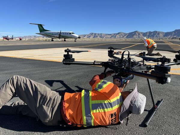
A USGS remote pilot secures a gamma ray spectrometer sensor onto an uncrewed aircraft system (UAS) at the Grand Junction Regional Airport (GJT) in Grand Junction, CO. Concrete pads built into the tarmac at GJT contain known concentrations of naturally occurring radioactive materials including Potassium, Thorium, and Uranium for radiometric calibration.
New Article: Spectrometer consistency testing supports flexible field data collection for drone vegetation mapping
New Article: Drone-based radiometric surveys provide high-resolution mine waste characterization
New research article: evaluating radiometric calibration and data quality of spectral UAS sensors
Using uncrewed aircraft systems to assess landslide damage after Hurricane Helene
UAS 3D Model of Marsh-Felch Quarry in Colorado
The U.S. Geological Survey (USGS) National Uncrewed Systems Office (NUSO) leads the research activities needed to make Uncrewed Aircraft Systems (UAS) data collection an efficient, safe, and cost-effective remote sensing tool for Department of the Interior (DOI) and USGS scientists.
Technology Research
Technology Research
Research Missions
Research Missions
What We Do
Media

Sources/Usage: Public Domain. View Media Details
We focus on the evaluation of new platforms, integration of new UAS-compatible sensors, development of data specifications and processing techniques, recommendations of UAS data acquisition best-practices, and operational support for new and existing DOI remote pilots.
Who We Are
Media

Sources/Usage: Public Domain. View Media Details
We are a team of platform and UAS-compatible sensor subject matter experts that, in addition to research, provide operational support to DOI remote pilots and outreach to federal, public, and international audiences. Our office, established on May 8th, 2008, operates as part of the National Land Imaging Program, and contributes to its goal to provide the Federal Government and the public with the remotely sensed data and applications needed to support our Nation’s economic security and environmental vitality.

NUSO Research Missions
Research missions, often performed in cooperation with other DOI bureaus as well as non-DOI collaborators, serve as vital tools in the ongoing evaluation and integration activities that support the strategic implementation of UAS into the USGS and the DOI. * Any use of trade, firm, or product names is for descriptive purposes only and does not imply endorsement by the U.S. Government.

NUSO Research Activities
Ongoing research efforts focus on the platform evaluation, sensor integration, technique development and data assessment activities needed to support the USGS’s and the DOI’s strategic implementation of UAS. * Any use of trade, firm, or product names is for descriptive purposes only and does not imply endorsement by the U.S. Government.
Filter Total Items: 125
Securing sensors to UAS
A USGS remote pilot secures a gamma ray spectrometer sensor onto an uncrewed aircraft system (UAS) at the Grand Junction Regional Airport (GJT) in Grand Junction, CO. Concrete pads built into the tarmac at GJT contain known concentrations of naturally occurring radioactive materials including Potassium, Thorium, and Uranium for radiometric calibration.
UAS at Grand Junction Regional Airport
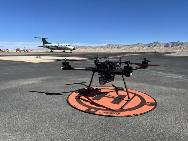
An uncrewed aircraft system (UAS) carrying a gamma ray spectrometer sensor sits on a landing pad at the Grand Junction Regional Airport (GJT) in Grand Junction, CO. USGS conducted UAS flights at a variety of transect spacings, altitudes, and directions over radioelement calibration pads built into the tarmac at GJT in support of critical mineral research.
An uncrewed aircraft system (UAS) carrying a gamma ray spectrometer sensor sits on a landing pad at the Grand Junction Regional Airport (GJT) in Grand Junction, CO. USGS conducted UAS flights at a variety of transect spacings, altitudes, and directions over radioelement calibration pads built into the tarmac at GJT in support of critical mineral research.
UAS performing radiometric calibration at Grand Junction Regional Airport
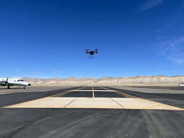
UAS performing radiometric calibration at Grand Junction Regional AirportAn uncrewed aircraft system (UAS) hovers a radioelement calibration pad with known concentrations of naturally occurring radioactive materials at the Grand Junction Regional Airport (GJT) in Grand Junction, CO. These calibration pads, managed by the U.S.
UAS performing radiometric calibration at Grand Junction Regional Airport
UAS performing radiometric calibration at Grand Junction Regional AirportAn uncrewed aircraft system (UAS) hovers a radioelement calibration pad with known concentrations of naturally occurring radioactive materials at the Grand Junction Regional Airport (GJT) in Grand Junction, CO. These calibration pads, managed by the U.S.
Tarps and targets used in UAS calibration and validation
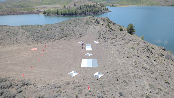
Tarps and targets used in UAS calibration and validationGreyscale tarps and ground control points were placed on land during harmful algae mapping fieldwork at Willow Creek Reservoir near Granby, CO. These targets enable calibration and validation of hyperspectral data captured by uncrewed aircraft systems (UAS) to study water quality and algae conditions across the reservoir.
Tarps and targets used in UAS calibration and validation
Tarps and targets used in UAS calibration and validationGreyscale tarps and ground control points were placed on land during harmful algae mapping fieldwork at Willow Creek Reservoir near Granby, CO. These targets enable calibration and validation of hyperspectral data captured by uncrewed aircraft systems (UAS) to study water quality and algae conditions across the reservoir.
UAS operations at Willow Creek Reservoir
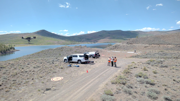
USGS remote pilots fly uncrewed aircraft systems to capture hyperspectral imagery and video footage at Willow Creek Reservoir in support of harmful algae bloom and water quality research led by the Colorado Water Science Center.
USGS remote pilots fly uncrewed aircraft systems to capture hyperspectral imagery and video footage at Willow Creek Reservoir in support of harmful algae bloom and water quality research led by the Colorado Water Science Center.
Willow Creek Reservoir, Colorado with UAS craft
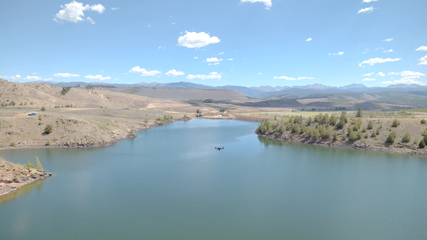
An uncrewed aircraft system (UAS) flies over the open water at Willow Creek Reservoir during a harmful algae bloom research campaign.
An uncrewed aircraft system (UAS) flies over the open water at Willow Creek Reservoir during a harmful algae bloom research campaign.
UAS over Willow Creek Reservoir, Colorado
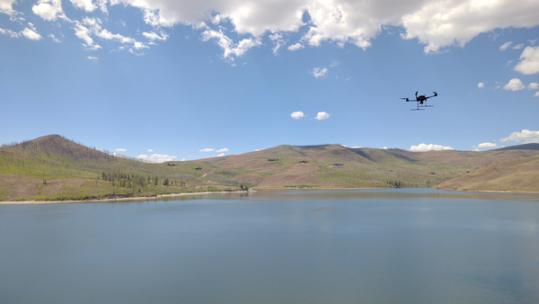
An uncrewed aircraft system (UAS) flies over the open water at Willow Creek Reservoir during a harmful algae bloom research campaign.
An uncrewed aircraft system (UAS) flies over the open water at Willow Creek Reservoir during a harmful algae bloom research campaign.
Flying UAS over Willow Creek Reservoir, Colorado
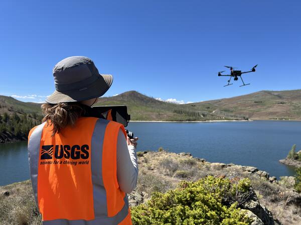
USGS National Uncrewed Systems Office (NUSO) remote pilot flies an uncrewed aircraft system (UAS) carrying a hyperspectral imaging payload at Willow Creek Reservoir near Granby, Colorado. This data collection supported harmful algae bloom and water quality research led by the Colorado Water Science Center.
USGS National Uncrewed Systems Office (NUSO) remote pilot flies an uncrewed aircraft system (UAS) carrying a hyperspectral imaging payload at Willow Creek Reservoir near Granby, Colorado. This data collection supported harmful algae bloom and water quality research led by the Colorado Water Science Center.
Preparing drone for data collection at Willow Creek Reservoir near Granby, Colorado
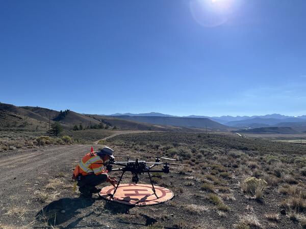
Preparing drone for data collection at Willow Creek Reservoir near Granby, ColoradoUSGS National Uncrewed Systems Office (NUSO) remote pilot prepares an uncrewed aircraft system (UAS) for hyperspectral data collection at Willow Creek Reservoir near Granby, Colorado. This data collection supported harmful algae bloom and water quality research led by the Colorado Water Science Center.
Preparing drone for data collection at Willow Creek Reservoir near Granby, Colorado
Preparing drone for data collection at Willow Creek Reservoir near Granby, ColoradoUSGS National Uncrewed Systems Office (NUSO) remote pilot prepares an uncrewed aircraft system (UAS) for hyperspectral data collection at Willow Creek Reservoir near Granby, Colorado. This data collection supported harmful algae bloom and water quality research led by the Colorado Water Science Center.
Setting up instruments for UAS flights at Williams Fork Reservoir, Colorado
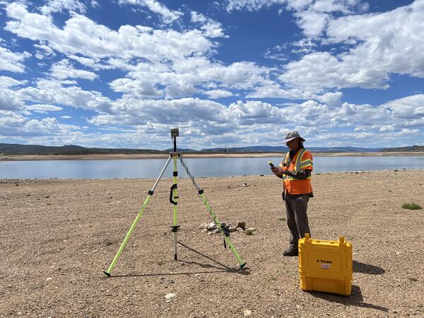
Setting up instruments for UAS flights at Williams Fork Reservoir, ColoradoUSGS National Uncrewed Systems Office (NUSO) remote pilot sets up a Global Navigation Satellite System (GNSS) base station to enable geospatial positioning corrections of remote sensing data at Williams Fork Reservoir near Kremmling, Colorado.
Setting up instruments for UAS flights at Williams Fork Reservoir, Colorado
Setting up instruments for UAS flights at Williams Fork Reservoir, ColoradoUSGS National Uncrewed Systems Office (NUSO) remote pilot sets up a Global Navigation Satellite System (GNSS) base station to enable geospatial positioning corrections of remote sensing data at Williams Fork Reservoir near Kremmling, Colorado.
Carrying UAS equipment to the launch site
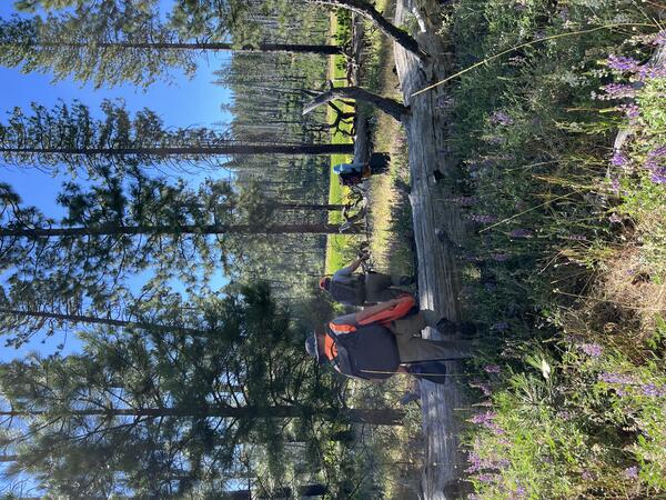
USGS personnel hike through tall grasses and over fallen trees to access a launch site for uncrewed aircraft systems (UAS) lidar data collection as part of the Ackerson Meadow restoration in Yosemite National Park, California.
USGS personnel hike through tall grasses and over fallen trees to access a launch site for uncrewed aircraft systems (UAS) lidar data collection as part of the Ackerson Meadow restoration in Yosemite National Park, California.
Ackerson Meadow, Yosemite National Park
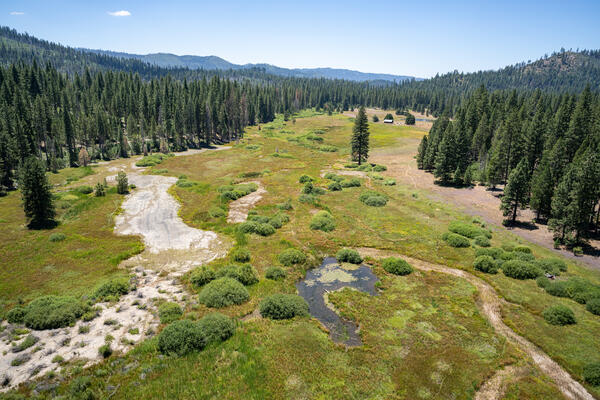
Oblique natural color view of Ackerson Meadow in Yosemite National Park, California, taken using UAS.
Oblique natural color view of Ackerson Meadow in Yosemite National Park, California, taken using UAS.
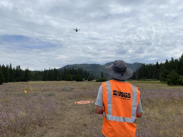
Piloting UAS in Yosemite National Park
A USGS National Uncrewed Systems Office (NUSO) remote pilot flies an uncrewed aircraft system (UAS) carrying a lidar sensor to map vegetation and topography during the Ackerson Meadow restoration in Yosemite National Park, California.
A USGS National Uncrewed Systems Office (NUSO) remote pilot flies an uncrewed aircraft system (UAS) carrying a lidar sensor to map vegetation and topography during the Ackerson Meadow restoration in Yosemite National Park, California.
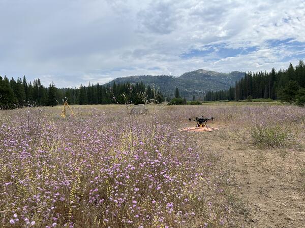
UAS in Yosemite National Park
An uncrewed aircraft system (UAS) with a mounted lidar sensor sits on an orange landing pad in a field of purple flowers at Ackerson Meadow in Yosemite National Park, California. Repeat lidar data scans were collected by the USGS National Uncrewed Systems Office (NUSO) to quantify vegetation and topographic changes during meadow restoration.
An uncrewed aircraft system (UAS) with a mounted lidar sensor sits on an orange landing pad in a field of purple flowers at Ackerson Meadow in Yosemite National Park, California. Repeat lidar data scans were collected by the USGS National Uncrewed Systems Office (NUSO) to quantify vegetation and topographic changes during meadow restoration.
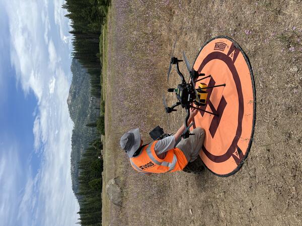
Readying UAS for flight in Yosemite National Park
USGS National Uncrewed Systems Office (NUSO) remote pilot Mark Bauer prepares an uncrewed aircraft system (UAS) for lidar data collection at Ackerson Meadow in Yosemite National Park, California.
USGS National Uncrewed Systems Office (NUSO) remote pilot Mark Bauer prepares an uncrewed aircraft system (UAS) for lidar data collection at Ackerson Meadow in Yosemite National Park, California.
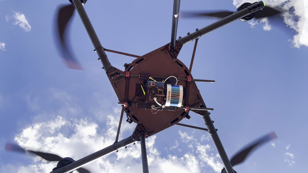
Drone with hyperspectral imaging payload with integrated lidar sensor
Drone with hyperspectral imaging payload with integrated lidar sensorUncrewed aircraft system (UAS) carrying a hyperspectral imaging payload with integrated lidar sensor during test and evaluation flights by the USGS National Uncrewed Systems Office.
Any use of trade, firm, logos, or product names is for descriptive purposes only and does not imply endorsement by the U.S. Government.
Drone with hyperspectral imaging payload with integrated lidar sensor
Drone with hyperspectral imaging payload with integrated lidar sensorUncrewed aircraft system (UAS) carrying a hyperspectral imaging payload with integrated lidar sensor during test and evaluation flights by the USGS National Uncrewed Systems Office.
Any use of trade, firm, logos, or product names is for descriptive purposes only and does not imply endorsement by the U.S. Government.
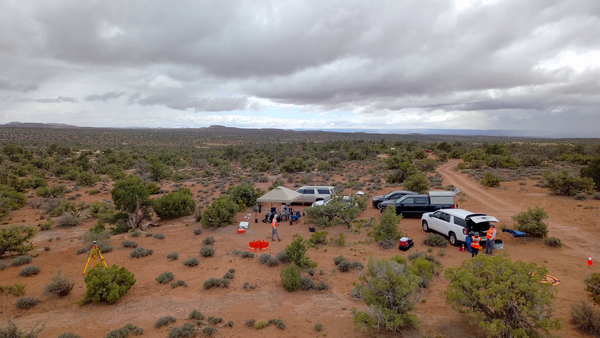
B-Roll: Field and drone remote sensing operations near Moab, Utah – May 2025
B-Roll: Field and drone remote sensing operations near Moab, Utah – May 2025In May 2025, the U.S. Geological Survey (USGS) National Uncrewed Systems Office (NUSO) collected uncrewed aircraft system (UAS, also known as drone) data to support a collaborative field campaign led by Sasha Reed of the Southwest Biological Science Center (SBSC) and Miguel Villarreal of the Western Geographic Science Center (WGSC) near Moab, Utah.
B-Roll: Field and drone remote sensing operations near Moab, Utah – May 2025
B-Roll: Field and drone remote sensing operations near Moab, Utah – May 2025In May 2025, the U.S. Geological Survey (USGS) National Uncrewed Systems Office (NUSO) collected uncrewed aircraft system (UAS, also known as drone) data to support a collaborative field campaign led by Sasha Reed of the Southwest Biological Science Center (SBSC) and Miguel Villarreal of the Western Geographic Science Center (WGSC) near Moab, Utah.
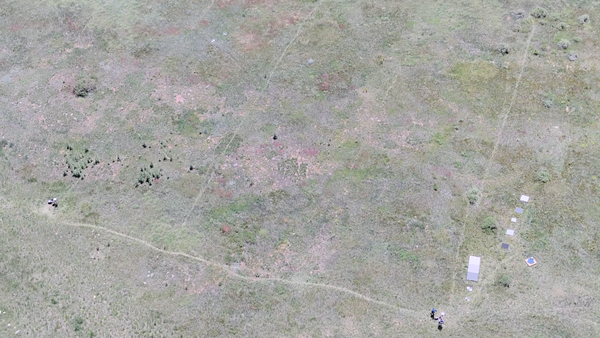
Uncrewed aircraft systems (UAS) instrument validation and calibration
Uncrewed aircraft systems (UAS) instrument validation and calibrationDrone-captured photo of a vegetated field in Golden, Colorado. Faint paths visible across the grass formed from the consistent, repeated pattern walked by a spectrometer operator multiple times per day for multiple days in a row.
Uncrewed aircraft systems (UAS) instrument validation and calibration
Uncrewed aircraft systems (UAS) instrument validation and calibrationDrone-captured photo of a vegetated field in Golden, Colorado. Faint paths visible across the grass formed from the consistent, repeated pattern walked by a spectrometer operator multiple times per day for multiple days in a row.
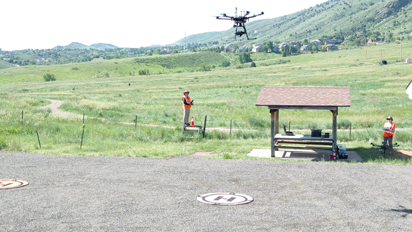
Collecting data using uncrewed aircraft systems (UAS)
Collecting data using uncrewed aircraft systems (UAS)USGS remote pilot Matt Burgess flies a drone to collect hyperspectral data over a field in Golden, Colorado.
Collecting data using uncrewed aircraft systems (UAS)
Collecting data using uncrewed aircraft systems (UAS)USGS remote pilot Matt Burgess flies a drone to collect hyperspectral data over a field in Golden, Colorado.
B-Roll: 2025 UAS radiometric calibration and validation research in Golden, Colorado
B-Roll: 2025 UAS radiometric calibration and validation research in Golden, ColoradoCalibration and validation (cal/val) are essential steps to ensure that remotely sensed data are reliable for scientific use. Radiometric cal/val involves converting digital image pixel values to meaningful units and assessing their accuracy.
B-Roll: 2025 UAS radiometric calibration and validation research in Golden, Colorado
B-Roll: 2025 UAS radiometric calibration and validation research in Golden, ColoradoCalibration and validation (cal/val) are essential steps to ensure that remotely sensed data are reliable for scientific use. Radiometric cal/val involves converting digital image pixel values to meaningful units and assessing their accuracy.
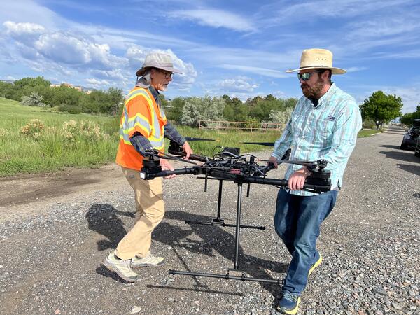
Carrying a drone aircraft
USGS remote pilots Joe Adams and Todd Burton carry a drone during flight training at the Denver Federal Center.
USGS remote pilots Joe Adams and Todd Burton carry a drone during flight training at the Denver Federal Center.
The U.S. Geological Survey (USGS) National Uncrewed Systems Office (NUSO) leads the research activities needed to make Uncrewed Aircraft Systems (UAS) data collection an efficient, safe, and cost-effective remote sensing tool for Department of the Interior (DOI) and USGS scientists.
Technology Research
Technology Research
Research Missions
Research Missions
What We Do
Media
Sources/Usage: Public Domain. View Media Details
We focus on the evaluation of new platforms, integration of new UAS-compatible sensors, development of data specifications and processing techniques, recommendations of UAS data acquisition best-practices, and operational support for new and existing DOI remote pilots.
Who We Are
Media
Sources/Usage: Public Domain. View Media Details
We are a team of platform and UAS-compatible sensor subject matter experts that, in addition to research, provide operational support to DOI remote pilots and outreach to federal, public, and international audiences. Our office, established on May 8th, 2008, operates as part of the National Land Imaging Program, and contributes to its goal to provide the Federal Government and the public with the remotely sensed data and applications needed to support our Nation’s economic security and environmental vitality.
NUSO Research Missions
Research missions, often performed in cooperation with other DOI bureaus as well as non-DOI collaborators, serve as vital tools in the ongoing evaluation and integration activities that support the strategic implementation of UAS into the USGS and the DOI. * Any use of trade, firm, or product names is for descriptive purposes only and does not imply endorsement by the U.S. Government.
NUSO Research Activities
Ongoing research efforts focus on the platform evaluation, sensor integration, technique development and data assessment activities needed to support the USGS’s and the DOI’s strategic implementation of UAS. * Any use of trade, firm, or product names is for descriptive purposes only and does not imply endorsement by the U.S. Government.
Filter Total Items: 125
Securing sensors to UAS
A USGS remote pilot secures a gamma ray spectrometer sensor onto an uncrewed aircraft system (UAS) at the Grand Junction Regional Airport (GJT) in Grand Junction, CO. Concrete pads built into the tarmac at GJT contain known concentrations of naturally occurring radioactive materials including Potassium, Thorium, and Uranium for radiometric calibration.
A USGS remote pilot secures a gamma ray spectrometer sensor onto an uncrewed aircraft system (UAS) at the Grand Junction Regional Airport (GJT) in Grand Junction, CO. Concrete pads built into the tarmac at GJT contain known concentrations of naturally occurring radioactive materials including Potassium, Thorium, and Uranium for radiometric calibration.
UAS at Grand Junction Regional Airport
An uncrewed aircraft system (UAS) carrying a gamma ray spectrometer sensor sits on a landing pad at the Grand Junction Regional Airport (GJT) in Grand Junction, CO. USGS conducted UAS flights at a variety of transect spacings, altitudes, and directions over radioelement calibration pads built into the tarmac at GJT in support of critical mineral research.
An uncrewed aircraft system (UAS) carrying a gamma ray spectrometer sensor sits on a landing pad at the Grand Junction Regional Airport (GJT) in Grand Junction, CO. USGS conducted UAS flights at a variety of transect spacings, altitudes, and directions over radioelement calibration pads built into the tarmac at GJT in support of critical mineral research.
UAS performing radiometric calibration at Grand Junction Regional Airport
UAS performing radiometric calibration at Grand Junction Regional AirportAn uncrewed aircraft system (UAS) hovers a radioelement calibration pad with known concentrations of naturally occurring radioactive materials at the Grand Junction Regional Airport (GJT) in Grand Junction, CO. These calibration pads, managed by the U.S.
UAS performing radiometric calibration at Grand Junction Regional Airport
UAS performing radiometric calibration at Grand Junction Regional AirportAn uncrewed aircraft system (UAS) hovers a radioelement calibration pad with known concentrations of naturally occurring radioactive materials at the Grand Junction Regional Airport (GJT) in Grand Junction, CO. These calibration pads, managed by the U.S.
Tarps and targets used in UAS calibration and validation
Tarps and targets used in UAS calibration and validationGreyscale tarps and ground control points were placed on land during harmful algae mapping fieldwork at Willow Creek Reservoir near Granby, CO. These targets enable calibration and validation of hyperspectral data captured by uncrewed aircraft systems (UAS) to study water quality and algae conditions across the reservoir.
Tarps and targets used in UAS calibration and validation
Tarps and targets used in UAS calibration and validationGreyscale tarps and ground control points were placed on land during harmful algae mapping fieldwork at Willow Creek Reservoir near Granby, CO. These targets enable calibration and validation of hyperspectral data captured by uncrewed aircraft systems (UAS) to study water quality and algae conditions across the reservoir.
UAS operations at Willow Creek Reservoir
USGS remote pilots fly uncrewed aircraft systems to capture hyperspectral imagery and video footage at Willow Creek Reservoir in support of harmful algae bloom and water quality research led by the Colorado Water Science Center.
USGS remote pilots fly uncrewed aircraft systems to capture hyperspectral imagery and video footage at Willow Creek Reservoir in support of harmful algae bloom and water quality research led by the Colorado Water Science Center.
Willow Creek Reservoir, Colorado with UAS craft
An uncrewed aircraft system (UAS) flies over the open water at Willow Creek Reservoir during a harmful algae bloom research campaign.
An uncrewed aircraft system (UAS) flies over the open water at Willow Creek Reservoir during a harmful algae bloom research campaign.
UAS over Willow Creek Reservoir, Colorado
An uncrewed aircraft system (UAS) flies over the open water at Willow Creek Reservoir during a harmful algae bloom research campaign.
An uncrewed aircraft system (UAS) flies over the open water at Willow Creek Reservoir during a harmful algae bloom research campaign.
Flying UAS over Willow Creek Reservoir, Colorado
USGS National Uncrewed Systems Office (NUSO) remote pilot flies an uncrewed aircraft system (UAS) carrying a hyperspectral imaging payload at Willow Creek Reservoir near Granby, Colorado. This data collection supported harmful algae bloom and water quality research led by the Colorado Water Science Center.
USGS National Uncrewed Systems Office (NUSO) remote pilot flies an uncrewed aircraft system (UAS) carrying a hyperspectral imaging payload at Willow Creek Reservoir near Granby, Colorado. This data collection supported harmful algae bloom and water quality research led by the Colorado Water Science Center.
Preparing drone for data collection at Willow Creek Reservoir near Granby, Colorado
Preparing drone for data collection at Willow Creek Reservoir near Granby, ColoradoUSGS National Uncrewed Systems Office (NUSO) remote pilot prepares an uncrewed aircraft system (UAS) for hyperspectral data collection at Willow Creek Reservoir near Granby, Colorado. This data collection supported harmful algae bloom and water quality research led by the Colorado Water Science Center.
Preparing drone for data collection at Willow Creek Reservoir near Granby, Colorado
Preparing drone for data collection at Willow Creek Reservoir near Granby, ColoradoUSGS National Uncrewed Systems Office (NUSO) remote pilot prepares an uncrewed aircraft system (UAS) for hyperspectral data collection at Willow Creek Reservoir near Granby, Colorado. This data collection supported harmful algae bloom and water quality research led by the Colorado Water Science Center.
Setting up instruments for UAS flights at Williams Fork Reservoir, Colorado
Setting up instruments for UAS flights at Williams Fork Reservoir, ColoradoUSGS National Uncrewed Systems Office (NUSO) remote pilot sets up a Global Navigation Satellite System (GNSS) base station to enable geospatial positioning corrections of remote sensing data at Williams Fork Reservoir near Kremmling, Colorado.
Setting up instruments for UAS flights at Williams Fork Reservoir, Colorado
Setting up instruments for UAS flights at Williams Fork Reservoir, ColoradoUSGS National Uncrewed Systems Office (NUSO) remote pilot sets up a Global Navigation Satellite System (GNSS) base station to enable geospatial positioning corrections of remote sensing data at Williams Fork Reservoir near Kremmling, Colorado.
Carrying UAS equipment to the launch site
USGS personnel hike through tall grasses and over fallen trees to access a launch site for uncrewed aircraft systems (UAS) lidar data collection as part of the Ackerson Meadow restoration in Yosemite National Park, California.
USGS personnel hike through tall grasses and over fallen trees to access a launch site for uncrewed aircraft systems (UAS) lidar data collection as part of the Ackerson Meadow restoration in Yosemite National Park, California.
Ackerson Meadow, Yosemite National Park
Oblique natural color view of Ackerson Meadow in Yosemite National Park, California, taken using UAS.
Oblique natural color view of Ackerson Meadow in Yosemite National Park, California, taken using UAS.
Piloting UAS in Yosemite National Park
A USGS National Uncrewed Systems Office (NUSO) remote pilot flies an uncrewed aircraft system (UAS) carrying a lidar sensor to map vegetation and topography during the Ackerson Meadow restoration in Yosemite National Park, California.
A USGS National Uncrewed Systems Office (NUSO) remote pilot flies an uncrewed aircraft system (UAS) carrying a lidar sensor to map vegetation and topography during the Ackerson Meadow restoration in Yosemite National Park, California.
UAS in Yosemite National Park
An uncrewed aircraft system (UAS) with a mounted lidar sensor sits on an orange landing pad in a field of purple flowers at Ackerson Meadow in Yosemite National Park, California. Repeat lidar data scans were collected by the USGS National Uncrewed Systems Office (NUSO) to quantify vegetation and topographic changes during meadow restoration.
An uncrewed aircraft system (UAS) with a mounted lidar sensor sits on an orange landing pad in a field of purple flowers at Ackerson Meadow in Yosemite National Park, California. Repeat lidar data scans were collected by the USGS National Uncrewed Systems Office (NUSO) to quantify vegetation and topographic changes during meadow restoration.
Readying UAS for flight in Yosemite National Park
USGS National Uncrewed Systems Office (NUSO) remote pilot Mark Bauer prepares an uncrewed aircraft system (UAS) for lidar data collection at Ackerson Meadow in Yosemite National Park, California.
USGS National Uncrewed Systems Office (NUSO) remote pilot Mark Bauer prepares an uncrewed aircraft system (UAS) for lidar data collection at Ackerson Meadow in Yosemite National Park, California.
Drone with hyperspectral imaging payload with integrated lidar sensor
Drone with hyperspectral imaging payload with integrated lidar sensorUncrewed aircraft system (UAS) carrying a hyperspectral imaging payload with integrated lidar sensor during test and evaluation flights by the USGS National Uncrewed Systems Office.
Any use of trade, firm, logos, or product names is for descriptive purposes only and does not imply endorsement by the U.S. Government.
Drone with hyperspectral imaging payload with integrated lidar sensor
Drone with hyperspectral imaging payload with integrated lidar sensorUncrewed aircraft system (UAS) carrying a hyperspectral imaging payload with integrated lidar sensor during test and evaluation flights by the USGS National Uncrewed Systems Office.
Any use of trade, firm, logos, or product names is for descriptive purposes only and does not imply endorsement by the U.S. Government.
B-Roll: Field and drone remote sensing operations near Moab, Utah – May 2025
B-Roll: Field and drone remote sensing operations near Moab, Utah – May 2025In May 2025, the U.S. Geological Survey (USGS) National Uncrewed Systems Office (NUSO) collected uncrewed aircraft system (UAS, also known as drone) data to support a collaborative field campaign led by Sasha Reed of the Southwest Biological Science Center (SBSC) and Miguel Villarreal of the Western Geographic Science Center (WGSC) near Moab, Utah.
B-Roll: Field and drone remote sensing operations near Moab, Utah – May 2025
B-Roll: Field and drone remote sensing operations near Moab, Utah – May 2025In May 2025, the U.S. Geological Survey (USGS) National Uncrewed Systems Office (NUSO) collected uncrewed aircraft system (UAS, also known as drone) data to support a collaborative field campaign led by Sasha Reed of the Southwest Biological Science Center (SBSC) and Miguel Villarreal of the Western Geographic Science Center (WGSC) near Moab, Utah.
Uncrewed aircraft systems (UAS) instrument validation and calibration
Uncrewed aircraft systems (UAS) instrument validation and calibrationDrone-captured photo of a vegetated field in Golden, Colorado. Faint paths visible across the grass formed from the consistent, repeated pattern walked by a spectrometer operator multiple times per day for multiple days in a row.
Uncrewed aircraft systems (UAS) instrument validation and calibration
Uncrewed aircraft systems (UAS) instrument validation and calibrationDrone-captured photo of a vegetated field in Golden, Colorado. Faint paths visible across the grass formed from the consistent, repeated pattern walked by a spectrometer operator multiple times per day for multiple days in a row.
Collecting data using uncrewed aircraft systems (UAS)
Collecting data using uncrewed aircraft systems (UAS)USGS remote pilot Matt Burgess flies a drone to collect hyperspectral data over a field in Golden, Colorado.
Collecting data using uncrewed aircraft systems (UAS)
Collecting data using uncrewed aircraft systems (UAS)USGS remote pilot Matt Burgess flies a drone to collect hyperspectral data over a field in Golden, Colorado.
B-Roll: 2025 UAS radiometric calibration and validation research in Golden, Colorado
B-Roll: 2025 UAS radiometric calibration and validation research in Golden, ColoradoCalibration and validation (cal/val) are essential steps to ensure that remotely sensed data are reliable for scientific use. Radiometric cal/val involves converting digital image pixel values to meaningful units and assessing their accuracy.
B-Roll: 2025 UAS radiometric calibration and validation research in Golden, Colorado
B-Roll: 2025 UAS radiometric calibration and validation research in Golden, ColoradoCalibration and validation (cal/val) are essential steps to ensure that remotely sensed data are reliable for scientific use. Radiometric cal/val involves converting digital image pixel values to meaningful units and assessing their accuracy.
Carrying a drone aircraft
USGS remote pilots Joe Adams and Todd Burton carry a drone during flight training at the Denver Federal Center.
USGS remote pilots Joe Adams and Todd Burton carry a drone during flight training at the Denver Federal Center.