



Research missions, often performed in cooperation with other DOI bureaus as well as non-DOI collaborators, serve as vital tools in the ongoing evaluation and integration activities that support the strategic implementation of UAS into the USGS and the DOI.
* Any use of trade, firm, or product names is for descriptive purposes only and does not imply endorsement by the U.S. Government.
The previous years' Research Missions are listed under the Science tab.
NUSO 2026 Research Missions
Returning to Yosemite: Post-restoration assessment of Ackerson Meadows
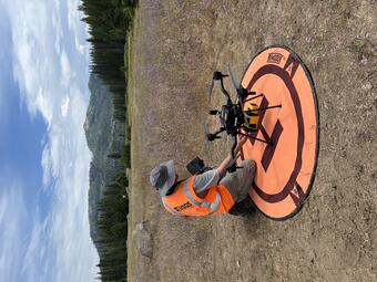
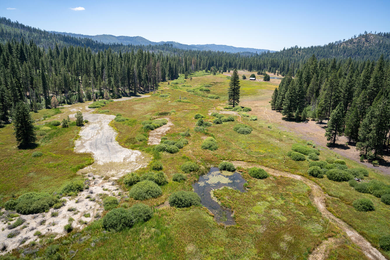
In July 2026, the U.S. Geological Survey (USGS) National Uncrewed Systems Office (NUSO), in partnership with the National Park Service (NPS), completed another field campaign mapping Ackerson Meadow in Yosemite National Park. NUSO flew an initial mission here in 2023 to collect pre-restoration, high-resolution Uncrewed Aircraft System (UAS, also known as drone) lidar datasets and photogrammetric imagery. NUSO has returned to Ackerson Meadow multiple times to collect additional datasets to monitor the restoration stages. The post-restoration lidar data provide precise, repeatable elevation measurements that allow scientists to measure changes in surface topography, track hydrologic responses, and evaluate restoration effectiveness.
During this three-year period, the NPS project team completed the largest wetland restoration project in Yosemite's history and the largest wetland restoration project by fill volume to date within the Sierra Nevada. The team filled 18,538 linear feet (3.51 miles) of erosion gully with 162,000 cubic yards of locally sourced material (132,900 cubic yards of mineral soil combined with 29,100 cubic yards of woodchips). In addition to restoring 94 acres of former wetlands and protecting an additional 84 acres of existing wetlands, the project provides outstanding long-term benefits to rare species, including the Pacific fisher (federally endangered), northwestern pond turtle (proposed for federal listing as threatened), great gray owl (California endangered), and little willow flycatcher (California endangered).
Study Points of Contact
- Stephen Delong, Supervisory Research Geologist, USGS Southwest Region, sdelong@usgs.gov
- Mark Bauer, Geographer, USGS NUSO & GECSC
Hyperspectral UAS flights for harmful algae bloom research at Williams Fork and Willow Creek Reservoirs near Granby, Colorado
In recent years, harmful algal blooms (HABs) have been an ongoing concern in multiple water bodies across Colorado, including Williams Fork Reservoir and Willow Creek Reservoir within the Upper Colorado Basin. In Colorado, HABs are primarily caused by cyanobacteria ("blue-green algae") that multiply rapidly under warm, nutrient-rich, calm conditions, sometimes producing toxins that can affect humans, pets, livestock, and wildlife. In both reservoirs, recreational closures have occurred because of cyanobacteria blooms. High-resolution Uncrewed Aircraft System (UAS, also known as drone) data have recently been explored to improve monitoring capabilities by expanding the spatial and temporal scales at which data can be collected. UAS tools also allow researchers to collect data that cannot be detected with boat-based sensing or satellite data alone. Specifically, hyperspectral imagery can capture the spectral signatures of different algal species and pigments.
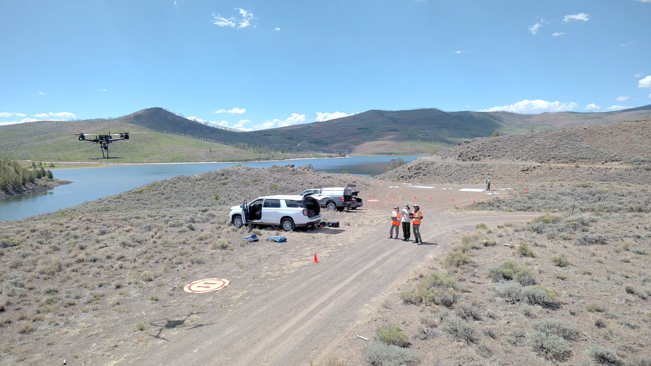
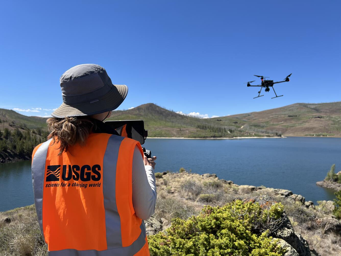
In August 2026, the USGS National Uncrewed Systems Office (NUSO) collected hyperspectral UAS remote sensing data to support HABs monitoring and water quality studies led by researchers from the USGS Water Resources Mission Area (WRMA) Colorado Water Science Center (COWSC) and Hydrologic Remote Sensing Branch (HRSB). Aquatic drones were also deployed to characterize algal fluorescence and other water quality parameters during surface transects and continuous vertical profiles. These underwater uncrewed vehicles collect high-frequency observations autonomously based on pre-planned missions, which can also be adjusted on the fly based on observed conditions. Boat-based samples were collected as well, including vertical profiles of the water column at 1-meter depth intervals measuring water temperature, dissolved oxygen, pH, specific conductance, turbidity, chlorophyll, and water clarity. Water samples were also taken for analysis of nutrient levels, phytoplankton speciation, and cyanobacteria gene and toxin content.
Study Points of Contact
- Theresa Armijo
- Victoria Scholl
Gamma Ray Spectrometer Testing and Evaluation – Dept of Energy Calibration Pads at Grand Junction Airport (GJT)
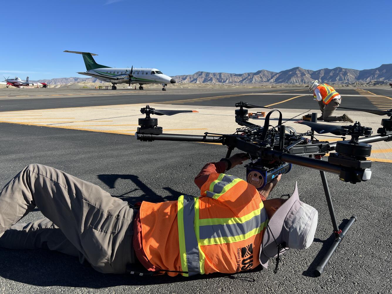
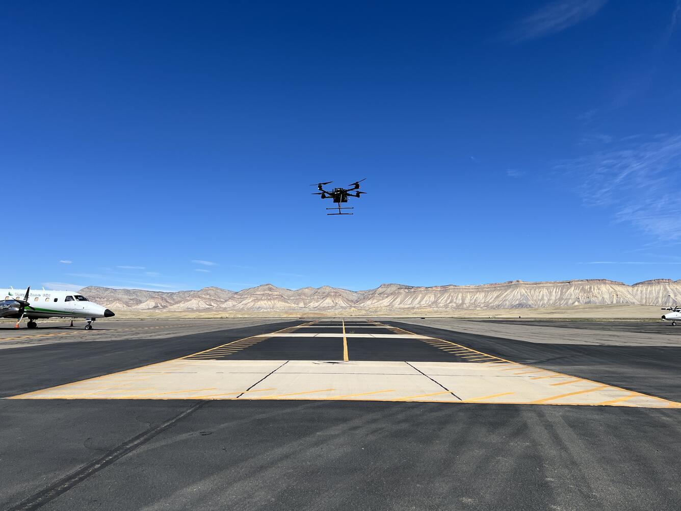
Uncrewed Aircraft Systems (UAS, also known as drones) safely cover the gap between collecting data with crewed aircraft in the air and with field personnel on the ground. They also reduce, and potentially eliminate, the need for personnel to walk, hike, and climb in unsafe terrain and environments where data collection is required. In September 2026, teams from the United States Geological Survey (USGS) National Uncrewed Systems Office (NUSO) and Geology, Geophysics, and Geochemistry Science Center (GGGSC) flew at Grand Junction Regional Airport (GJT) to learn how to collect quality data with the Medusa MS-1000 Gamma Ray Spectrometer mounted on a UAS. The Medusa MS-1000 can detect natural and man-made radiation from the upper layers of soil, helping teams map geology, mineral composition, and potential contamination with high precision.
In coordination with GJT, a variety of transect spacings, altitudes, and directions were flown over the radioelement calibration pads built into the tarmac at the airport. This will allow both USGS teams to calculate height attenuation coefficients that can be applied to measurements recorded at USGS field sites, all within a safe and controlled training environment.
Study Points of Contact
- Anjana Shah, Research Geophysicist, Geology, Geophysics, and Geochemistry Science Center
Range Testing of BluMorpho Ultra-Lightweight Radio Tracking Devices to Support Monarch Butterfly Migration Monitoring
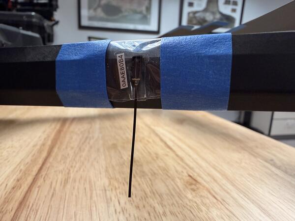
In September 2026, the National Uncrewed Systems Office (NUSO) range-tested BluMorpho radio tags in preparation for upcoming fieldwork aimed at tracking monarch butterfly migration pathways. Over the past several decades, monarch butterfly populations have steadily declined due to a combination of habitat loss (particularly the loss of milkweed), widespread herbicide and pesticide use, climate-driven weather extremes, degradation of overwintering forest habitats, and increasing disease pressures. These new BluMorpho tags weigh less than a grain of rice (0.06 g) and rely on a crowdsourced detection network to record locations and deliver data packets.
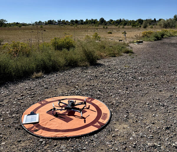
NUSO secured six of the ten test tags to a Skydio X‑10 drone and conducted vertical altitude testing at heights ranging from 50 to 400 feet to evaluate detection reliability across flight elevations. The remaining four tags were placed on the ground surrounding the node to serve as control points, helping researchers compare airborne detection performance against stationary baseline signals. These tests also allowed the team to evaluate how antenna orientation, tag spacing, and environmental factors influence detection strength.
By determining the detectability range of these tags across both aerial and ground placements, researchers can better understand how to interpret location data once tags are deployed on monarch butterflies, including the limitations imposed by altitude, phone density, and signal attenuation. Findings from this testing will also guide decisions on optimal tag placement, receiver-network deployment, and flight parameters during migration monitoring, helping ensure reliable data acquisition throughout the study.
Study Points of Contact
- Jay Diffendorfer, USGS Geosciences and Environmental Change Science Center (GECSC)
- Zach Ancona, GECSC
Enhancing Geologic Mapping of the Cossatot River Using High-Resolution UAS Lidar and Photogrammetry
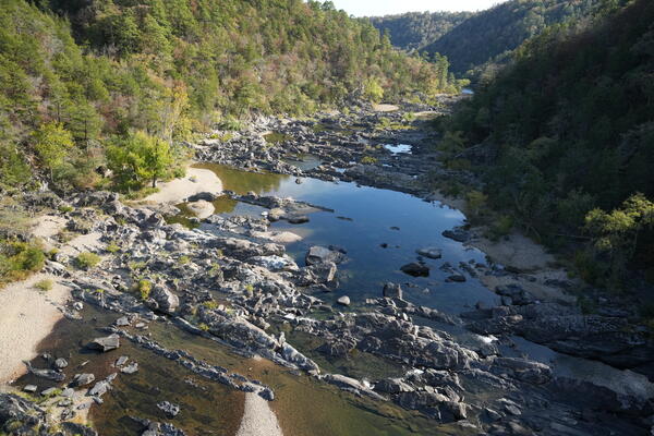
At low water levels, the Cossatot River in western Arkansas hosts spectacular and extensive outcrops of highly deformed late Paleozoic sedimentary rocks (ca. 330-323 Ma). United States Geological Survey (USGS) geologists at the Geosciences and Environmental Change Science Center are mapping a ~6 km, ~north-south stretch of the river in the Cossatot River State Park that contains highly folded and faulted deepwater sandstones, shales and volcanic tuffs of the Stanely Group. This rock record preserves a relatively unique glimpse of ocean basin closure, as well as Ouachita orogenesis. Preliminary stratigraphic and provenance work indicate that the ancient sedimentary systems once operating in this now exposed region of the Ouachita Mountains were sourced by Gondwanan crust (e.g., modern-day South America). Despite the scientific significance of these exposures, the area remains poorly characterized with respect to sediment provenance, high-precision geochronology, and detailed stratigraphic relations. Furthermore, unraveling the structural complexity in this mapping area and understanding those stratigraphic relations provide an important geologic framework, which bears on subsequent Arkoma basin development, and associated hydrocarbon (e.g., Fayetteville Shale) and mineral (e.g., Tri-State Pb-Zn deposit) systems in the broader region.
High-resolution geologic mapping of these riverbed exposures offers an opportunity to refine regional stratigraphic correlations, reconstruct depositional environments, reevaluate existing structural models, and improve constraints on the timing and tectonic evolution of basin closure. Mapping and characterization of this structurally complex, ancient deepwater sedimentary system will also provide insight into sediment source and the nature of deformation in this region.
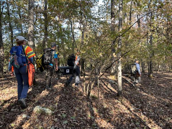
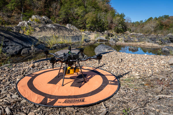
Existing topographic data from the USGS 3D Elevation Program (3DEP) does not adequately resolve the riverbed morphology required for detailed geologic mapping. To address this limitation, the USGS National Uncrewed Systems Office (NUSO) used an uncrewed aircraft system, or UAS, to collect lidar data with an estimated point spacing of approximately 4 cm and high-resolution red, green, blue (RGB) imagery with an estimated ground sample distance of approximately 2 cm. The imagery will be processed using photogrammetric techniques to generate complementary topographic and visual products.
In support of the USGS Western Arkansas-Eastern Oklahoma Geologic Mapping Project (ARKOMA) project, these datasets will provide the high-resolution topographic and surface characterization needed to improve geologic mapping and interpretation of key reaches of the Cossatot River, ultimately advancing our understanding of the tectonic and sedimentary history of the Ouachita region during the Late Paleozoic.
Study Points of Contact
- Tyson Smith, Research Geologist, GECSC
Please note that as a result of Secretarial Order 3379 no research missions were performed in 2020.

National Uncrewed Systems Office
NUSO 2025 Research Missions

NUSO 2024 Research Missions

NUSO 2023 Research Missions

NUSO 2022 Research Missions

NUSO 2021 Research Missions
NUSO 2019 Research Missions

NUSO 2018 Research Missions

NUSO 2017 Research Missions

NUSO 2016 Research Missions

NUSO 2015 Research Missions

NUSO 2014 Research Missions

NUSO 2013 Research Missions
Research missions, often performed in cooperation with other DOI bureaus as well as non-DOI collaborators, serve as vital tools in the ongoing evaluation and integration activities that support the strategic implementation of UAS into the USGS and the DOI.
* Any use of trade, firm, or product names is for descriptive purposes only and does not imply endorsement by the U.S. Government.
The previous years' Research Missions are listed under the Science tab.
NUSO 2026 Research Missions
Returning to Yosemite: Post-restoration assessment of Ackerson Meadows
In July 2026, the U.S. Geological Survey (USGS) National Uncrewed Systems Office (NUSO), in partnership with the National Park Service (NPS), completed another field campaign mapping Ackerson Meadow in Yosemite National Park. NUSO flew an initial mission here in 2023 to collect pre-restoration, high-resolution Uncrewed Aircraft System (UAS, also known as drone) lidar datasets and photogrammetric imagery. NUSO has returned to Ackerson Meadow multiple times to collect additional datasets to monitor the restoration stages. The post-restoration lidar data provide precise, repeatable elevation measurements that allow scientists to measure changes in surface topography, track hydrologic responses, and evaluate restoration effectiveness.
During this three-year period, the NPS project team completed the largest wetland restoration project in Yosemite's history and the largest wetland restoration project by fill volume to date within the Sierra Nevada. The team filled 18,538 linear feet (3.51 miles) of erosion gully with 162,000 cubic yards of locally sourced material (132,900 cubic yards of mineral soil combined with 29,100 cubic yards of woodchips). In addition to restoring 94 acres of former wetlands and protecting an additional 84 acres of existing wetlands, the project provides outstanding long-term benefits to rare species, including the Pacific fisher (federally endangered), northwestern pond turtle (proposed for federal listing as threatened), great gray owl (California endangered), and little willow flycatcher (California endangered).
Study Points of Contact
- Stephen Delong, Supervisory Research Geologist, USGS Southwest Region, sdelong@usgs.gov
- Mark Bauer, Geographer, USGS NUSO & GECSC
Hyperspectral UAS flights for harmful algae bloom research at Williams Fork and Willow Creek Reservoirs near Granby, Colorado
In recent years, harmful algal blooms (HABs) have been an ongoing concern in multiple water bodies across Colorado, including Williams Fork Reservoir and Willow Creek Reservoir within the Upper Colorado Basin. In Colorado, HABs are primarily caused by cyanobacteria ("blue-green algae") that multiply rapidly under warm, nutrient-rich, calm conditions, sometimes producing toxins that can affect humans, pets, livestock, and wildlife. In both reservoirs, recreational closures have occurred because of cyanobacteria blooms. High-resolution Uncrewed Aircraft System (UAS, also known as drone) data have recently been explored to improve monitoring capabilities by expanding the spatial and temporal scales at which data can be collected. UAS tools also allow researchers to collect data that cannot be detected with boat-based sensing or satellite data alone. Specifically, hyperspectral imagery can capture the spectral signatures of different algal species and pigments.
In August 2026, the USGS National Uncrewed Systems Office (NUSO) collected hyperspectral UAS remote sensing data to support HABs monitoring and water quality studies led by researchers from the USGS Water Resources Mission Area (WRMA) Colorado Water Science Center (COWSC) and Hydrologic Remote Sensing Branch (HRSB). Aquatic drones were also deployed to characterize algal fluorescence and other water quality parameters during surface transects and continuous vertical profiles. These underwater uncrewed vehicles collect high-frequency observations autonomously based on pre-planned missions, which can also be adjusted on the fly based on observed conditions. Boat-based samples were collected as well, including vertical profiles of the water column at 1-meter depth intervals measuring water temperature, dissolved oxygen, pH, specific conductance, turbidity, chlorophyll, and water clarity. Water samples were also taken for analysis of nutrient levels, phytoplankton speciation, and cyanobacteria gene and toxin content.
Study Points of Contact
- Theresa Armijo
- Victoria Scholl
Gamma Ray Spectrometer Testing and Evaluation – Dept of Energy Calibration Pads at Grand Junction Airport (GJT)
Uncrewed Aircraft Systems (UAS, also known as drones) safely cover the gap between collecting data with crewed aircraft in the air and with field personnel on the ground. They also reduce, and potentially eliminate, the need for personnel to walk, hike, and climb in unsafe terrain and environments where data collection is required. In September 2026, teams from the United States Geological Survey (USGS) National Uncrewed Systems Office (NUSO) and Geology, Geophysics, and Geochemistry Science Center (GGGSC) flew at Grand Junction Regional Airport (GJT) to learn how to collect quality data with the Medusa MS-1000 Gamma Ray Spectrometer mounted on a UAS. The Medusa MS-1000 can detect natural and man-made radiation from the upper layers of soil, helping teams map geology, mineral composition, and potential contamination with high precision.
In coordination with GJT, a variety of transect spacings, altitudes, and directions were flown over the radioelement calibration pads built into the tarmac at the airport. This will allow both USGS teams to calculate height attenuation coefficients that can be applied to measurements recorded at USGS field sites, all within a safe and controlled training environment.
Study Points of Contact
- Anjana Shah, Research Geophysicist, Geology, Geophysics, and Geochemistry Science Center
Range Testing of BluMorpho Ultra-Lightweight Radio Tracking Devices to Support Monarch Butterfly Migration Monitoring
In September 2026, the National Uncrewed Systems Office (NUSO) range-tested BluMorpho radio tags in preparation for upcoming fieldwork aimed at tracking monarch butterfly migration pathways. Over the past several decades, monarch butterfly populations have steadily declined due to a combination of habitat loss (particularly the loss of milkweed), widespread herbicide and pesticide use, climate-driven weather extremes, degradation of overwintering forest habitats, and increasing disease pressures. These new BluMorpho tags weigh less than a grain of rice (0.06 g) and rely on a crowdsourced detection network to record locations and deliver data packets.
NUSO secured six of the ten test tags to a Skydio X‑10 drone and conducted vertical altitude testing at heights ranging from 50 to 400 feet to evaluate detection reliability across flight elevations. The remaining four tags were placed on the ground surrounding the node to serve as control points, helping researchers compare airborne detection performance against stationary baseline signals. These tests also allowed the team to evaluate how antenna orientation, tag spacing, and environmental factors influence detection strength.
By determining the detectability range of these tags across both aerial and ground placements, researchers can better understand how to interpret location data once tags are deployed on monarch butterflies, including the limitations imposed by altitude, phone density, and signal attenuation. Findings from this testing will also guide decisions on optimal tag placement, receiver-network deployment, and flight parameters during migration monitoring, helping ensure reliable data acquisition throughout the study.
Study Points of Contact
- Jay Diffendorfer, USGS Geosciences and Environmental Change Science Center (GECSC)
- Zach Ancona, GECSC
Enhancing Geologic Mapping of the Cossatot River Using High-Resolution UAS Lidar and Photogrammetry
At low water levels, the Cossatot River in western Arkansas hosts spectacular and extensive outcrops of highly deformed late Paleozoic sedimentary rocks (ca. 330-323 Ma). United States Geological Survey (USGS) geologists at the Geosciences and Environmental Change Science Center are mapping a ~6 km, ~north-south stretch of the river in the Cossatot River State Park that contains highly folded and faulted deepwater sandstones, shales and volcanic tuffs of the Stanely Group. This rock record preserves a relatively unique glimpse of ocean basin closure, as well as Ouachita orogenesis. Preliminary stratigraphic and provenance work indicate that the ancient sedimentary systems once operating in this now exposed region of the Ouachita Mountains were sourced by Gondwanan crust (e.g., modern-day South America). Despite the scientific significance of these exposures, the area remains poorly characterized with respect to sediment provenance, high-precision geochronology, and detailed stratigraphic relations. Furthermore, unraveling the structural complexity in this mapping area and understanding those stratigraphic relations provide an important geologic framework, which bears on subsequent Arkoma basin development, and associated hydrocarbon (e.g., Fayetteville Shale) and mineral (e.g., Tri-State Pb-Zn deposit) systems in the broader region.
High-resolution geologic mapping of these riverbed exposures offers an opportunity to refine regional stratigraphic correlations, reconstruct depositional environments, reevaluate existing structural models, and improve constraints on the timing and tectonic evolution of basin closure. Mapping and characterization of this structurally complex, ancient deepwater sedimentary system will also provide insight into sediment source and the nature of deformation in this region.
Existing topographic data from the USGS 3D Elevation Program (3DEP) does not adequately resolve the riverbed morphology required for detailed geologic mapping. To address this limitation, the USGS National Uncrewed Systems Office (NUSO) used an uncrewed aircraft system, or UAS, to collect lidar data with an estimated point spacing of approximately 4 cm and high-resolution red, green, blue (RGB) imagery with an estimated ground sample distance of approximately 2 cm. The imagery will be processed using photogrammetric techniques to generate complementary topographic and visual products.
In support of the USGS Western Arkansas-Eastern Oklahoma Geologic Mapping Project (ARKOMA) project, these datasets will provide the high-resolution topographic and surface characterization needed to improve geologic mapping and interpretation of key reaches of the Cossatot River, ultimately advancing our understanding of the tectonic and sedimentary history of the Ouachita region during the Late Paleozoic.
Study Points of Contact
- Tyson Smith, Research Geologist, GECSC
Please note that as a result of Secretarial Order 3379 no research missions were performed in 2020.
National Uncrewed Systems Office
NUSO 2025 Research Missions
NUSO 2024 Research Missions
NUSO 2023 Research Missions
NUSO 2022 Research Missions
NUSO 2021 Research Missions
NUSO 2019 Research Missions
NUSO 2018 Research Missions
NUSO 2017 Research Missions
NUSO 2016 Research Missions
NUSO 2015 Research Missions
NUSO 2014 Research Missions