
The old Kennecott copper mill from the north. Kennecott was once a thriving mine and mill during the early 1900s. The mines are 5 miles up the mountain.
Images
Browse images from a wide range of science topics covered by USGS.
Filter Total Items: 988

The old Kennecott copper mill from the north side
The old Kennecott copper mill from the north. Kennecott was once a thriving mine and mill during the early 1900s. The mines are 5 miles up the mountain.

Ice Out on Yukon River, Pilot Station, Alaska
Panoramic image of ice break up on the Yukon River at Pilot Station, Alaska.
Panoramic image of ice break up on the Yukon River at Pilot Station, Alaska.

Ice Out on Yukon River, Pilot Station, Alaska
Spring breakup on May 21 on the Yukon River at Pilot Station, Alaska.
Spring breakup on May 21 on the Yukon River at Pilot Station, Alaska.

Mallard Duck swimming
Mallard Duck swimming

Barrow Alaska, April 2010
Satellite image showing Barrow Alaska.
Satellite image showing Barrow Alaska.

Examining Arctic lake sediment core
John Pohlman (USGS, left) and colleagues from the University of Alaska Fairbanks examine a sediment core retrieved through winter ice from the bottom of a lake in northern Alaska. Such cores are used to reconstruct methane emissions and climate history over the past 20,000 years.
John Pohlman (USGS, left) and colleagues from the University of Alaska Fairbanks examine a sediment core retrieved through winter ice from the bottom of a lake in northern Alaska. Such cores are used to reconstruct methane emissions and climate history over the past 20,000 years.
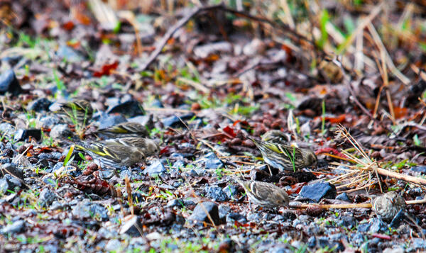
Seven Pine Siskins foraging for food on the ground in Juneau, Alaska
Seven Pine Siskins foraging for food on the ground in Juneau, AlaskaSeven Pine Siskins foraging for food on the ground in Juneau, Alaska.
Seven Pine Siskins foraging for food on the ground in Juneau, Alaska
Seven Pine Siskins foraging for food on the ground in Juneau, AlaskaSeven Pine Siskins foraging for food on the ground in Juneau, Alaska.

Molecular ecology laboratory procedure
Rob Wilson adding prepared genetic material to a gel in the Alaska Science Center Molecular Ecology Laboratory.
Rob Wilson adding prepared genetic material to a gel in the Alaska Science Center Molecular Ecology Laboratory.

Extracting DNA from sample
Lisa Pajot extracting DNA from samples (specifically she is precipitating the DNA out of solution with ethanol).
Lisa Pajot extracting DNA from samples (specifically she is precipitating the DNA out of solution with ethanol).

Black-capped Chickadee with a crossed beak on a branch
Black-capped Chickadee with a crossed beak on a branchBlack-capped Chickadee with a crossed beak on a branch.
Black-capped Chickadee with a crossed beak on a branch
Black-capped Chickadee with a crossed beak on a branchBlack-capped Chickadee with a crossed beak on a branch.

Bald Eagle on a broken tree on shore of Juneau Beach, Juneau, Alaska
Bald Eagle on a broken tree on shore of Juneau Beach, Juneau, AlaskaBald Eagle on a broken tree on shore of Juneau Beach, Juneau, Alaska.
Bald Eagle on a broken tree on shore of Juneau Beach, Juneau, Alaska
Bald Eagle on a broken tree on shore of Juneau Beach, Juneau, AlaskaBald Eagle on a broken tree on shore of Juneau Beach, Juneau, Alaska.

A Bald Eagle on Juneau Beach in Juneau, Alaska
A Bald Eagle on Juneau Beach in Juneau, Alaska
A Bald Eagle on Juneau Beach in Juneau, Alaska

Bald Eagle on a broken tree on Juneau Beach, Juneau, Alaska
Bald Eagle on a broken tree on Juneau Beach, Juneau, AlaskaBald Eagle on a broken tree on Juneau Beach, Juneau, Alaska.
Bald Eagle on a broken tree on Juneau Beach, Juneau, Alaska
Bald Eagle on a broken tree on Juneau Beach, Juneau, AlaskaBald Eagle on a broken tree on Juneau Beach, Juneau, Alaska.

Sunset on the Gulf of Alaska
Sunset from the coastal Gulf of Alaska.
Sunset from the coastal Gulf of Alaska.

Sounding weight on the Copper River Delta, Alaska
Sounding weight on the Copper River Delta, Alaska
Sounding weight on the Copper River Delta, Alaska

Two polar bears swimming in the water in the Beaufort Sea
Two polar bears swimming in the water in the Beaufort SeaTwo polar bears swimming in the water in the Beaufort Sea
Two polar bears swimming in the water in the Beaufort Sea
Two polar bears swimming in the water in the Beaufort SeaTwo polar bears swimming in the water in the Beaufort Sea

Drawing blood samples from an anesthetized polar bear
Drawing blood samples from an anesthetized polar bearDrawing blood samples from an anesthetized polar bear
Drawing blood samples from an anesthetized polar bear
Drawing blood samples from an anesthetized polar bearDrawing blood samples from an anesthetized polar bear

Normal Black-capped Chickadee
Normal Black-capped Chickadee
Normal Black-capped Chickadee

Salmon in Montana Bill Creek after the Redoubt Volcano 2009 eruption
Salmon in Montana Bill Creek after the Redoubt Volcano 2009 eruptionA coho salmon holding in Montana Bill Creek after the Redoubt volcano eruption.
Salmon in Montana Bill Creek after the Redoubt Volcano 2009 eruption
Salmon in Montana Bill Creek after the Redoubt Volcano 2009 eruptionA coho salmon holding in Montana Bill Creek after the Redoubt volcano eruption.

Cannery Creek after the Redoubt Volcano eruption of 2009
Cannery Creek after the Redoubt Volcano eruption of 2009Cannery Creek on the west side of Cook Inlet, Alaska. Aerial surveys were done after the eruption of the Redoubt volcano to determine the condition of fish streams.
Cannery Creek after the Redoubt Volcano eruption of 2009
Cannery Creek after the Redoubt Volcano eruption of 2009Cannery Creek on the west side of Cook Inlet, Alaska. Aerial surveys were done after the eruption of the Redoubt volcano to determine the condition of fish streams.

Clear Montana Bill Creek flowing into volcanically silted creek
Clear Montana Bill Creek flowing into volcanically silted creekA clear Montana Bill Creek flowing into volcanically silted creek. Coho salmon are seen holding in the clear water area. Aerial surveys were done after the eruption of the Redoubt volcano to determine the condition of fish streams.