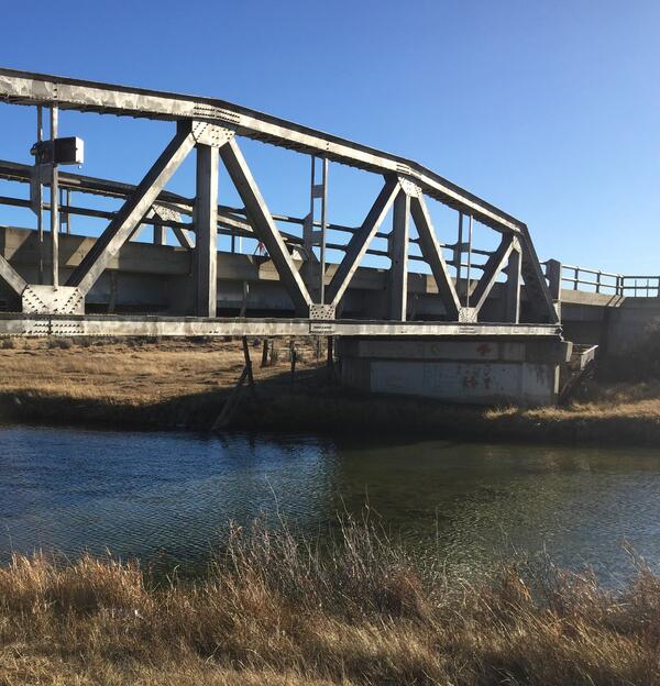
Measuring streamflow in Goose Creek, near Acme, station 06305700
Measuring streamflow in Goose Creek, near Acme, station 06305700Measuring streamflow in Goose Creek, near Acme, station 06305700

Official websites use .gov
A .gov website belongs to an official government organization in the United States.
Secure .gov websites use HTTPS
A lock () or https:// means you’ve safely connected to the .gov website. Share sensitive information only on official, secure websites.
Images described and linked on this webpage come from a wide variety of USGS science activities and presentations performed by USGS Science Center staff members in the Region 7: Upper Colorado Basin. A search tool is provided to narrow the number of image files shown.

Measuring streamflow in Goose Creek, near Acme, station 06305700
Measuring streamflow in Goose Creek, near Acme, station 06305700

Measuring streamflow under ice, Pass Creek, near Parkman, WY, station 06289600
Measuring streamflow under ice, Pass Creek, near Parkman, WY, station 06289600

Cheyenne Wyoming office

USGS scientists check breach on glass-calm Great Salt Lake in surreal light.
USGS scientists check breach on glass-calm Great Salt Lake in surreal light.

The wire weight is lowered to determine stage of Bull Lake Creek above Bull Lake
The wire weight is lowered to determine stage of Bull Lake Creek above Bull Lake
Wire weight mounted on bridge crossing Blacks Fork, streamgage 09219200
Wire weight mounted on bridge crossing Blacks Fork, streamgage 09219200

Jemez Falls located in the Jemez Mountains near Santa Fe, New Mexico
Jemez Falls located in the Jemez Mountains near Santa Fe, New Mexico

Setting up to measure streamflow, Muddy Creek near Dad
Setting up to measure streamflow, Muddy Creek near Dad

Installing new radar sensor and staff plate, Big Sandy River
Installing new radar sensor and staff plate, Big Sandy River

On September 19th, 2017 staff from the USGS NM WSC Albuquerque and Las Cruces offices visited a Climate Response Network (CRN) well just on the east side of the Organ Mountains outside of Las Cruces to receive training on integrity testing groundwater wells.
On September 19th, 2017 staff from the USGS NM WSC Albuquerque and Las Cruces offices visited a Climate Response Network (CRN) well just on the east side of the Organ Mountains outside of Las Cruces to receive training on integrity testing groundwater wells.

Pipetting for DNA analysis using loop-mediated isothermal amplification
Pipetting for DNA analysis using loop-mediated isothermal amplification

Elk are not concerned with our work. USGS and the Monterey Bay Aquarium Research Institute conducted tests of the feasibility of real-time eDNA monitoring at USGS streamgage 06190540 Boiling River at Mammoth,YNP, September 13, 2017.
Elk are not concerned with our work. USGS and the Monterey Bay Aquarium Research Institute conducted tests of the feasibility of real-time eDNA monitoring at USGS streamgage 06190540 Boiling River at Mammoth,YNP, September 13, 2017.

Mark, Nicole, Rich, Ryan, Dean taking out the "trash" from the base of the trench.
Mark, Nicole, Rich, Ryan, Dean taking out the "trash" from the base of the trench.

Staff float down the Rio Grande in New Mexico as part of their Swiftwater Awareness training.
Staff float down the Rio Grande in New Mexico as part of their Swiftwater Awareness training.

USGS Hydrologist Eric White flies a small unoccupied aircraft system – sUAS or "drone" – equipped with a thermal infrared camera during a groundwater/surface-water exchange study along the East River in Gunnison National Forest near Gothic, Colorado, in August 2017.
USGS Hydrologist Eric White flies a small unoccupied aircraft system – sUAS or "drone" – equipped with a thermal infrared camera during a groundwater/surface-water exchange study along the East River in Gunnison National Forest near Gothic, Colorado, in August 2017.

U.S. Geological Survey, New Mexico Water Science Center - Las Cruces Field Office location
U.S. Geological Survey, New Mexico Water Science Center - Las Cruces Field Office location

Sample collection from cableway above Big Horn River near Kane, Wyoming as part of project evaluating pesticides in Wyoming.
Sample collection from cableway above Big Horn River near Kane, Wyoming as part of project evaluating pesticides in Wyoming.

Taking water-quality equipment to Fogarty Creek

Hydrologic technician Chris Peskuski snapped this picture from Eagle Nest Dam overlooking the Cimarron River where streamflow measurements are made to measure outflow from the dam. Eagle Nest Dam sits at 8,300 feet elevation and is surrounded by two of the highest peaks in New Mexico; Wheeler Peak and Baldy Mountain.
Hydrologic technician Chris Peskuski snapped this picture from Eagle Nest Dam overlooking the Cimarron River where streamflow measurements are made to measure outflow from the dam. Eagle Nest Dam sits at 8,300 feet elevation and is surrounded by two of the highest peaks in New Mexico; Wheeler Peak and Baldy Mountain.

Field crew install a Restoration Field Trial Network garden in the rangelands of Northern Arizona.
Field crew install a Restoration Field Trial Network garden in the rangelands of Northern Arizona.

On an average day during the fire season, multiple wildfires burn in the western United States. For example, 216 fires were active on July 7, 2017. Firefighters were battling 27 of these fires through ground and air support.
On an average day during the fire season, multiple wildfires burn in the western United States. For example, 216 fires were active on July 7, 2017. Firefighters were battling 27 of these fires through ground and air support.